预订 预订住宿
直接预订立减 10%,代码 立减 10% · 12月1日 前入住 · 适用于 2026年12月1日 前入住
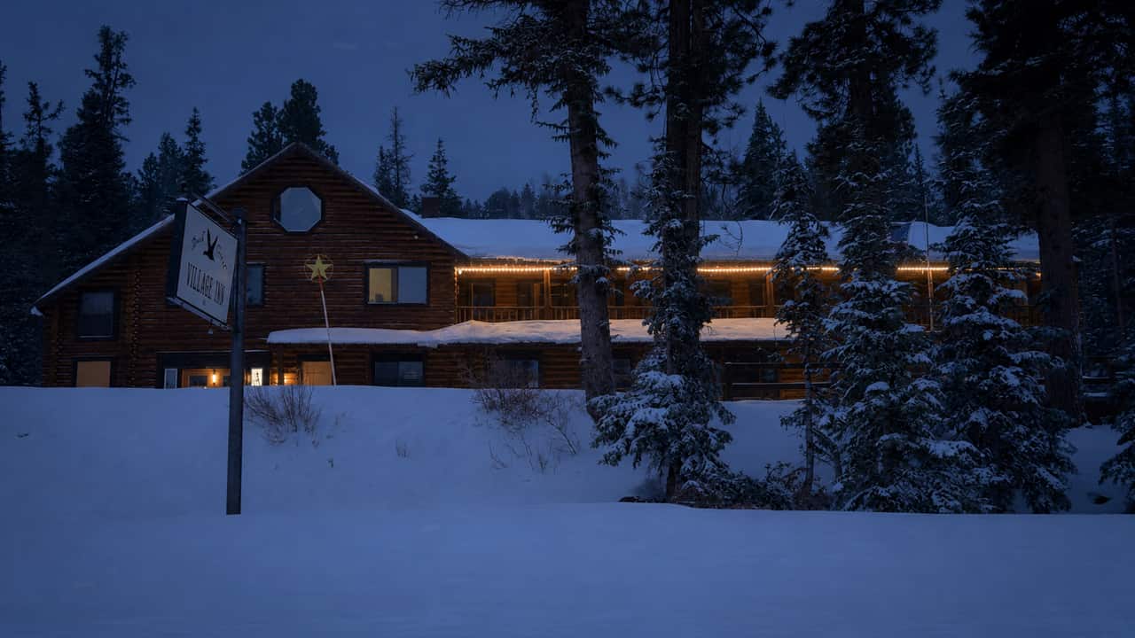
Duck Creek Village Inn on a winter evening with snow on the roof and warm light in the windows

Plan Your Trip

Winter Driving to Duck Creek

A 4,059-foot climb, a summit a shade over 9,900 feet, and a road UDOT plows all season. Here is what that asks of your tires, your timing and your day.

At a glance

Cedar City to the village
29.4 miles, about 45 minutes
The climb
5,846 ft to 9,905 ft at the summit
Highway 14 in winter
Plowed all season; closures last hours, not days
Traction law
SR-14 is a Class I segment; SR-143 to Brian Head is Class II
Mid-December daylight
Sunrise 7:39 AM, sunset 5:14 PM
Fuel and groceries
Cedar City is the last full stop before the climb

The honest answer to “can we get up there in winter?” is almost always yes. Highway 14 is a plowed, year-round state highway, and most winter days it is bare pavement or packed snow that any car handles. The trips that go wrong are not the ones with the wrong car — they are the ones that start too late, on worn tires, with no chains in the trunk, on the afternoon a storm is landing.

This page is the driving side of a winter trip: the climb itself, what Utah's traction law actually requires, how much snow is on the ground month by month, how early the light goes, and what to do when UDOT closes the canyon. For what to do once you are here — snowmobile trails from the village, groomed ski loops at Deer Hollow, Brian Head, Cedar Breaks on snowshoes — see the winter guide.

The climb is the whole story

Cedar City sits at 5,846 feet. The village sits at about 8,455 feet. In between, Highway 14 climbs 4,059 feet in seventeen miles, crosses a summit at 9,905 feet, and only then drops into the meadows. That shape explains nearly everything about winter here: why the forecast you read for Cedar City is useless, why the road can be dry at the bottom and packed at the top, and why a two-wheel-drive car with summer tires can be fine for twelve miles and then stop climbing.

Elevation profile of Highway 14 from Cedar City to Duck Creek Village The road leaves Cedar City at 5,846 feet, climbs steadily through Cedar Canyon with a two-mile stretch near 6.9 percent, tops out at 9,905 feet at mile 17.1, passes the Highway 148 junction, and drops to 8,455 feet at Duck Creek Village at mile 29.4. About 18 miles of the drive sit above 8,000 feet. Above 8,000 ft: packed snow and ice are the winter normal 6,000 7,000 8,000 9,000 10,000 6.9% for two miles Cedar City 5,846 ft Cedar Canyon 6,709 ft The steep pitch 8,968 ft The summit 9,905 ft Highway 148 junction 9,789 ft Duck Creek Village 8,455 ft mile 0510152025
29.4 miles, about 45 minutes without snow. You climb 4,059 feet out of Cedar City, cross the summit at 9,905 feet, then lose 1,450 feet into the village — so the top of the drive is not the end of it. Route traced with OSRM; elevations are USGS 3DEP sampled every 500 m, September 2026.
  • mile 0 Cedar City 5,846 ft Last fuel, last groceries, last tire shop. The valley can be dry and 20 degrees warmer than the top.
  • mile 6.2 Cedar Canyon 6,709 ft The canyon walls close in and the road starts to bend. This stretch holds shade, ice and rockfall.
  • mile 13.5 The steep pitch 8,968 ft About 7 percent for two miles, mile 12.4 to 14.6. The place a two-wheel-drive car with worn tires stops climbing.
  • mile 17.1 The summit 9,905 ft Just over 9,900 ft — the highest point of the drive, and the windiest. UDOT’s summit camera and weather sensor sit here.
  • mile 17.7 Highway 148 junction 9,789 ft The turn for Cedar Breaks, gated and unplowed in winter. The lot here is the plowed trailhead.
  • mile 29.4 Duck Creek Village 8,455 ft The road drops 1,450 ft off the summit into the meadows. You arrive lower than the highest point you crossed.

Two practical consequences. First, 12.1 miles of the drive sit above 9,000 feet, so plan for a snow-covered surface up there even when the valley is clear and dry. Second, the summit is west of the Cedar Breaks junction, which means you climb past the highest point and then descend to the village. Coming down a grade on packed snow is where most winter trouble on this road starts, not going up it. Low gear, long following distance, no cruise control.

Chains, tires and 4WD: what Utah actually requires

Utah does not require chains all winter. It has a traction law, Utah Administrative Code R920-6, that UDOT or law enforcement switches on for designated stretches of highway when conditions call for it. You are told by road signs, message boards, the UDOT Traffic app and UDOT's own social accounts — not by a website you checked yesterday.

When it is posted, this is the minimum kit, straight from UDOT's traction law summary:

What satisfies the traction law, by vehicle
Your vehicle Minimum Also acceptable
Two-wheel drive under 12,000 lb Three-peak mountain snowflake (3PMSF) tires on all four wheels Chains or snow socks on both drive tires
All-wheel or four-wheel drive M+S (mud and snow) tires on all four wheels 3PMSF tires, or chains and socks
Over 12,000 lb — motorhomes, buses, trucks Chains or socks on all drive tires One tire per dual-mounted pair counts

The bit that is specific to this road

UDOT's traction law map classifies segments. Highway 14 from Cedar City east across the plateau is a Class I segment, where a posted requirement applies to vehicles over 12,000 pounds gross weight — motorhomes, buses, box trucks, heavy tow rigs. Highway 143 up Parowan Canyon to Brian Head is Class II, where it applies to every vehicle on the road. If your trip includes a ski day at Brian Head, that is the drive with the stricter rule, and it is worth knowing before you are sitting at the bottom of the canyon behind a trooper.

One more piece of internet folklore to clear up: the 5/32-inch tread requirement you will find in Utah traction-law articles belongs to the Class 3 designation written for Big and Little Cottonwood Canyons outside Salt Lake City. It does not apply here. What does apply statewide is the plain tread law — any tire under 2/32 inch is illegal, in any season, and is also the reason a car slides on a grade it should have climbed.

What all-wheel drive does and does not buy you

All-wheel drive helps you start moving and keeps you tracking on a packed climb. It does nothing for stopping and nothing for cornering — those are entirely the tires, which is why the traction law is written about rubber and not about drivetrains. A front-wheel-drive car on true winter tires will out-drive an all-wheel-drive SUV on worn all-seasons on this road, and the SUV's extra confidence is exactly what gets it going too fast for the descent into the village.

If you carry chains, fit them at the bottom, in a pullout, before you need them — not on a grade in the dark with traffic going by. And fit them to the drive wheels: front on a front-wheel-drive car, rear on a rear-wheel-drive truck.

If you are driving a rental from Las Vegas or Salt Lake

Most guests arrive in a rental car picked up at a desert airport, and rental fleets in Las Vegas and St. George are built for the desert: two-wheel drive, all-season tires, no chains in the trunk, and frequently a rental agreement that forbids fitting chains at all. That is a fine car for this road on a clear day and a poor one in an active storm.

What to do about it, in order of how much it helps:

  • Book the drive up for the morning, not the evening, and give yourself a day of flex in the itinerary.
  • Pay for the AWD or 4WD class if snow is in the forecast. It is the cheapest insurance in the trip.
  • Look at the tires in the lot before you leave. A three-peak mountain snowflake stamp on the sidewall is what you want; a bald all-season is a reason to ask for a different car.
  • Read the rental agreement on chains before you buy a set you are not allowed to use.
  • Fuel and shop in Cedar City. It is the last full-service town, and 29 miles is a long way to go back for milk.

Coming from further afield, the approach matters too. From Las Vegas or St. George you climb I-15 to Cedar City before you ever start the canyon; from the east on US-89 you join Highway 14 at Long Valley Junction and climb the gentler side. Our getting here page has the route detail, and the Las Vegas drive guide maps the whole run.

How much snow, and when

There are no weather stations in the village itself, but two NRCS SNOTEL stations bracket it: Harris Flat at 7,800 feet, about 9 minutes away and 600 feet below us, and Midway Valley at 9,830 feet, 1,400 feet above — which happens to be close to the elevation of the summit you drive over. Everything below is measured at those two, with the village figure interpolated between them and labeled as the estimate it is.

Median snow depth by month at three elevations around Duck Creek Village Grouped bars for October through May. The deepest month at village elevation is Feb, with a median of about 30 inches on the ground, against roughly 20 inches at 7,800 feet and 54 inches at 9,830 feet. The strip below each month gives the share of days with any snow on the ground at village elevation. 20" 40" 60" Oct 12% 2" Nov 45% 11" Dec 85% 21" Jan 94% 30" Feb 92% 29" Mar 86% 16" Apr 53% 6" May 21% days
  • Harris Flat, 7,800 ft
  • Duck Creek Village, 8,400 ft (estimated)
  • Midway Valley, 9,830 ft
Median depth on the ground for each month in the NRCS SNOTEL record, with the share of days carrying any snow along the bottom. The village figure is interpolated between the two stations that bracket it and is an estimate, not a measurement. The deepest day anywhere in the archive is 166 inches at Midway Valley. Live depths at both stations are on our snow report.
Winter month by month at village elevation
Month Typical high Typical low Median snow on the ground Days with snow cover Sunset, 15th
November 45°F 21°F 2" 45% 5:21 PM
December 35°F 14°F 11" 85% 5:14 PM
January 36°F 14°F 21" 94% 5:36 PM
February 38°F 16°F 30" 92% 6:10 PM
March 45°F 21°F 29" 86% 7:38 PM
April 52°F 24°F 16" 53% 8:06 PM

Temperatures are NOAA 1991–2020 normals interpolated between the Alton (7,100 ft) and Brian Head (9,770 ft) stations; depth and snow-cover figures come from the SNOTEL archive. Sunset times are computed for the village and shown in local time, so the March and April jumps include daylight saving.

The pattern that matters for driving: first snow usually arrives around October 15 at the upper station and November 16 at the lower one, the ground holds snow through March, and January nights sit near 14°F with afternoons near 36°F. That freeze-and-thaw cycle is what puts ice on the road in the shade of Cedar Canyon on an otherwise sunny afternoon. For today's actual depth at both stations, our snow report reads them live.

The light goes earlier than you think

This is the single most common winter planning mistake we see, and it costs nothing to fix. In mid-December the sun is up at 7:39 AM and down at 5:14 PM. A four-o'clock departure from Cedar City means finishing the climb in the dark, and dark on a snow-packed grade with no streetlights, no shoulder and deer at the meadow edges is a different road than the one you drove up in July.

Daylight by month at Duck Creek Village, with the latest sensible departure from Cedar City One bar per month from sunrise to sunset in Mountain Time. The shortest day sampled is Dec 15, with about 9.6 hours of daylight and sunset at 5:14 PM. The marker on each bar is sunset minus 75 minutes — the latest you should be leaving Cedar City to finish the climb before dark. 6 AM 8 AM 10 AM noon 2 PM 4 PM 6 PM 8 PM Oct 15 11.3 hrs Nov 15 10.2 hrs Dec 15 9.6 hrs Jan 15 9.9 hrs Feb 15 10.8 hrs Mar 15 11.9 hrs Apr 15 13.2 hrs leave Cedar City by
Sunrise to sunset at the village on the 15th of each month, Mountain Time. The tick is the latest departure from Cedar City that still gets you up Highway 14 in daylight: sunset minus the 45-minute drive and 30 minutes of winter slack. In mid-December that is 3:59 PM, which is earlier than most people plan for.

Build the day backwards from that marker. If you are flying into Las Vegas, an afternoon flight rarely gets you up the canyon in daylight in December — either book the morning flight or plan a night in Cedar City or St. George and climb in the morning. If you are coming off a day in Zion or Bryce, leave the park earlier than feels necessary; the drive home gains elevation the whole way.

Storm days: what UDOT does, and what you should do

It is worth knowing the standard the plows work to, because it tells you exactly when the road changes character. Every UDOT maintenance station runs a Snow Plan designed to keep at least one lane open in each direction when snow is accumulating at one inch per hour or less. Above that rate, crews are pulled onto higher-priority routes first, and a plowed lane becomes a packed lane.

So the question on a storm day is not “is it snowing?” — it is “how hard, and for how long?” A two-inch afternoon is a normal drive with winter tires. A six-inch, one-inch-an-hour system is a good afternoon to eat lunch in Cedar City and let the plows get a cycle ahead of you. And when UDOT does close Highway 14 it is typically for hours while crews clear Cedar Canyon, not for days. The road's long closures in living memory came from landslides, not snow: the 2011 slide near milepost 8 took out roughly 1,300 feet of roadway and kept the highway shut for months.

The five-minute check before you drive

  1. Road conditions — UDOT's live SR-14 status, restrictions and the canyon cameras.
  2. Live cams — look at the summit and the village before you trust a forecast.
  3. Weather — the National Weather Service forecast for 8,400 feet, not for the valley floor.
  4. Snow report — what is actually on the ground at both SNOTEL stations.

What closes for the season

  • Highway 148 through Cedar Breaks: gated from roughly mid-November to late May, which is why Brian Head becomes a 1 hour 15 minute drive by Cedar City and Parowan instead of the 35-minute summer shortcut.
  • Navajo Lake road, Strawberry Point road and the forest roads off Highway 14: unplowed all winter. They become snowmobile and ski routes, not driving routes.
  • The Mammoth Creek shortcut toward Panguitch Lake: not reliably plowed, so plan the paved way around through Long Valley Junction.
  • Duck Creek Visitor Center: closed for the season.

And a note for anyone planning to leave the road corridor: the Utah Avalanche Center does not publish a daily forecast for southwest Utah. It collects observations from the Brian Head and Cedar Mountain backcountry, which is useful, but it is not a rated danger level. Snowmobilers, skiers and snowshoers here are making their own call on terrain — read the observations, and treat steep, wind-loaded slopes with the respect a forecast would have told you to.

What to carry in the car

None of this is exotic. It is the difference between a delay and an incident.

  • Chains or snow socks that fit your drive wheels — and one dry run fitting them at home, in daylight, before the trip
  • A snow brush and a real ice scraper; a credit card does not clear a windshield at 14 degrees
  • A full tank leaving Cedar City, because idling in a closure burns fuel
  • Warm layers, hats and gloves inside the cabin, not in the trunk under the luggage
  • Water, food that survives freezing, and a phone battery pack
  • A headlamp, and a small shovel if you have room
  • Offline maps downloaded before you leave town — cell service fades above Cedar Canyon

If you do end up stopped

  1. Stay with the car. It is shelter, it is visible, and Highway 14 is a plowed route with traffic on it.
  2. Get off the travel lane if you can do it safely, and leave the hazards on. Snowbanks hide the shoulder edge, so do not trust what looks like pavement.
  3. Clear snow away from the exhaust pipe before you run the engine for heat, and run it in short bursts with a window cracked.
  4. Call 911 for a vehicle off the road; call 511 or open the UDOT Traffic app for the closure picture.
  5. Do not walk out. Distances on this road are longer than they look and the temperature drops fast after sunset.

And when you arrive

You have just moved to 8,400 feet, in dry, cold air, probably from sea level. Drink more water than you want to, go easy on the first evening, and expect to sleep poorly the first night — that is altitude, not the bed. Cold at this elevation is a dry cold and it is very manageable; the wind at the summit is the part that bites. Sunglasses matter more than people expect, because snow at 9,000 feet throws light back at you all day.

Check in before dark if you can. It makes the arrival a pleasure instead of a navigation exercise, and it leaves the evening for the thing winter here is actually best at: a very dark, very clear sky over a very quiet village.

Winter driving questions

The questions guests ask us on the phone in December.

Do I need four-wheel drive to get to Duck Creek Village in winter?

Not usually. Highway 14 is plowed all winter, and on a clear day a two-wheel-drive car on decent tires makes the climb without drama. What matters more than the drivetrain is the tires and the timing: proper winter tires, chains in the trunk, and a departure that gets you up the canyon in daylight and not in the middle of a storm.

Is Highway 14 open in winter?

Yes. SR-14 is a year-round plowed state highway, not a seasonal road. UDOT closes it occasionally during or right after a big storm, usually for hours while crews clear Cedar Canyon. The seasonal closure people confuse it with is Highway 148 through Cedar Breaks, which does gate shut from about mid-November to late May.

Are chains required on Highway 14?

Only when UDOT posts the traction law, and SR-14 is a Class I traction segment, which means the requirement is aimed at vehicles over 12,000 pounds — motorhomes, buses and trucks — rather than every car. Carry chains anyway from December through March: the law is the floor, not the advice, and a posted restriction can appear while you are already on the road.

What counts as a legal snow tire in Utah?

Under Utah Administrative Code R920-6, an all-wheel or four-wheel-drive vehicle needs M+S tires on all four wheels as the minimum, and a two-wheel-drive vehicle under 12,000 pounds needs three-peak mountain snowflake (3PMSF) tires on all four. Chains and snow socks satisfy the requirement for either. Statewide, any tire below 2/32 inch of tread is illegal year-round.

How much snow does Duck Creek Village get?

Enough to change the trip. At village elevation the median depth on the ground works out to about 11 inches in December and 30 inches in February, and there is snow on the ground on roughly 94 percent of January days. First snow typically falls around October 15 at the 9,830-foot station and November 16 at the 7,800-foot one. Those are interpolated from the two NRCS SNOTEL stations that bracket the village, and our snow report reads both of them live.

What time should I leave Cedar City to arrive before dark?

In mid-December the sun sets at the village at 5:14 PM, so leaving Cedar City by about 4:00 PM gets you up Highway 14 in daylight with slack for plow traffic. On a storm day, leave earlier or wait it out over a meal in town rather than climbing the canyon in the dark behind a plow.

Is there an avalanche forecast for Cedar Mountain?

Not a daily one. The Utah Avalanche Center does not issue regular forecasts for southwest Utah, though it does collect and publish observations from the Brian Head and Cedar Mountain backcountry. That matters for anyone leaving the road corridor on a sled, skis or snowshoes — you are working from observations and your own judgement, not a rated danger level.

Can I bring an RV or tow a trailer up Highway 14 in winter?

It is legal and people do it, but understand what you are asking of the vehicle: a 4,059-foot climb with a two-mile stretch near 7 percent, then a descent into the village. Over 12,000 pounds gross weight you are the vehicle the traction law is written for, so carry chains for all drive tires. Snowmobile trailers are common here; time the climb for a clear day.

Reviewed September 2026

Why trust this page

We live in the village and drive Highway 14 through the storms. The numbers here are not ours, though: the route, elevations and grades come from an OSRM trace sampled against USGS 3DEP elevation data; the traction requirements come from Utah Administrative Code R920-6 and UDOT's own traction law summary and segment map; the plowing standard is UDOT's published winter maintenance policy; snow depths and snow-covered days come from the two NRCS SNOTEL stations that bracket the village; and temperatures are NOAA 1991 to 2020 normals interpolated to 8,400 feet. Conditions change hourly in winter, so check the live sources below before you commit to the climb.

A warm room at the top of the climb

Book a room or cabin at Duck Creek Village Inn — five minutes off Highway 14, with the snowmobile trailhead in the village and the plows working the road you came in on.

直订立减 10%,代码 · 适用于 2026年12月1日 前入住 直订最优价 · 现在预订,之后付款

致电我们 · 435-990-5488