清晨看野生动物
Mule deer、elk、marmot, 偶尔还有 fox。早餐前通常最好。
Duck Creek 指南
从这座山间小镇出发,游湖、走林间步道,按季节安排行程。
鸭溪村位于迪克西国家森林内,沿犹他州14号公路而建,海拔约2,560米(8,400英尺)。村里的池塘、附近的湖泊和森林步道,让你可以就近安排一天的活动。
这里也可作为前往雪松断崖、布莱斯峡谷和锡安国家公园东侧的落脚点。行程要随季节调整,出发前请查看道路、步道和天气状况。
高原活动
按旅行目的筛选。多数地点距离旅馆 30 分钟内, 也有不少活动可以直接从村里开始。
超过 300 英里的指定路线遍布高原(林务局统计为 408 英里),有适合不同水平的环线。只在最新 MVUM 地图上的路线骑行。
短步道通往瀑布和峡谷景观, 也能看到 Navajo Lake 与熔岩流的地质故事。
Duck Creek Pond, Aspen Mirror, Navajo Lake 和 Panguitch Lake 各有不同钓法。
9,000 ft 高海拔湖泊, 适合 kayak、paddleboard、凉爽空气和安静湖面。
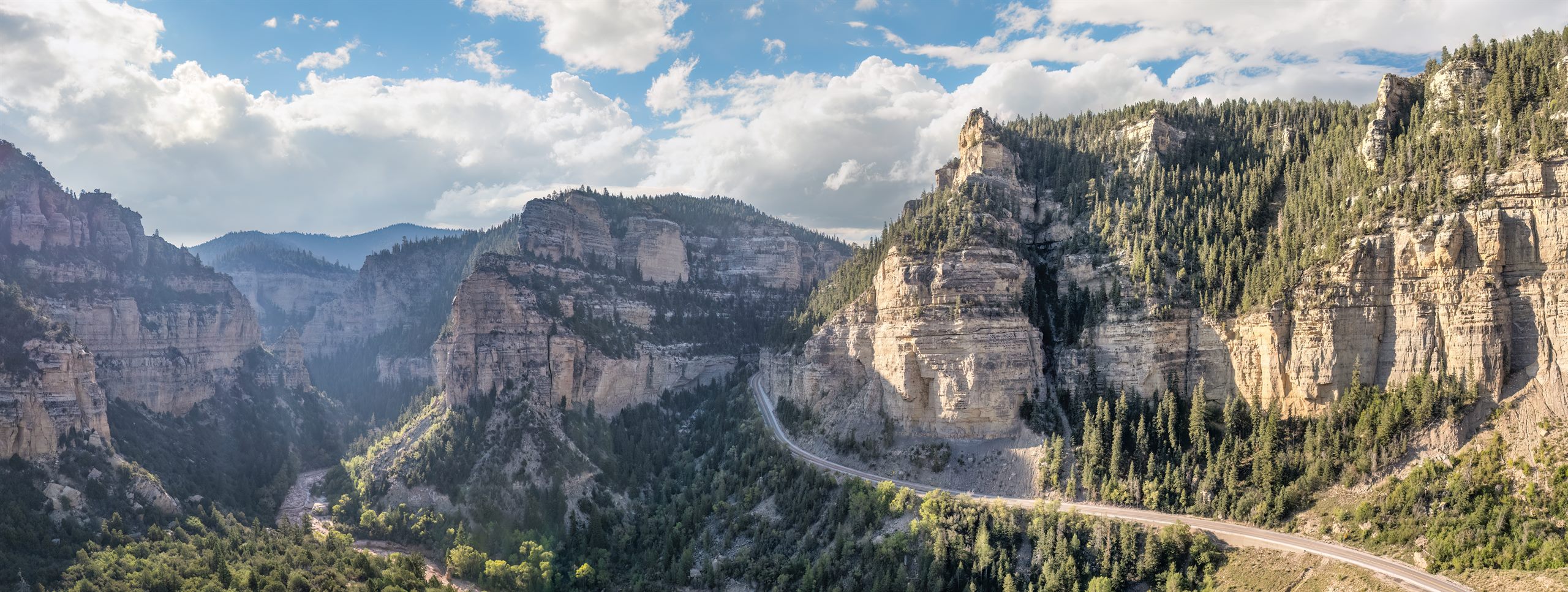
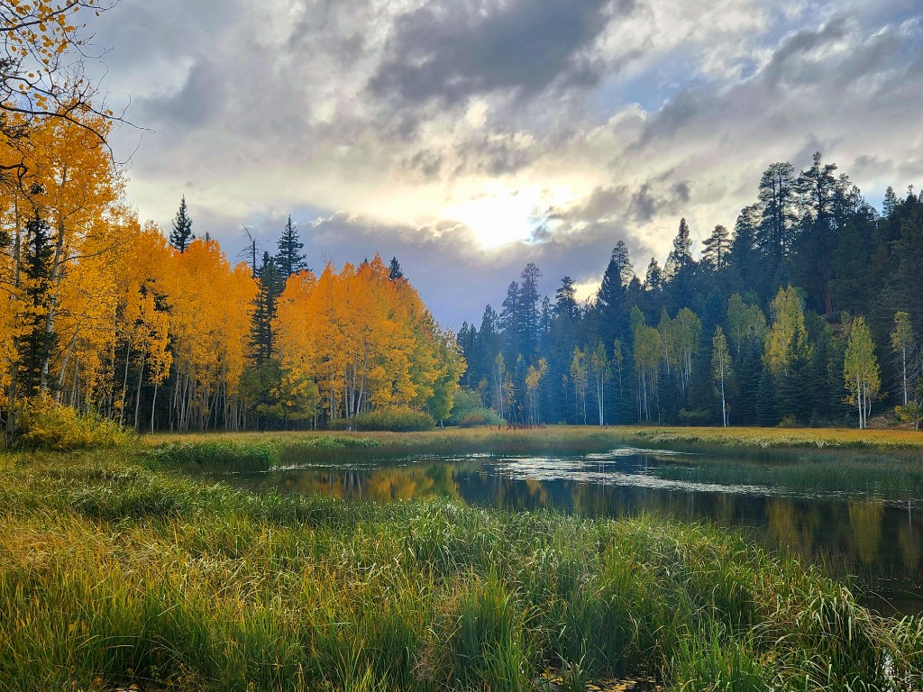
9 月下旬开始, 白杨变成红色和金色。开车本身就是风景。
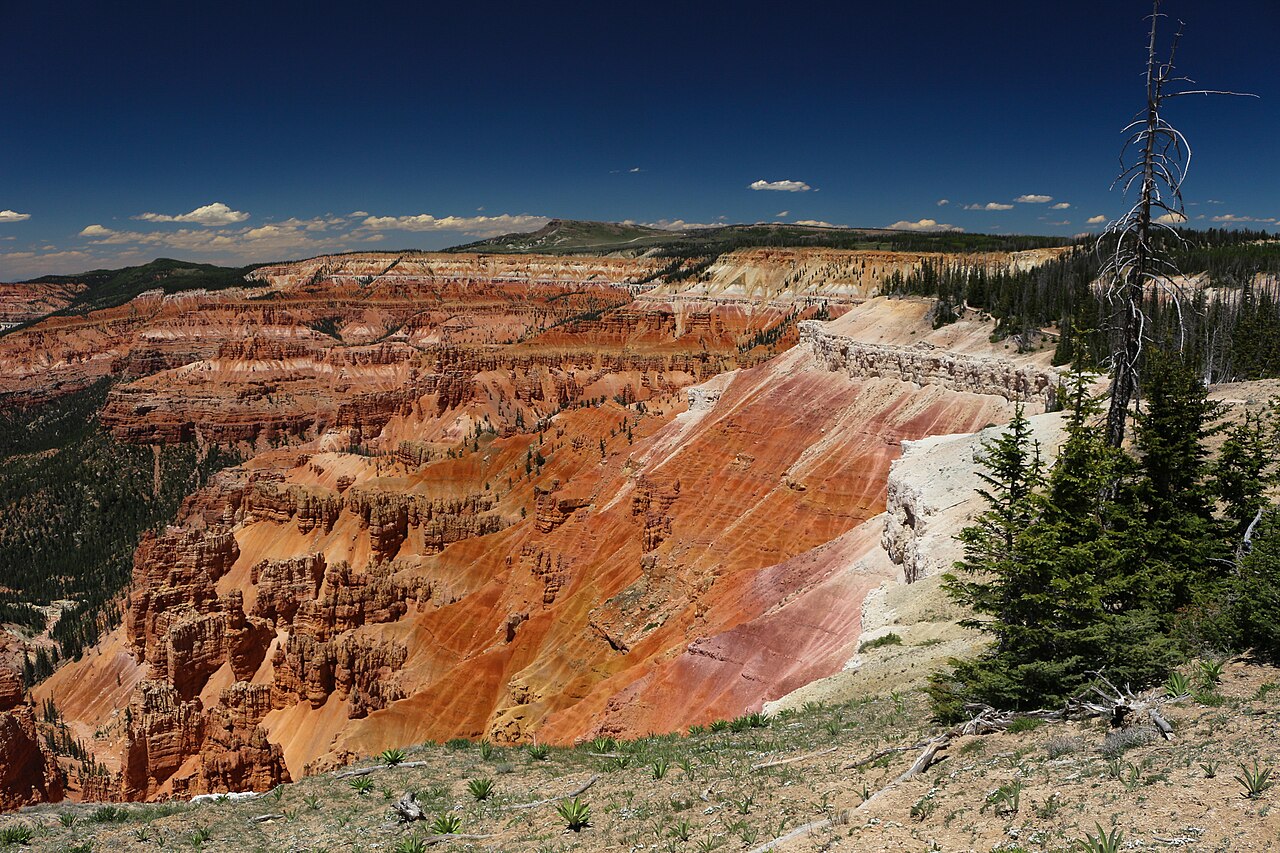
一眼看到通往 Zion 方向的巨大落差。日落时段最好。
国际暗夜公园, 季节性护林员夜空活动以 NPS 日程为准。
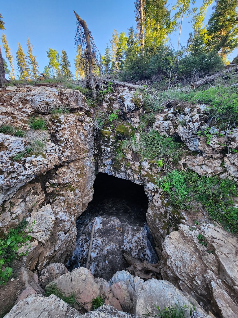
当地经典的熔岩管,每年 10 月 1 日至 4 月 30 日因蝙蝠冬眠关闭,每人都要带一支好用的灯。
Mule deer、elk、marmot, 偶尔还有 fox。早餐前通常最好。
家庭友好型高海拔雪场,约从 9,600 ft 升至近 11,000 ft。
雪量足够时有压雪路线, 也就是被雪覆盖的 OHV 路线。
从村里出发的安静森林路线, 山上也有租赁选择。
Duck Creek Pond 就在村内, 很多孩子第一次下竿都在这里。
轻松半英里步道, 通往附近最上镜的小湖。
村里有咖啡、早餐、pizza、pub 风格餐和 barbecue。
沿 UT-14 下山约 40 分钟有大型超市和商店。回山上前把油加满。
每一篇指南都深入介绍 Duck Creek 体验中的一个部分。
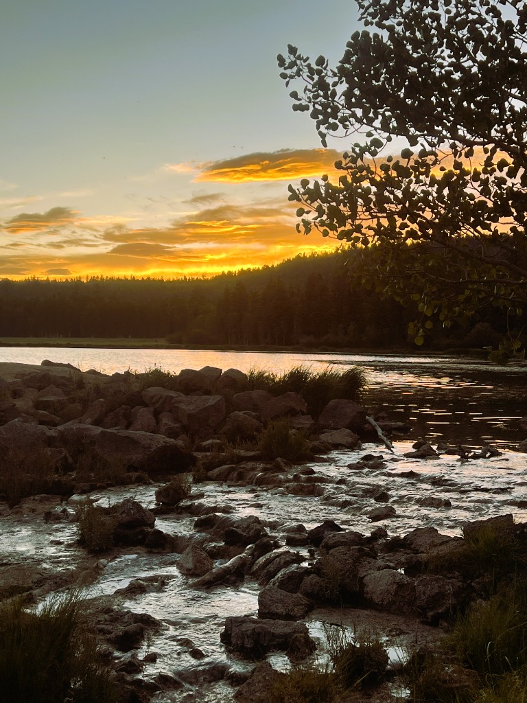
Duck Creek Village 附近的钓点:Navajo Lake、Duck Creek Pond、Aspen Mirror Lake 和 Panguitch Lake,包括鱼种、装备和季节建议
查看指南 Duck Creek Village 附近的露营地——Duck Creek 营地、Navajo Lake 各营地、Uinta Flat 免费分散露营区,以及费用、季节和房车信息
查看指南 Scenic Highway 14 秋色公路之旅、最佳观赏时间、最佳停靠点,以及 Duck Creek 一带的拍照建议
查看指南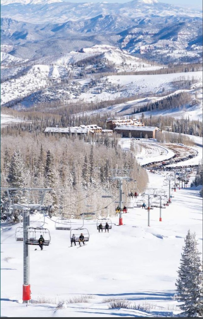
Deer Hollow 冬季休闲区、雪地摩托、越野滑雪,以及 Duck Creek Village 周边的冬季风景
查看指南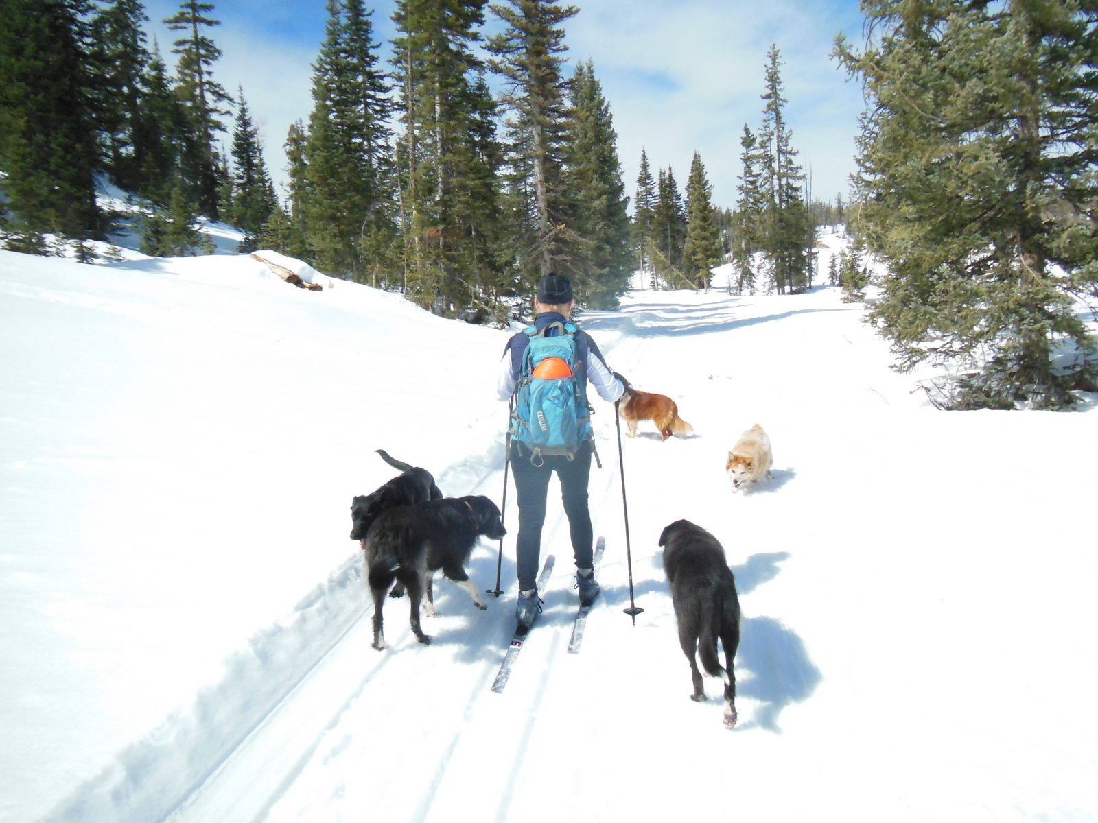
Highway 14 旁、村庄以西约 6 英里(23 英里标附近)的 Deer Hollow 冬季休闲区:压雪越野滑雪环线、雪鞋与胖胎自行车道、可携犬路线,以及这片草甸在夏季的玩法
查看指南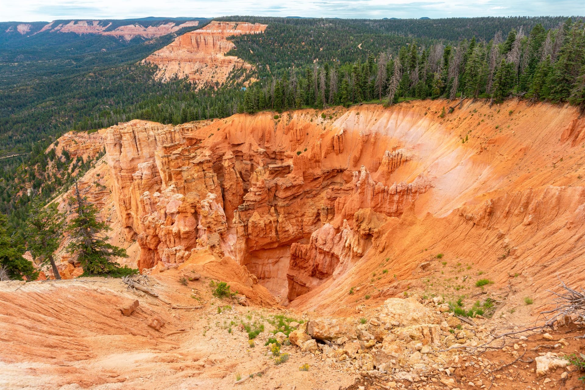
Strawberry Point 观景点:从 Highway 14 出发的碎石路、五分钟步行到崖边、石林与 Zion 景观、日落最佳时段,以及崖边与道路季节的注意事项
查看指南 一部注明来源的 Duck Creek Village 历史——南派尤特人的高地、山间奶场与牧羊人、1930 年代的民间资源保护队营地、Navajo Lake 与灰岩坑洞穴、14 号公路,以及电影牧场时代
查看指南 为什么主路叫 Movie Ranch Road(电影牧场路)——汇编并注明来源的 Duck Creek Village 好莱坞取景地历史,从《Drums Along the Mohawk》(1939)到《How the West Was Won》
查看指南The identity facts people most often look up, with the sources they come from.
Elevation is cited two ways because both are correct: the USGS GNIS benchmark for Duck Creek Village is 8,507 ft (2,593 m), while the village core along Highway 14 — where the lodging, restaurants, and pond sit — is right around 8,400 ft. Duck Creek Village is an unincorporated community rather than a census-designated place, so no separate population figure is published for it.
Sources: Wikidata Q14711503 Wikipedia
Duck Creek Village sits at about 8,400 feet (2,560 m) above sea level, on the Markagunt Plateau inside Dixie National Forest, roughly 30 miles east of Cedar City on Scenic Byway Highway 14. The USGS GNIS benchmark for Duck Creek Village reads 8,507 ft (2,593 m); the village core along the highway — where the lodging, restaurants, and pond sit — is right around 8,400 ft. Both figures are correct, they just measure slightly different points on the same plateau.
That altitude is the whole reason the village feels the way it does. Summer days run far cooler than the red-rock country below, and nights stay cool right through July and August. Winter brings real snow from roughly December through March, tracked by the two SNOTEL stations that bracket the village.
It is also high enough that some guests notice it on arrival: slight breathlessness on hills, faster dehydration, and a stronger sun than the temperature suggests. Drink more water than you think you need, take the first afternoon easy, and use sunscreen even in fall.
Duck Creek weather and forecast → Live snow report and SNOTEL history →
Duck Creek Village is 30 miles east of Cedar City on Highway 14, a 40 to 45 minute drive; the nearest interstate is I-15 at Cedar City.
Nearly everyone arrives on Highway 14, the Scenic Byway that climbs east out of Cedar City and crests the Markagunt Plateau. The last 18 miles gain serious elevation, moving from high desert into ponderosa, spruce, and aspen. The road is paved the whole way and plowed through winter, but it is a mountain highway — it closes for storms and for the occasional rockfall, and UDOT is the authority on whether it is open.
From the south and west, take I-15 to Cedar City and turn east on UT-14. From the north, I-15 south to UT-20, then US-89 south, then UT-14 west. Coming from Bryce Canyon or Kanab, US-89 to UT-14 is the usual approach.
At 8,400 feet, Duck Creek Village runs 20 to 30 degrees cooler than St George and Zion in summer and holds real snow from about December through March.
Elevation is the single most important thing to understand about Duck Creek. At 8,400 feet the village runs far cooler than the red-rock country below it — which is exactly why it fills up in July and August, when Zion and St George are punishing. Nights stay cool through the summer.
Winter brings real snow. The two SNOTEL stations that bracket the village — Harris Flat at 7,800 ft below it and Midway Valley at 9,830 ft above — have been recording depth and snow-water equivalent since the 1980s and 1990s, and we publish their live readings and historical bands rather than a generic forecast.
The altitude is high enough that some guests notice it: slight breathlessness on hills, faster dehydration, and a stronger sun than the temperature suggests.
The Markagunt Plateau — a Southern Paiute name usually rendered "highland of trees" — was in seasonal use long before settlement. Cedar City families ran summer dairies on Cedar Mountain from the 1860s, sheepherders gathered at Duck Creek, and the Dixie Forest Reserve was established in 1905. The Civilian Conservation Corps arrived in 1933, building the Duck Creek work center and campground and, later, the earthen dike that still stabilizes Navajo Lake against its sinkholes.
The village also had a Hollywood era, which is why the main road through town is called Movie Ranch Road.
Full sourced history of Duck Creek Village → Why it is called Movie Ranch Road →
高原上的一天
这是很多客人喜欢的夏日节奏。肩季可以调整顺序, 但保留早出发、下午湖边和夜晚星空。
01
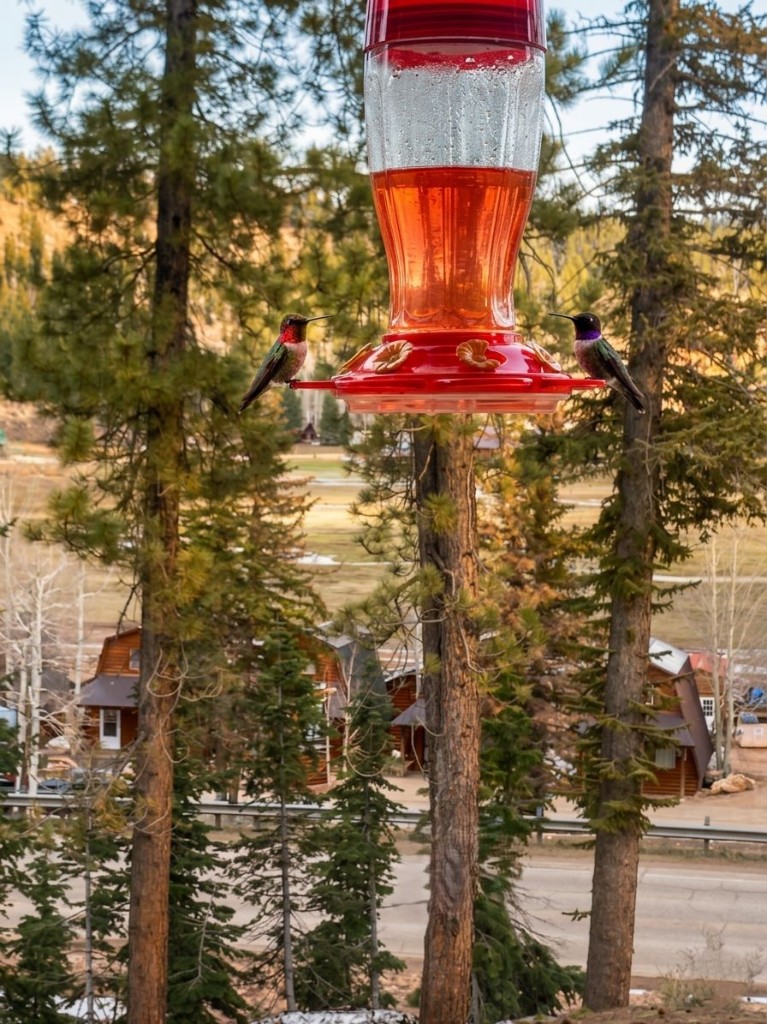
在门廊喝咖啡, 看草地慢慢醒来。Mule deer 常在清晨经过。
02
往返半英里。起风前湖面最平, 像镜子一样。
03
选择一条 Markagunt 环线, 或沿 UT-14 和 UT-148 上 Cedar Breaks。
04
野餐、划船, 或钓放养虹鳟。下午常起风, 想钓鱼要早些。
05
Pizza、pub 餐或烧烤都在村内。饭后可以散步。
06
不必开车。Duck Creek 的夜空足够暗, 有机会看到银河。
地图展示客人常去的湖泊、观景点、洞穴和步道的大致位置。车程为天气良好时从旅馆出发的常见估算。
按季节
Duck Creek 按季节变化很明显。先选符合旅行目标的季节, 再在上 Highway 14 前确认路况和开放情况。
12 月 - 3 月
雪、壁炉、安静
Brian Head 滑雪、雪地摩托、从村里出发的雪鞋路线。请准备冬季驾驶装备。
4 月 - 5 月
融雪、野花、人少
Cascade Falls 因融雪水量大。低海拔步道先开放; Cedar Breaks 的季节性通道通常较晚。
6 月 - 8 月
湖泊、步道、暗夜
ATV、钓鱼和 Cedar Breaks 野花的主要季节。下午雷阵雨较常见。
9 月 - 10 月
白杨、凉爽、人少
Highway 14 秋色、舒服的徒步天气和更轻松的公园日。晚上要带保暖层。
ATV trails, fishing, caves, wildlife, fall color, hiking, supplies, and local events — with links to deeper guides.
Duck Creek Village Inn 就在村中心,所以本指南里的所有内容都离门口很近。
March 2026
我们从 Duck Creek Village Inn 客人的角度来整理这些指南,写下最实用的路线、时间和季节信息。
行程规划者最常问的 Duck Creek 问题。
可以玩雪地摩托、越野滑雪、雪鞋徒步、Brian Head 滑雪和 Panguitch Lake 冰钓。
可以,只要积雪够厚。
大约 25 分钟。
全年由 UDOT 维护,但风雪过后路况会迅速变化。
可以,Panguitch Lake 在结冰时很受欢迎。