预订 预订住宿
直接预订立减 10%,代码 立减 10% · 12月1日 前入住 · 适用于 2026年12月1日 前入住
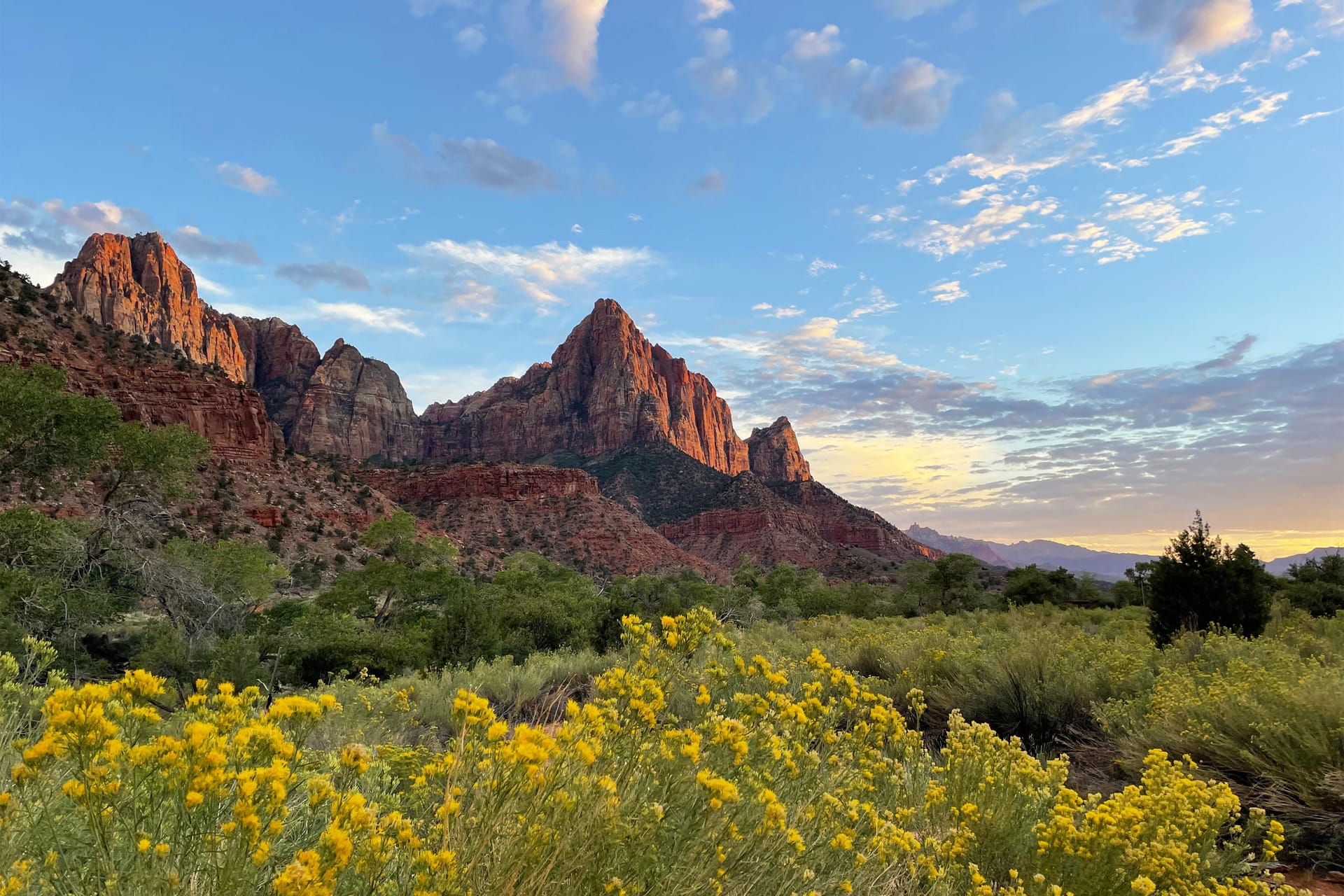
Zion Canyon from near Scout Lookout, sandstone walls dropping to the Virgin River, photographed by the innkeepers

Duck Creek 指南

Zion National Park

行车路线、停车与前往 Zion Canyon 的方式

速览

车程
从 Duck Creek Village Inn 通过 UT-14 W → US-89 S → UT-9 约 1 小时
门票
每车 35 美元,7 天有效,或可使用 America the Beautiful 年票
接驳车
Zion Canyon Scenic Drive 在大约 3 月到 11 月期间需要搭乘;东侧步道不需要
难度
从容易(风景驾驶、Riverside Walk)到艰苦(Angels Landing、The Narrows)
宠物
只允许在 Pa'rus Trail 和开发区;不允许搭接驳车或进入其它步道

快速了解

简短版本

从 Duck Creek Village 出发,游览 Checkerboard Mesa、Canyon Overlook 和 Zion–Mount Carmel Highway 通常走东入口。如果计划在 Zion Canyon 徒步,仍需继续开往游客中心一带,并安排停车和乘坐公园接驳车的时间。出发前,请确认穿园道路是否开放。

关键信息

分类 Daytrip
距离 从酒店出发单程约 1 小时
适合 经典峡谷风光,距 Duck Creek Village 约一小时

出行须知

  • 东入口:UT-9 开放时,从 Duck Creek 前往 Checkerboard Mesa 和 Canyon Overlook 通常走这里。东侧各景点之间需要自行驾车。Canyon Overlook 车位有限;请停在合法车位,并提前想好停车场已满时可去的其他景点。
  • Springdale 南入口:紧邻 Zion Canyon Visitor Center,也是峡谷主要接驳车的出发点。即使从东入口进入,大多数峡谷行程仍从这里开始。前往 The Narrows、通往 Angels Landing 的步道或其他峡谷站点时,请将停车、候车和末班车时间纳入计划。

沿 UT-14 向东至 US-89,再向南至 Mt. Carmel Junction,随后沿 UT-9 向西前往 Zion。正常路况下,到东入口约需一小时,停留和交通延误需另留时间。东入口并非 Zion Canyon Visitor Center;前往峡谷还要继续驾车经过隧道和连续回头弯。

哪个 Zion 入口适合您当天的行程?

东入口:UT-9 开放时,从 Duck Creek 前往 Checkerboard Mesa 和 Canyon Overlook 通常走这里。东侧各景点之间需要自行驾车。Canyon Overlook 车位有限;请停在合法车位,并提前想好停车场已满时可去的其他景点。

Springdale 南入口:紧邻 Zion Canyon Visitor Center,也是峡谷主要接驳车的出发点。即使从东入口进入,大多数峡谷行程仍从这里开始。前往 The Narrows、通往 Angels Landing 的步道或其他峡谷站点时,请将停车、候车和末班车时间纳入计划。

The drive, on a real map

The green line is the road you will actually drive: Highway 14 down to Long Valley Junction, US-89 south, then SR-9 west through the east entrance and the tunnel. The dotted amber road is the Zion Canyon Scenic Drive, shuttle-only in season. Tap any pin for the note we would give you at the front desk.

46 mi inn to the east entrance, about 55 minutes
58 mi inn to the visitor center and shuttle, about 1 hr 35 min
4,525 ft of descent from 8,455 ft at the inn to 3,930 ft at the visitor center

The interactive map needs JavaScript. The route is SR-14 east to US-89, south to Mount Carmel Junction, then SR-9 west through the East Entrance and the Zion-Mount Carmel Tunnel.

  • Your drive from the inn
  • Shuttle road (no private cars in season)
  • Stop or trailhead
  • Shuttle stop
Route geometry traced from OpenStreetMap routing; point coordinates from the National Park Service. Basemap by CARTO and OpenStreetMap contributors.

Down, then up, then down through the tunnel

Elevation profile of the drive from Duck Creek Village Inn to Zion Canyon Visitor Center About 58 miles, dropping from 8,455 feet at the inn to 3,930 feet at the visitor center, a descent of 4,525 feet. The road falls steadily down Highway 14 and US-89 to 5,200 feet at Mount Carmel Junction, climbs back to about 6,000 feet on SR-9, reaches the East Entrance at 5,690 feet, and drops through the tunnel into Zion Canyon. 4,000 5,000 6,000 7,000 8,000 The inn 8,455 ft Long Valley Jct 7,460 ft Mt. Carmel Jct 5,200 ft East Entrance 5,690 ft Canyon Overlook 5,130 ft Visitor Center 3,930 ft mile 01020304050 58 mi
Fifty-eight miles and 4,525 feet of descent. You lose most of it before Mount Carmel Junction, climb back over the divide on SR-9, then drop through the tunnel into the canyon. USGS 3DEP elevations sampled every 500 m along the OSRM-traced route.

From the east entrance

Top 10 things to do in Zion, in the order the day unfolds

Enter from the east and the park arranges itself in a line: the pie stop, the mesa, the overlook, the tunnel, then the canyon. Here are the ten we send guests to, with the distances the National Park Service publishes for each.
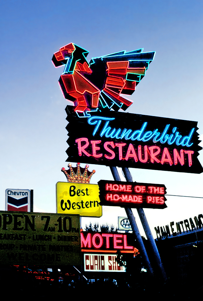
  1. Neon Thunderbird Restaurant sign at dusk with the Ho-Made Pies panel lit

    Mile 34, Mount Carmel Junction

    Pie and coffee at the turn

    Where US-89 meets SR-9, the Thunderbird and its "Ho-Made Pies" sign have marked the turn toward Zion since the 1930s. It is the last fuel before the park and the easiest breakfast on the route. The Shop Coffee Co. in Orderville, ten minutes earlier, is the other morning stop.

    Where to eat around Zion
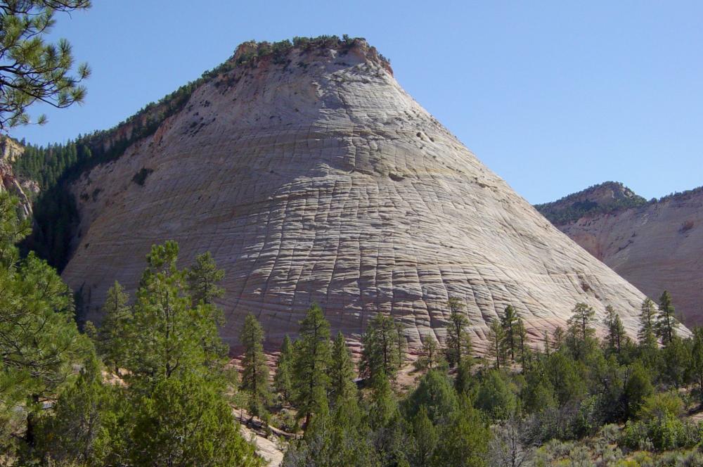
  2. Checkerboard Mesa, a sandstone dome scored into a grid pattern

    Just inside the east entrance

    Checkerboard Mesa pullout

    The first thing the park shows you is a dome of Navajo sandstone scored into a grid: horizontal cross-bedding from ancient dunes crossed by vertical fractures. A signed pullout on the right is the place to stop. There is no trail to the top, so treat it as a photograph and a stretch, not a hike.

    The east side in detail
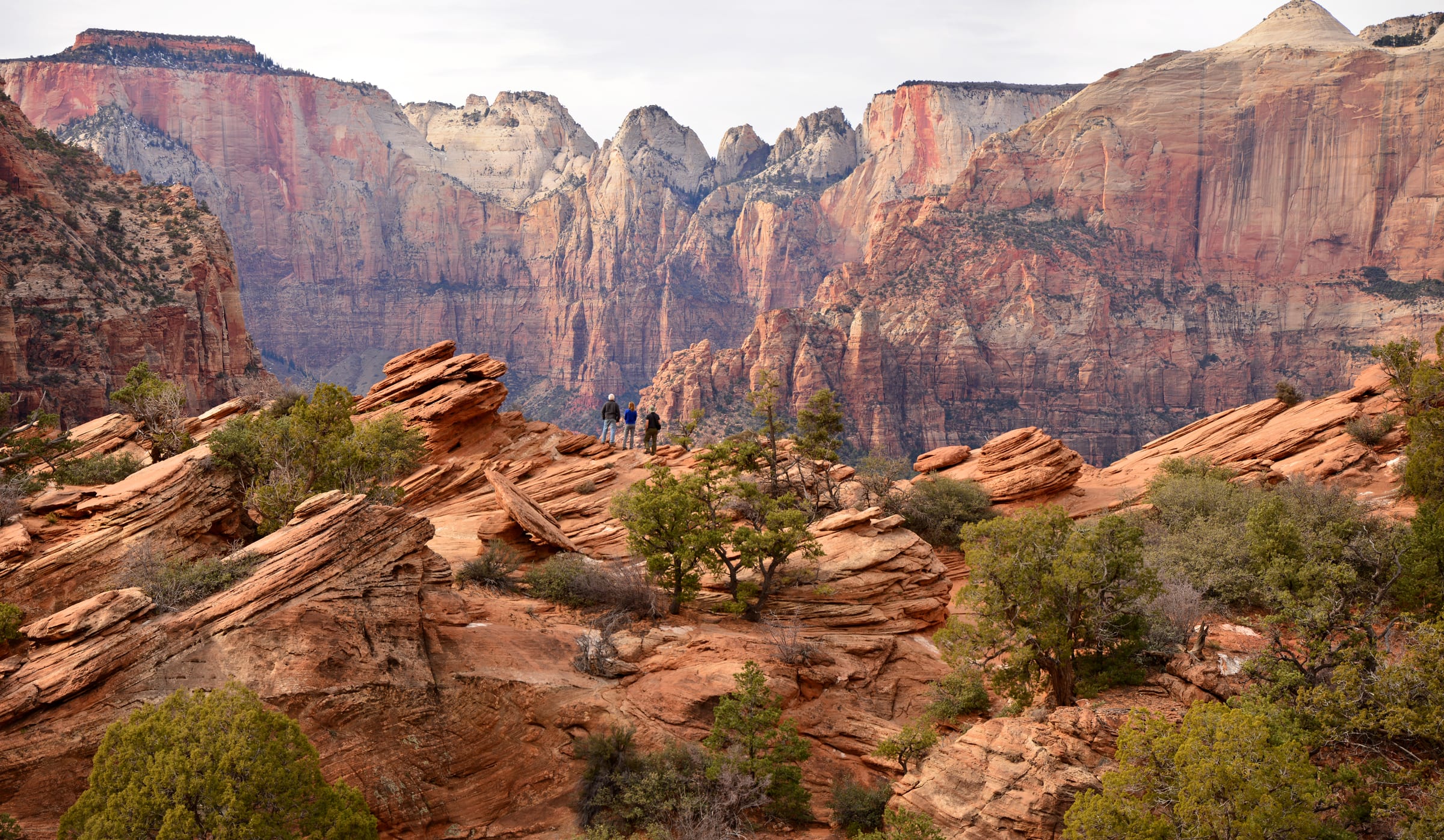
  3. View from Canyon Overlook Trail across lower Zion Canyon

    1 mi round trip, 163 ft

    Canyon Overlook Trail

    The best view-per-step in Zion starts at the small lot at the tunnel’s east portal, right turns only in and out. Sandstone steps with a handrail climb above a slot canyon, then the trail opens onto slickrock and ends at a fenced ledge facing the Towers of the Virgin. The NPS itself says to be ready to try the lot more than once; arriving from the east at 8 AM usually solves that.

    Parking and timing for Canyon Overlook
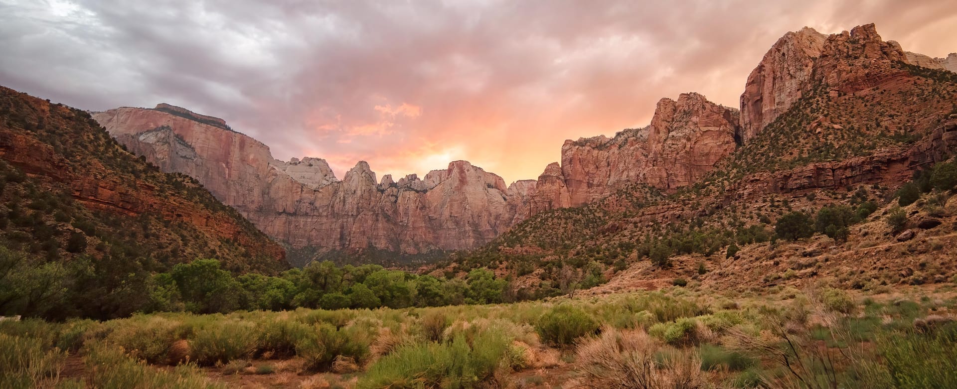
  4. Towers of the Virgin sandstone cliffs seen from the west side of the tunnel

    1.1 mi, opened 1930

    Drive the Zion-Mount Carmel Tunnel

    A mile of darkness blasted through the cliff between 1927 and 1930, with gallery windows cut into the canyon side that flash red rock as you pass. Cars, SUVs and pickups drive straight through. Since June 2026 oversize vehicles are banned from the whole highway, so RVs and trailers over the limits must plan a detour.

    Tunnel history and the 2026 vehicle rules
  5. The Watchman formation glowing at sunset above the Virgin River

    1.6 mi one way, paved

    Pa’rus Trail, dogs and bikes welcome

    Pa’rus is Paiute for "bubbling water," and this paved path follows the Virgin River from the visitor center to Canyon Junction with the best views of the Watchman in the park. It is the only Zion trail open to leashed dogs and bicycles, wheelchair friendly, and the NPS names it as a sunset and stargazing spot.

    如果想在 Canyon Junction 附近拍摄 Watchman 和河流,请使用 Pa'rus Trail 上的人行桥。Canyon Junction 的公路桥禁止行人通行,请勿在桥上停留拍照。

    NPS 推荐的日出与日落观赏地点

    All the easy hikes
  6. The Riverside Walk beside the Virgin River as the canyon walls close in

    1 mi one way, paved, shuttle stop 9

    Riverside Walk, then wade into the Narrows

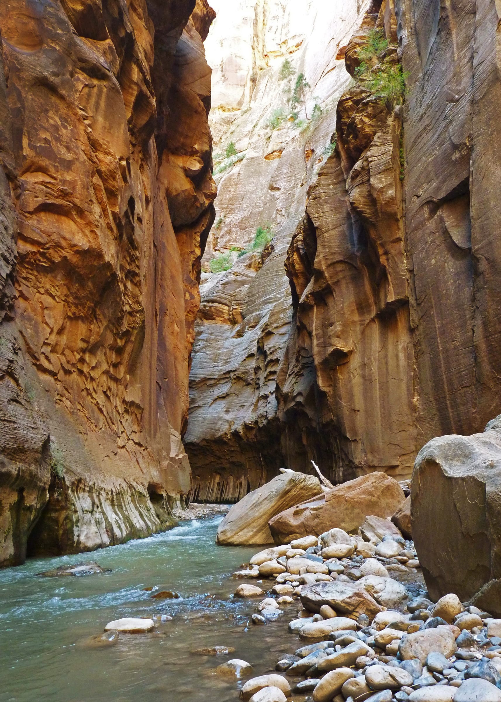
    The paved Riverside Walk from the Temple of Sinawava ends at a set of stairs into the river. From there the Narrows is the trail: no permit as far as Big Spring, a strenuous ten miles round trip, and most people are happy with the first hour. The NPS closes it entirely above 150 cfs, which is why the live gauge is on this page.

    Gear, flow and how far to go
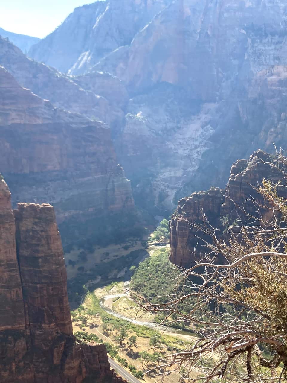
  7. Zion Canyon and the Virgin River seen from near Scout Lookout, photographed by the innkeepers

    1.9 mi one way, 1,187 ft, shuttle stop 6

    Scout Lookout, no permit required

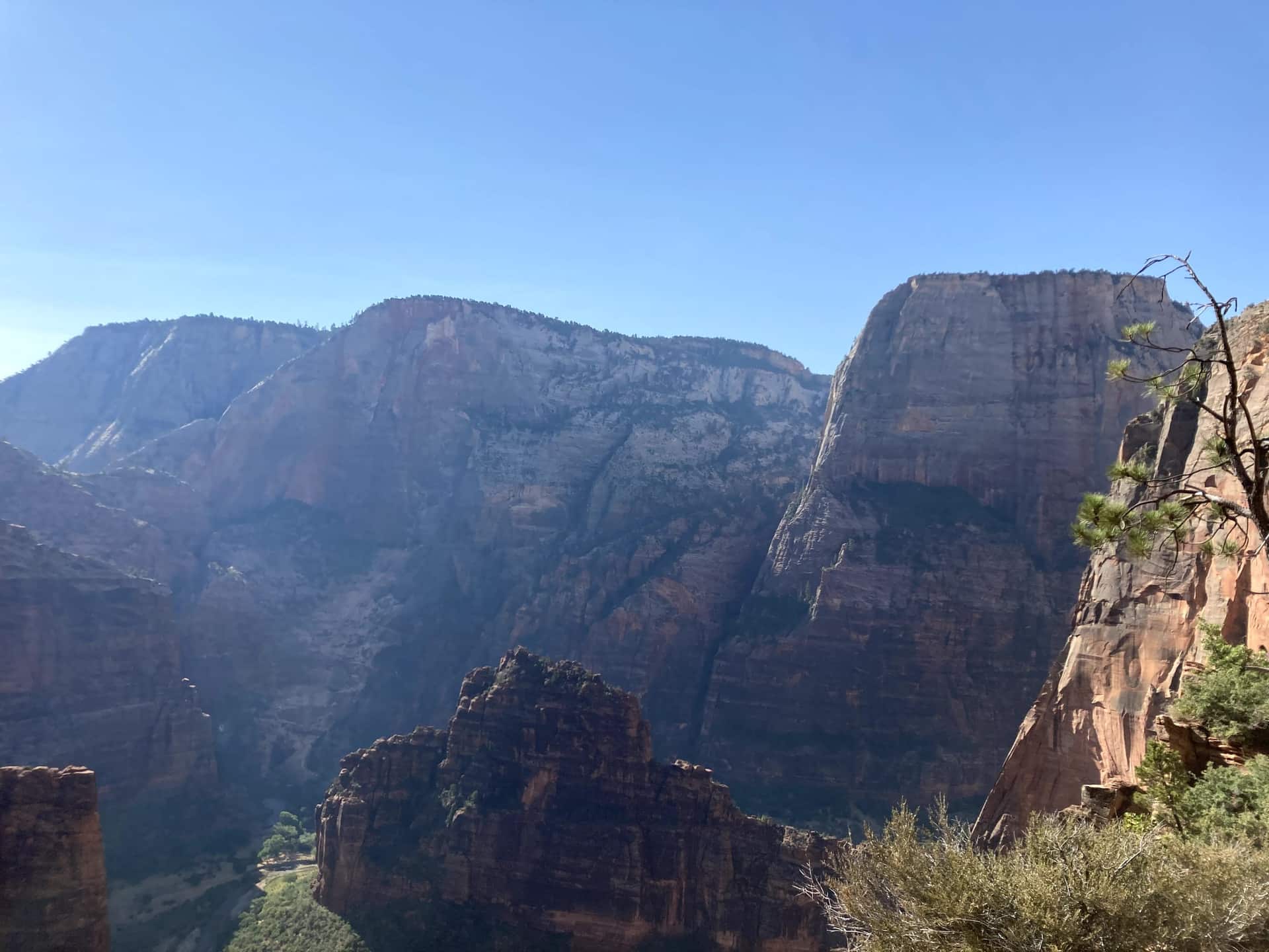
    From the Grotto footbridge the West Rim Trail climbs the canyon wall, levels out in the shade of Refrigerator Canyon, then finishes with the 21 switchbacks of Walter’s Wiggles. Scout Lookout sits about a thousand feet above the river with restrooms, condors, and the view in our photos below. Only the final chained ridge to Angels Landing needs a permit.

    Angels Landing permits and the lottery
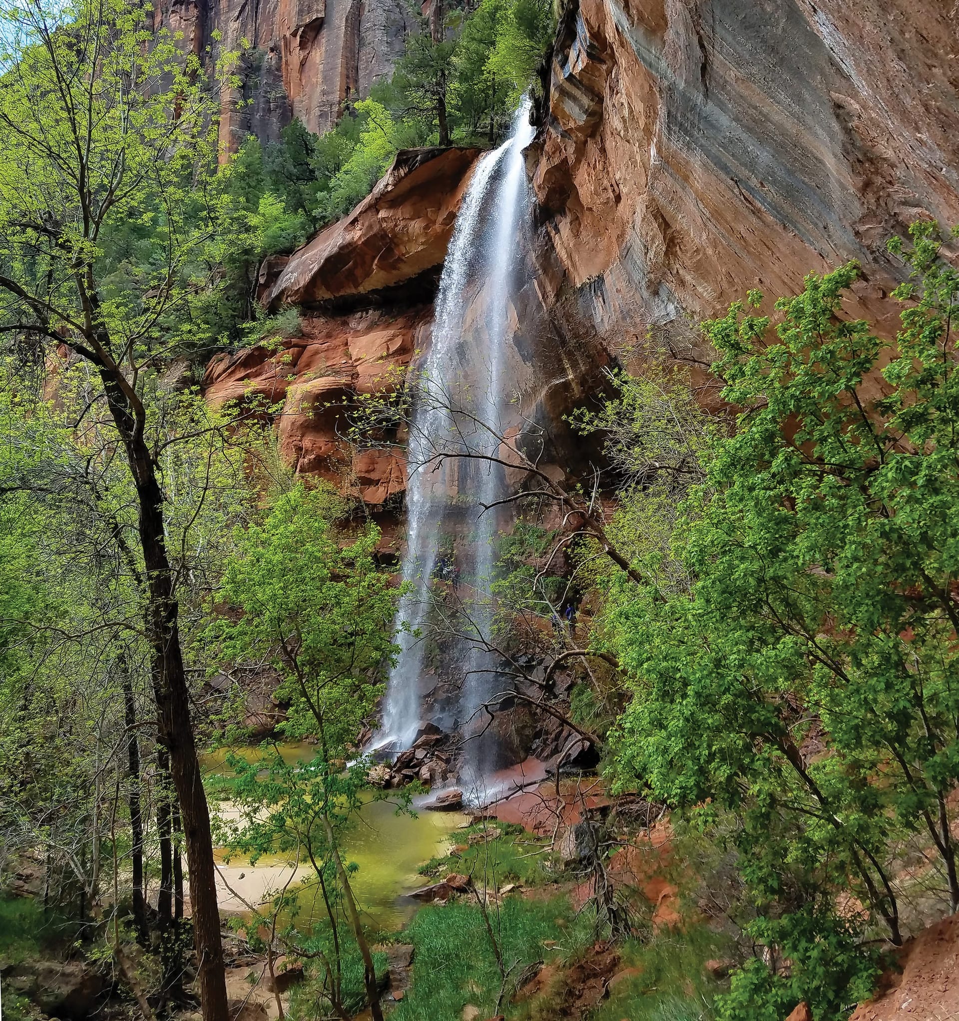
  8. Emerald Pools waterfall dropping from a sandstone alcove in Zion

    Lower pool 0.6 mi one way, shuttle stop 5

    Emerald Pools from Zion Lodge

    A tiered set of pools fed by seasonal waterfalls, starting across the road from Zion Lodge. The Lower Emerald Pool path is rough-paved and family friendly; the Upper Pool adds stone steps and sand to the base of the cliffs, with Lady Mountain and the Great White Throne in view. The pools are wildlife water, so no swimming.

    Moderate hikes compared
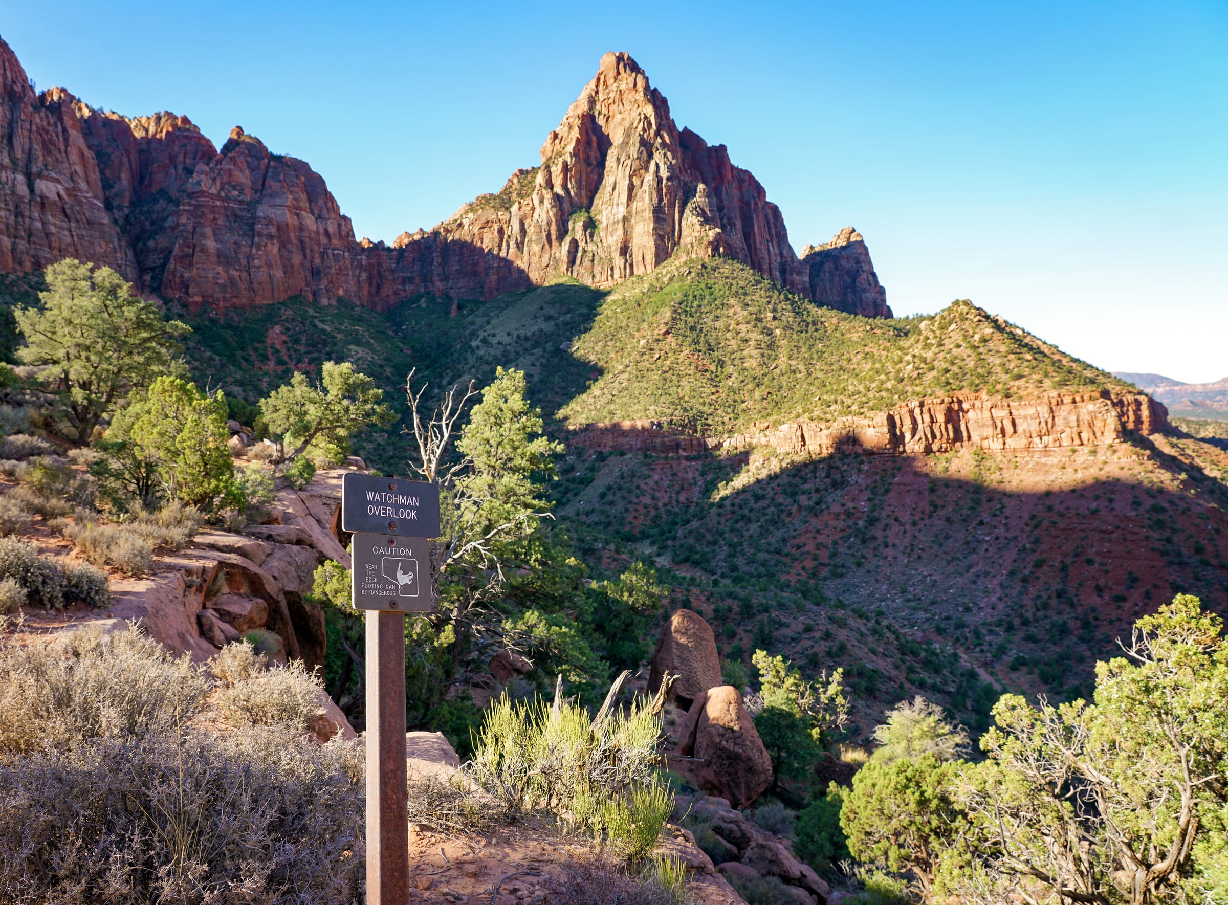
  9. The Watchman Trail climbing above Springdale toward the canyon walls

    1.4 mi one way, 479 ft, no shuttle needed

    Watchman Trail at golden hour

    The one canyon hike that starts at the visitor center parking lot, so it works even after the shuttles stop for the day. An unpaved climb to an overlook of the Watchman, the Temples and Towers, and Springdale below, with the late light on the walls that people drive from Las Vegas for.

    Watchman Trail details
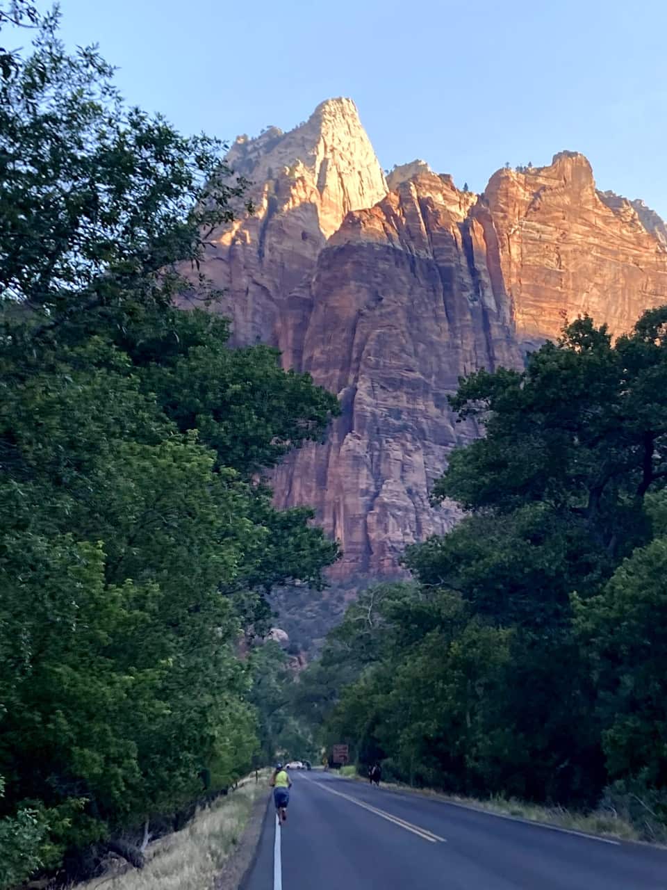
  10. First light on the sandstone walls above the Zion Canyon Scenic Drive, photographed by the innkeepers

    International Dark Sky Park since 2021

    Stay for the dark sky, then drive home east

    Most cars file out of the park as the light fades. Zion has been an International Dark Sky Park since June 3, 2021, and the NPS points stargazers to the Human History Museum patio and the Pa’rus Trail. Check the moon phase, bring a jacket, and you will have the Milky Way over the Towers of the Virgin.

    NPS stargazing guide

Our own hike

From the Grotto to Scout Lookout, one June morning

These are our photos, not stock. We left the inn before seven, were on the Zion Lodge road as the sun hit the walls, crossed the Grotto footbridge at eight, and were looking down on the river from Scout Lookout by half past nine. No permit needed for any of it.
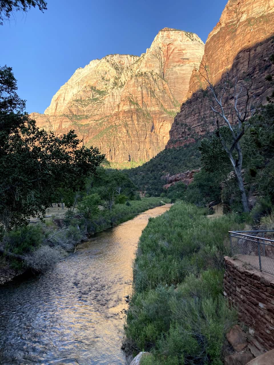
The Virgin River from the Grotto footbridge at 8 AM, sunlight on the canyon wall above
The Virgin River from the Grotto footbridge, just after 8 AM. The West Rim Trail starts on the far bank.
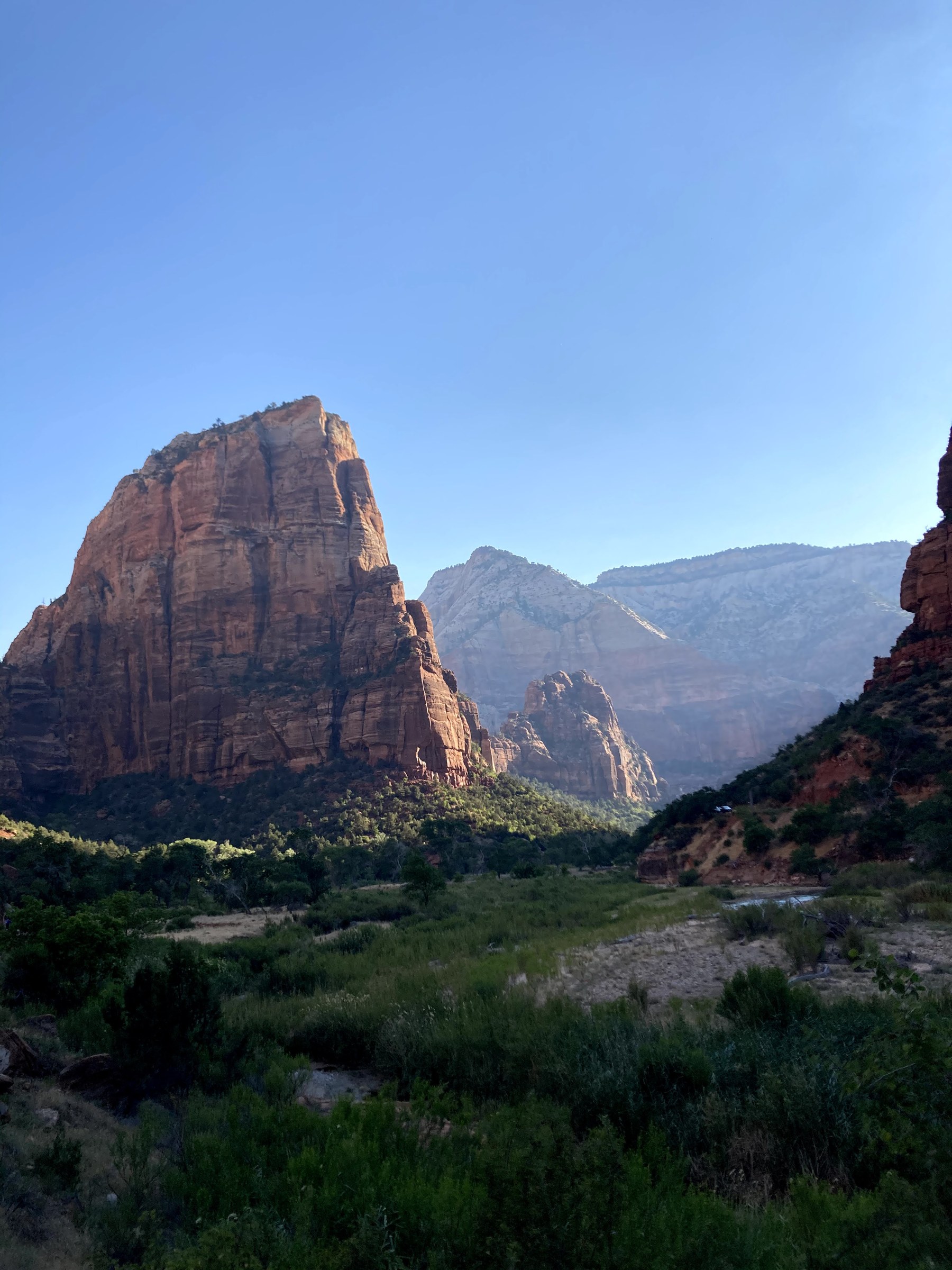
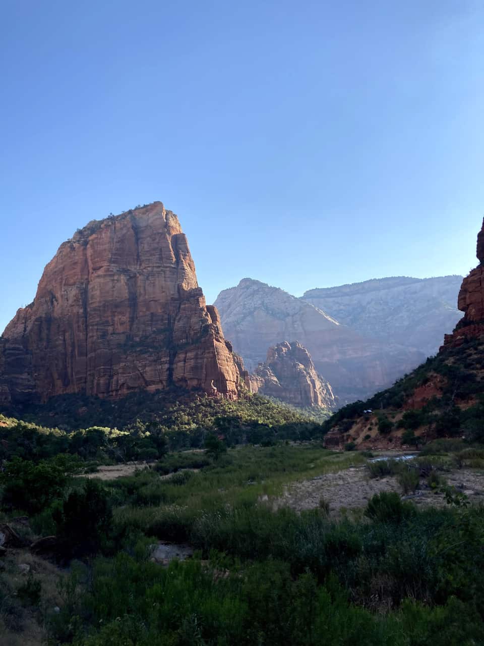
Angels Landing rising above the canyon floor, seen from the start of the West Rim Trail
Angels Landing from the first steps of the West Rim Trail. Scout Lookout is the saddle behind it.
Looking down on the Virgin River and the scenic drive from near Scout Lookout
Looking back down at the river and the road from near Scout Lookout, about a thousand feet up.

The numbers most Zion guides skip

Live river flow, two climates, and how busy it really gets

Virgin River right now

Is the Narrows open today?

1820 cfs Over 150 cfs

Above the NPS closure threshold: the Narrows is closed to all travel at this flow. Make it a Riverside Walk day and check back tomorrow.

USGS gauge 09405500, North Fork Virgin River near Springdale · reading from Nov 1, 11:05 AM MT . The NPS closes the Narrows to all travel above 150 cfs. Cfs is cubic feet per second of water moving past the gauge.

  • 30% of Zion visits come through the east entrance against 60% at Springdale, per UDOT's Zion Area program
  • nearly 5 million recreation visits in 2025 NPS visitor use statistics; Zion was the second most visited national park
  • 65% of the year’s visitors arrive April through September a June averages 556,426 visits, a January 130,503 (NPS, 2019 to 2023)
  • 4,525 ft of descent from the inn to the visitor center USGS 3DEP elevations along the traced route; you climb it all again after dinner
  • 200 to 4,500 cfs how fast the Virgin River rose in a 1998 flash flood NPS geology record; the Narrows closes to all travel above 150 cfs
  • June 3, 2021 certified an International Dark Sky Park the last of Utah’s Mighty Five to earn it; the museum patio is the NPS pick for stargazing

Sleep at 8,400 feet, hike at 4,000

The canyon floor and the village are an hour apart and a season apart. The bars show each month's normal daily low to high at both. Plan the canyon for the morning, and expect a jacket on the deck when you get home.

Monthly temperature ranges: Zion Canyon floor versus Duck Creek Village Paired bars for each month showing the normal daily low to high. In July the canyon floor runs from 69.5 to 100.3 degrees Fahrenheit while Duck Creek Village runs from 47 to 78. The canyon's afternoon high is about 22 degrees warmer than the village in May. 20° 40° 60° 80° 100° 100°F Jan Feb Mar Apr May Jun Jul Aug Sep Oct Nov Dec 100° 78°
  • Zion Canyon floor, about 4,000 ft (normal daily low to high)
  • Duck Creek Village, 8,400 ft
NOAA 1991 to 2020 normals. The canyon floor is the Zion NP (NOAA station USC00429717) station by the Human History Museum; the village figures are interpolated between the Alton (7,100 ft) and Brian Head (9,770 ft) stations that bracket it. In July the canyon's normal high is 100°F while the village tops out near 78°F.

How the day flows from the inn

  1. 离开村庄前,先决定当天游览东侧,还是到峡谷徒步。

  2. 游览东侧时,先查看 UT-9 路况,再前往沿途观景点;如果有合法停车位,可安排 Canyon Overlook。请留出额外时间,不要把整个行程建立在一定能找到车位的前提上。

  3. 到峡谷徒步时,请尽早抵达游客中心,并在运营季乘坐接驳车。开始徒步前,确认最后一班返程车的时间;只有时间和停车条件允许时,再增加东侧景点。

  4. 返程前,再次查看 Highway 14 和 Zion 穿园道路的路况。道路关闭可能意味着需要换一条路线返回 Duck Creek。

何时前往

Zion 全年开放,但不同季节体验很大。

从 Duck Creek 出发的话,春秋肩季最理想。

如果夏天去,最好 7 点前出发。

携带物品

  • 足够的水
  • 防晒和分层衣物
  • 结实鞋子
  • 打印或下载好的接驳时间表和步道地图
  • 零食或午餐

住宿规划

如果行程结合山地活动、Zion 和 Bryce Canyon,Duck Creek Village 是适合的住宿地点。如果大部分时间都会花在峡谷步道上,请比较从这里往返 Zion Canyon 的额外车程与住在 Springdale 的便利程度。旅馆的客房和木屋适合也想在 Duck Creek 周边游玩的旅客。
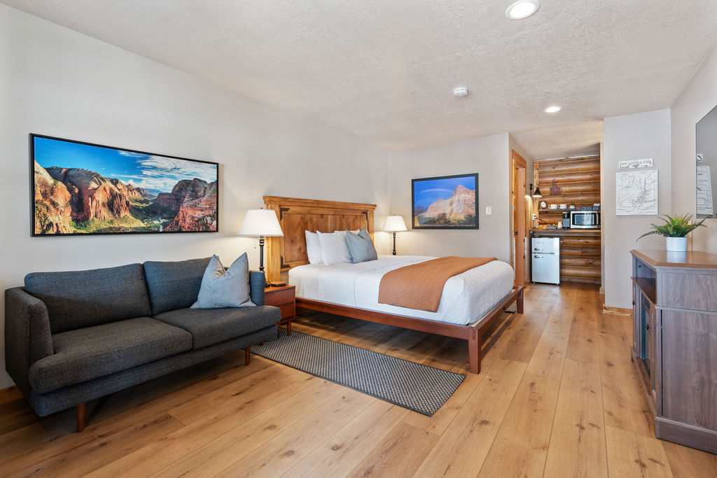
Zion Canyon Suite at Duck Creek Village Inn, a king studio with Zion photography on the walls Sleep in the theme Zion Canyon Suite Zion on three walls, a king bed and a sofa, and the park about an hour away. See the room
Cover of the Duck Creek Village Inn guide to Zion from the east entrance

Free printable guide

Zion from the east: the top 10, on your phone

A short, pretty version of this page for the car: the route, the ten stops in order, the day plan, the tunnel rules, and the links to check the morning you go. Save it before you lose signal on Highway 14.

It also carries our mystery-gift invitation: book a stay with Duck Creek Village Inn and mention the guide at check-in for a small surprise from the inn.

Download the Zion guide (PDF)

Free · No email required · English

September 2026

为什么信任这份指南

我们从住在 Duck Creek Village Inn 的客人视角来写这些 Zion 指南。

从 Duck Creek 规划 Zion

行程规划者接下来最常问的问题。

从 Duck Creek Village 出发,该走 Zion 的哪个入口?

前往东入口的常用路线是 UT-14 向东、US-89 向南,再沿 UT-9 向西。这条路线适合游览东侧观景点;穿园道路开放时,也可继续前往 Zion Canyon。请先查看道路关闭信息。如果计划在峡谷徒步,还要预留前往游客中心停车场及乘坐接驳车的时间。

Zion Canyon Visitor Center 在东入口吗?

不在。它位于 Springdale 南入口附近。从东入口前往游客中心,需要在道路开放时沿 Zion–Mount Carmel Highway 行驶,经过隧道和连续回头弯。

东侧哪里可以停车?

请使用指定的路边停车区和步道起点停车场。Canyon Overlook 的车位非常有限,早到也不保证有位置。不要在隧道内停车,也不要停在合法车位以外的地方。停车场已满时,请选择其他景点。

东入口有公园接驳车吗?

没有。公园峡谷接驳车从南入口附近的 Zion Canyon Visitor Center 出发。接驳车运营期间,大多数游客需要在游客中心停车,或利用 Springdale 的接驳服务换乘,才能到达 Zion Canyon 的步道起点。

房车可以通过东入口吗?

只有符合 NPS 全部尺寸和重量限制的车辆,才可使用东入口与 Canyon Junction 之间的公路。出发前,请根据车辆及拖车情况核对官方限制。较大车辆可通过其他路线前往南入口,但仍需考虑停车位和营地是否可用。

Duck Creek Village 的客房与木屋

先确定适合此次行程的公园游览日和村庄活动,再选择住宿。

直订立减 10%,代码 · 适用于 2026年12月1日 前入住 直订最优价 · 现在预订,之后付款

致电我们 · 435-990-5488