
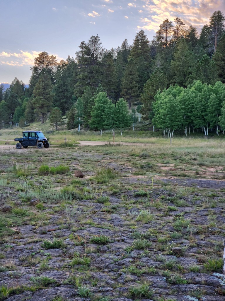
What are the Henrie Knolls?
A chain of cinder cones north of Duck Creek Village. The Henrie Knolls lava flow dammed Duck Creek and created Navajo Lake. Forest Service spur 42 climbs just over two miles to the top of the northernmost knoll.
Ride from the inn
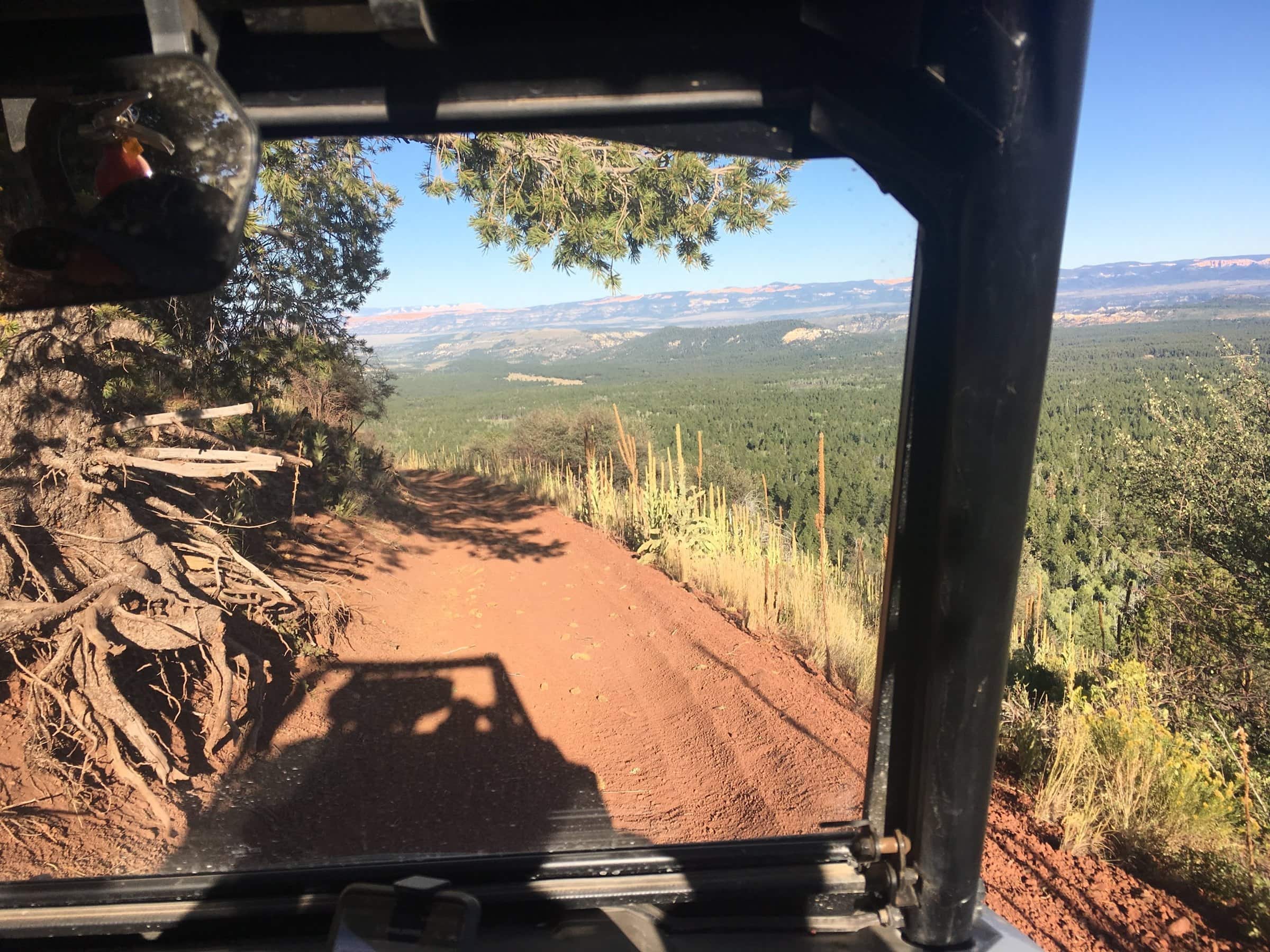
Up a cinder cone for the Pink Cliffs on the horizon
One digit is a loop; two digits is a spur of that loop (52 branches off Loop 5).
The Henrie Knolls & Lava Flat route from the inn, traced from the official 2019 Markagunt OHV System map. Tap a marker for the trail number.
Henrie Knolls is a chain of cinder cones north of the village, and the lava that poured out of them is the reason Navajo Lake exists: the flow dammed Duck Creek, and the lake has been backing up behind it ever since. This ride goes to the top of the northernmost knoll. From our lot it heads north through the black lava field and Lava Flat, joins the Forest Service Trail 4 Tommy Creek Loop country, and finishes on spur 42 Henrie Knolls, a two-mile climb to the summit.
The photo at the top of this page is ours, taken on the way back down: the road drops off the knoll with the Pink Cliffs on the horizon, and on a clear day the view runs across the whole plateau. The climb is what makes it intermediate; the rest is forest road at a steady grade. Our routed line shows about 2,100 feet of total climbing between roughly 8,240 and 8,730 feet, but elevation data under-reads the knoll itself, which tops out near 9,250 feet, so expect the last two miles to be steeper than the profile suggests.
7 legs, 22.4 miles out and back. Every ride starts and ends in our parking lot.
Pull out of our lot onto Movie Ranch Road and follow the village OHV routes (spurs 52 and 59). Village streets are 15 mph and transit only. This ride heads north rather than toward the lake.
Where the route meets SR-14, cross. If your machine is not street legal you may only cross the highway: stop, yield to traffic, and cross at a right angle. Street-legal side-by-sides may ride SR-14 itself under Utah Code 41-6a-1509, but nothing on this ride needs it.
Forest roads lead north out of the village through the lava field to Lava Flat, a little over a mile north of the inn as the crow flies. Expect washboard and cinders; the flow is rough underfoot but the roads are graded.
The route continues north and joins the Forest Service Trail 4 Tommy Creek Loop corridor, where spur 46 Mammoth Cave and spur 42 Henrie Knolls branch. Follow the markers with a 4 and watch for the 42.
Spur 42 Henrie Knolls climbs just over two miles to the top of the northernmost knoll. It is the steepest sustained grade on any of our featured rides; take it in low range and give the machine ahead of you room on the cinders.
From the top the view takes in the plateau, and on the way down the road points you at the Pink Cliffs on the horizon. Descend slowly; loose cinders do not grip like dirt.
Retrace the Tommy Creek corridor south past Lava Flat, recross SR-14 with the same stop-and-yield rule, and roll back through the village to our lot. 22.4 miles as ridden from the inn.
Best time: Late morning on a clear day for the longest view from the top; late September puts gold aspen in the lava field. Avoid the knoll in wind and lightning.
Rules in full, including permits, helmets and the highway crossing law, are on our rules and safety page. Rentals and packing are on rentals and tips.
What guests ask at the front desk before they head out.
A chain of cinder cones north of Duck Creek Village. The Henrie Knolls lava flow dammed Duck Creek and created Navajo Lake. Forest Service spur 42 climbs just over two miles to the top of the northernmost knoll.
It is the steepest sustained grade among our featured rides, on loose cinders, which is why we rate the ride intermediate. The rest of the route is graded forest road. Use low range and descend slowly.
The profile is built from SRTM terrain data, which smooths small steep features like a cinder cone, so the routed line tops out around 8,730 feet while published summit figures are about 9,250 feet. Trust the summit number for the climb.
Yes. Spur 46 Mammoth Cave branches from the same Tommy Creek Loop corridor. Our Mammoth Cave and Tommy Creek Loop ride does both in a full day of about 44 miles.
September 2026
We ride these routes and send guests out on them all season. The route line, mileage and elevation were traced from the official 2019 Forest Service Markagunt OHV System map and routed by computer, not recorded with a GPS, so treat them as a plan, not a survey. Loop and spur names, mileages and closures come from the Forest Service pages below; the highway crossing rule from Utah Code. Closure orders change: carry the current MVUM and ask at the desk.
Rooms and cabins at Duck Creek Village Inn, trailer parking in our lot, rentals across the street, and the trail a few minutes from the door.