Boek Boek direct
Boek direct & bespaar 10%: code Bespaar 10% · t/m 1 dec · verblijven t/m 1 dec 2026
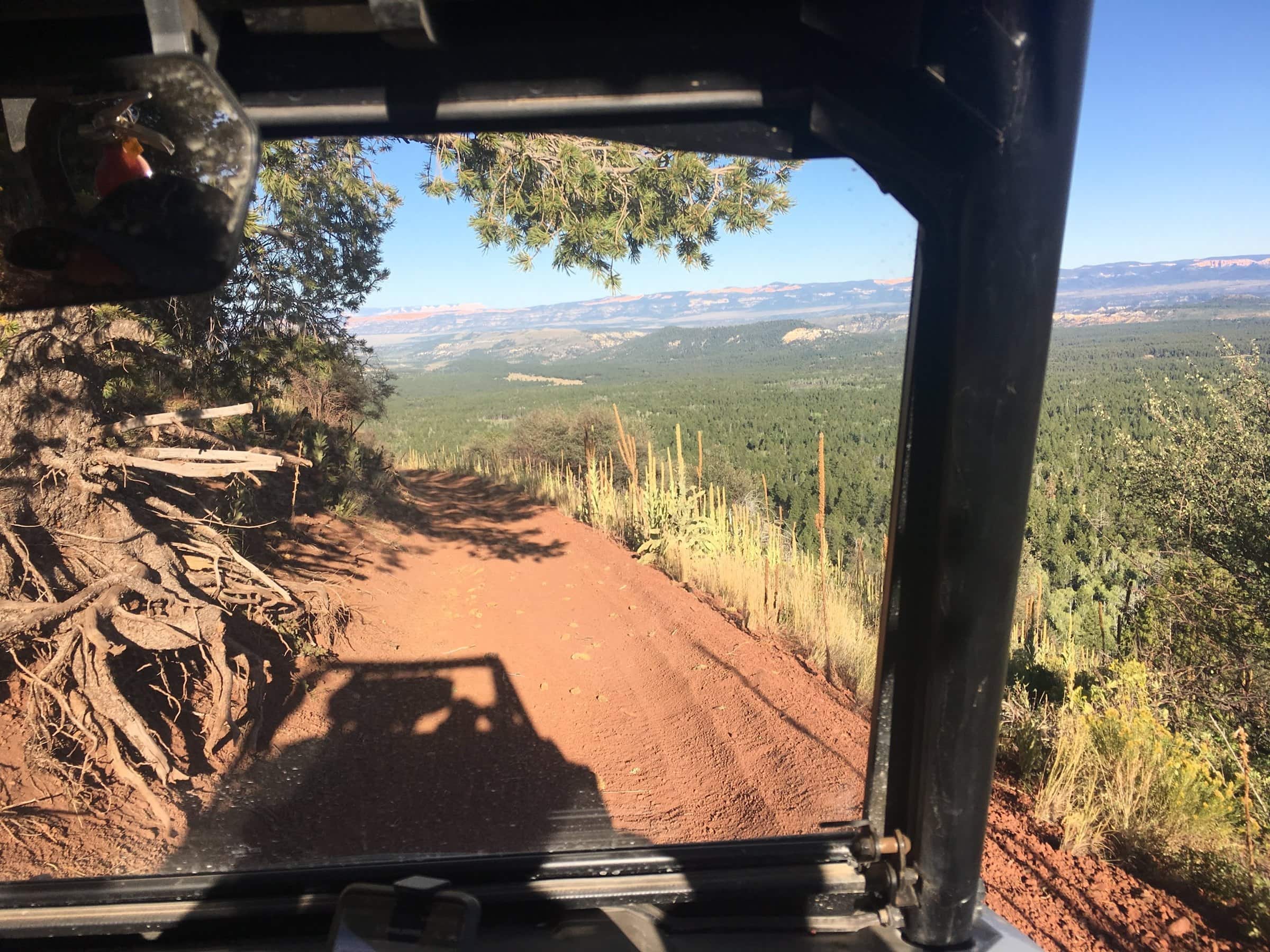
Dropping off Henrie Knolls with the Pink Cliffs on the horizon.

Ritten

Eight Rides from Our Front Door

Family loops, rim overlooks, a lava tube and two remote full days, each mapped from the inn with mileage, elevation and a GPX file

These are the rides we send guests on, in the order we usually suggest them: start with the six-mile loop to Aspen Mirror Lake to learn the machine and the village routes, ride out to Strawberry Point when you want the big view, and work up to the full-day loops once you trust your fuel math. Every one leaves from our lot on designated routes, crosses SR-14 at least once, and never needs a mile of highway riding. Pick a chip to narrow the list, or open the full trail map to see them all at once.

Find your ride

Showing all 8 rides

Easy

Aspen Mirror Lake & Duck Creek Pond

The first ride, the evening ride, the one you do with kids

Distance
6 mi loop
Time
1 to 2 hours
Climbing
350 ft up
  • Family
  • Lakes
  • Short
  • Evening
Easy to intermediate

Strawberry Point Overlook

Thirteen miles to the edge of the plateau and the biggest view on the mountain

Distance
13.2 mi out and back
Time
2 to 3 hours
Climbing
1,200 ft up
  • Views
  • Short
  • Family
Intermediate

Strawberry Loop (Trail 5)

The official 12.5-mile loop, ridden from our door as a 23-mile day

Distance
22.8 mi loop
Time
3 to 4 hours
Climbing
2,900 ft up
  • Views
  • Caves
  • History
Easy to intermediate

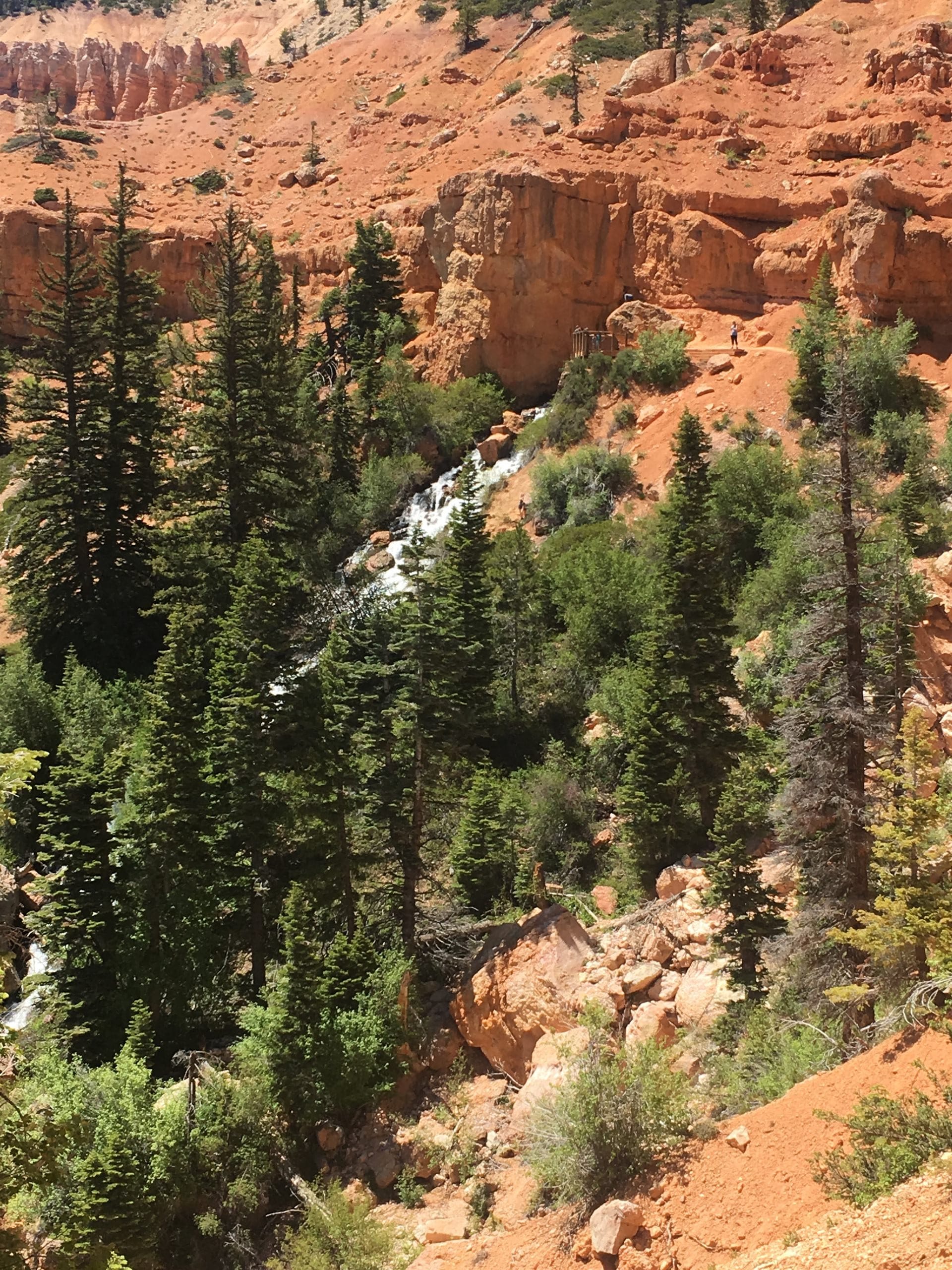
Cascade Falls & the Virgin River Rim

Ride to the trailhead, walk to a waterfall pouring out of a cliff

Distance
14.6 mi out and back
Time
2 to 3 hours plus the hike
Climbing
1,280 ft up
  • Waterfall
  • Views
  • Short
  • Family
Intermediate

Henrie Knolls & Lava Flat

Up a cinder cone for the Pink Cliffs on the horizon

Distance
22.4 mi out and back
Time
3 to 4 hours
Climbing
2,080 ft up
  • Views
  • History
Intermediate

Mammoth Cave & the Tommy Creek Loop

A full day: the lava tube, Mammoth Springs, and the knoll in one 44-mile loop

Distance
43.6 mi loop
Time
5 to 7 hours
Climbing
4,630 ft up
  • Caves
  • Full day
  • Views
Intermediate to advanced

Harris Rim & Swains Creek

The remote loop: Pink Cliffs lookouts, Zion on the horizon, and almost nobody else

Distance
36.6 mi loop
Time
5 to 6 hours
Climbing
4,150 ft up
  • Remote
  • Views
  • Full day
Advanced

Stout Ridge to the Pink Cliffs

Eleven miles out a dead-end ridge to the top of the Pink Cliffs above US-89

Distance
35.7 mi out and back
Time
5 to 7 hours
Climbing
4,790 ft up
  • Remote
  • Views
  • Full day

How to use these rides

  • Every ride starts and ends in our parking lot. The village roads are designated OHV routes (Forest Service spurs 52 and 59), so you ride from the door; there is plenty of room for trucks and trailers if you bring your own machine, and Duck Creek Adventures rents right across the street.
  • Mileage, elevation and the route lines were traced from the official 2019 Forest Service Markagunt OHV System map and routed by computer, not ridden with a GPS. Treat them as plans. Carry the current Motor Vehicle Use Map; it is the legal document and it changes.
  • Times assume about 10 miles an hour on the trail plus stops for photos, the cave, or the overlook. Add time for a rented machine you are still learning, and subtract nothing for the ride home; the afternoon always takes longer than the morning.
  • Every ride crosses SR-14 at least once and none needs highway riding. Non-street-legal machines may only cross: stop, yield, cross at a right angle. Street-legal side-by-sides may ride SR-14 under Utah Code 41-6a-1509.
  • The only fuel is in the village (Loose Wheels / Phillips 66 on Movie Ranch Road, daily 9 to 6). Fill up before any ride over 20 miles. From July into September, storms build over the plateau by early afternoon, so start early on the rim rides.

Permits, helmets, the education card and the highway law are on our rules and safety page; the four rental shops, what they rent and what to pack are on rentals and tips; the seven official loops, spur by spur, are on the trail system page.

September 2026

Why trust these ride plans

We ride these routes and send guests out on them all season. Route lines, mileage and elevation were traced from the official 2019 Forest Service Markagunt OHV System map and routed by computer; loop and spur names come from the Forest Service; the highway rule from Utah Code. Closure orders change through the season, so carry the current MVUM and ask at the desk before a long day.

Stay Where the Rides Start

Rooms and cabins at Duck Creek Village Inn, trailer parking in our lot, rentals across the street, and the trail a few minutes from the door.
10% korting direct met code · verblijven t/m 1 dec 2026 Beste prijs direct · Reserveer nu, betaal later

Bel ons · 435-990-5488