One digit is a loop; two digits is a spur of that loop (52 branches off Loop 5).
Points
Duck Creek Village Inn
Fuel
ATV and UTV rentals
Destination or trailhead
Viewpoint
Campground or camp
The Harris Rim & Swains Creek route from the inn, traced from the official 2019 Markagunt OHV System map. Tap a marker for the trail number.
The ride
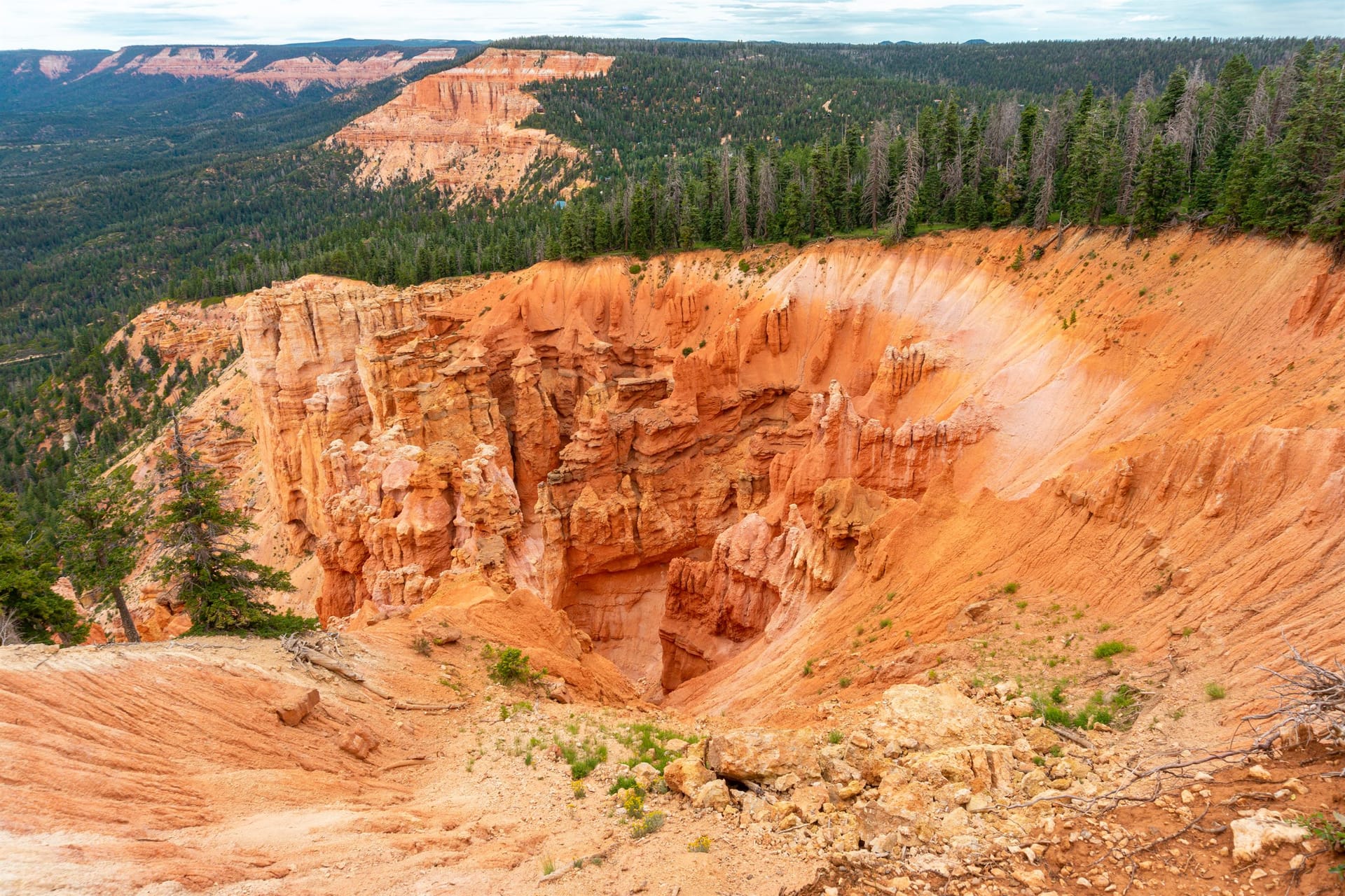
The Forest Service describes the Trail 6 Harris Rim Loop as remote with minimal use, and that is exactly why we like it. South of Strawberry Valley the plateau narrows toward the Pink Cliffs, the traffic thins to nothing, and the overlooks on spur 68 Lydia's Canyon Overlook and along the rim look out over the cliffs with Zion on the southern horizon. Ridden from our lot it is a 36.6-mile loop with about 4,150 feet of total climbing between roughly 7,680 and 8,520 feet.
We rate it intermediate to advanced for the remoteness and the length rather than technical riding: cell service is unreliable, the spurs are narrow in places, and help is a long way off. Carry the MVUM and a downloaded map, a tool kit, water, and a full tank, and tell the front desk where you are headed. Our routed line uses spur 61 Strawberry Ridge to reach the loop, the 14-mile Harris Rim Loop itself, spur 68 to the overlook, spur 67 Swains-Rim Connector and spur 66 Billingsley Creek, and spur 65 Swains Creek for the return toward SR-14.
What you'll see
The village routes, the SR-14 crossing, and Trail 5 into Strawberry Valley
Spur 61 Strawberry Ridge, just under seven miles, dropping south toward the Harris Rim country
The Trail 6 Harris Rim Loop: 14 miles of remote rim and forest with Zion and Pink Cliffs views
Spur 68 Lydia's Canyon Overlook, a 2.5-mile spur to a Pink Cliffs lookout with Zion views
Spur 67 Swains-Rim Connector and spur 66 Billingsley Creek
Spur 65 Swains Creek, eight miles along the creek back toward SR-14
How the ride goes
7 legs, 36.6 miles loop. Every ride starts and ends in our parking lot.
1
Leave the inn's lot
Fuel first on Movie Ranch Road, then pull out of our lot and follow the village OHV routes (spurs 52 and 59) toward Trail 5. Village streets are 15 mph and transit only.
2
Cross SR-14 and ride into Strawberry Valley
Trail 5 crosses SR-14 near Duck Lake. If your machine is not street legal you may only cross the highway: stop, yield to traffic, and cross at a right angle. Street-legal side-by-sides may ride SR-14 itself under Utah Code 41-6a-1509, but nothing on this ride needs it. South of the highway, follow the Trail 5 corridor east and south into Strawberry Valley.
3
Spur 61 Strawberry Ridge to the Harris Rim Loop
Spur 61 Strawberry Ridge (just under seven miles) leaves the Strawberry Valley corridor and drops south to the Trail 6 Harris Rim Loop. Expect the traffic to disappear here; the Forest Service calls this area minimal use.
4
The Harris Rim Loop and Lydia's Canyon Overlook
Follow the markers with a 6 along the rim. Spur 68 Lydia's Canyon Overlook is a 2.5-mile spur to a Pink Cliffs lookout with Zion on the horizon; it is the view of the day and the place to eat lunch.
5
Spurs 67 and 66 across to Swains Creek
Spur 67 Swains-Rim Connector (2 miles) and spur 66 Billingsley Creek (2.5 miles) link the rim to the Swains Creek drainage. These are the narrow, less-traveled stretches; ride them slowly and expect brush.
6
Spur 65 Swains Creek north toward SR-14
Spur 65 Swains Creek runs about eight miles along the creek back toward SR-14. It is the long, easy exit from the remote country.
7
Recross the highway and ride home
Cross SR-14 with the same stop-and-yield rule and follow the designated routes back through the village to our lot. 36.6 miles as ridden from the inn.
Elevation profile
Elevation in feet along the routed line, from the inn. Terrain data is SRTM, which smooths short steep features; treat the shape as a guide, not a survey.
Good to know
Best time: June and September for long, stable days. In monsoon season start by eight and be off the rim spurs by early afternoon. The lower country along Swains Creek is the first to dry out in spring.
Remote means remote: unreliable cell service, minimal traffic, and a long wait for help. Ride with a second machine if you can, carry a tool kit and a spare belt, and leave your plan at the front desk. Kane County Sheriff: 435-644-2349.
The rim spurs have real edges and no railings. Park well back and walk to the overlooks.
Monsoon season: from July into September, storms build over the plateau by early afternoon. Ride early, watch the western sky, and get off exposed rims when you hear thunder.
Width limit: Forest Service Order 0407-22-15 caps MVUM-designated trails at 72 inches and 2,500 pounds through 2027, and a few trails are narrower. Check your machine against the MVUM before you commit to a spur.
Fuel only in the village: Loose Wheels / Phillips 66 at 835 E Movie Ranch Road (daily 9 to 6, gas and diesel) is the only pump out here, and there is none on the trail.
Dust and dry roads: give riders ahead of you room, slow for oncoming machines on blind corners, and expect washboard on the open forest roads.
Season: MVUM seasonal roads open May 1 to November 30. Spring mud order 0407-26-03 (signed March 26, 2026, rescinded June 1, 2026) posted Duck Creek OHV Trails 1 and 5 between the Visitor Center and Uinta Flat Road closed when wet, and a mid-season repair closure ran July 13 to 23, 2026 (order 0407-26-11). Last checked September 2026; ask at the front desk or the Visitor Center for the current order.
Mileage, elevation and the route line were traced from the official 2019 Forest Service map and routed by computer, not ridden with a GPS. Carry the current MVUM; it is the legal document, and it changes.
Rules in full, including permits, helmets and the highway crossing law, are on our rules and safety page. Rentals and packing are on rentals and tips.
What guests ask at the front desk before they head out.
How remote is the Harris Rim Loop?
The Forest Service describes Trail 6 as a remote area with minimal use. Expect no cell service in places, few other riders, and a long wait for help. We suggest two machines, a tool kit, a full tank, and leaving your plan at the desk.
What is at Lydia's Canyon Overlook?
Spur 68 is a 2.5-mile spur to a lookout on the Pink Cliffs with views toward Zion. It is the best view on the loop and the natural lunch stop. There are no railings; park back from the edge.
Is this ride technical?
Not especially. The intermediate-to-advanced rating comes from distance (36.6 miles), remoteness, and narrow, brushy connector spurs rather than rock or steep pitches. Confident intermediate riders with a good map do fine.
How much fuel do I need?
A full tank. There is no fuel anywhere on the loop; the only pump is Loose Wheels / Phillips 66 in the village, open daily 9 to 6.
September 2026
Why trust this ride plan
We ride these routes and send guests out on them all season. The route line, mileage and elevation were traced from the official 2019 Forest Service Markagunt OHV System map and routed by computer, not recorded with a GPS, so treat them as a plan, not a survey. Loop and spur names, mileages and closures come from the Forest Service pages below; the highway crossing rule from Utah Code. Closure orders change: carry the current MVUM and ask at the desk.