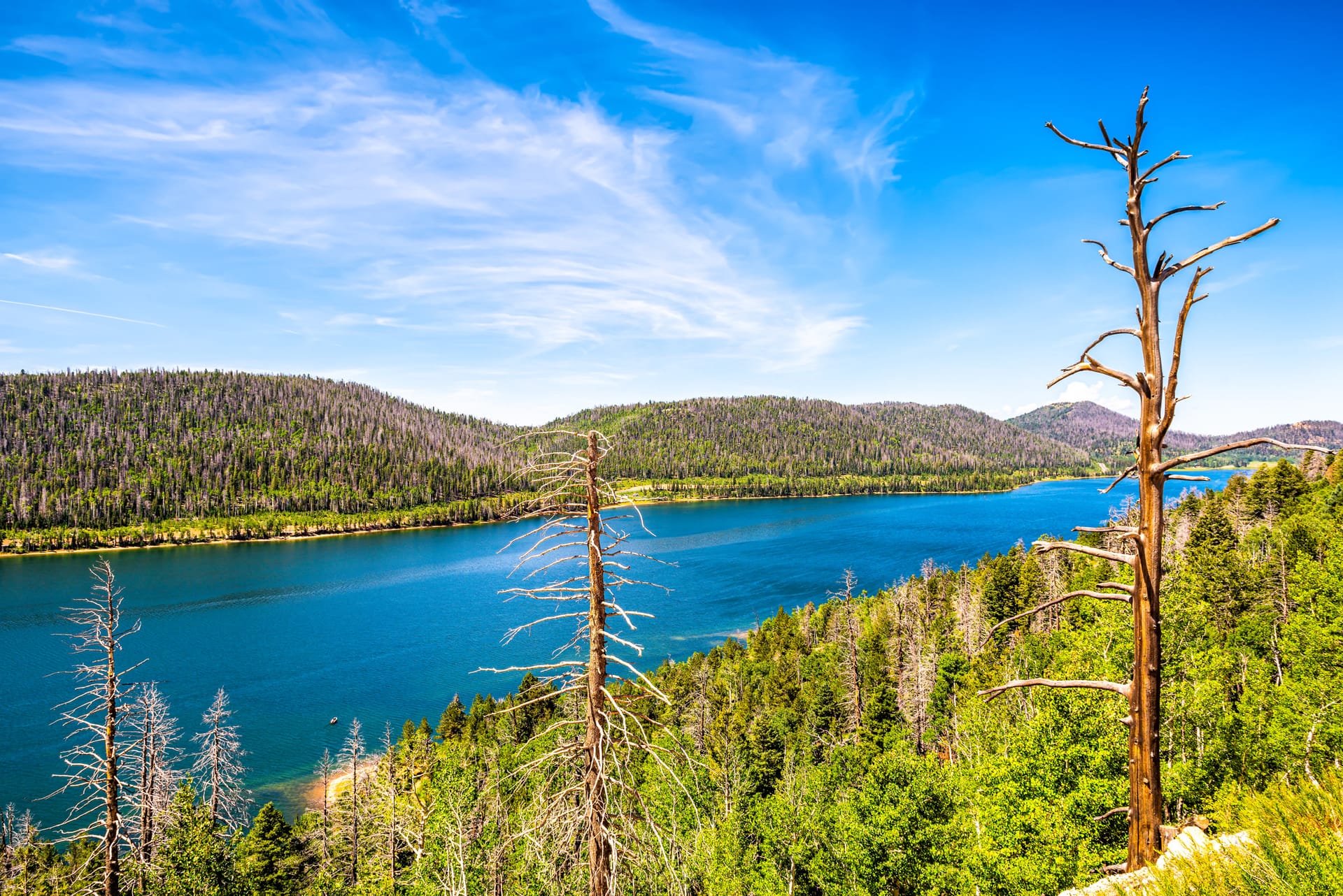
The 11.5-mile loop around the lake, the Virgin River Rim Trail on the plateau edge above it, Cascade Falls, and the short walks from each campground
Navajo Lake is ringed by trails that never touch a motor. The Navajo Lake Loop Trail circles the lake, 11.5 miles by the Forest Service count, on the water through aspen along the north shore and above the road on the south side. Higher up, the Virgin River Rim Trail runs 32 miles along the plateau edge, and short connectors climb to it from the campgrounds. A mile south of the lake, Cascade Falls Trail walks 0.6 miles out to the cliff where the lake's water reappears. Add a handful of short walks and one paved road gives you a week of trail.
All of it is about 15 minutes from Duck Creek Village: about 4 miles west on Highway 14 to the Navajo Lake Road turnoff, then paved road around the east end and along the south shore. The trails are open to feet, mountain bikes, and horses, closed to motors, and usable roughly Memorial Day to Labor Day, while Navajo Lake Road is open. This page covers every trail that starts at the lake. For the falls in full, use the Cascade Falls page; for the rest of the plateau, the hiking guide.
Trail map
Trail treads from OpenStreetMap. Toggle layers in the legend; tap a marker for details.
Trails at a glance
Longest trail
Virgin River Rim Trail, 32 miles end to end; the loop around the lake is 11.5 miles
Shortest walk
Lodge Trail, 0.1 mile from the lodge to the loop; Pinks Trail is 0.4 mile to a viewpoint
Motors
None. Every trail here is closed to motorized use; ATV routes are elsewhere on the plateau
Bikes
Loop (IMBA 2), rim trail (IMBA 3), and the campground connectors; not Cascade Falls, Pinks, or Bristlecone
Season
Memorial Day to Labor Day, when Navajo Lake Road is open; unplowed the rest of the year
Water
No potable water on any trail; fill at a campground spigot or filter lake water
Dogs
Allowed on a leash
Trailhead toilets
Pit toilets at the loop trailhead and the Cascade Falls trailhead; none at Bristlecone Pine
Every trail at the lake, compared
Lengths are the Forest Service figure where one exists; otherwise the OpenStreetMap tread measured in September 2026. IMBA ratings are from the OSM tags on each trail.
Trail
Length
Rated for
Start
Why go
Navajo Lake Loop
11.5 mi per the Forest Service; 8.5 mi of mapped single-track plus campground roads
Hike, bike (IMBA 2), horse; rated easy; no motors
Loop trailhead on the north side of the west end, or any campground
The whole lake at water level on the north shore
Cascade Falls Trail
0.6 mi each way, about 1.1 mi round trip
Hike only; National Recreation Trail
End of Forest Road 054
The lake's water pouring out of a cliff
Virgin River Rim Trail (near the lake)
32 mi total; 8.5 mi from Cascade Falls to Te-Ah
Hike, bike (IMBA 3), horse; no motors
Cascade Falls trailhead, Te-Ah, or a campground connector
Rim views down the Virgin River country
Spruces Trail
0.5 mi
Hike, bike, horse, dogs
Spruces Campground
The shortest climb from a campground to the rim trail
Navajo Trail
1.2 mi
Hike, bike
Navajo Lake Campground
Rim trail access from the lakeside campground
Pinks Trail
0.4 mi
Hike
North of Te-Ah Campground
A viewpoint over the pink Claron cliffs
Bristlecone Pine Trail
0.5 mi loop
Hike; not recommended for bikes or horses
Highway 14 west of the lake
Ancient bristlecones and a rim view
Navajo Lake Loop Trail
Forest Trail 32022 goes all the way around the lake. The Forest Service loop trail page calls it 11.5 miles and rates it easy. OpenStreetMap has 8.5 miles of mapped single-track in five segments; the difference is the campground roads on the south shore that the loop follows between segments, so plan your day on the Forest Service figure. Recreation.gov puts the elevation change at about 200 feet, which over 11.5 miles means the trail is close to flat.
The two halves feel different. The north side follows the water through open aspen with no road anywhere near it; it is the quietest shore on the lake and the only way to reach it on foot. The south side climbs above Navajo Lake Road and looks down on the water, threading through the campgrounds along the way. The trailhead is on the north side of the west end of the lake, off Navajo Lake Road between the lodge and Te-Ah Campground, with parking and a pit toilet. There is no potable water at the trailhead or anywhere on the loop; carry it in or filter lake water. You can also pick up the trail from any of the three campgrounds.
The loop is open to hikers, mountain bikes, and horses and closed to motorized use. OpenStreetMap rates it IMBA 2. Recreation.gov describes it as an 11.5-mile counterclockwise ride, 15.5 miles if you add the spur out to Cascade Falls, or a 20-mile point-to-point between Te-Ah and Strawberry Point using the Virgin River Rim Trail, which needs a shuttle vehicle at the far end. The season runs Memorial Day to Labor Day; outside it, Navajo Lake Road is closed and the trail is under snow.
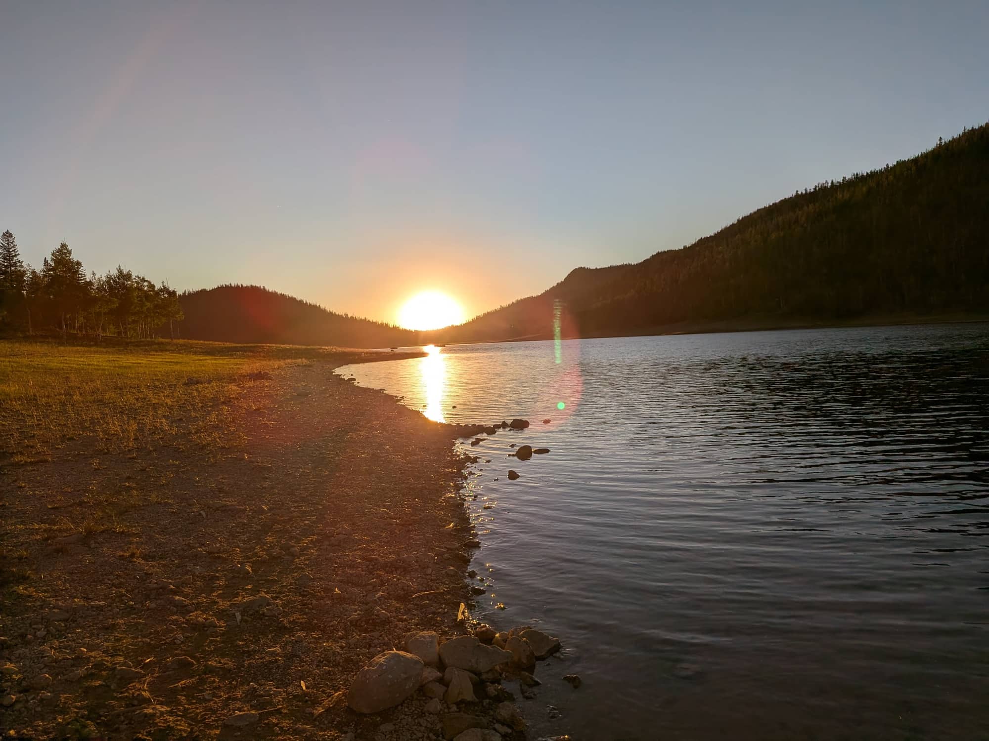
Sunset from the south shore, July 10, 2026.
Cascade Falls Trail
Cascade Falls Trail is Forest Trail 32055, a National Recreation Trail, and the one walk at the lake that everyone does. It starts at the trailhead at the end of Forest Road 054, south of the lake, where there is a pit toilet, and runs along the rim to the falls. OpenStreetMap measures the tread at 0.6 mile each way; our Cascade Falls page calls it about 1.1 miles round trip, and both are the same walk. Benches are spaced along it, there are stairs near the end, the drop-offs are real, and there is no shade, so go early on a hot day and keep children in hand.
The falls are Navajo Lake. The lake has no surface outlet; its water drains through sinkholes at the east end into a cave in the Claron Formation and pours out of this cliff face about a mile away, reaching Cascade Springs in roughly 8.5 hours by dye tracing. Flow tracks the lake level, from a trickle in a dry fall to a torrent in early summer. The Cascade Falls page has the full description, the upper pools, and directions from the highway. The trail is hike only.
Virgin River Rim Trail above the lake
The Virgin River Rim Trail, Forest Trail 32011, runs 32 miles along the edge of the Markagunt Plateau, and the stretch above the south side of Navajo Lake is the part most people see. OpenStreetMap breaks the trail near the lake into three segments: Strawberry Point to the Cascade Falls trailhead, 6.3 miles; Cascade Falls to Te-Ah Campground, 8.5 miles; and Te-Ah to Woods Ranch, 7.6 miles of mapped tread with the far end incomplete. The Forest Service rim trail page lists hiking, mountain biking, and horses, closed to motors, with the Cats Den hoodoos and bristlecone pines along the way.
It is a harder trail than the loop. OpenStreetMap rates it IMBA 3, and its notes flag numerous fallen trees on both the Cascade Falls to Te-Ah and Te-Ah to Woods Ranch segments, so expect to step or lift a bike over deadfall. There is no potable water anywhere on the trail, only seasonal streams that may be dry by August. The pit toilets at the Cascade Falls trailhead are the only facilities on this stretch. Season is Memorial Day to Labor Day.
From the lake you reach the rim on the campground connectors rather than driving to an end. The Spruces Trail, Forest Trail 32013, climbs 0.5 mile south from Spruces Campground to the rim trail and is open to hikers, bikes, horses, and dogs. The Navajo Trail climbs 1.2 miles south from Navajo Lake Campground to the same trail. Either one turns a campground into a rim trailhead: climb the connector, go out and back along the rim, or link the rim with the loop below for a longer circuit.
Short walks
Five walks under a mile, for an hour before dinner or a day when the loop is too much.
Pinks Trail, 0.4 mile. Starts north of Te-Ah Campground and climbs to Pinks Trail Viewpoint, a look at the pink Claron cliffs that give the trail its name. Hiking only.
Bristlecone Pine Trail, half-mile loop. Not on the lake but on Highway 14 west of it, toward the Cedar Breaks junction, with a small parking area at the trailhead. The loop passes ancient bristlecone pines and reaches a rim view over the Virgin River country. There is no water and no toilet, and the Forest Service does not recommend it for bikes or horses.
Lodge Trail, 0.1 mile. The connector from Navajo Lake Lodge on the south shore up to the loop trail. Open to feet, bikes, and dogs; the way lodge guests join the loop without moving the car.
Navajo Lake Loop Connector, 0.4 mile. The old Forest Road 34223 at the east end of the lake, linking the loop to Navajo Lake Road near the dike. Hike or bike. Useful if you want to start the loop from the east end rather than the west trailhead.
Deer Hollow to the Navajo Lake overlook, winter only. When the lake trails are under snow, the Deer Hollow Winter Recreation Area, 4 miles west of the village on Highway 14, grooms a ski trail to an overlook above Navajo Lake. Details on our Deer Hollow page.
Mountain biking
The Navajo Lake Loop is the beginner ride on the plateau: 11.5 miles, about 200 feet of elevation change, IMBA 2, and ridden counterclockwise from the trailhead or from any campground. The Virgin River Rim Trail is the committed one, IMBA 3 with deadfall on the segments nearest the lake, and it is where the 20-mile Te-Ah to Strawberry Point shuttle ride lives. The connectors are all open to bikes: Spruces Trail, Navajo Trail, Lodge Trail, and the Loop Connector at the east end. Cascade Falls Trail and Pinks Trail are hiking only, and the Forest Service does not recommend Bristlecone Pine Trail for bikes.
OpenStreetMap tags these trails as closed to e-bikes, which matches the Forest Service no-motors rule; treat an e-bike as a motor here. Nobody rents bikes at the lake; the lodge rents boats, not bicycles, so bring your own. Riders who want motors should look at the ATV guide for the Markagunt trail system instead; none of it runs on these trails.
Planning a trail day
The lake sits at about 9,000 feet, and the rim trail is higher. If you drove up from Las Vegas or St. George that morning, the loop will feel longer than 11.5 miles; take the first day easy and drink more than you think you need. Afternoon thunderstorms are routine from July into early September, and the rim and the open north shore are exposed, so start early and plan to be off the high ground by early afternoon. Check the Duck Creek weather page the morning you go.
There is no potable water on any of these trails. Fill bottles at a campground spigot before you start; if you plan to filter, the only source on the loop is the lake itself. Dogs are welcome on a leash. For the loop, the trailhead on the north side of the west end has parking and a pit toilet and puts you on the quiet north shore first; starting from a campground puts you on the south side first. Park in the trailhead lot or a campground day-use spot, never on a campsite spur.
The closest heated beds to the trailhead are in Duck Creek Village, about 15 minutes east. Our rooms and cabins at Duck Creek Village Inn put you at the loop trailhead in the cool of the morning and in a hot shower by dinner. If you would rather sleep at the lake, the three Forest Service campgrounds and the lodge cabins are covered on the Navajo Lake camping page.
September 2026
Why trust this page
We are innkeepers in Duck Creek Village, not rangers, and we walk these trails. Trail numbers, ratings, and seasons come from the Forest Service trail pages and recreation.gov; lengths are the Forest Service figure where one exists and otherwise the OpenStreetMap tread we measured in September 2026. Where the two disagree, the page says so. The Cedar City Ranger District at 435-865-3700 can answer anything this page cannot.
The Forest Service lists the Navajo Lake Loop Trail, Forest Trail 32022, at 11.5 miles with about 200 feet of elevation change. OpenStreetMap shows 8.5 miles of mapped single-track; the rest of the loop follows campground roads on the south shore. Plan on 11.5.
Can you bike the Navajo Lake Loop?
Yes. The loop is open to mountain bikes, rated IMBA 2 on OpenStreetMap, and usually ridden counterclockwise. Adding the Cascade Falls spur makes it 15.5 miles, and a 20-mile shuttle ride links Te-Ah and Strawberry Point on the Virgin River Rim Trail. No bike rentals at the lake.
Where is the Navajo Lake Loop trailhead?
On the north side of the west end of the lake, off Navajo Lake Road between Navajo Lake Lodge and Te-Ah Campground, with parking and a pit toilet. You can also join the loop from Spruces, Navajo Lake, or Te-Ah campground, or from the lodge on the 0.1-mile Lodge Trail.
Is the Navajo Lake trail hard?
The Forest Service rates the loop easy, with about 200 feet of elevation change over 11.5 miles. The length and the 9,000-foot elevation are the challenge, not the terrain. The Virgin River Rim Trail above the lake is harder, IMBA 3 with fallen trees on the segments nearest the lake.
Are dogs allowed on the Navajo Lake trails?
Yes, on a leash, the same rule as the campgrounds.
How far is Cascade Falls from Navajo Lake?
The falls are about a mile from the lake, on the cliff face south of it. The walk from the Cascade Falls trailhead at the end of Forest Road 054 is 0.6 mile each way on the OpenStreetMap tread, about 1.1 miles round trip, with benches, stairs, drop-offs, and no shade.
Can you ride ATVs on the Navajo Lake Loop?
No. The loop, the Virgin River Rim Trail, and every connector at the lake are closed to motorized use, and Te-Ah Campground prohibits OHVs inside its loops. The Markagunt ATV trail system is elsewhere on the plateau; see the ATV guide.
When are the Navajo Lake trails open?
Generally Memorial Day to Labor Day, matching the campground season and the time Navajo Lake Road is open. The road is not plowed, so in winter the lake is reached by snowmobile, and the Deer Hollow ski trail on Highway 14 reaches an overlook above it.
Is there water on the Navajo Lake trails?
No potable water on any of them. Fill at a campground spigot before you start. The lake is the only source on the loop, and the rim trail has only seasonal streams; filter anything you take from either.
On the Trail by Morning, in a Real Bed by Night
Rooms and cabins at Duck Creek Village Inn are 15 minutes from the Navajo Lake Loop trailhead, with a hot shower and a kitchen waiting after the loop.