
How far is Strawberry Point from the inn by ATV?
About 6.6 miles each way, 13.2 miles round trip as ridden from our lot on the designated village routes, Trail 5, and spur 58. Plan on two to three hours including time at the rim.
Ride from the inn
Thirteen miles to the edge of the plateau and the biggest view on the mountain
One digit is a loop; two digits is a spur of that loop (52 branches off Loop 5).
The Strawberry Point Overlook route from the inn, traced from the official 2019 Markagunt OHV System map. Tap a marker for the trail number.
If you have half a day and one ride in you, this is the one. From our lot it is about 6.6 miles to the point: through the village on the designated routes, across SR-14, onto Trail 5, then south on spur 58 Strawberry Point, a five-mile dead-end road that climbs through aspen and spruce to the end of the Virgin River Rim. The ride is easy for most of the way and gets rougher in the last miles as the road climbs; expect roughly 1,200 feet of gain overall.
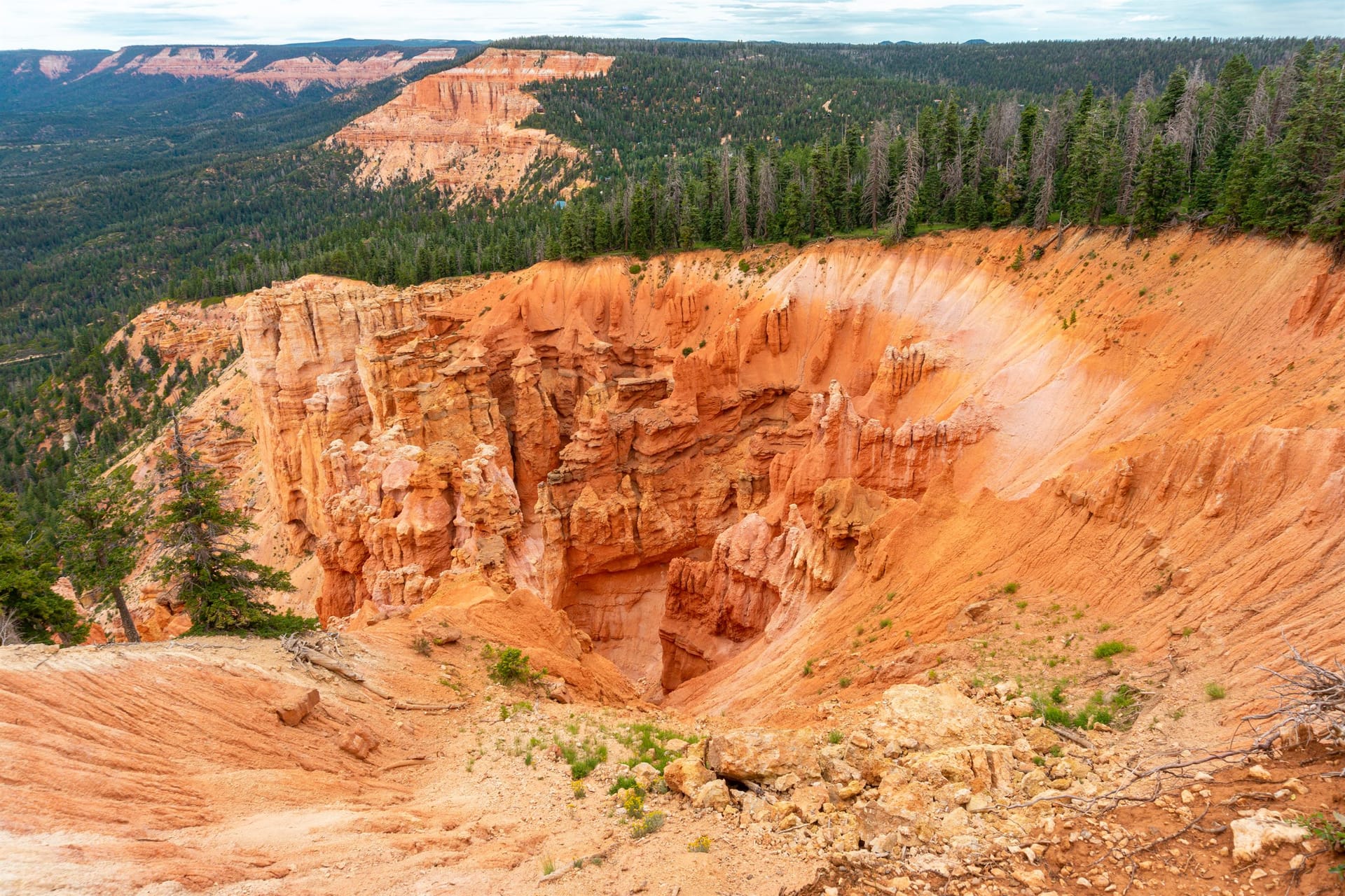
The point is the reason. The plateau simply stops at roughly 9,000 feet: pink and orange hoodoos fall away under the rim, the cliffs run off to the west toward Navajo Lake, and to the south the country steps down toward Zion. There are no railings and the drops run 100 to 500 feet, so it is a hold-hands place for kids and a short-leash place for dogs. Give it the respect you would give a national park rim and it is the view people remember from the whole trip.
6 legs, 13.2 miles out and back. Every ride starts and ends in our parking lot.
Pull out of our parking lot onto Movie Ranch Road and follow the village OHV routes (spurs 52 and 59) toward the trail. The village streets are transit only at 15 mph.
The route meets SR-14 near the east edge of Duck Lake. If your machine is not street legal you may only cross the highway: stop, yield to traffic, and cross at a right angle. Street-legal side-by-sides may ride SR-14 itself under Utah Code 41-6a-1509, but nothing on this ride needs it.
South of the highway, follow the Trail 5 markers. The routed line reaches the signed turn for spur 58 Strawberry Point about 1.6 miles from the inn; look for the brown Forest Service sign.
Spur 58 is a graded road that dead-ends at the point. It climbs gradually through aspen and spruce with pullouts and side lookouts along the way; the last stretch is rockier and steeper, which is where the intermediate rating comes from.
The road ends at a small lot. The walk to the overlook is under five minutes, then rock and dirt to the edge with no railings. Stop where the trees end if anyone in your group is unsteady, and kneel for photos when it is gusty.
Return north on spur 58 to Trail 5, recross SR-14 with the same stop-and-yield rule, and follow the village routes back to the inn. Total: 13.2 miles as ridden from our lot.
Best time: Late afternoon for the view (it faces south and west), morning in July and August to stay ahead of lightning, and the last week of September into early October for gold aspens along spur 58.
Rules in full, including permits, helmets and the highway crossing law, are on our rules and safety page. Rentals and packing are on rentals and tips.
What guests ask at the front desk before they head out.
About 6.6 miles each way, 13.2 miles round trip as ridden from our lot on the designated village routes, Trail 5, and spur 58. Plan on two to three hours including time at the rim.
Roughly 9,000 feet at the overlook; published figures range from about 8,930 to 9,030 feet. You climb about 1,200 feet from the inn, so bring a jacket even in July.
The ride is, with a helmet and an adult driving. The rim is the concern: no railings, loose rock, drops of 100 feet and more. Hold hands from the parking area out and turn around where the trees end if anyone is unsteady.
No. The route crosses SR-14 once near Duck Lake; non-street-legal machines stop, yield, and cross at a right angle. Street-legal side-by-sides may ride the highway under Utah law, but the ride does not need it.
September 2026
We ride these routes and send guests out on them all season. The route line, mileage and elevation were traced from the official 2019 Forest Service Markagunt OHV System map and routed by computer, not recorded with a GPS, so treat them as a plan, not a survey. Loop and spur names, mileages and closures come from the Forest Service pages below; the highway crossing rule from Utah Code. Closure orders change: carry the current MVUM and ask at the desk.
Rooms and cabins at Duck Creek Village Inn, trailer parking in our lot, rentals across the street, and the trail a few minutes from the door.