
Boek Boek je verblijf
Boek direct & bespaar 10%: code Bespaar 10% · t/m 1 dec · verblijven t/m 1 dec 2026
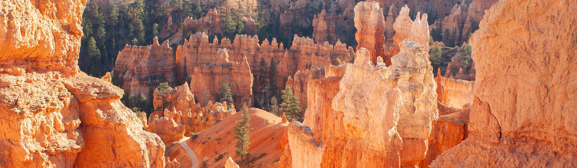
The Bryce Amphitheater from the rim, the end of the drive from Las Vegas

Drive guide

Las Vegas to Bryce Canyon: the drive, measured three ways

About 250 miles and 4 hr 43 min to 5 hr 19 min behind the wheel, an hour lost to the clock, and 5,893 feet of climbing. Here are the three routes, side by side, with cameras on them.

How far is Bryce Canyon from Las Vegas?

In het kort

De korte versie

Las Vegas to Bryce Canyon National Park is about 250 miles by road: 248 miles through Cedar City and Duck Creek Village, 260 miles by the fastest route over Highway 20, or 244 miles through Zion. Driving time without stops is about 4 hr 43 min by Highway 20, 4 hr 52 min through Duck Creek and 5 hr 19 min through Zion. Utah is an hour ahead of Nevada, so add an hour to the clock: leave Las Vegas at 9 a.m. and you reach the park after 3 p.m. Utah time once you stop for fuel and food.

The numbers

Distance 244–260 miles
Fastest drive 4 hr 43 min, via SR-20
Time change Utah is +1 hour
Climb 5,893 ft net, Vegas to the rim

Goed om te weten

  • Fastest: I-15 to exit 95, then SR-20, US-89 and Scenic Byway 12. 260 miles, 4 hr 43 min.
  • Through Duck Creek: 248 miles, 4 hr 52 min. Twelve miles shorter, 9 minutes slower, and it climbs to 9,905 feet.
  • Through Zion: the shortest at 244 miles, the slowest at 5 hr 19 min before park traffic, and you pay Zion's $35 entrance fee even just driving through.
  • Clocks go forward an hour on the way. Utah is on Mountain Time, Nevada on Pacific.
  • Towing or in an RV? Take SR-20. UDOT advises large vehicles against SR-14, and the Zion tunnel bans anything over 11'4" tall or 7'10" wide.
Distance
248 miles via Duck Creek, 260 via SR-20, 244 via Zion
Drive time
4 hr 43 min to 5 hr 19 min without stops, plus one hour on the clock
Elevation
2,001 ft in Las Vegas to 7,894 ft at the visitor center and 9,115 ft at Rainbow Point
Every route
Starts on I-15 north and finishes on Scenic Byway 12 east and SR-63 south
Large vehicles
Use SR-20. Not SR-14, and not the Zion tunnel if you are over its limits
Winter
No road on any of the three routes closes for the season. Storms close them briefly

Road conditions right now

The three routes on a map

All three leave Las Vegas the same way and finish the same way. For the first 126 miles they are one road, I-15 through Mesquite, the Virgin River Gorge and St. George. They split at three different exits to climb from the desert to US-89, then meet again at the foot of Scenic Byway 12, 17 miles from the park. The solid line is the one we drive.

The interactive map needs JavaScript. All three routes leave Las Vegas on I-15 north and cross the Virgin River Gorge into Utah. They split at St. George (SR-9 for Zion), Cedar City (SR-14 for Duck Creek) and I-15 exit 95 (SR-20), and meet again on US-89 before Scenic Byway 12 takes you east to the park.

  • Via Cedar City and Duck Creek (SR-14)
  • Via SR-20
  • Via Zion (SR-9)
  • Stop worth making
  • Junction, town or state line
Real road geometry traced with OpenStreetMap routing on 9 November 2026, from downtown Las Vegas to the Bryce Canyon Visitor Center. Tap a pin for the note we would give you at the front desk.

Which route: the measured comparison

We traced all three on the same day with the same router so the numbers compare fairly. The result surprises people: the shortest route is the slowest, and the scenic route over the mountain costs only 9 minutes against the fastest.

Three driving routes from Las Vegas to Bryce Canyon compared by distance, time and highest point
Route Miles Drive time High point Best for
Via Cedar City and Duck Creek I-15 north to Cedar City, SR-14 east over the Markagunt Plateau, US-89 north, Scenic Byway 12 east, SR-63 south 248 4 hr 52 min 9,905 ft A two-day drive with a night in the mountains, or anyone who wants the scenic way in a car or SUV. Cedar Canyon, the 9,905 ft summit, Navajo Lake and Duck Creek Village, then Red Canyon.
Via SR-20 I-15 north to exit 95, SR-20 east, US-89 south through Panguitch, Scenic Byway 12 east, SR-63 south 260 4 hr 43 min 7,912 ft Getting there fastest, towing, driving an RV, or crossing in a snowstorm. Open sagebrush country, the Sevier Valley and Panguitch, then Red Canyon.
Via Zion National Park I-15 north to exit 16, SR-9 east through Springdale and the Zion-Mount Carmel Tunnel, US-89 north, Scenic Byway 12 east, SR-63 south 244 5 hr 19 min 7,894 ft Seeing Zion on the way, in a vehicle that fits the tunnel, with time to spare. Springdale, the Zion-Mount Carmel switchbacks and tunnel, Checkerboard Mesa, Long Valley.

Times are no-stop driving at the router's own speed model, which runs a little under interstate speed limits, so a phone may show less. Measured from downtown Las Vegas; from the Strip, add about 5 miles and 5 minutes to each.

Via Cedar City and Duck Creek: the scenic one

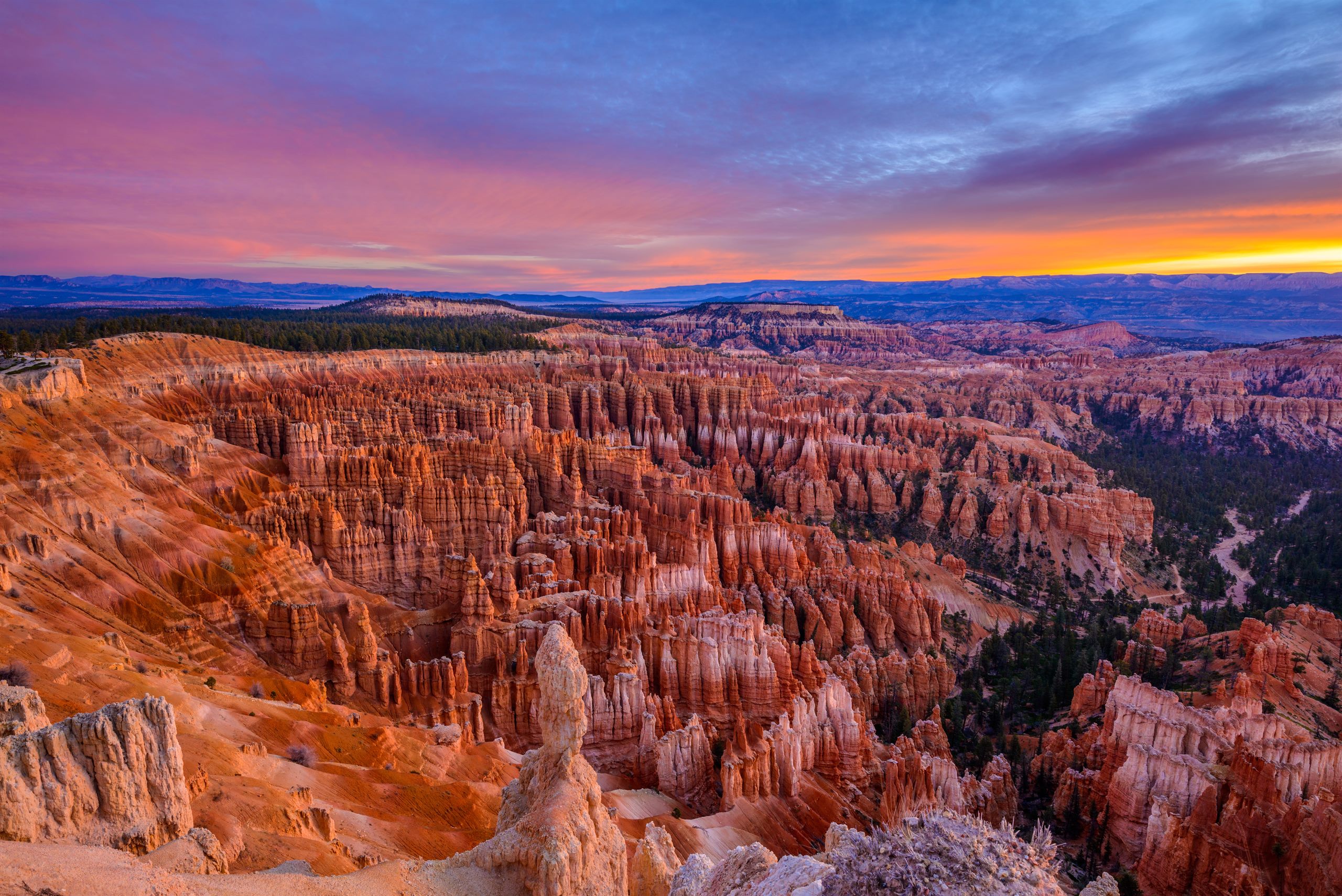
248 miles, 4 hr 52 min. Off I-15 at Cedar City and straight up Cedar Canyon on Highway 14, over a 9,905-foot summit and across the top of the Markagunt Plateau through aspen and pine, past Navajo Lake and through Duck Creek Village. It is the only route that climbs into real mountains rather than skirting them, and the top can be 20 degrees cooler than Cedar City. We are biased, because we live on it, but the numbers are not: it costs nine minutes.

Via SR-20: the fast one

260 miles, 4 hr 43 min, and it is what a router gives you if you do not ask for anything else. You stay on the interstate 37 miles longer, past Parowan to exit 95, then cross to US-89 on SR-20 over a 7,912-foot summit and drop south through Panguitch. It is open, empty country with long sightlines and no towns on SR-20 itself. This is the route for RVs, trailers, and snowstorms.

Via Zion: the short one that takes longest

244 miles, 5 hr 19 min before any traffic. You leave I-15 at exit 16, drive SR-9 through Hurricane and Springdale and straight through Zion National Park: the canyon switchbacks, the 1.1-mile Zion-Mount Carmel Tunnel and the slickrock country past Checkerboard Mesa. It is spectacular and slow. You pay Zion's $35 fee even to drive through, summer traffic in Springdale and at the tunnel can add a lot to the router's time, and since June 2026 vehicles over 11'4" tall, 7'10" wide or 35'9" long cannot use the road at all. The Zion end of this route has its own guide: Zion to Bryce Canyon, mile by mile.

From 2,001 feet to the rim

Las Vegas sits at 2,001 feet and the Bryce Canyon Visitor Center at 7,894, so every route climbs nearly 5,900 feet net. They climb it differently. Highway 14 goes highest, to 9,905 feet, then comes down to the village and down again to US-89 before the last pull up to the rim. SR-20 crests about 2,000 feet lower. The Zion route stays in the desert longest and does its climbing late.

Elevation profiles of three routes from Las Vegas to Bryce Canyon All three routes start at 2,001 feet in Las Vegas, dip to about 1,600 feet at Mesquite, and climb through St. George. The route through Cedar City climbs to 9,905 feet at the SR-14 summit, drops to 8,455 feet at Duck Creek Village, falls to 6,745 feet on US-89 and finishes at 7,894 feet at the Bryce Canyon Visitor Center. The SR-20 route crests at 7,912 feet. The Zion route stays below 4,000 feet as far as Zion Canyon, climbs through the Zion-Mount Carmel Tunnel and up Long Valley, and reaches its highest point at Bryce itself. 2,000 4,000 6,000 8,000 10,000 Las Vegas 2,001 ft Utah line clocks +1 hr Near Mesquite 1,564 ft SR-14 summit 9,905 ft SR-20 summit 7,912 ft Bryce 7,894 ft mile 0 50 100 150 200 250
  • Via Duck Creek, 248 mi
  • Via Zion, 244 mi
  • Via SR-20, 260 mi
USGS 3DEP elevations sampled every two miles along each OSRM-traced route, with the summits and endpoints taken from the verified figures on our other drive guides. The dashed line is the Utah state line, where Mountain Time begins.

Our route in six legs

This is the Duck Creek route, the one we would send a friend on in a car or SUV between May and October. The first three legs are the same on every route as far as St. George.

  1. Las Vegas to Mesquite, 81 miles

    I-15 north out of the valley, over the Apex grade and down through the Moapa Valley. It is the dullest and fastest stretch of the day. Mesquite is the last Nevada town and the obvious first fuel stop.

    Elevation drops, not rises: Mesquite sits below Las Vegas.

  2. Arizona and the Virgin River Gorge, 29 miles

    I-15 cuts across the corner of Arizona and threads the Virgin River Gorge, a narrow canyon with tight curves, no services and patchy phone signal. A crash here can close the interstate, and the detour is long. The two Arizona cameras below bracket it.

    Utah line at mile 110.5. Mountain Time from here.

  3. The Utah line to Cedar City, 59 miles

    Past St. George the interstate climbs the Black Ridge and the desert turns to juniper. The Zion route leaves at exit 16. Our route stays on I-15 to Cedar City and turns east on Center Street, which becomes Highway 14.

    Cedar City is the last large town before the mountain. Fill the tank here.

  4. Over the Markagunt on Highway 14, 29 miles

    The road leaves Cedar City at 5,846 feet and climbs Cedar Canyon for 17 miles to a summit at 9,905 feet, with about two miles at close to 7 percent near the top. Highway 148 to Cedar Breaks leaves just past the summit. Then the road eases down past Navajo Lake into Duck Creek Village at 8,455 feet.

    The highest road on any of the three routes, and the one that needs watching in winter.

  5. Duck Creek to US-89 and Scenic Byway 12, 32 miles

    East on Highway 14 down to Long Valley Junction at 7,460 feet, north on US-89 through Hatch, then right onto Scenic Byway 12. The SR-20 and Zion routes have joined you by now.

    Miss the Byway 12 turn and you end up in Panguitch.

  6. Red Canyon and into the park, 17 miles

    Byway 12 climbs into Red Canyon, where the orange hoodoos start well before the park, and passes through two short arches cut in the rock. South on SR-63 at the roundabout and you are at the Bryce Canyon Visitor Center.

    The Red Canyon Visitor Center has restrooms and no fee.

Stops along the way, by mile

Mileposts are measured from downtown Las Vegas along the traced Duck Creek route. Elevations are USGS figures, or the Park Service's own at Bryce.

Landmarks between Las Vegas and Bryce Canyon by milepost and elevation
Mile Landmark Elevation
0 Las Vegas Mile 0 is downtown, where I-15 meets US-95. From the Strip, add about five miles and five minutes. All three routes leave town the same way: I-15 north. 2,001 ft
81.2 Mesquite and the Arizona line The last Nevada town. Past it, I-15 crosses a 29-mile corner of Arizona, including the Virgin River Gorge. Arizona does not use daylight saving time, so in winter your phone may jump an hour here rather than at the Utah line. —
110.5 Utah state line Mountain Time from here on. You are an hour later than Las Vegas for the rest of the trip, in every season. —
118 St. George The largest town between Las Vegas and Bryce. The Zion route leaves I-15 eight miles north of here, at exit 16 for SR-9. 2,860 ft
169.8 Cedar City Leave I-15 and turn east on Center Street, which becomes SR-14. The last large town, with full services, before the mountain. 5,846 ft
186.9 SR-14 summit The highest point of any route on this page, 17 miles and 4,059 feet above Cedar City. UDOT has a camera and a weather sensor here. Highway 148 to Cedar Breaks leaves just past it. 9,905 ft
199.2 Duck Creek Village Inn On the route, not off it. 199 miles from Las Vegas and 49 miles short of the Bryce visitor center, at 8,455 feet. 8,455 ft
210.3 Long Valley Junction SR-14 ends at US-89. Turn left, north. No services at the junction. 7,460 ft
223 Hatch The first town on US-89 after Long Valley Junction, in an open river valley. 6,943 ft
230.9 US-89 and Scenic Byway 12 All three routes meet here and turn east onto Scenic Byway 12. Eighteen miles to go. 6,745 ft
234.7 Red Canyon Visitor Center Dixie National Forest, no fee, restrooms and water, and the first orange hoodoos of the day. Two short rock arches carry the road through a fin just east of it. 7,100 ft
244.5 SR-12 and SR-63 South on SR-63 at the roundabout into Bryce Canyon City and the park. 7,611 ft
248.2 Bryce Canyon Visitor Center The end of the drive, 5,893 feet above downtown Las Vegas. Card only at the entrance station: Bryce is cashless. 7,894 ft

Worth a detour off the route: Navajo Lake, a few minutes south of Highway 14 before the village; Strawberry Point, a high overlook on a gravel road south of Duck Creek; and in summer Cedar Breaks, off the SR-14 summit.

Time zones, fuel and fees

  • The time change. Utah is one hour ahead of Nevada all year. Arizona, which you cross for 29 miles, does not use daylight saving time, so in winter your phone may change at the Arizona line (mile 81.2) instead of the Utah line (mile 110.5). Either way you arrive an hour later than your watch suggests. Sunset at Bryce comes an hour sooner than you think.
  • Fuel. Every route has one long gap. Through Duck Creek it is the 29 miles of mountain from Cedar City to the village, which has one gas station with daytime hours, then 24 miles to Hatch. On SR-20 there is no town at all between I-15 exit 95 and Panguitch, 31 miles. Fill up in Cedar City on either route.
  • Entrance fees. Bryce charges $35 per private vehicle, valid seven days, and is card only. The Zion route adds a second $35: the Park Service requires a pass even if you only drive through on SR-9. One America the Beautiful pass ($80 for US residents) covers both.
  • Non-US residents. Each park adds $100 per person aged 16 and over, unless you enter on an annual or America the Beautiful pass. The non-resident America the Beautiful pass is $250.
  • Altitude. You gain 5,893 feet between Las Vegas and the Bryce visitor center, and the rim runs higher still to 9,115 feet at Rainbow Point. Pack a jacket even in July, and drink more water than you think you need.
  • No reservation to drive in. Bryce has no timed entry. You can arrive any time the road is open.

Driving it in winter

All three routes stay open through the winter, and most winter days the roads are dry. What changes is how high you go and how fast the weather can change up there.

  • Nothing on these routes closes for the season. I-15, SR-9, SR-14, SR-20, US-89, Scenic Byway 12 and SR-63 are all absent from UDOT's seasonal-closure list. Storms close sections for hours while plows work. Bryce plows its park road and keeps it open to cars all year.
  • SR-14 is the high road. It tops out at 9,905 feet and spends twelve miles above 9,000. UDOT designates it a traction-law corridor (Class I, aimed at vehicles over 12,000 lb), and in a storm it is the slowest of the three. If you are coming to stay with us in winter, read the winter driving brief first.
  • SR-20 is the low crossing. Its summit is 7,912 feet, about 2,000 feet lower than SR-14, and it is the route UDOT sends large vehicles on. UDOT's traction-law map covers parts of SR-20 too, so check the current restriction before you go.
  • Cedar Breaks closes in winter. Highway 148, the turn to Cedar Breaks from the SR-14 summit, is gated from roughly mid-November to mid-May. It is not on any route to Bryce, but it is a reason the Duck Creek route is a different trip in summer.
  • Daylight is short. In December the sun sets at Bryce between about 5:10 and 5:20 p.m. Mountain Time. Leave Las Vegas early enough to be off the mountain roads before dark.

Live surface conditions, plows and every camera on these roads: road conditions and live cams.

Rij je vanuit Las Vegas omhoog? Volg de hele I-15-route live

Live DOT-camera’s langs de rit van 325 km van de Strip naar Duck Creek Village, in rijvolgorde: de I-15 van Nevada door Las Vegas tot Mesquite, de twee Virgin River Gorge-camera’s van Arizona en daarna de I-15 van Utah plus de klim over SR-14. Beelden verversen ongeveer elke minuut.

De Virgin River Gorge live: beide uiteinden van de kloof

De gorge is het stuk waar iedereen naar vraagt — zo’n 32 km I-15 door een smalle kloof tussen Littlefield (Arizona) en de grens met Utah, zonder tankstations of eten en met nauwelijks bereik. Arizona DOT heeft op dit stuk precies twee camera’s, één aan elk uiteinde, en geen enkele in de kloof zelf — langzaam of stilstaand verkeer in deze twee beelden is dus je beste vroege waarschuwing dat er iets mis is daartussen.

Sluit een ongeval de gorge af, dan gaat het verkeer via de oude US-91 over Beaver Dam en Utah Hill — reken op minstens 30–45 minuten extra, meer als iedereen tegelijk omrijdt. Arizona-meldingen staan op az511.gov.

Las Vegas uit: van de Strip naar Apex en Mesquite

Toon alle camera’s op dit stuk (7)

Na Apex loopt de I-15 zo’n 95 km door de Moapa Valley zonder één camera — het volgende livebeeld is Mesquite, vlak voor de grens met Arizona.

Utah: St. George naar Cedar City en de klim over SR-14

Toon alle camera’s op dit stuk (6)

Camerabeelden komen van de Departments of Transportation van Nevada, Arizona en Utah en verversen ongeveer elke minuut. Volledige netwerken: nvroads.com · az511.gov · udottraffic.utah.gov

Make it two days: overnight in Duck Creek

Five hours of driving and an hour lost to the clock means a same-day arrival at Bryce late in the afternoon, tired, with the light going. Splitting the drive fixes that, and on the Duck Creek route the split falls in the right place: 199 miles and about 3 hr 44 min on the first day, 49 miles and about 1 hr 8 min on the second.

Leave Las Vegas after lunch and you are in Duck Creek Village by early evening, 8,455 feet up, in the pines, with Navajo Lake and Aspen Mirror Lake a few minutes away. In the morning Bryce is a little over an hour east, which puts you at the rim before the midday crowd, or in time for sunrise if you leave in the dark. Nobody backtracks: the inn is on the route, not off it.

If you are doing Zion too, Duck Creek is also about an hour from Zion's East Entrance, so one base covers both parks.

Las Vegas to Bryce Canyon: common questions

The questions we answer most often from guests driving up from Las Vegas.

How far is Bryce Canyon from Las Vegas?

About 250 miles by road. Measured from downtown Las Vegas to the Bryce Canyon Visitor Center it is 260 miles by the fastest route (I-15 and SR-20), 248 miles through Cedar City and Duck Creek Village (I-15 and SR-14), and 244 miles through Zion (I-15 and SR-9). From the Strip, add about 5 miles.

How long is the drive from Las Vegas to Bryce Canyon?

About 4 hr 43 min of driving by the fastest route, 4 hr 52 min through Duck Creek and 5 hr 19 min through Zion, without stops. Your phone may show a little less, because routing apps assume interstate speeds closer to the limit. With one stop for fuel and food, plan on about five and a half hours of travel, which reads as six and a half on the clock once you cross into Utah.

What is the best route from Las Vegas to Bryce Canyon?

It depends on what you are driving and when. The fastest is I-15 north to exit 95, SR-20 east, US-89 south and Scenic Byway 12 east. The most scenic in a car is I-15 to Cedar City and Highway 14 over the mountain, which is only 9 minutes slower and puts you in Duck Creek Village if you want to stop for the night. Through Zion is shortest on paper but slowest in practice and costs a second park fee.

What are the directions from Las Vegas to Bryce Canyon?

Take I-15 north out of Las Vegas through Mesquite, the Virgin River Gorge and St. George. For the fastest route, stay on I-15 past Cedar City to exit 95, take SR-20 east to US-89, turn right (south) through Panguitch, then turn left onto Scenic Byway 12 east. For the Duck Creek route, leave I-15 in Cedar City, follow Center Street east onto Highway 14, then turn left onto US-89 at Long Valley Junction and right onto Byway 12. On either route, turn south on SR-63 at the roundabout to reach the park.

Is there a time change between Las Vegas and Bryce Canyon?

Yes. Utah is on Mountain Time and Nevada on Pacific Time, so Bryce is one hour ahead of Las Vegas all year. You lose the hour on the way there and get it back on the way home.

Can I drive an RV or tow a trailer from Las Vegas to Bryce Canyon?

Yes, by SR-20. UDOT advises large vehicles not to use SR-14 or SR-143 because of their steep grades and sharp curves, even when navigation apps suggest them. Through Zion, vehicles over 11'4" tall, 7'10" wide, 35'9" long, or 50' combined, are banned from the Zion-Mount Carmel Highway outright since 7 June 2026. SR-20 has neither problem and is the fastest route anyway.

Can you do Las Vegas to Bryce Canyon as a day trip?

You can, but it is close to ten hours of driving round trip before you see a single viewpoint, with an hour lost to the time change on the way out. Most people are better off splitting it: 199 miles to Duck Creek Village on the first day, then 49 miles and about an hour to Bryce the next morning.

9 November 2026

Why trust this page

Distances and drive times on this page were traced along the real roads with OpenStreetMap routing on 9 November 2026, all three routes the same day from the same start point, and cross-checked against the separate traces behind our Zion to Bryce, Bryce Canyon and Highway 14 winter guides. Elevations are USGS 3DEP samples along the same lines, or the Park Service's published figures at Bryce. Fees, the Zion tunnel limits, large-vehicle advice and seasonal closures come from the National Park Service and the Utah Department of Transportation, read the same day. Where we could not confirm something from a primary source, it is not on the page.

Break the drive at 8,455 feet

On Highway 14, 199 miles from Las Vegas and about an hour from Bryce Canyon.

10% korting direct met code · verblijven t/m 1 dec 2026 Beste prijs direct · Reserveer nu, betaal later

Bel ons · 435-990-5488