Reserva Reserva tu estancia
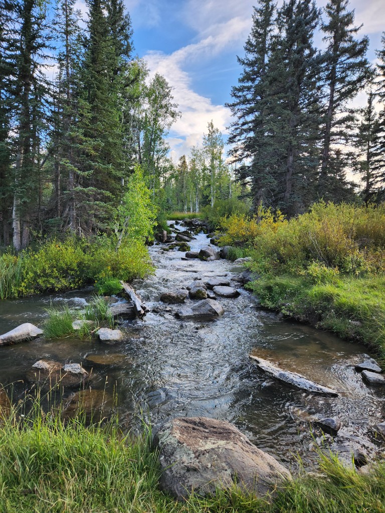
A clear mountain creek running through forest near Duck Creek Village, Utah

Guía de Duck Creek

A History of Duck Creek Village

From Paiute high country and mountain dairies to the CCC, the sinkhole caves, and the movie ranch that named the town

A short history of Duck Creek Village

Duck Creek Village sits at about 8,400 feet on the volcanic Markagunt Plateau in Kane County, Utah. It was Southern Paiute high country, then a summer range of dairies and sheepherders for Cedar City settlers, then — in the 1930s — a hub of Civilian Conservation Corps work that built the campground, roads, and the dike holding Navajo Lake. From 1939 it doubled as a Hollywood filming location, and the “Movie Ranch” of that era became the cabin town you visit today. This page assembles that history from public, citable sources — and is honest about what the record still doesn’t tell us.

Duck Creek history at a glance

  1. Pre-1850 Southern Paiute seasonal use of the Markagunt Plateau — “highland of trees.”
  2. 1852 A Parowan exploring party notes the plateau’s pine timber, opening it to lumbering.
  3. 1860s Cedar City families run summer dairies on Cedar Mountain; sheepherders gather at Duck Creek.
  4. 1905–07 Dixie Forest Reserve established (1905); national forest status follows in 1907.
  5. 1912 The Cedar City–Long Valley road (later State Route 14) enters the state highway system.
  6. 1927 Navajo Lake Lodge opens — one of the region’s original fishing lodges.
  7. 1933 CCC Camp F-16 builds the Duck Creek work center and campground; recreation camp dedicated June 25.
  8. 1930s The CCC builds the earthen dike that stabilizes Navajo Lake against its sinkholes.
  9. 1939 Hollywood arrives: a fort rises on Cedar Mountain for Drums Along the Mohawk.
  10. 1960s The filming-era “Movie Ranch” becomes a cabin subdivision — the village takes shape.
  11. 1994–96 The 1933 CCC office is converted and restored as the Duck Creek Visitor Center.

The story, in seven chapters

Before settlement

The name, and the Paiute homeland

Duck Creek takes its name from the water itself. The creek rises in the lava fields north of Navajo Lake, where Sage Valley Creek and Deer Hollow Creek meet, then flows east and vanishes into the Duck Creek Sinks — porous volcanic ground that swallows the stream underground. Ducks gather on its quiet stretches, and the name stuck. The naming is documented by John W. Van Cott in Utah Place Names.

Long before any of that was written down, this was Southern Paiute country. The whole high tableland is the Markagunt Plateau — a Paiute word meaning “highland of trees” — and the Paiute name for nearby Navajo Lake was Pa-cu-ay, “Cloud Lake.” The Paiute Indian Tribe of Utah is headquartered today in Cedar City, at the foot of the mountain.
1850s–1920s

Dairies, sheep, and sawmills

Cedar City was settled in 1851, and Cedar Mountain quickly became its summer larder. Families drove dairy cattle up to the high meadows each summer — women and children often ran the mountain dairies while the men farmed in the valley below, hauling butter and cheese back to town every week or two. The McConnell family is credited with one of the first mountain dairies, around 1869.

Duck Creek in particular became a gathering place for sheepherders, who grazed the open meadows and aspen parks. The timber drew loggers too: as early as 1852 a Parowan party had noted the plateau’s stands of high-quality pine, and small mills worked the mountain in the decades that followed — one lumber cut on Cedar Mountain supplied beams for Old Main, the landmark building at what is now Southern Utah University.

Honest gap: we have not found a confirmed record of a specific sawmill or “founding family” at Duck Creek itself. Cedar Mountain’s milling and grazing history is well documented; Duck Creek’s own earliest settlement is thinner in the record, and we would rather say so than repeat an unsourced founding story.

1933–early 1940s

The CCC years — the landscape people built

The Duck Creek you drive through today was largely shaped in the 1930s by the Civilian Conservation Corps. In 1933 the Forest Service brought in CCC Camp F-16, and the enrollees — most of them young men from back east, led by locally hired foremen — went to work building a ranger work center and, just to the north, the Duck Creek Campground.

The Duck Creek Recreation Camp was dedicated on June 25, 1933, with Governor Henry Blood giving the keynote, a men’s chorus up from Kanab, and a band from Parowan. Over the following years the corps cut roads, did range and wildlife work, and built the earthen dike that still holds Navajo Lake against its sinkholes. The camp ran until the early 1940s, when the CCC was disbanded nationwide.

One building from that era outlasted all the rest. The 1933 “Plan 51” office at the work center was converted for public use in 1994, and a 1996 restoration exposed its original 1930s construction. It serves today as the Duck Creek Visitor Center — a rare chance to stand inside the CCC’s work rather than just beside it.

Geologic time

Navajo Lake, the sinks, and the caves

Much of what makes Duck Creek strange and beautiful is volcanic. Navajo Lake exists because a lava flow dammed a narrow valley; it is shallow — only about 25 feet at most — and it has no natural surface outlet. Instead it drains downward through sinkholes at its east end, into a cave system in the Claron limestone that carries the water more than a mile before it reappears as Cascade Falls, spilling out of the Pink Cliffs toward the Virgin River. It was to slow that underground drain that the CCC built the lake’s dike.

The same porous ground riddles the highway corridor with sinkholes between Midway Valley and the Duck Creek Sinks. Two of the region’s caves are lava-and-limestone landmarks: Mammoth Cave, a lava tube with more than 2,200 feet of passage formed by an eruption less than about 2,000 years ago (parts are gated October–April for hibernating bats), and the Duck Creek Ice Cave, a limestone “cold trap” at roughly 8,820 feet where trapped winter air preserves ice — though, as the Utah Geological Survey notes, it can melt out by late summer.

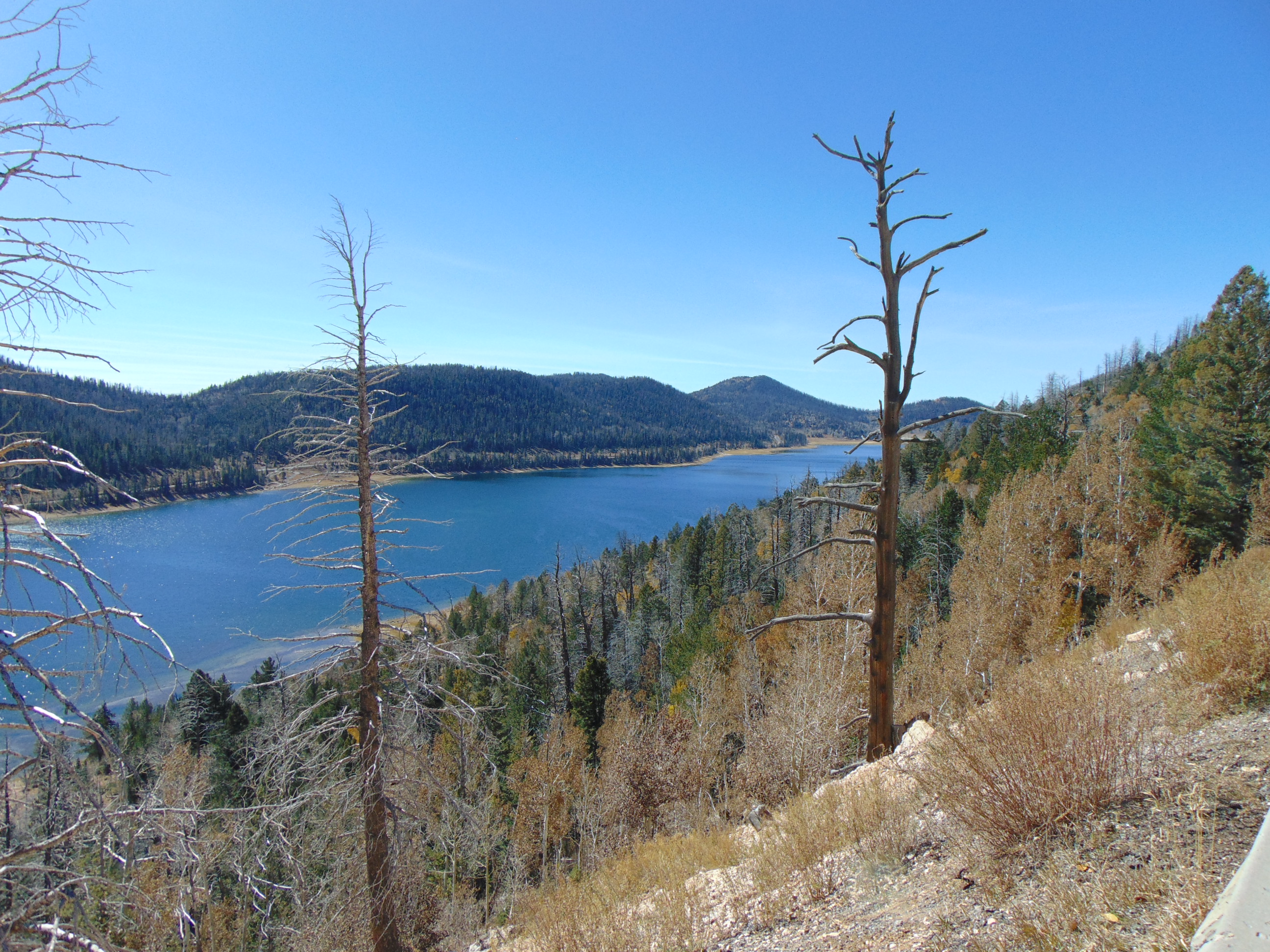
Navajo Lake in Kane County, Utah, ringed by forest under a mountain sky
Navajo Lake — lava-dammed, and drained from below through sinkholes to Cascade Falls.An Errant Knight · CC BY-SA 4.0 · via Wikimedia Commons

1927–present

A lodge on Cloud Lake

Navajo Lake Lodge opened in 1927 and is remembered as one of the original fishing lodges in the country. Local histories credit its founding to a “Dr. Aiken,” described as the only doctor across three counties, and its cluster of rustic 1927-era log cabins still rents to summer visitors on a short May-to-October season. The lodge anchors the lake that the Paiute called Cloud Lake, a fifteen-minute drive from the village.

1912–present

Getting here: Highway 14

For most of its history Duck Creek was reachable only by a rough mountain road. The Cedar City–Long Valley route was added to Utah’s state highway system in 1912 and numbered State Route 14 in the 1920s; the modern road up the canyon was largely constructed in the early 1920s. It remains a spectacular, steep drive — and a fragile one. Major landslides closed it in 1989 and again in October 2011, when a slide near the bottom of the canyon carried away roughly 1,300 feet of roadway.

That history is why we pay such close attention to conditions on the road today. See our Highway 14 guide and road conditions page before you drive up in shoulder season.

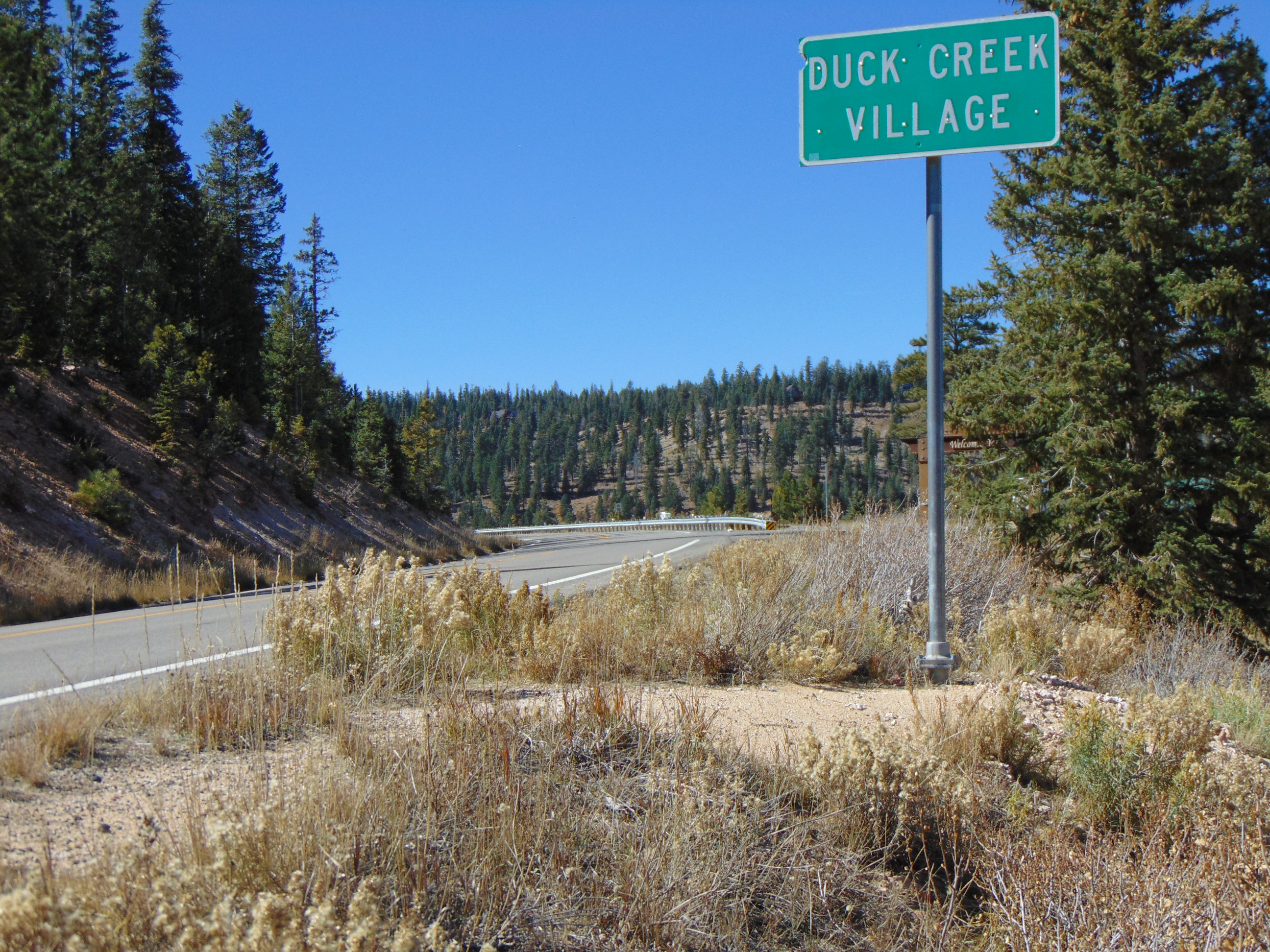
State Route 14 entering Duck Creek Village, Utah, through high-country forest
State Route 14 entering Duck Creek Village — the mountain road that made the village reachable.An Errant Knight · CC BY-SA 4.0 · via Wikimedia Commons

1939–today

From movie ranch to cabin town

From 1939 through the 1970s, Cedar Mountain was a working Hollywood location, and the meadows around Duck Creek picked up a nickname: the Movie Ranch. When the filming era faded, the name became an address. Starting in the 1960s the land was platted as the Movie Ranch Subdivision, and the cabin community that is Duck Creek Village today grew out of it — which is why the main road through town is still called Movie Ranch Road.

That story deserves its own page. We assembled the full, sourced filmography — Drums Along the Mohawk, My Friend Flicka, Sierra, Daniel Boone, How the West Was Won and more — on our Duck Creek movie history page.

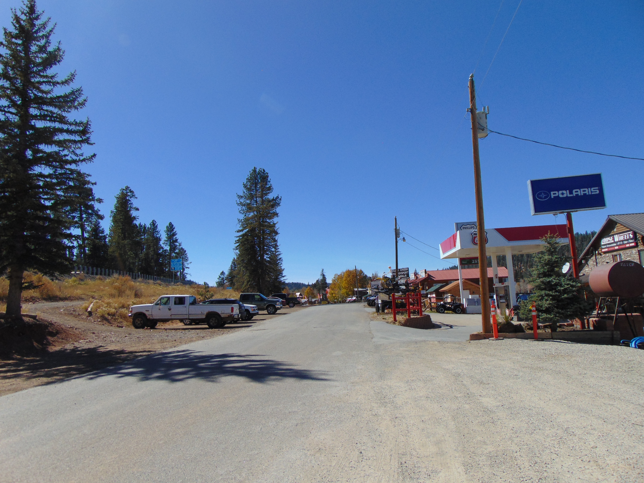
Movie Ranch Road looking west through Duck Creek Village, Utah, with forest beyond
Movie Ranch Road, looking west through the village that grew out of the old Movie Ranch.An Errant Knight · CC BY-SA 4.0 · via Wikimedia Commons

What we still don’t know

Becoming the resource for Duck Creek history means being honest about its gaps. These are the questions the public record hasn’t answered for us yet. If you are a local family, a historian, or a Forest Service veteran who can help — with a documented source or a photograph you own the rights to — we would genuinely love to hear from you.

  • The exact date Duck Creek Village (the Movie Ranch Subdivision) was first platted.
  • Which family or mill first worked the timber at Duck Creek itself, as opposed to Cedar Mountain broadly.
  • When State Route 14 up the canyon was first paved.
  • The origins of the Duck Creek Pond and Aspen Mirror Lake impoundments.

Sources

This history is assembled from public, citable records, cross-checked where possible. We restate facts in our own words and never reproduce copyrighted text or photographs.

July 2026

How we researched this

We built this page from Utah place-name references, U.S. Forest Service and Utah Geological Survey publications, state highway records, and local history reporting — cross-checking dates against more than one source before stating them plainly, and hedging or omitting claims that rest on folklore alone. Corrections and additions from the Duck Creek community are welcome.

Duck Creek Village history questions

Common questions about how the village came to be.

How did Duck Creek Village get its name?

From Duck Creek itself. The creek rises north of Navajo Lake and drains into the porous “Duck Creek Sinks,” where it disappears underground; ducks gather on its quiet water. The naming is documented in John W. Van Cott’s Utah Place Names.

How old is Duck Creek Village?

The area was used by Southern Paiute people long before settlement, and by Cedar City dairies and sheepherders from the mid-1800s. The village as a cabin community dates to the 1960s, when the filming-era “Movie Ranch” was platted as a subdivision.

What did the Civilian Conservation Corps build at Duck Creek?

In the 1930s, CCC Camp F-16 built the Duck Creek work center and campground, cut roads, did range and wildlife work, and built the earthen dike that stabilizes Navajo Lake. The 1933 work-center office survives today as the Duck Creek Visitor Center.

Why does Navajo Lake drain into caves?

Navajo Lake was formed by a lava flow damming a valley and has no natural surface outlet. It drains through sinkholes at its east end into a limestone cave system that carries the water over a mile to Cascade Falls in the Pink Cliffs.

Stay in the history

Duck Creek Village Inn sits in the heart of the old Movie Ranch, minutes from the CCC-built visitor center, Navajo Lake, and the caves. Book a room or cabin.