The Markagunt High Plateau Scenic Byway — Cedar City to Duck Creek Village and on to Long Valley Junction, mile by mile
At a glance
Drive time
On the route
At a glance
The short version
Scenic Highway 14 (Utah SR-14) is the main road between Cedar City and Duck Creek Village and is designated the Markagunt High Plateau Scenic Byway. It runs about 41 miles from SR-130 in downtown Cedar City east to US-89 at Long Valley Junction, climbing from 5,846 feet in the valley to a summit near 9,900 feet before easing back down to 8,400 feet at Duck Creek Village — about 4,050 feet of climbing in roughly 30 miles, with grades up to eight percent and a tight set of switchbacks through Cedar Canyon. Plan about 45 minutes from Cedar City. UDOT keeps SR-14 plowed and open year-round, and snow tires or chains are required from November 1 through March 31.
Quick facts
Route
Utah SR-14, the Markagunt High Plateau Scenic Byway
Length
About 41 miles — SR-130 in Cedar City (MP 0) to US-89 at Long Valley Junction (MP 41)
The climb
Cedar City 5,846 ft over a ~9,900 ft summit down to Duck Creek Village 8,400 ft — about 4,050 ft of climbing
Grades
Up to eight percent; switchbacks near MP 13 (UDOT SR-14 corridor study)
Drive time
About 45 minutes Cedar City to Duck Creek Village in good conditions
Winter
Plowed and open year-round; snow tires or chains required November 1 – March 31
Good to know
About 30 miles and 45 minutes from Cedar City to Duck Creek Village, but you climb about 4,050 feet to a summit near 9,900 feet and come back down to 8,400, so it drives longer than the mileage suggests.
UDOT's SR-14 corridor study puts grades at up to eight percent, with the steepest pitches between the Kolob Reservoir turnoff and Cedar Breaks and a tight set of switchbacks near milepost 13.
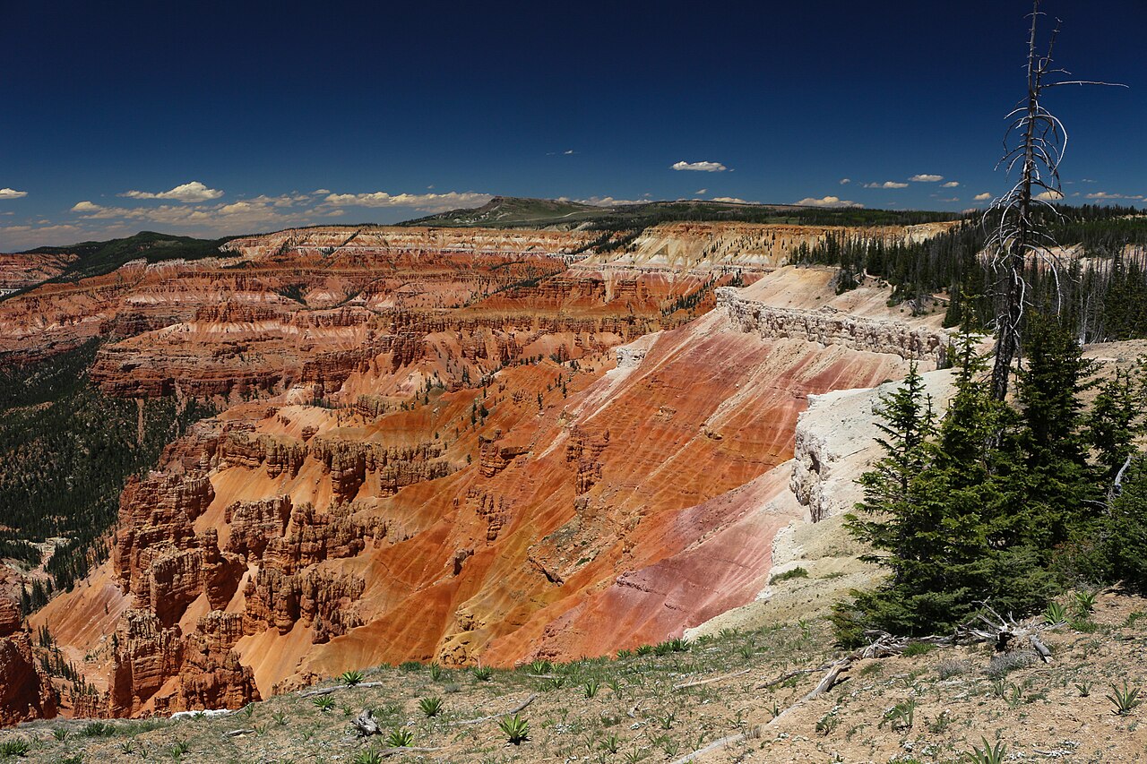
Cedar Breaks is a four-mile spur (SR-148) off SR-14 at milepost 18. That spur closes for winter from about mid-November to mid-May while SR-14 itself stays open and plowed.
There is no fuel, no store, and no restaurant between Cedar City and Duck Creek Village. Fill up before you turn east on Center Street.
Cedar Canyon is active landslide and rockfall ground. The October 2011 slide near milepost 8 buried the highway, and SR-14 did not fully reopen until August 2012.
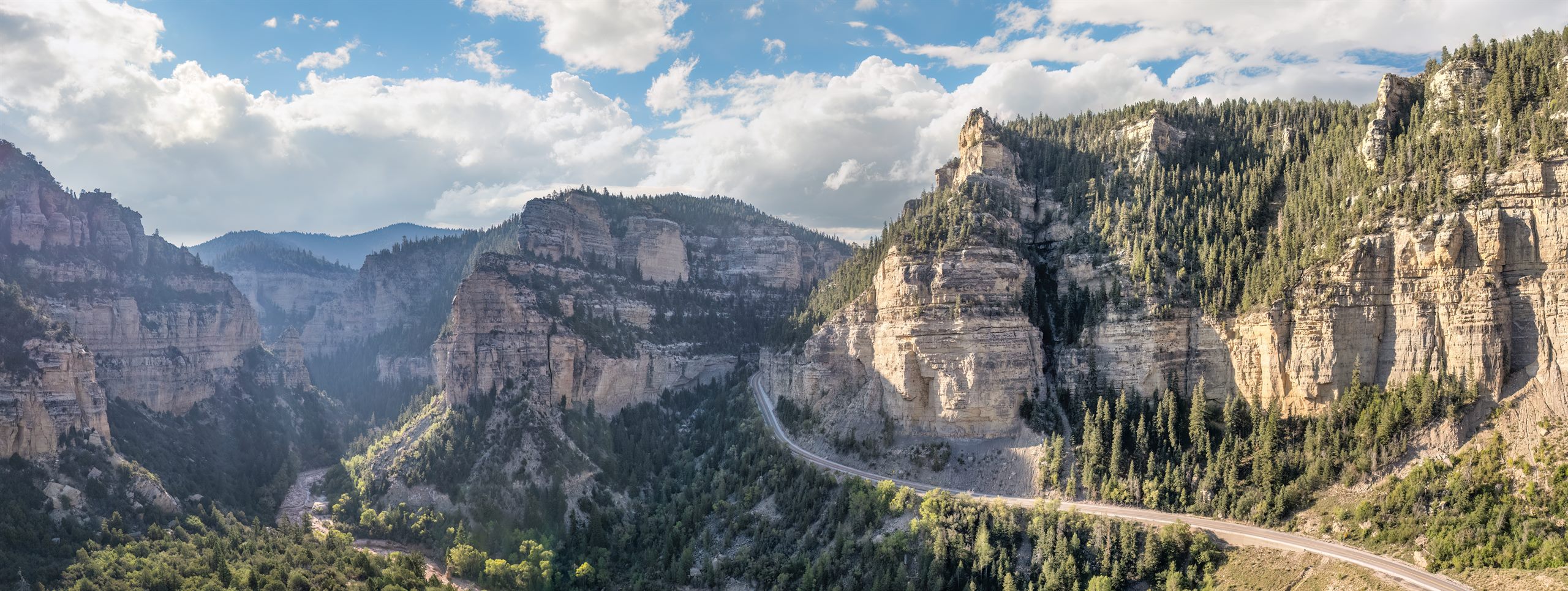
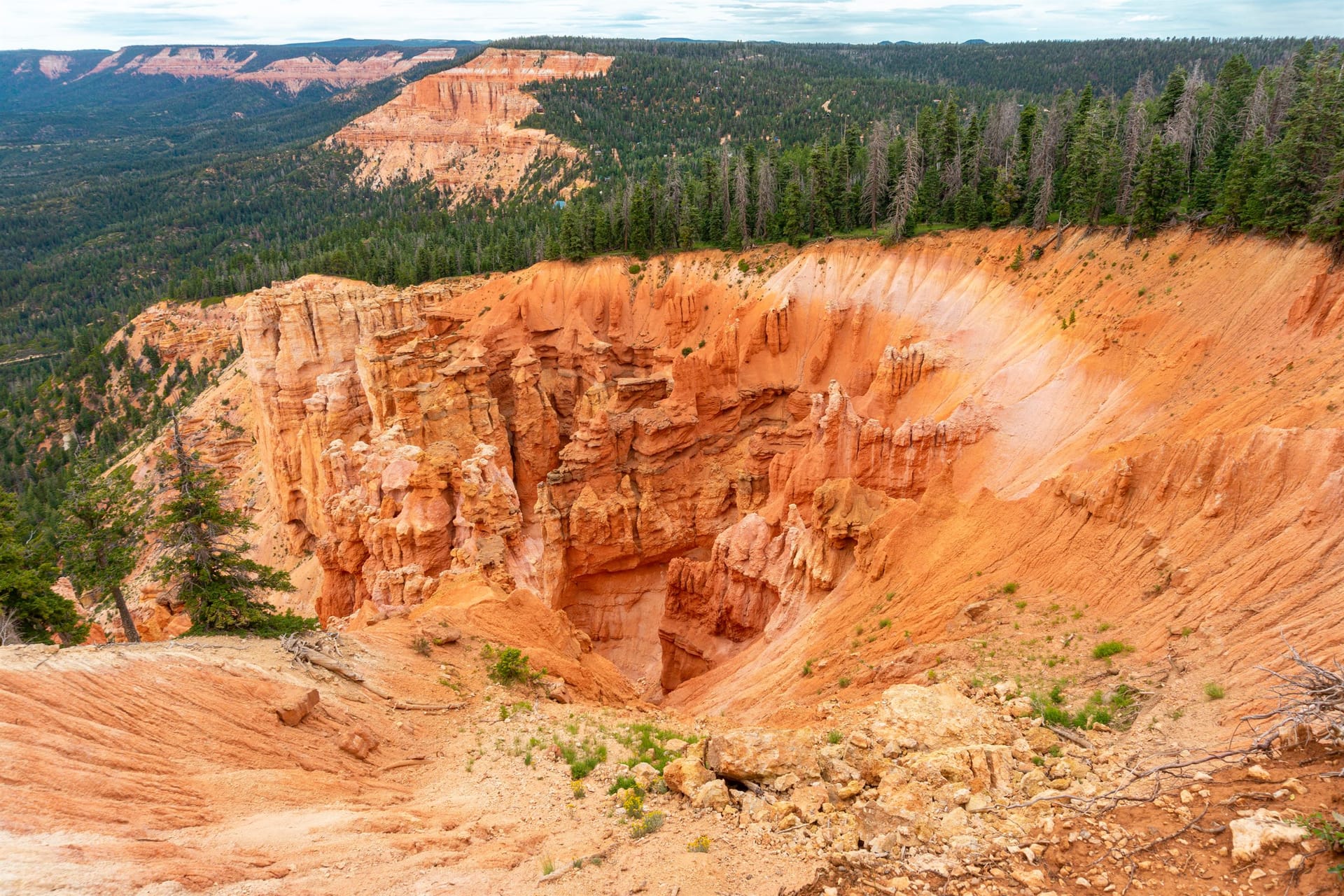
Highway 14 is more than the road into Duck Creek Village. It is one of the reasons the location works so well: in about 30 miles you go from valley floor at 5,846 feet to pine and aspen at 8,400 feet, climbing some 4,050 feet through a red-rock canyon and over a summit near 9,900 feet before the road eases down onto the Markagunt Plateau. Utah designates the whole 41-mile run from Cedar City to Long Valley Junction as the Markagunt High Plateau Scenic Byway, and it earns the name — you can spend part of a day simply driving the corridor, stopping for overlooks, lakes, and trailheads, without ever feeling like you left the vacation behind.
Highlights
MP 0 — Center Street in Cedar City, where SR-14 leaves SR-130 and the climb starts within a mile
MP 5 to 10 — Cedar Canyon, sheer walls on both sides with the Ashdown Gorge Wilderness above and almost no shoulder
About 12 miles up — the SUU Mountain Center, then Woods Ranch picnic area and kids pond, the last easy roadside stop before the steep middle
Around MP 13 — the switchbacks, tight enough that UDOT signs them for trucks and posts turn-arounds at both ends of the highway
About mile 16 — Zion Overlook, where the forest opens and the plateau drops away toward the canyons of Zion
Mile marker 17 — Bristlecone Pine Trail, an easy 0.6-mile loop through ancient trees, generally open Memorial Day to Labor Day
MP 18.17 — SR-148, the four-mile spur to Cedar Breaks National Monument, closed to vehicles about mid-November to mid-May
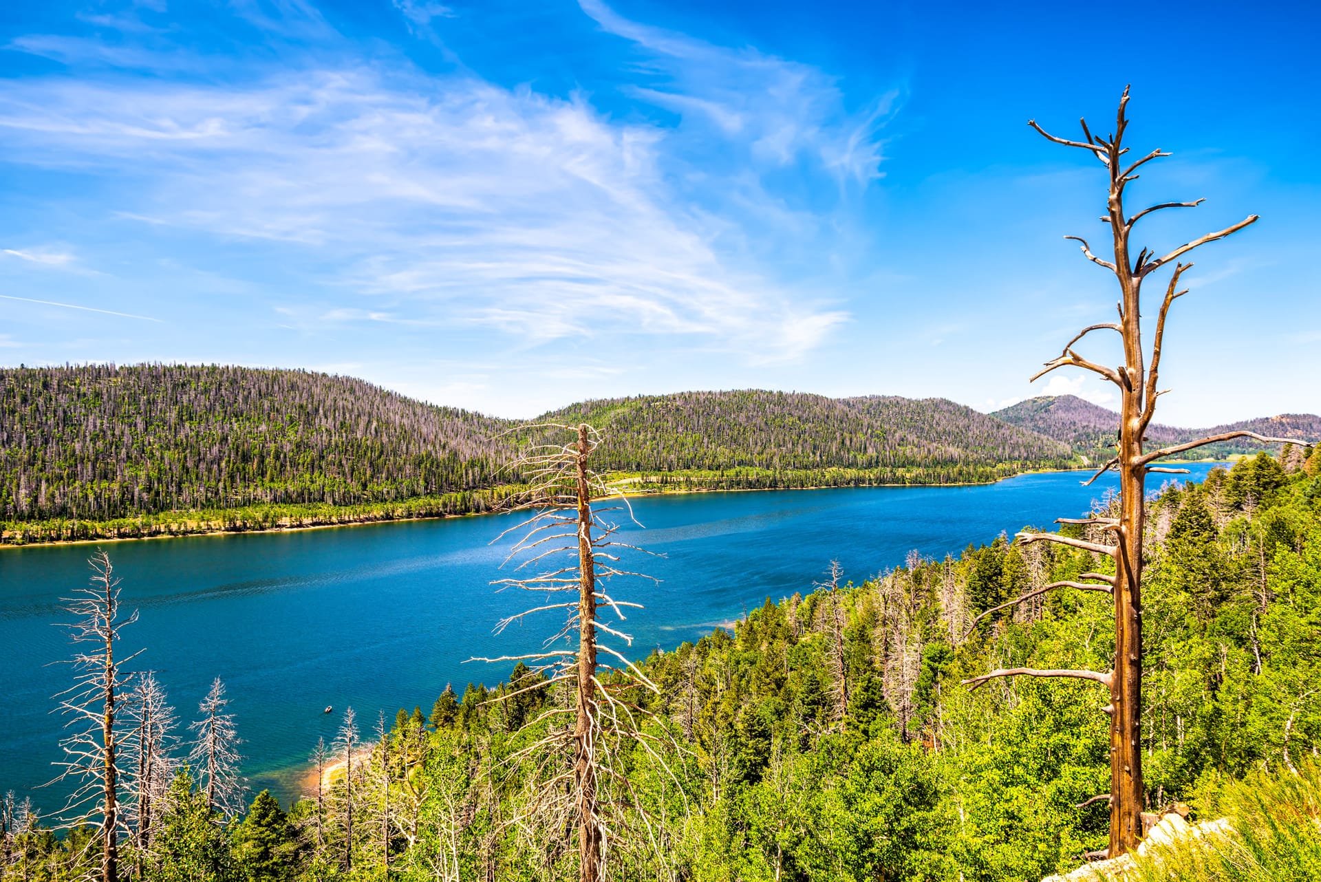
MP 25.7 — Navajo Lake Road (Forest Road 053), the turn for Navajo Lake, Cascade Falls, and the Virgin River Rim Trail
MP 28.1 and MP 30 — Duck Creek Campground, then Duck Creek Village and the inn
MP 31.4 to MP 41 — Mammoth Creek Road toward Mammoth Cave, then the drop through scrub oak and maple to US-89 at Long Valley Junction
Tips
Treat the climb as the main event rather than transit. Fill up in Cedar City: there is no fuel, store, or restaurant between town and Duck Creek Village, and cell service is spotty in the canyon, so download directions before you turn east. Watch your temperature gauge on the way up and use low gear on the way down instead of riding the brakes — grades reach eight percent and the switchbacks near milepost 13 come up fast. Towing is normal here, but give yourself room and pull over to let traffic by if you are slow. Pack a jacket for the top: it runs about 10°F cooler at Duck Creek than in Cedar City, and mornings at 8,400 feet can be sharp even in July. If you want the most relaxed introduction to Duck Creek, keep day one simple and let Highway 14 be the outing.
When to go
SpringSummerFallWinter
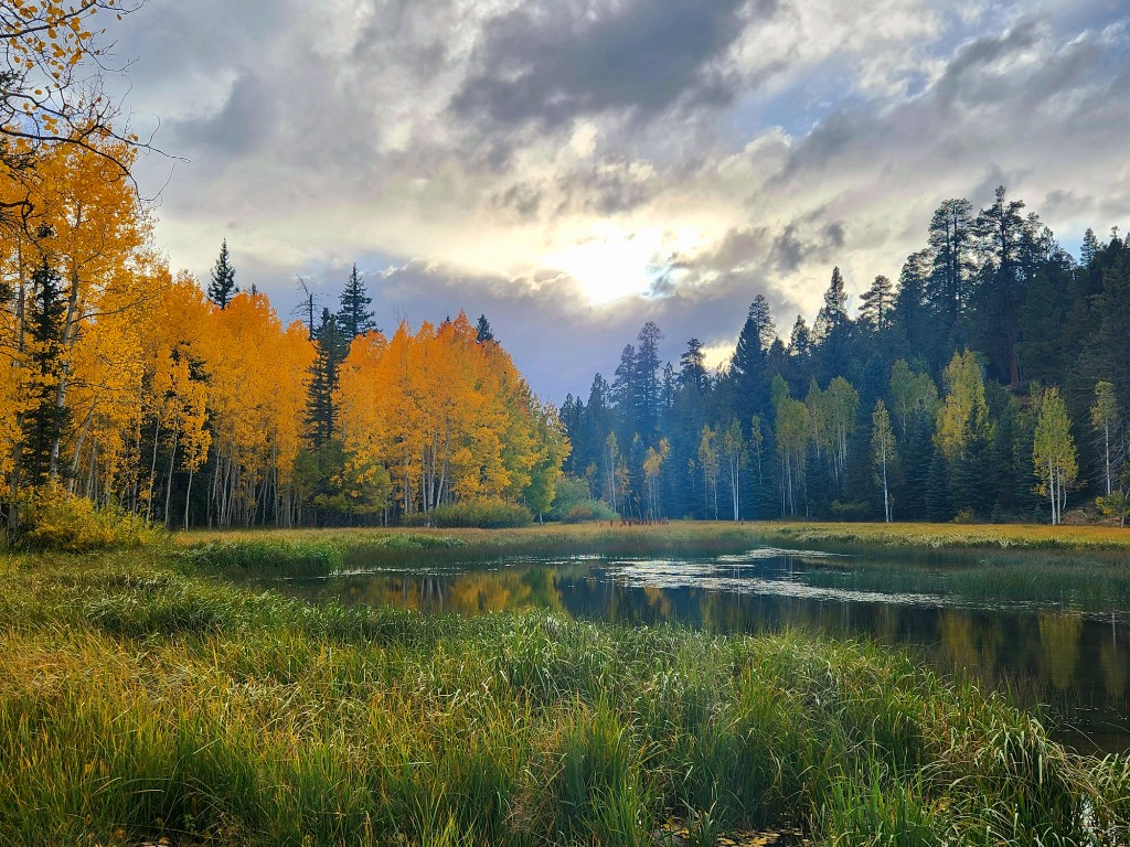
Summer is the easiest driving and the busiest, with brief monsoon thunderstorms most likely in July and August — mornings are the calm window. Aspen color along the corridor peaks from mid-September into early October and is the single best reason to drive it slowly. Winter changes the road rather than closing it: SR-14 is plowed and stays open year-round, but snow tires or chains are required from November 1 through March 31, and storms or rockfall can shut the canyon for a few hours at a time. Cedar Canyon has real history here — a 1989 slide closed SR-14 for months, a 2009 rock fall closed it for days, and the October 8, 2011 landslide near milepost 8 (about four million cubic yards, burying roughly 1,200 feet of roadway) kept the highway shut until limited traffic returned in May 2012 and full reopening in August 2012. The Utah Geological Survey still tracks that slide complex as active, so check conditions before you commit to the drive.
What to bring
A full tank from Cedar City — there is no fuel, food, or store between town and Duck Creek Village
Offline maps or written directions downloaded before you leave the valley
A jacket or fleece within reach, because it runs about 10°F cooler at the top than in Cedar City
Snow tires or chains from November 1 through March 31, which UDOT requires on SR-14
Water, a charger, and a headlamp — the canyon has no shoulders and few places to sit out a problem
Stay planning
Once this stop is on your list, use Plan Your Days for itinerary ideas or compare our rooms and cabins to match the style of trip you want.
July 2026
Why trust this guide
We shape these Duck Creek guide pages around the route, timing, and packing questions guests ask before they book. Before you drive, cross-check seasonal access and weather with the official resources here.
How long is the drive from Cedar City to Duck Creek?
About 45 minutes in good conditions. Duck Creek Village sits at milepost 30 on SR-14, roughly 30 miles east of the Main Street junction in Cedar City. It takes longer than 30 flat miles would because the road climbs about 4,050 feet — from 5,846 feet in Cedar City to a summit near 9,900 feet, then down to 8,400 feet at the village — on grades of up to eight percent. Add time at night, in storms, when towing, or when you stop at the overlooks, which most people do. For live camera views of the whole corridor before you leave, see duckcreekvillageinn.com/road-conditions.
Is Highway 14 open in winter?
Yes. SR-14 is a plowed state highway that stays open through the winter — the National Park Service notes it is kept open all winter, and UDOT maintains a plowed parking lot at the Highway 14 and Highway 148 junction except during and right after storms. What changes is the surface: expect packed snow and ice on the canyon grades, and UDOT requires snow tires or chains on SR-14 from November 1 through March 31. Storms and rockfall can still close the canyon temporarily. When that happens the detour is I-15 north to SR-20, east to US-89, then south to Long Valley Junction and west into Duck Creek — roughly two hours instead of 45 minutes.
Is Highway 14 steep? Can I tow a trailer or drive an RV?
It is steep, and yes, you can tow it — most of the traffic climbing SR-14 in summer is trailer-towing pickups and RVs. UDOT's corridor study describes grades up to eight percent, with the steepest section between the Kolob Reservoir turnoff and Cedar Breaks and a notably tight set of switchbacks near milepost 13. Semi-trucks are discouraged, though not banned, from using SR-14 as a through route, and UDOT provides truck turn-around areas at both ends. Current UDOT restrictions only kick in for genuinely oversize loads: anything wider than 14 feet on SR-14 needs two certified pilot vehicles and two police escorts. Note that the Cedar Breaks spur, SR-148, does have a hard limit — vehicles over 26,000 pounds gross weight are prohibited through the monument. Use low gear on the descent rather than riding the brakes.
What is there to see on Highway 14?
Going east from Cedar City: Cedar Canyon itself, with cliffs on both sides and the Ashdown Gorge Wilderness above; the Southern Utah University Mountain Center and Woods Ranch picnic area and kids pond about 12 miles up; the Zion Overlook around mile 16, where the plateau falls away toward Zion; the Bristlecone Pine Trail at mile marker 17, an easy 0.6-mile loop through ancient trees; the SR-148 junction at milepost 18, which is the four-mile spur to Cedar Breaks National Monument; Navajo Lake Road (Forest Road 053) at milepost 25.7 for Navajo Lake, Cascade Falls, and the Virgin River Rim Trail; Duck Creek Campground at milepost 28; Duck Creek Village at milepost 30; and Mammoth Creek Road at milepost 31.4 toward Mammoth Cave. East of the village the road drops through scrub oak and maple to US-89 at Long Valley Junction.
Are there gas stations or services between Cedar City and Duck Creek?
No. There is no fuel, no store, and no restaurant along SR-14 between Cedar City and Duck Creek Village — the corridor runs through Dixie National Forest, and the next services are in the village itself. Fill the tank and pick up groceries in Cedar City before you turn east. Cell service is spotty in the canyon and limited in the village, so download your directions before you start the climb.
Go up one level
Start from the broader guide hub if you want the bigger set of destinations, activities, and planning pages first.