A lava-dammed lake at 9,000 feet, 15 minutes from the inn. Fishing, paddling, three campgrounds, ice fishing by snowmobile, and the sinkholes that feed two rivers.
Navajo Lake is the big water of Cedar Mountain: a three-mile lake at 9,000 feet ringed by spruce and aspen, 15 minutes west of the inn on Highway 14. Most of our summer guests end up here at least once, usually with a rod, a kayak, or a picnic, and it is the lake we point people to first because it has everything the smaller waters do not. Three Forest Service campgrounds and a 1927 lodge sit on the south shore, an 11.5-mile trail circles it, the fishing was rebuilt from scratch in 2021, and in winter the ice holds splake for anyone willing to snowmobile in.
It is also a strange lake. A lava flow dammed the valley and left it with no outlet, so the water leaves through sinkholes at the east end, runs underground, and pours out of a cliff a mile away as Cascade Falls, the headwaters of the river that carved Zion. This page covers the practical side, getting there, what to do, when, and what the weather does, with deeper pages on fishing and ice fishing and the campgrounds.
Navajo Lake at a glance
Elevation
9,035 ft, on the Markagunt Plateau
Size
About 3 miles long, half a mile wide, roughly 700 acres when full
Depth
Shallow: about 25 ft at the deepest point
From the inn
About 8 miles west on Highway 14, 15 minutes
Fees
None to visit; Dixie National Forest. Camping and the lodge ramp are paid
Season
Road and campgrounds open late May to early September; snowmobile access in winter
Fish
Rainbow, tiger and cutthroat trout, splake, tiger muskie
Dogs
Welcome on leash at the campgrounds and shoreline
Quick answers
How big is Navajo Lake?
About 3 miles long and half a mile wide, roughly 700 acres when the lake is full. Levels drop in dry years because the lake drains through sinkholes.
How deep is Navajo Lake?
Shallow. The deepest water is about 25 feet, which is why it freezes early in December and why the fishery needs species that tolerate low winter oxygen.
What is the elevation?
9,035 feet. Expect July highs near 75°F, nights in the 40s, and thin air if you are coming up from the desert.
Where is it?
Kane County, Utah, in Dixie National Forest, about 25 miles east of Cedar City on Highway 14 and 8 miles west of Duck Creek Village.
Can you swim?
Yes. The Forest Service lists swimming, but there is no beach or lifeguard and the water is snowmelt-fed and cold. Check habs.utah.gov for algae advisories in late summer.
Are motorboats allowed?
Yes. Navajo Lake Lodge rents motorboats and pontoons and runs a ramp. Every craft that launches, including kayaks, needs the free annual Utah Mussel-Aware course.
Where Navajo Lake is and how to get there
From Duck Creek Village, drive west on Highway 14 for about four miles to the Navajo Lake Road turnoff (Forest Road 053) on the left. The paved road wraps around the east end of the lake and runs the length of the south shore: about 3.5 miles to Navajo Lake Campground, 5.6 miles to its end past Te-Ah. Call it eight miles and 15 minutes from the inn to the campground. From Cedar City it is 25 miles east on Highway 14, roughly 40 minutes of climbing through Cedar Canyon.
In order from the highway: the dike across the sinkhole end at about 2 miles, Spruces Campground at 2.5, Navajo Lake Campground at 3.5, Navajo Lake Lodge at 4, and Te-Ah Campground near the west end at 5.5, with day-use pullouts and shady shoreline between them. Parking is free everywhere but the lodge ramp. On the way in, the Navajo Lake Overlook on Highway 14, at about 9,600 feet above the north shore, gives you the whole lake in one frame and is the best photo stop on the drive. The map below has every stop.
Navajo Lake Road is not plowed. The campgrounds close in early September, the road drifts shut with the first big storms, and from then until late spring the lake is reached by snowmobile on the Cedar Mountain trail system, 9.2 miles from the trailhead in the village. Check road conditions for Highway 14 before any shoulder-season trip.
Where everything is at Navajo Lake
Lake outline, roads and trail treads from OpenStreetMap; place markers set from the same data and the Forest Service pages. Road miles are measured from the Highway 14 turnoff.
Where to fish from shore
Turn on the fishing-access layer in the map for the six stretches of bank we send guests to. None of them is a secret and none guarantees a fish; they are the places where you can park, walk to the water, and cast without bushwhacking, ordered from the highway in.
The dike at the east end.About two miles in, where the road crosses the 1932 embankment. A long, open bank you can walk end to end with the sinkhole basin behind it. Exposed to the afternoon wind, so fish it early.
The east flats below Spruces.Shallow, walkable shoreline on the east half of the lake, wade-able when the lake is full. Long casts over the flats; the water warms first here in June.
The campground bank.Navajo Lake Campground at 3.5 miles: park, walk down, fish. The stocking trucks use the landing here, so freshly planted rainbows hold nearby for a week or two after each plant.
The lodge dock and ramp.Four miles in. The developed ramp, the rentals, and the fish cleaning station. The obvious place to start if you are trolling the middle of the lake for splake.
The west end shallows.The inlet end below Te-Ah, reached from the loop trailhead on the north side. Snowmelt comes in here in spring and early summer.
The north shore.No road. Walk in on the loop trail from either end and you have the quietest bank on the lake and the least pressure. Worth the effort on a summer weekend.
Species, limits, the stocking calendar, and the winter version of all this are on the fishing guide.
Why the lake has no outlet
Navajo Lake exists because a lava flow dammed the eastern end of the valley. No river drains it. Instead the water sinks into holes in the lake bed at the east end, drops into a dissolution cave in the limestone of the Claron Formation, and travels underground. Dye traces run by the U.S. Geological Survey show it surfacing in two places: at Cascade Springs about 8.5 hours later, where it becomes the North Fork of the Virgin River and eventually flows through Zion Canyon to the Colorado, and at Duck Creek Springs about 53 hours later, bound for the Sevier River and the Great Basin. One lake feeds two river systems on opposite sides of the continental divide of drainage.
That plumbing also explains the earthen embankment you cross near the east end. Built in 1932, it keeps most of the lake away from the sinkholes so the water does not drain to a puddle in dry years, which is what kept a fishery here at all. Levels still swing with the snowpack, and so does the waterfall: the Utah Geological Survey describes Cascade Falls ranging "from a small trickle to a raging torrent" as the lake rises and falls. Late spring, when the lake is fullest, is when the falls put on the show. Our Cascade Falls page has the trail details; it is a 1.1-mile round trip and pairs with the lake in a single afternoon.
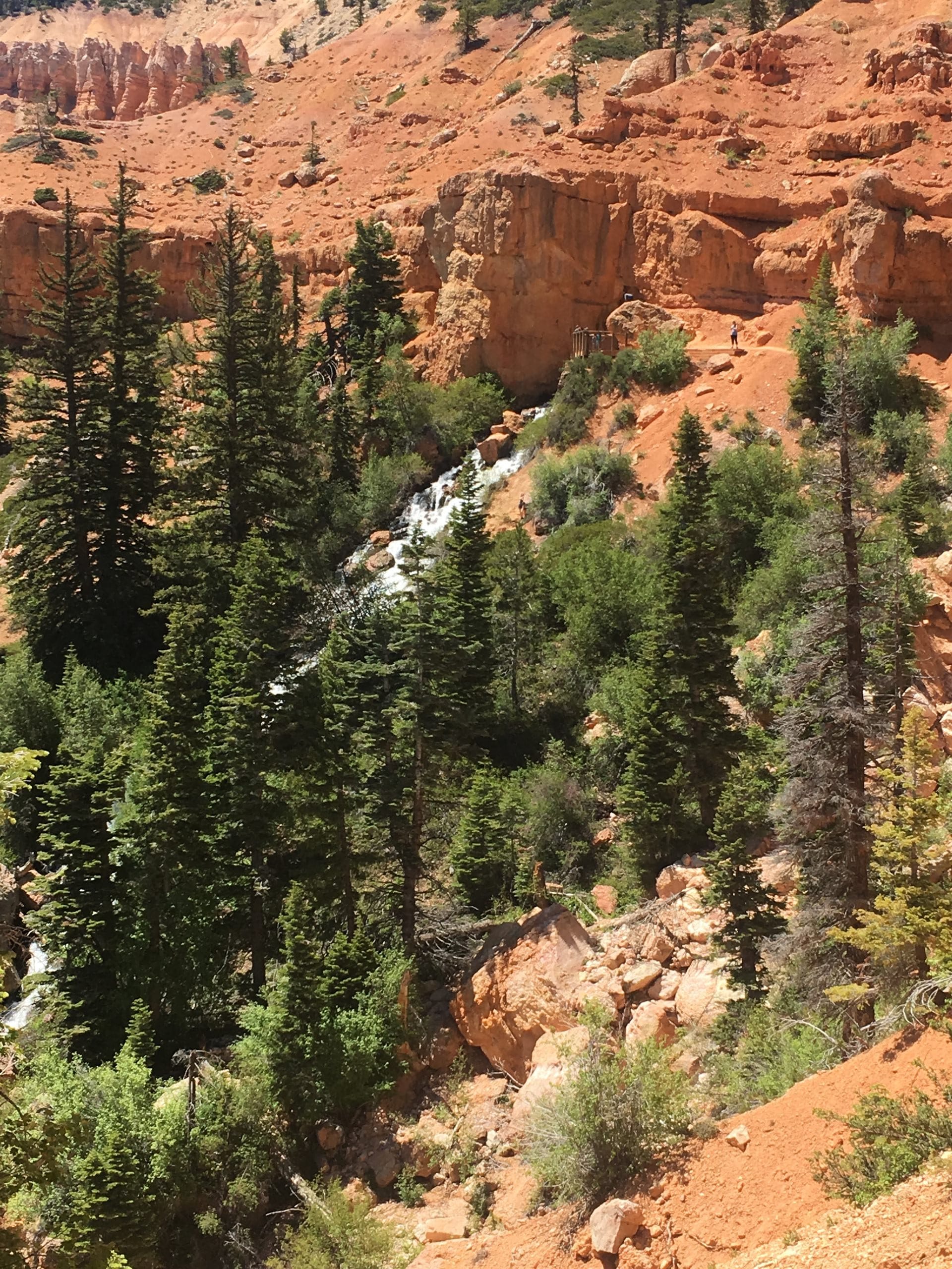
Cascade Falls, a mile from the lake, is Navajo Lake water re-emerging from the cliff after its trip through the sinkholes.
Things to do at Navajo Lake
Fishing
The lake was treated with rotenone in October 2021 to remove Utah chub, which had taken over more than 90 percent of the fish, and restocked under a plan built with local anglers: rainbow trout for families, tiger trout and splake as predators and trophy fish, tiger muskie on top, and Arctic grayling once the hatcheries can supply them. The special rule is one trout or grayling over 22 inches regardless of species; everything else follows the statewide four-trout limit. Shore fishing is easy at the campground and along the road, and the lodge rents boats.
Kayaks and paddleboards go in anywhere along the south shore; the lake is shallow and the shoreline is mostly gravel and grass. Motorboats are allowed. Navajo Lake Lodge rents pontoons, motorboats, kayaks and paddleboards and charges $10 to use its ramp, and there is a primitive dirt landing for small boats inside Navajo Lake Campground. Mornings are calm; the afternoon wind on the plateau is reliable enough to plan around. Every craft that launches in Utah, including a paddleboard, needs the free annual Mussel-Aware Boater course, and motorboats also pay the annual invasive-species fee ($20 resident, $25 nonresident) and carry the decal.
Swimming
The Forest Service lists swimming, and on a hot July afternoon the shallow water near the campground warms enough for kids to wade and splash. There is no designated beach and no lifeguard, the bottom drops away unevenly, and the water is snowmelt at 9,000 feet, so treat it as a quick plunge rather than a swim. Check habs.utah.gov for harmful algal bloom advisories in late summer; none was posted for Navajo Lake when we reviewed this page.
Hiking and mountain biking
The Navajo Lake Loop Trail (Forest Trail 32022) circles the lake in 11.5 miles with only about 200 feet of elevation change. It follows the water through open aspen on the north side and looks down on the lake from the slope on the south. It is closed to motors, open to bikes and horses, and usually rideable from Memorial Day to Labor Day. Short connectors climb from Spruces and Navajo Lake campgrounds to the 32-mile Virgin River Rim Trail above the lake, Pinks Trail is a quarter-mile climb to a cliff view above Te-Ah, and Cascade Falls is the walk everybody should do.
Navajo Lake, Spruces, and Te-Ah campgrounds sit along the south shore road, about 95 sites in all, with water and flush toilets but no hookups or showers. Navajo Lake Campground is on the water and mostly first-come; Spruces and Te-Ah take reservations at recreation.gov. All three open in late May and close in early September, a month before Duck Creek Campground in the village.
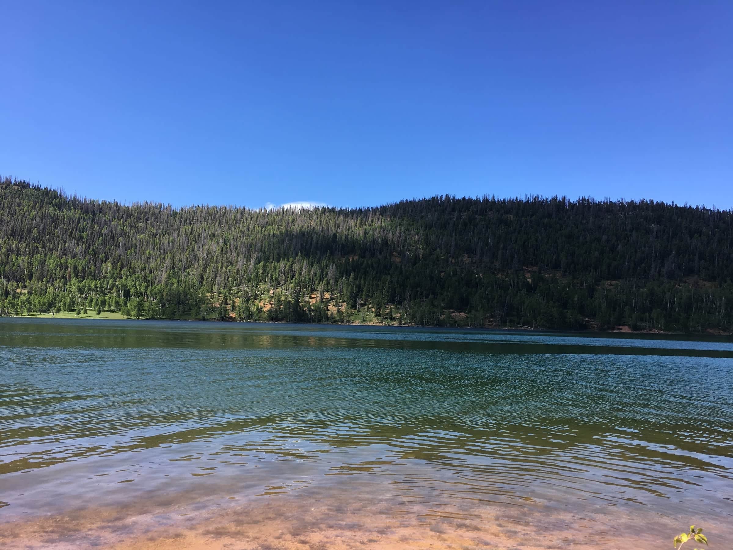
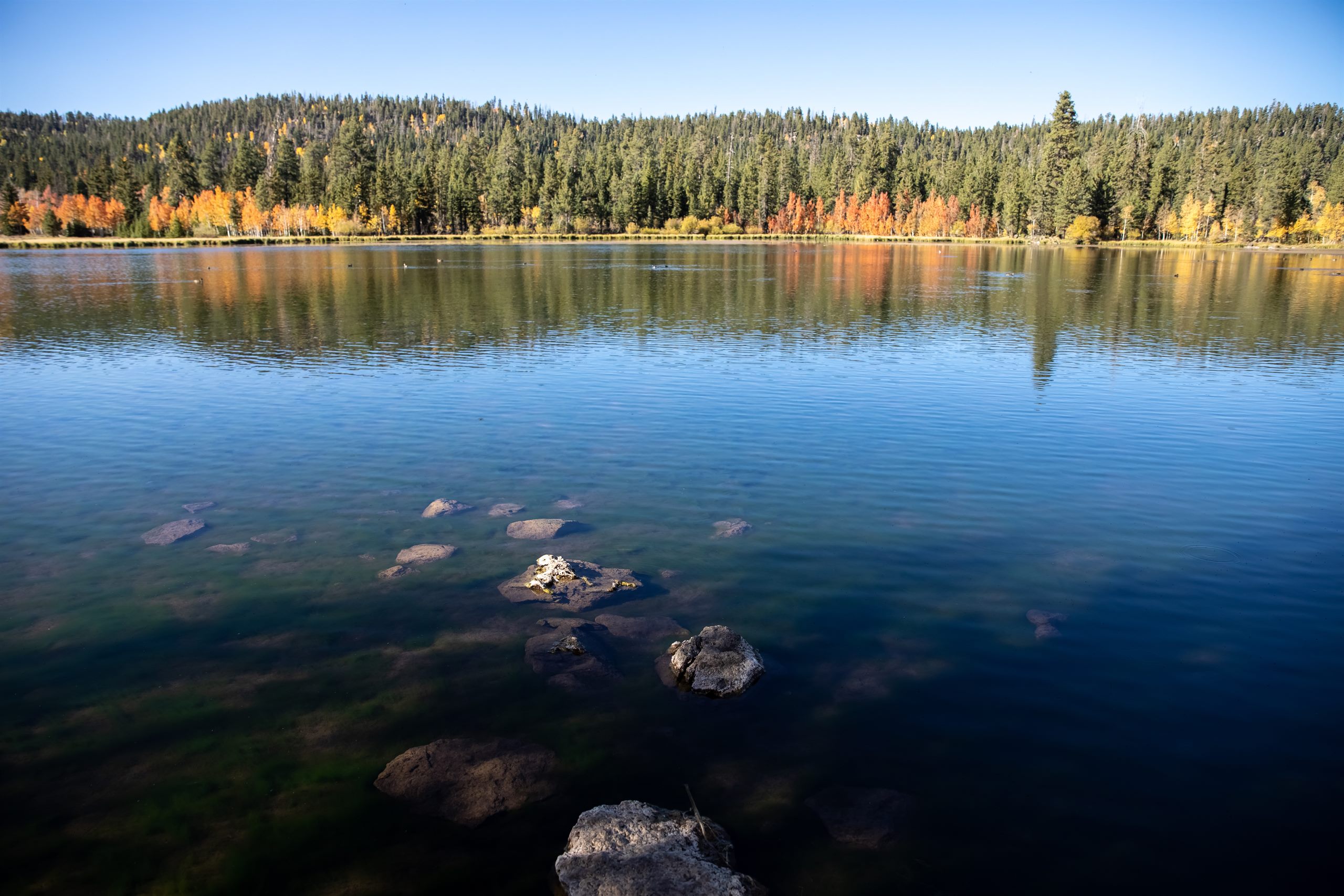
The photo at the top of this page is ours, taken from the south shore. The grey trees on the ridge are Engelmann spruce killed by the bark beetle outbreak that swept the Markagunt Plateau in the 1990s and 2000s; the green coming up between them is the next forest. Bring a picnic, a chair, and a jacket. Even in July the shade is cool, and the light on the water in the last hour before sunset is the reason most people stay longer than they planned.
Last stocked: rainbow trout on September 2, 2026.
Navajo Lake has been stocked every year since 2013, typically 8 plants and about 34,000 fish between May 24 and August 26. Live stocking report
Navajo Lake in winter
The lake typically ices over in early to mid December, according to the Utah Division of Wildlife Resources, and stays frozen into March. Because the road is not plowed, winter at Navajo Lake means a snowmobile: the marked Cedar Mountain trail runs 9.2 miles from the Duck Creek trailhead to the lake, and rentals are available in the village. Ice fishing for splake is the draw, and because the lake is so shallow the ice sets up quickly once the cold arrives.
Treat it as a real backcountry outing. Utah State Parks recommends at least 4 inches of clear ice to walk on and 6 or more for a snowmobile, and you have to drill test holes to know, because nobody measures Navajo Lake for you. If you want to ice fish from a plowed parking lot, Panguitch Lake is the drive-to option, about an hour and a quarter away by the paved winter route. The ice fishing section of our fishing guide covers gear, safety, and the rules, and the winter guide covers everything else about the season.
Weather at Navajo Lake, month by month
The lake sits 600 feet above the village and about 3,200 feet above Cedar City, so it runs cooler than either. The table is an estimate for 9,035 feet, interpolated from NOAA 1991 to 2020 climate normals at Alton (7,100 ft) and Brian Head (9,770 ft), the two long-running stations that bracket it. It is a planning guide, not a forecast.
Estimated typical highs and lows at Navajo Lake, °F
Month
Jan
Feb
Mar
Apr
May
Jun
Jul
Aug
Sep
Oct
Nov
Dec
High
33°
35°
42°
48°
59°
71°
75°
73°
65°
53°
42°
32°
Low
12°
14°
19°
21°
30°
38°
45°
45°
37°
27°
19°
12°
Estimates from NOAA 1991 to 2020 normals at Alton and Brian Head, interpolated to 9,035 ft. July averages 75° by day and 45° at night; January 33° and 12°.
In practice: July and August days reach the mid 70s and nights fall into the 40s, so a jacket comes out at sunset even in high summer. Afternoon thunderstorms build over the plateau most days from mid July into early September; be off the water by early afternoon when the clouds stack up, because the lake is the most exposed place on the mountain. May and October are gambles that pay off on the good days and can snow on the others. From December through March the lake is frozen and the road is closed. For the current forecast at village elevation, use our weather page.
When to go
Late May to mid June. The road opens, the campgrounds open, the lake is at its fullest and Cascade Falls is loudest. Cold mornings, snow still on the north slopes, the first stocking trucks of the season. Bring a real coat.
Late June through August. The season. Warm days, cold nights, afternoon storms, the campgrounds full on weekends. Paddle and fish in the morning, hike or nap in the afternoon, be back at the water for the evening.
September. Our favorite month. The campgrounds close in the first week, the crowds go with them, the aspen on the loop trail turn gold in the last ten days, and the fishing picks up as the water cools. Shorter days and the first hard frosts.
October to early December. Quiet and cold. The road is open until it drifts shut, the lodge is closed, and you can have the shore to yourself on a bright day. Watch the forecast.
December to April. Frozen, snowed in, and reached by snowmobile only. Ice fishing for splake.
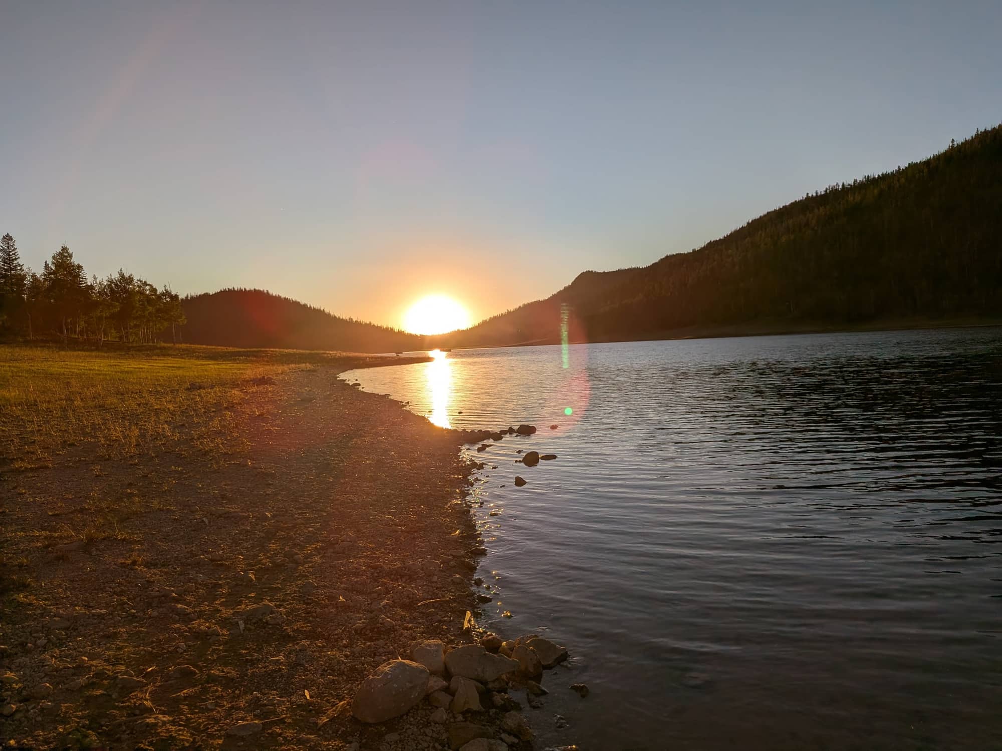
Sunset from the south shore, July 10, 2026. The sun goes down over the west end, so the last light lands on the campground side of the lake.
Navajo Lake Lodge, and where to stay
Navajo Lake Lodge has been on the south shore, about four miles in from the highway, since 1927. It has 11 rustic cabins with kitchenettes (bring a cooler; there are no refrigerators), a general store, a fish cleaning station, boat rentals, and the only proper boat ramp on the lake. As of September 2026 the posted rates are $335 a day for a 24-foot pontoon, $285 for an 18-foot pontoon, $125 for a boat and motor, and $60 for four hours with a kayak or paddleboard, with life jackets included; slips are $55 a day and the ramp is $10 unless you are a cabin guest. Seasons and prices change, so call (702) 646-4197 before you count on anything.
If you want the lake by day and a real bed, a hot shower, and heat at night, that is what we are for. Our cabins have full kitchens for cleaning up after a fishing day, several take dogs, and the rooms at the inn include breakfast so you can be on the water by eight. The stay near Navajo Lake page compares the options, and Aunt Sue's and the other village restaurants are 15 minutes from the shore.
Nearby, in the same day
Cascade Falls: the lake's outlet, 1.1 miles round trip along the rim, best in late spring.
Duck Creek history: the Paiute high country, the dairies, the CCC camp, and the sinkhole caves.
Reviewed September 2026
Why trust this guide
We are 15 minutes from the lake and send guests there all summer. The figures on this page come from the Forest Service campground pages, the 2026 Utah Fishing Guidebook, Utah DWR stocking records and reports, USGS and Utah Geological Survey publications on the sinkholes, NOAA climate normals, and Navajo Lake Lodge's published rates, all checked in September 2026. Conditions change with the snowpack; confirm road status and fire restrictions before you drive.
Distance, depth, fees, fish, swimming, boats, camping, and winter.
How far is Navajo Lake from Duck Creek Village?
About 8 miles and 15 minutes: four miles west on Highway 14 to Navajo Lake Road, then about 3.5 miles of paved road around the east end to Navajo Lake Campground on the south shore. Spruces Campground comes first, at 2.5 miles.
How far is Navajo Lake from Cedar City?
About 25 miles east on Highway 14, roughly 40 minutes, climbing from 5,800 feet in town to over 9,000 feet at the lake.
How big and how deep is Navajo Lake?
About 3 miles long and half a mile wide, roughly 700 acres when full, and shallow: about 25 feet at its deepest. The level changes with the snowpack because the lake drains through sinkholes rather than a river.
What is the elevation of Navajo Lake, Utah?
9,035 feet. July highs average about 75°F and July nights about 45°F, and afternoon thunderstorms are common in late summer.
Is there a fee to visit Navajo Lake?
No. The lake is in Dixie National Forest with no entrance fee and free parking. You pay for camping ($23 to $30 a night for a single site in 2026), for the lodge boat ramp ($10), and for a Utah fishing license if you fish.
What fish are in Navajo Lake?
Rainbow trout, tiger trout, splake, cutthroat trout, and tiger muskie, all stocked by the Utah Division of Wildlife Resources since the lake was treated to remove chub in 2021. Arctic grayling are in the plan but had not yet been stocked as of 2025. The special rule is one trout or grayling over 22 inches, regardless of species.
Can you swim in Navajo Lake?
Yes. The Forest Service lists swimming, but there is no beach or lifeguard and the water is cold snowmelt at 9,000 feet. Most people wade near the campground on hot afternoons rather than swim. Check habs.utah.gov for algal bloom advisories in late summer.
Are motorboats allowed on Navajo Lake?
Yes. Navajo Lake Lodge rents motorboats and pontoons and operates a ramp, and there is a primitive landing at Navajo Lake Campground. Anyone launching any watercraft in Utah, including kayaks and paddleboards, must complete the annual Mussel-Aware Boater course; motorboats also pay the invasive-species enrollment fee.
Can you rent a boat at Navajo Lake?
Yes, at Navajo Lake Lodge on the south shore: pontoons, motorboats, kayaks, and paddleboards by the hour or day, life jackets included. As of September 2026 a 24-foot pontoon is $335 a day and a kayak or paddleboard is $60 for four hours. Call (702) 646-4197 to confirm the season.
Can you camp at Navajo Lake?
Yes. Navajo Lake, Spruces, and Te-Ah campgrounds sit on the south shore road with about 95 sites between them, open late May to early September. Navajo Lake Campground is mostly first-come, first-served; Spruces and Te-Ah take reservations at recreation.gov. None has hookups or showers.
Can you ice fish at Navajo Lake?
Yes, and splake are the winter target. The lake usually freezes in early to mid December. The road is not plowed, so access is by snowmobile, 9.2 miles from the trailhead in Duck Creek Village. Check ice thickness yourself: at least 4 inches of clear ice to walk on.
Is Navajo Lake open in winter?
The lake never closes, but Navajo Lake Road is unplowed and the campgrounds and lodge shut in early September, so from the first big storm until late spring it is a snowmobile trip. Highway 14 stays open all winter.
Why does Navajo Lake drain through sinkholes?
A lava flow dammed the valley and left the lake with no outlet, so water sinks through holes at the east end into caves in the Claron limestone. Dye tests show it resurfaces at Cascade Springs after about 8.5 hours (the Virgin River) and at Duck Creek Springs after about 53 hours (the Sevier River). A 1932 embankment keeps most of the lake away from the sinkholes.
Is Navajo Lake worth visiting?
If you are staying in Duck Creek Village or driving Highway 14, yes: it is the largest lake on the mountain, 15 minutes from the village, free to visit, and it combines easily with Cascade Falls and Cedar Breaks in one day. It is a quiet forest lake rather than a resort, so come for fishing, paddling, a picnic, or a campsite.
Related stops
Other lakes and shoreline stops that fit the same kind of day.