Snowmobile trails from the village, groomed ski loops four miles away, and the quietest months of the year at 8,400 feet
Duck Creek Village gets a real winter. The village sits at 8,400 feet on the Markagunt Plateau, snow usually covers the ground from December through March, and the forest that fills with side-by-sides in July turns into the Cedar Mountain snowmobile complex, one of the larger groomed trail systems in southern Utah. Four miles west, the Forest Service closes 1,300 acres to machines so skiers and snowshoers get groomed loops of their own. Both start within fifteen minutes of the inn.
It is also a much quieter place than the summer village. The seasonal shops close, a couple of restaurants keep their lights on, sunset comes before 5:30, and the sky after dark is as clear as it gets all year. This guide covers what actually runs in winter, how far each thing is once the Cedar Breaks shortcut closes, and how to handle Highway 14 so the trip starts well.
Winter at a glance
Snow season
On the ground from about December through March; first flakes between mid-October and mid-November
January weather
Typical highs near 36°F and nights near 14°F at the village, from NOAA climate normals
Snow depth
Late-winter median about 20 inches at 7,800 ft and 50 to 60 inches at 9,800 ft; the village sits between
Snowmobiling
Cedar Mountain complex trailhead in the village; roughly 100 miles groomed by the Forest Service and Utah State Parks
Nordic skiing
Deer Hollow, 4 miles west on Highway 14, groomed by the Cedar Mountain Nordic Ski Club
Downhill skiing
Brian Head Resort, about 1 hour 15 minutes in winter via Cedar City and Parowan
Highway 14
Plowed all winter; closes for hours, not days, in big storms; carry chains December through March
Daylight
Sunset about 5:10 PM in late December, so plan the outing for the morning
Snowmobiling from the village
Snowmobiling is the reason most winter guests are here. The Cedar Mountain Snowmobile Complex covers the plateau between Duck Creek and Brian Head, groomed by the Dixie National Forest with Utah State Parks, and its Duck Creek trailhead is in the village itself. The Forest Service puts the groomed mileage near 100 miles; the county tourism office counts more than 160 once the open play areas are added. Either way it is more trail than a long weekend can cover.
From the Duck Creek trailhead the marked trails fan out in every direction. The Duck Creek Trail runs 14.5 miles to Midway Valley and is narrow enough that the trail guide tells riders to slow down. Navajo Lake is 9.2 miles, Strawberry Point 9 miles to the rim, where the wind piles drifts across the trail, Cedar Breaks 8.9, Sage Valley 8.4, Lars Fork 6.9, and the short Duck Creek South loop 4.7. A second plowed trailhead sits at Midway on Highway 14 if you would rather trailer up the road and skip the village leg.
Two rules matter more than the rest. Inside Cedar Breaks, snowmobiles stay on the marked route along the closed Highway 148, flagged with orange poles; riding off it onto the meadows carries fines up to $5,000 and can get the machine impounded. And Deer Hollow, the ski area below, is closed to motorized use all winter, with the boundary signed. Everywhere else, the summer Motor Vehicle Use Map is not the winter rule book; the grooming report and the Forest Service winter travel map are.
Rentals. At least two village outfitters list snowmobiles in season; names, hours and the Utah rules are on our rentals page.
Your own sled. Out-of-state machines need Utah's non-resident OHV permit before they touch the trail.
Grooming. It runs on snowpack, not the calendar. Read the Cedar Mountain grooming report the morning you ride.
Carry. A shovel, a spare belt, and a paper map. There is no cell signal on most of the complex.
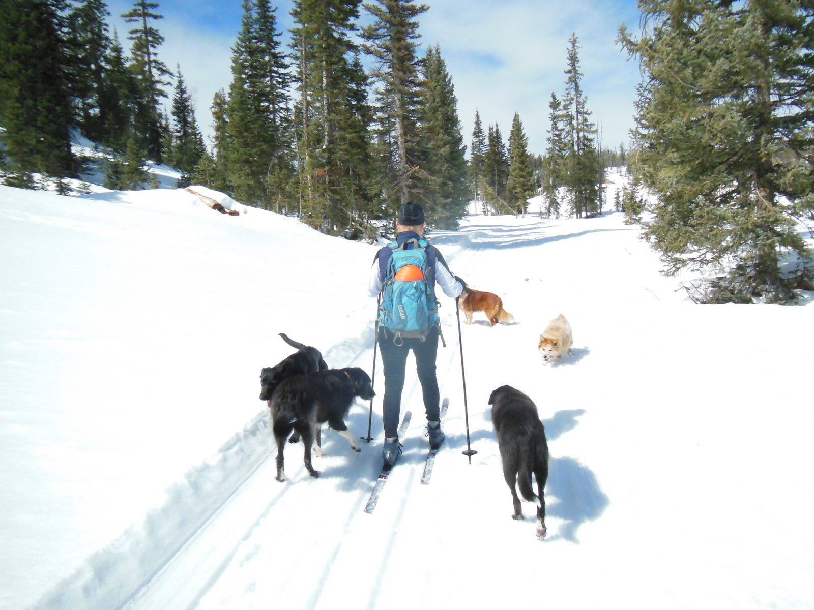
A groomed classic track on the Dixie National Forest. Deer Hollow, four miles from the village, is groomed the same way. US Forest Service, Intermountain Region · Public domain · via the Forest Service on Flickr
Cross-country skiing and snowshoeing at Deer Hollow
Deer Hollow Winter Recreation Area is the closest groomed Nordic skiing to the inn: four miles west on Highway 14, a plowed lot on the south side of the road at 9,510 feet, and a trail system that climbs gently to two overlooks, one above Navajo Lake and one over the lava field. The volunteer Cedar Mountain Nordic Ski Club sets classic track on the loops from about mid-December to late March and posts a report each time it grooms. The club says about 11 of its 16 marked miles get groomed regularly; the Forest Service brochure counts 23 miles in all.
The marker colors do the explaining. Blue trails are for skis only, yellow trails take skis, snowshoes and fat bikes, and the purple Aspen Trail is the one built for skiers with dogs. Snowshoers walk beside the set track, never in it. There is no fee, no warming hut, and no rental counter, so bring gear from home or rent in Cedar City on the way up. Our Deer Hollow guide has the trail-by-trail detail, and the winter trails page lists the other places to ski or snowshoe when Deer Hollow is tracked out.
If you would rather just walk in the snow, you do not need to drive anywhere. The meadows and forest edges around the village take a pair of snowshoes well after a storm, and the unplowed forest roads off Highway 14 make flat, obvious routes for an hour out and back. Keep it short in the wind, turn around before the light goes, and stay off the highway shoulder, where snowbanks hide the road edge.
A ski day at Brian Head
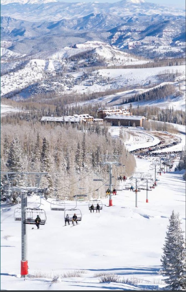
Brian Head Resort is the nearest lift-served skiing: 8 chairlifts, 75 runs, and more than 650 acres across two connected mountains, with a base at 9,800 feet that gives it the highest base elevation of any Utah ski area and a season that has run from early November into May. The Navajo side is the family hill with a learning area; Giant Steps has the main lodge, night skiing on Friday and Saturday evenings, and the snow tubing hill, which sells 1.5-hour sessions with the tube included. For 2026-27 the resort has announced Friday, November 6, 2026 as opening day.
The catch is the drive. In summer Brian Head is 35 minutes away over Highway 148 through Cedar Breaks. That road closes with the snow, so the winter route runs west on Highway 14 to Cedar City, north on I-15 to Parowan, then up Parowan Canyon on Highway 143: about 1 hour 15 minutes each way. Plenty of our guests do it as a day trip and come back to a quieter village for the evening. If the whole group skis every day, stay closer to the lifts. Our Brian Head guide covers tubing rules, kids' pricing, and the summer lift.
Cedar Breaks on snowshoes
Cedar Breaks National Monument does not close in winter; its road does. Highway 148 through the monument shuts around mid-November on average and stays shut until mid or late May, though in the 2025-26 season it held on until January 2 for lack of snow. Once it closes, the plowed lot at the junction of Highway 14 and Highway 148, about 15 minutes west of the village, becomes the Duck Creek side's winter trailhead. From there Point Supreme is 3.5 miles along the buried road. The Park Service sets ski track on the road itself, snowshoers and skiers may use any trail, and snowmobiles follow the orange-pole route.
The amphitheater under snow, pink hoodoos poking through white, is a view most visitors never see. It is also 10,000 feet of exposed rim in January, so treat it as a real outing: spend a day at village altitude first, start early, and check the Utah Avalanche Center forecast before leaving the road corridor. In recent seasons rangers have led guided snowshoe walks on Fridays and Saturdays from the first weekend of January, with snowshoes and poles provided and registration on the park website. The visitor center and vault toilets are closed from mid-October to late May, and the ranger line is 435-986-7120. Our Cedar Breaks conditions page shows the live road status.
Ice fishing at Panguitch Lake
Panguitch Lake is the winter fishery here: 1,248 acres of Blue Ribbon water at about 8,200 feet that freezes solidly enough for ice fishing most years from late December into February. Rainbow trout make up most of the catch, with Bear Lake cutthroat and tiger trout mixed in, and a slot limit protects the mid-size cutthroat and tigers, so read the current Utah guidebook before you keep fish. A Utah license is required from age 12.
The drive is the winter caveat. In summer the lake is about 35 minutes away by the Mammoth Creek road. That road is not reliably plowed, so in winter plan on the paved way around: east on Highway 14 to Long Valley Junction, north on US-89 to Panguitch, then west on Highway 143 to the lake, about an hour and a quarter. Navajo Lake freezes too, but its road goes unplowed and it becomes a snowmobile trip rather than a drive. Check ice thickness locally, treat 4 inches of clear ice as the minimum for walking, and see our fishing guide and Panguitch Lake page for the rest.
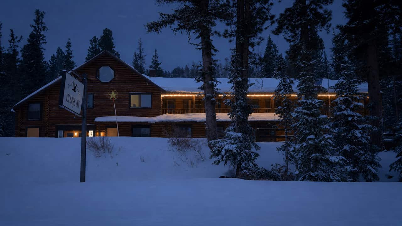
The inn on a winter evening. The meadows behind it are where guests sled after a storm.
The village in winter
Winter is Duck Creek at its smallest. The seasonal shops and the summer food trucks close after the fall color, and the businesses that stay open run shorter weeks. Aunt Sue's Chalet is the one that makes a point of staying open through the snow; the others tend to run Thursday or Friday through Sunday, so check hours before you count on a meal and plan to cook in the cabin a night or two. Fuel is limited in the village, so fill up in Cedar City before the climb and buy groceries there too.
Snow play does not need a ticket. Kids sled the meadows around the inn after a storm, and a pair of snowshoes turns any forest edge into a walk. Keep sledders well back from Highway 14. Several of our cabins have gas fireplaces, one has a private hot tub, and a hot tub in falling snow is the best seat in the village.
After dark, winter is the best stargazing of the year. Cold, dry air over the plateau is steadier and clearer than summer haze, Orion is high by nine o'clock, and with sunset around 5:10 PM in late December you can see the whole show and still be in bed by ten. Cedar Breaks is an International Dark Sky Park, but you do not need to drive: step off the deck, give your eyes ten minutes, and look up. Our stargazing guide has the moon calendar and what to look for.
Getting here on Highway 14
Highway 14 is the only paved road in, and UDOT plows it all winter over a summit just under 10,000 feet. On most winter days it is packed snow or bare pavement and any car makes it. A few times a season it closes during or just after a big storm, usually for hours, occasionally overnight while crews clear Cedar Canyon. When UDOT posts the traction law, two-wheel-drive cars need snow tires with the mountain-snowflake symbol or chains, and AWD needs M+S tires all round. Carry chains from December through March even if they never leave the trunk.
Our own pages do most of the checking. The snow report shows live depth at the two SNOTEL stations above and below the village, road conditions pulls UDOT's alerts and the Highway 14 camera, the live cams show the village end of the road, and the weather page carries the NWS forecast for 8,400 feet rather than the valley floor. Make the climb in daylight, and if snow is actively dumping, have lunch in Cedar City and let the plows work. The winter access page has the full driving brief.
What closes for the season
Highway 148 through Cedar Breaks: closed roughly mid-November to late May
Strawberry Point Road and the other gravel forest roads: unplowed, snowmobile country until spring
Navajo Lake road and campgrounds: closed; Cascade Falls and the lava tubes are snowed in
Duck Creek Visitor Center: closed for the season, so ask at the inn instead
What to bring
Chains or snow socks, an ice scraper, and a full tank from Cedar City
Insulated waterproof boots, plus traction cleats for icy parking lots
Layers you can shed: the climb at Deer Hollow is warm work, the rim at Cedar Breaks is not
Sunglasses and sunscreen; snow at 9,000 feet burns fast
A headlamp, since it is dark by 5:30 through January
Downloaded maps; cell service fades above Cedar Canyon
Skis, snowshoes, or sleds from home; the village has no rental counter for any of them
Planning a winter stay
Three nights is the sweet spot. The pattern that works for most guests: arrive in daylight, ski or snowshoe Deer Hollow the first morning while the body adjusts to the altitude, spend the second day on a snowmobile or at Brian Head, and keep the third loose for whatever the storm did overnight. Dogs are welcome on three Deer Hollow trails and in our pet-friendly cabins. Compare rooms and cabins, and check village events for anything on the calendar during your dates.
September 2026
Why trust this guide
We live in the village year-round and drive Highway 14 through every storm. Trail mileages come from the Cedar Mountain complex trail guide, Deer Hollow details from the Forest Service brochure and the ski club, Cedar Breaks access from the National Park Service winter access page, Brian Head figures from the resort, and temperatures from NOAA 1991 to 2020 normals adjusted to 8,400 feet. Conditions change weekly, so check the sources below before you commit a day.
What guests ask before a winter trip to Duck Creek.
What is there to do in Duck Creek Village in winter?
Snowmobile the Cedar Mountain complex straight from the village, cross-country ski or snowshoe the groomed loops at Deer Hollow four miles away, drive to Brian Head for lifts and tubing, snowshoe into Cedar Breaks from the Highway 14 lot, ice fish Panguitch Lake, and sled and stargaze around the inn. Snow usually covers the village from December through March.
Can you snowmobile right from Duck Creek Village?
Yes. The Cedar Mountain Snowmobile Complex has a trailhead in the village, and marked trails run from it to Navajo Lake, Strawberry Point, Cedar Breaks, Sage Valley, Lars Fork, and Midway Valley, from 4.7 to 14.5 miles each. Village outfitters rent machines in season, and the Forest Service grooms roughly 100 miles of trail with Utah State Parks.
How far is Brian Head from Duck Creek Village in winter?
About 1 hour 15 minutes. The 35-minute summer shortcut over Highway 148 through Cedar Breaks closes with the snow, so the winter route is Highway 14 west to Cedar City, I-15 north to Parowan, and Highway 143 up Parowan Canyon to the resort.
Is Highway 14 open in winter, and do I need four-wheel drive?
Highway 14 is plowed all winter and open most days; it closes for a few hours during or after major storms. On a clear day any car makes the climb. When UDOT posts the traction law, two-wheel-drive cars need snow tires or chains and AWD needs M+S tires on all four wheels. Carry chains from December through March.
Can you visit Cedar Breaks in winter?
On snowshoes, skis, or a snowmobile, yes. Highway 148 closes around mid-November and reopens in late May. The plowed lot where Highway 14 meets Highway 148, about 15 minutes from the village, puts Point Supreme 3.5 miles away on the snowed-over road, and rangers have led weekend snowshoe walks from January in recent seasons.
When does Duck Creek Village get snow, and how much?
First snow usually falls between mid-October and mid-November, and the ground stays white from about December through March. Late-winter snow depth typically runs around 20 inches at the SNOTEL station 600 feet below the village and 50 to 60 inches at the one 1,400 feet above it. Our snow report shows both stations live.
Can I rent skis or snowshoes in Duck Creek Village?
No. There is no ski or snowshoe rental in the village or at Deer Hollow, so bring your own or rent in Cedar City on the way up. Snowmobiles are the exception: village outfitters rent them in season.
Where can I ice fish near Duck Creek Village?
Panguitch Lake, which usually holds safe ice from late December into February, for rainbow, Bear Lake cutthroat, and tiger trout. In winter plan on the paved route through Long Valley Junction and Panguitch, about an hour and a quarter, because the Mammoth Creek shortcut is not reliably plowed. Navajo Lake freezes too but is reached by snowmobile in winter.
Stay Where the Trails Start
Book a room or cabin at Duck Creek Village Inn. Snowmobile trailhead in the village, groomed ski loops ten minutes away, and a warm bed waiting when the light goes.