
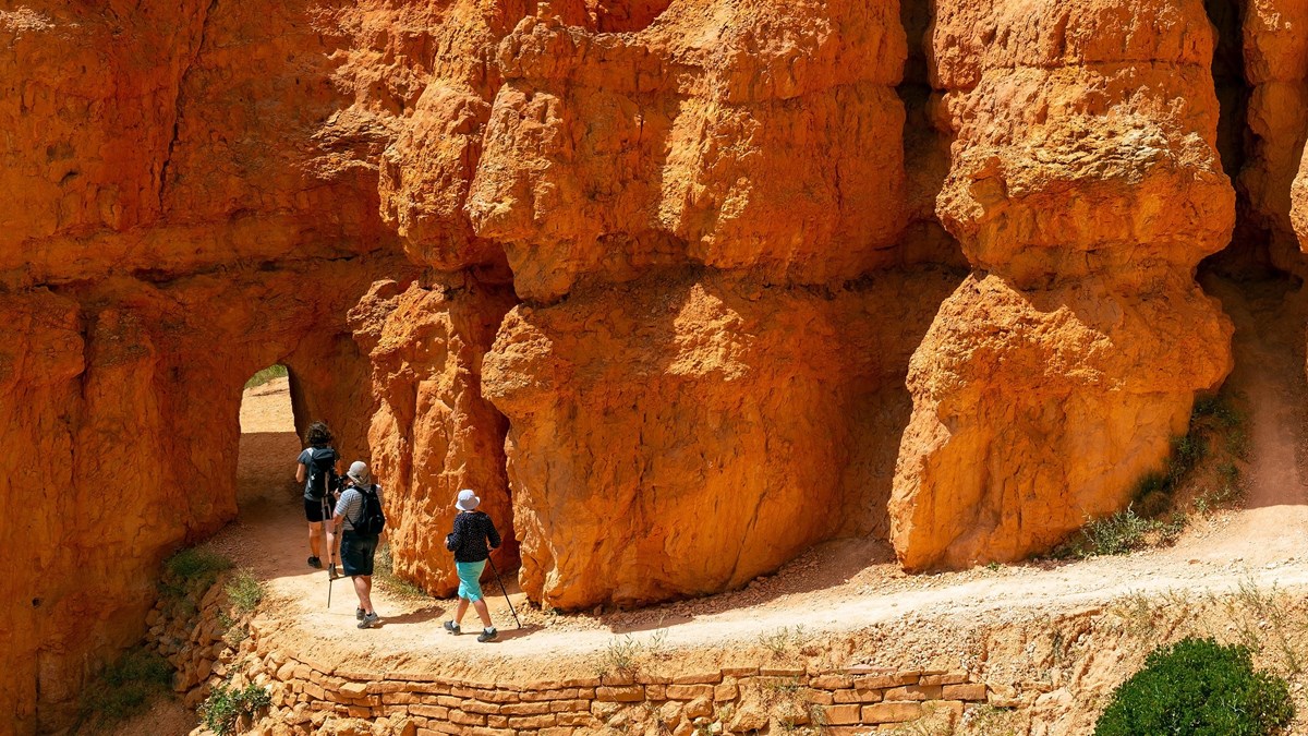
Wall Street (seasonal): Narrow slot canyon with towering walls and Douglas firs rooted in the rock. More dramatic but steeper switchbacks. Closes when ice or snow is present, typically December through March or April.
Duck Creek Guide
Queen's Garden & Navajo Loop
The signature Bryce Canyon hike: 2.9 miles and 625 feet through the hoodoos and back to the rim
At a glance
- Distance
- 2.9 miles, loop including the Rim Trail return
- Elevation gain
- 625 ft, per the National Park Service
- Time
- 2 to 3 hours, allowing for photo stops
- Difficulty
- Moderate: well graded, but real climbing above 8,000 feet
- Trailhead
- Sunrise Point to descend Queen's Garden, Sunset Point to climb the Navajo Loop
- Permit
- None. A standard day hike with the park entrance fee
If you do one hike at Bryce Canyon, this is it. The Queen's Garden and Navajo Loop combination is the most popular trail in the park and the one the NPS recommends for first-time visitors. It drops you below the rim into the amphitheater, weaves through hoodoo corridors and narrow canyon walls, and climbs you back out with the whole amphitheater laid out behind you. The hike takes most people about two hours and gives you the Bryce experience that viewpoints alone cannot.
Why the park says hike it clockwise
These are the two halves of the loop, sampled from USGS elevation data along their mapped lines. Queen’s Garden gives up its height gradually over most of a mile; the Navajo Loop takes it all back in a few hundred yards of switchbacks. Going clockwise means you lose elevation on the gentle side and climb the steep side, which is both safer and easier to pace.
The interactive map needs JavaScript. Every trail below the rim starts from Sunrise, Sunset, Inspiration or Bryce Point, all within the first three miles of the park road.
- Moderate
- Viewpoint or trailhead
How the combo works
The loop connects two trails, Queen's Garden (starting from Sunrise Point) and Navajo Loop (ending at Sunset Point), with a short connector below the rim. Hike it clockwise: descend from Sunrise Point on the Queen's Garden trail, walk the connecting trail at the bottom, then ascend the Navajo Loop switchbacks to Sunset Point. Walk the flat, paved Rim Trail half a mile back to your car at Sunrise Point.
The NPS recommends clockwise for three reasons: the Queen's Garden descent is gentler and puts the amphitheater views in front of you as you go down; ascending the steeper Navajo switchbacks is safer than descending them; and when everyone hikes the same direction, a busy trail feels less congested.
What to expect below the rim
The Queen's Garden descent is the gentler half. You drop along a ridgeline with open views of the amphitheater, passing formations the early explorers named for their resemblance to Queen Victoria and her court. The hoodoos go from distant shapes to arm's-length structures as you descend.
At the bottom, a connector trail links you to the Navajo Loop. This section winds through hoodoo corridors with walls on either side. It is quieter here than at the top and the scale of the formations becomes real: you are walking among towers that are taller than most buildings.
The Navajo Loop ascent has two routes. The Wall Street side passes through a narrow slot with Douglas fir trees growing in the shadows between 200-foot walls. It is the more dramatic option but closes when icy (usually December through March or April). The Two Bridges side stays open year-round and passes Thor's Hammer, the park's most-photographed hoodoo. Either way, the switchbacks are steep and the last stretch to the rim is the part where altitude makes itself felt.
Wall Street vs. Two Bridges
Two Bridges (year-round): Wider trail with views of Thor's Hammer and two natural rock bridges. Open all year. Slightly less steep than Wall Street and better for anyone uneasy with tight spaces or heights.
Seasonal notes
Summer (June to August) gives you the most reliable conditions: all routes open, long days, shuttle running. Afternoon thunderstorms are common but usually pass quickly. Start in the morning to beat heat and crowds.
Spring and fall offer smaller crowds and beautiful light. Wall Street may still have ice into May; fall colors in the surrounding forest add to the drive from Duck Creek. These are our favorite seasons for this hike.
Winter turns the hoodoos into a different landscape. Snow on the red rock is spectacular for photography. Wall Street closes, but Two Bridges stays open. Traction devices (microspikes or similar) are strongly recommended. Shorter days mean earlier starts.
Tips from Duck Creek
- Arrive early. Parking at Sunrise and Sunset Points fills by mid-morning in summer. Leave Duck Creek by 8 AM, or take the free shuttle from the shuttle station to skip the parking stress.
- Park at Sunrise Point. If you are hiking clockwise (recommended), park at Sunrise Point so you end the loop with a short Rim Trail walk back to your car instead of an uphill return.
- Morning light is best. The amphitheater faces east, so morning light hits the hoodoos directly and makes the colors pop. By afternoon the amphitheater is in shadow.
- Wear hiking boots. The switchbacks are sandy and the rock steps are uneven. The NPS says inappropriate footwear is the number one cause of rescues at Bryce. Lug soles and ankle support make the climb out much easier.
- Bring water and a layer. At 8,000 feet, you dehydrate faster than expected. Carry at least a liter per person. Mornings can be cool even in summer, and a light jacket is worth having.
- Check Wall Street status. If you want the Wall Street route, confirm it is open on the NPS conditions page before you go. The Two Bridges side is always a good alternative.
Pairing with other activities
After the combo, walk the Rim Trail to Inspiration Point and Bryce Point for additional viewpoints without dropping below the rim again. If you still have energy, the scenic drive south to Rainbow Point adds quieter overlooks and the short Bristlecone Loop at the end of the road.
Back at Duck Creek, pair a Bryce day with something easier the next day: a morning at Aspen Mirror Lake, a drive to Cedar Breaks, or a rest day with village dining and a walk on the property. Check our rooms and cabins to build the stay around the trip.
March 2026
Why trust this guide
We recommend this hike to nearly every guest who asks about Bryce Canyon. Trail conditions and Wall Street closures change seasonally, so always check the NPS resources before you commit to a route.
Questions to Queen's Garden & Navajo Loop
Common questions from trip planners.
How long does the Queen's Garden and Navajo Loop combo take?
Most people complete the 2.9-mile loop in 1.5 to 2.5 hours, depending on pace and how long you stop for photos. At 8,000+ feet, the climb back out takes longer than you expect, so budget extra time if you are not accustomed to the altitude.
Which direction should I hike the loop?
Clockwise: descend from Sunrise Point on the Queen’s Garden trail, then ascend via the Navajo Loop to Sunset Point. The NPS recommends this direction because the Queen’s Garden descent is gentler, the views face you on the way down, and ascending the steeper Navajo switchbacks is safer than descending them.
Is Wall Street on the Navajo Loop always open?
No. The Wall Street side of the Navajo Loop closes during winter and early spring when ice and snow accumulate on the steep switchbacks. The Two Bridges side stays open year-round. Check the NPS conditions page before your visit.
Is the Queen's Garden and Navajo Loop good for kids?
Older kids who can handle moderate hiking generally do well. The trail is well-maintained but involves real elevation change at high altitude. Young children in strollers cannot do this trail. The Rim Trail between Sunrise and Sunset Points is a better family option.
Do I need a permit for the Queen's Garden and Navajo Loop?
No permit is needed. This is a standard day hike accessible from the Sunrise and Sunset Point trailheads. The only fee is the $35 park entrance fee (per vehicle, valid for 7 days).
Stay Here, Hike the Hoodoos Tomorrow
Book your room or cabin at Duck Creek Village Inn, cool mountain evenings at 8,400 feet after a day below the rim at Bryce.