Trail-by-trail distances, elevations, seasons, and exactly where each trailhead is — from a 1.1-mile family waterfall walk to 32 miles of rim trail
When people search for Duck Creek trails, they almost always mean one of three: the short walk to
Cascade Falls, where Navajo Lake pours out of a cliff; the Navajo Lake Loop,
which you can walk for an hour or circle in a day; and the Virgin River Rim Trail, the
32-mile rim route that the Forest Service splits into three shorter hiking trails. Add the half-mile walk
to Aspen Mirror Lake five minutes from the inn, and the rim trails at Cedar Breaks twenty
minutes up the road, and that is the honest shortlist.
Every trail below sits on the Markagunt Plateau in Dixie National Forest, all of it between about 8,400
and 10,500 feet. Trail numbers, distances, and open seasons come from the
Cedar City Ranger District,
the National Park Service, and Recreation.gov, with the source linked under each trail. Where the Forest
Service does not publish a figure, we have left it out rather than guessed.
Pick by how much day you have, not by how tough you are. The altitude does enough of that on its own.
Trail
Distance
Difficulty
Drive from the inn
Cascade Falls #32055
~1.1 mi round trip
Easy to moderate
~20 min
Aspen Mirror Lake
~0.5 mi each way
Easy
~5 min
Navajo Lake Loop #32022
11.5 mi full loop; shorter sections available
Easy (rated by the Forest Service)
~15 min
Virgin River Rim #32011
32 mi in three shorter trails
Varies by segment
~15–30 min to the access points
Alpine Pond Loop (Cedar Breaks)
1–2 mi loop
Moderate
~20 min
South Rim Trail (Cedar Breaks)
5 mi; 2 mi round trip to Spectra Point, 4 mi to the Ramparts
Moderately strenuous
~20 min
Cascade Falls Trail (Forest Trail #32055)
The one most people mean, and the right first hike with kids
Distance
About 1.1 miles round trip — the Forest Service describes it as a 3/4-mile rim trail out to the falls
Elevation
Roughly 8,800 ft along the rim; gentle overall, with stairs and a few short steep pitches
Difficulty
Easy to moderate. Foot traffic only — no bikes or horses
Season
Roughly Memorial Day to Labor Day, weather permitting; the dirt access road is snowed in through winter and early spring
Trailhead
Cascade Falls Trailhead — Highway 14 to Navajo Lake Road (FR-053), then FR-054. Large lot with a pit toilet
Drive from the inn
About 20 minutes, the last three or so on dirt forest road
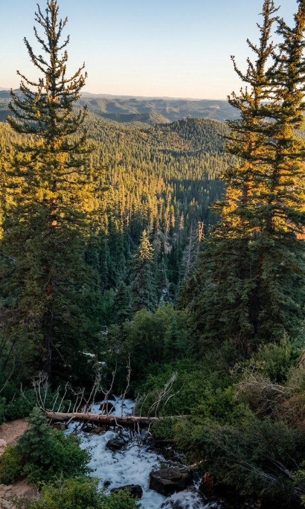
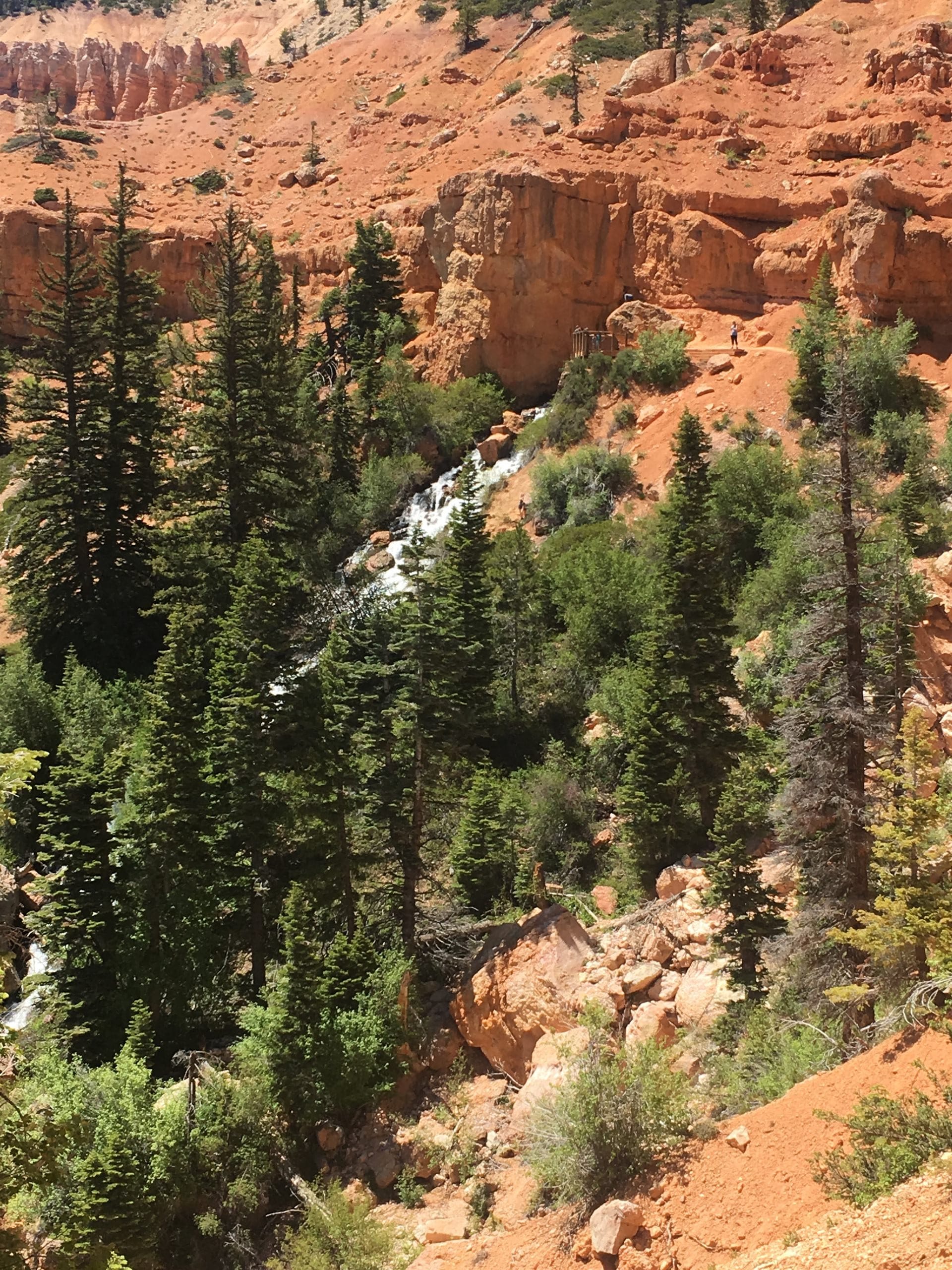
This is the hike guests come back talking about. A waterfall pours straight out of a hole in the Pink Cliffs, and the water is Navajo Lake — the lake has no surface outlet, so it drains through sinkholes at its east end, runs underground, and reappears here as the headwaters of the North Fork of the Virgin River. The Forest Service notes the lava tube itself is closed to entry because of low oxygen and high water flows, so the show is from the rim.
The path is short, well built, and mostly gentle, with stairs doing most of the work and benches when you want them. Two viewing platforms — one at the halfway point, one at the falls — give you the falls and a long look south toward Zion. Flow tracks the lake level, so late spring and early summer snowmelt is the showstopper window; by a dry September the falls can shrink to a trickle while the cave mouth and canyon views still earn the walk.
Steep drop-offs edge parts of the rim, so keep kids close. There is no shade and no water on the trail — carry your own, including for the dog.
We keep a longer page on this one — the geology, the flow through the season, and what the platforms
look like: the full Cascade Falls Trail guide.
Navajo Lake Loop Trail (Forest Trail #32022)
A full lap of the lake, or any bite-sized piece of it
Distance
11.5 miles for the complete loop; the Forest Service notes shorter sections are available, so most guests walk an out-and-back piece
Elevation
Lakeshore sits around 9,000 ft; the south side climbs above the water, the north side stays in open aspen
Difficulty
Rated easy by the Forest Service — the distance, not the terrain, is what makes a full lap a day
Season
Roughly Memorial Day to Labor Day, weather permitting
Trailhead
Navajo Lake Loop Trailhead, at the lake. Parking and a pit toilet; no potable water on trail (lake water needs filtering)
Drive from the inn
About 15 minutes — Highway 14 west, then south on Navajo Lake Road
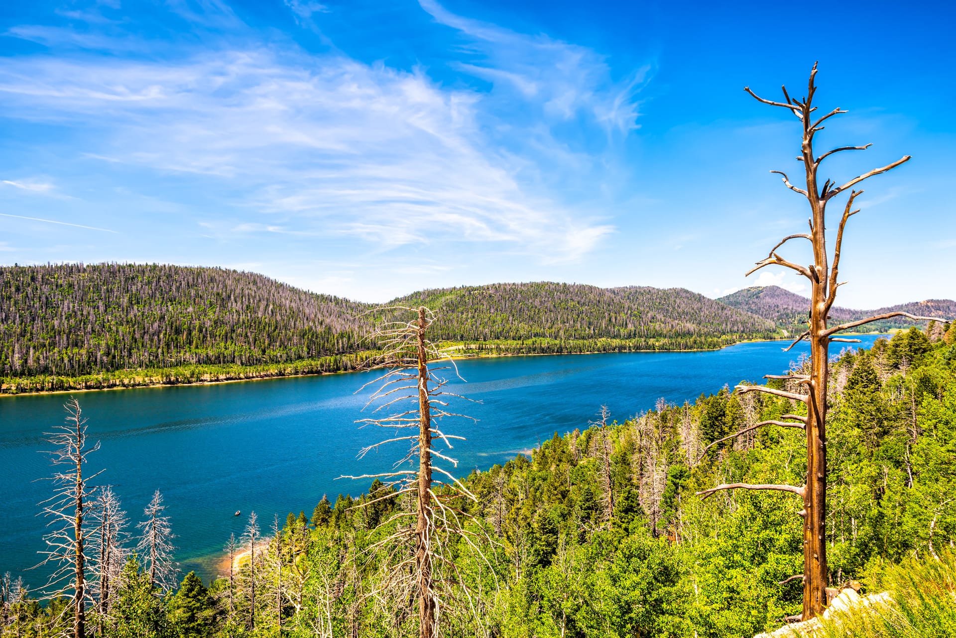
The loop circles Navajo Lake and splits its personality between the two shores. The south side runs above the water with views down onto the lake; the north side threads beautiful, open aspen stands — the reason this is a September favorite when the leaves turn.
You do not have to commit to all 11.5 miles. Walking out along one shore for an hour and turning around is a perfectly good afternoon, and the trail is shared with mountain bikers and horses (motorized use is closed), so expect to step aside now and then.
Pair it with Cascade Falls and you get the whole geologic story in one day: the lake that disappears, and the cliff where it comes back out.
More on the lake itself — fishing, paddling, and the sinkholes that drain it — on the Navajo Lake page. If you would rather sleep at the
trailhead, see camping near Duck Creek.
Virgin River Rim Trail (Forest Trail #32011)
The big one — 32 miles along the rim, hiked in pieces
Distance
32 miles end to end. The Forest Service breaks it into three shorter hiking trails you can combine for a backpacking trip
Elevation
Follows the Virgin River rim across the Markagunt Plateau, high above the canyons that drain toward Zion
Difficulty
Non-motorized and open to hiking, mountain biking, and horseback. Difficulty depends entirely on which segment you pick
Season
Roughly Memorial Day to Labor Day, weather permitting — this is high, north-facing country that holds snow
Trailheads
Deer Haven (the trail starts near the campground entrance), Te-Ah Campground, the Lodge Trail from the Navajo Lake basin, and Cascade Falls Trailhead
Water
None potable. Some seasonal streams can be filtered. Pit toilets at the Cascade Falls Trailhead
This is the trail that makes the plateau feel enormous. It skirts the Virgin River rim with Zion in the distance, and along the way the Forest Service calls out the Cats Den, hoodoos, fins and windows, bristlecone pine, and wildflowers. Almost nobody walks all 32 miles; almost everybody who stays a week walks part of it.
From Duck Creek the easiest way on is through the Navajo Lake basin. The Lodge Trail (#32015) is a short access trail that climbs from the basin up to the rim, and the Forest Service points you at the Navajo Lake Loop Trailhead for parking and a pit toilet. From Te-Ah Campground, the rim trail is reachable on foot or bike just outside the campground boundary — and the campground's own Pinks Trail runs a half mile from the upper loop to Pink Cliff.
If you want the trail's western end, Deer Haven Campground is where it begins: 16 miles east of Cedar City on Highway 14, then three miles of dirt at the Webster Flat road turnoff. That is a longer drive from the village than the Navajo Lake access points, but it puts you on the quieter half of the rim.
The closest real trail to the village — half a mile to still water
Distance
About a half-mile walk from the trailhead to the lake; a connecting trail continues to Duck Lake roughly a mile farther
Elevation
Around 8,400 ft — flat forest walking, no real climb
Difficulty
Easy, but not stroller-friendly: there are lava rocks underfoot
Season
Best June through November. Fall color peaks September into early October; snow closes access in winter and early spring
Trailhead
Small parking area on Forest Service Road 057 off Highway 14, with vault toilets
Drive from the inn
About 5 minutes, then the half-mile walk
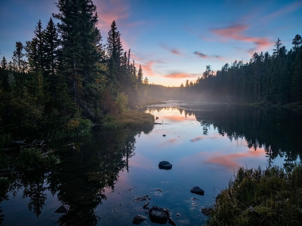
If you have one hour and a camera, this is the walk. A 15-acre lake sits hidden in the aspens, and on a still morning it does exactly what the name promises. The Forest Service carries an Aspen Mirror Trail (#32029) on the Cedar City Ranger District trail list; on the ground, what most guests do is the short, flat forest path in from FR-057.
Go early for the reflections and the wildlife along the shoreline. In late September the aspens turn red, orange, and yellow and the place gets genuinely crowded by Duck Creek standards — which still means a dozen cars.
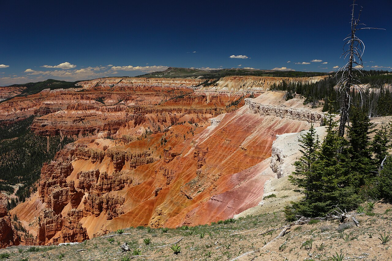
Cedar Breaks rim trails, about twenty minutes away
Cedar Breaks National Monument has a small trail system but a high hit rate, and every trail starts above
10,000 feet. The Park Service is blunt about it: the trails "can be more difficult then they appear for
those not acclimated." There is no maintained route below the rim — the Park Service asks visitors not to
attempt hiking down into the amphitheater.
Alpine Pond Loop Trail — 1 to 2 miles, 1.5 to 2.5 hours, moderate. A figure-eight loop through forest and meadows with multiple route options.
South Rim Trail — 5 miles, about 4 hours, moderately strenuous. It begins at 10,500 ft and follows the rim down to the viewpoints. Spectra Point (10,285 ft) is 2 miles round trip; the Ramparts (9,952 ft) is 4 miles round trip.
Sunset Trail — 2 miles, about an hour, easy and paved, connecting Point Supreme and Sunset View overlooks with gentle slopes and rest areas. This is the only Cedar Breaks trail where pets are permitted.
Nature Trail — 0.6 miles, about 30 minutes, easy and unpaved, from Point Supreme Campground to the Sunset Trail. Good for birds and wildlife.
More trails on the Cedar City Ranger District list
These are real, numbered Forest Service trails, but the agency does not publish driving directions for
every trailhead. Ask at the Duck Creek Visitor Center or call the Cedar City Ranger District at
(435) 865-3200 before you go looking.
Lodge Trail #32015 — a short access trail from the Navajo Lake basin up to the Virgin River Rim Trail. Park at the Navajo Lake Loop Trailhead; no water on the trail.
Bristlecone Pine Trail #32048 — an easy loop through ancient bristlecone pines with views of the Virgin River and Zion National Park. Small parking area at the trailhead, no restrooms and no water. Hiking only; not recommended for horses or bicycles.
Hancock Peak Trail #32053 — starts at a rock cairn, crosses Mammoth Creek near Meadow Lake, runs through spruce and aspen, climbs a lava hill past a junction with a side trail to an alpine lake, and comes out at Sage Valley and Forest Road 240. The Forest Service warns the footing is "sometimes rough because of the lava beds." Small parking at either end; no toilet, no water.
Dark Hollow Trail #32032 — begins at the Brian Head Peak Trailhead and climbs through conifer and aspen into alpine meadows, with views over Parowan Valley, a pass by Cub Lake, and a junction with the Hendrickson Lake Trail near Paradise Spring. A drive from Duck Creek, but the payoff is real alpine country.
Pinks Trail — a half mile from the upper loop of Te-Ah Campground out to Pink Cliff. The easiest way to stretch your legs if you are camping at Te-Ah.
Strawberry Point Overlook — barely a hike; the Forest Service puts the walk from parking at under five minutes. But the red rock, the hoodoos, and the drop into the valley below make it the best five minutes on the plateau. Small parking area, no potable water.
There is no one Duck Creek trailhead. There is a string of them along Highway 14, and knowing which is
which saves you a wrong turn onto a dirt road. Mileages below are measured from Cedar City on Highway 14,
the way the Forest Service publishes them — the Duck Creek Visitor Center sits at mile 28, so you can
place everything else relative to the village from there.
Cascade Falls Trailhead
Turn off Highway 14 onto Navajo Lake Road (FR-053), then follow FR-054 to a large trailhead lot — about three miles of dirt forest road in total. Usually fine for a careful passenger car when dry; rough or slick after storms. Pit toilet at the lot. This is also a Virgin River Rim Trail access point.
Navajo Lake Loop Trailhead / Navajo Lake Campground
From Cedar City, go 25 miles east on Scenic Byway SR-14 to the Navajo Lake road turnoff to the south, then five miles to Navajo Lake Campground. Parking and a pit toilet at the loop trailhead; the campground has drinking-water spigots, flush toilets, and an accessible vault toilet. Recreation.gov notes the 32-mile Virgin River Rim Trail passes a short distance from the campground.
Te-Ah Campground
25 miles east of Cedar City on Highway 14, then about 4.5 miles on Navajo Lake Road — all paved. Flush and vault toilets, potable water, 40 campsites plus a group site, open late May to early September. The Virgin River Rim Trail is reachable on foot or bike outside the campground boundary, and the Pinks Trail runs a half mile from the upper campground to Pink Cliff.
Deer Haven Campground: the west end of the Virgin River Rim Trail
16 miles east of Cedar City on Highway 14, turn off at the Webster Flat road and go three miles on dirt. The rim trail starts near the campground entrance. Flush and vault toilets; potable water Memorial Day through Labor Day; dogs must stay leashed.
Aspen Mirror Lake Trailhead
Small parking area on Forest Service Road 057 off Highway 14, just north of the village, with vault toilets. Half a mile of flat forest trail to the lake. This is the closest trailhead to the inn.
Strawberry Point Road
From Main Street in Cedar City, head east on UT-14 for 32.6 miles, then turn onto Strawberry Point Road — roughly four and a half miles east of the Duck Creek Visitor Center. The overlook has a small parking area and a walk of under five minutes.
Duck Creek Visitor Center: where to ask before you go
28 miles east of Cedar City on Highway 14, at 8,600 feet. Porta-potty restrooms and picnic tables; no potable water. Open daily 10 a.m. to 5 p.m. Memorial Day through Labor Day, then weekends only through September — with Friday-to-Monday hours of 10 a.m. to 3 p.m. noted for 2026. It is the right stop for a current district map and honest answers about which roads have dried out.
Cedar Breaks National Monument trailheads
Reached on Highway 148, which the Park Service says closes each year for snowpack — typically mid-November to mid-May on average. Paved lots at the visitor center and trailheads.
Altitude, storms, and water: what the mountain asks of you
You are hiking between roughly 8,400 feet in the village and 10,500 feet at the Cedar Breaks rim. Nothing
here is technical. The altitude is what makes an easy mile feel like a hard one, and the Park Service says
it plainly: these trails can be harder than they look for anyone who is not acclimated. Go slower than you
think you need to, especially on your first day up from Zion or Las Vegas.
Afternoon storms, July through September. The Park Service puts monsoon season in those three months and warns that lightning can strike up to 60 miles from the nearest rainfall. Above 10,000 feet at Cedar Breaks, storms are common and dangerous in the afternoons.
The 30-minute rule. If you hear thunder, get to a building or a hard-top vehicle with the windows up — and do not go back out for at least 30 minutes after the last thunder clap. The rain stopping is not the signal.
Start early. The simplest fix for both problems: be walking by mid-morning and off the exposed rim by early afternoon.
Carry all your water. The Forest Service lists no potable water on the Virgin River Rim, Navajo Lake Loop, Bristlecone Pine, or Hancock Peak trails. Cascade Falls is fully sun-exposed with none either.
Snow lingers. The general open season on these trails is roughly Memorial Day to Labor Day, weather permitting. Early-season hikes often mean mud, drifts on north-facing sections, and a dirt access road that has not dried out.
Layers, always. A 70°F afternoon at the rim can feel like 50°F once the wind picks up.
Trail numbers, distances, seasons, and trailhead directions on this page come from the Dixie National Forest, the National Park Service, and Recreation.gov, verified on 12 August 2026 and linked beside each trail. We write it from the front desk, so drive times are ours — but conditions change fast at 8,400 feet. Check the official sources here the morning you go.
The four most-hiked trails from the village are the Cascade Falls Trail (Forest Trail #32055, about 1.1 miles round trip), the Navajo Lake Loop Trail (#32022, 11.5 miles for the full loop with shorter sections available), the Virgin River Rim Trail (#32011, 32 miles broken into three shorter hiking trails), and the half-mile walk in to Aspen Mirror Lake. Cedar Breaks National Monument adds the Alpine Pond Loop, the South Rim Trail out to Spectra Point and the Ramparts, and the paved Sunset Trail about 20 minutes away.
Where is the Duck Creek trailhead?
There is no single Duck Creek trailhead — there are several, all off Highway 14. The closest is the Aspen Mirror Lake trailhead on Forest Service Road 057 just north of the village. The Cascade Falls Trailhead is reached by taking Navajo Lake Road (FR-053) then FR-054, about three miles of dirt road. The Navajo Lake Loop Trailhead is at Navajo Lake, 25 miles east of Cedar City on SR-14 then five miles south. Te-Ah Campground (25 miles east on Highway 14, then 4.5 paved miles on Navajo Lake Road) and Deer Haven Campground (16 miles east, then three miles of dirt at the Webster Flat road) are the two main access points for the Virgin River Rim Trail.
Are the trails near Duck Creek dog friendly?
The Dixie National Forest trails are. Dogs are welcome on leash on the Cascade Falls, Aspen Mirror Lake, and Navajo Lake trails, and the Forest Service requires leashed dogs at campgrounds such as Deer Haven. Cedar Breaks National Monument is the exception: the Park Service allows pets on the paved Sunset Trail only, not on any other monument trail. Carry water for your dog — most of these trails have no potable water and Cascade Falls is fully sun-exposed.
When do the trails near Duck Creek melt out?
The Forest Service gives the same general window for the trails on this district: roughly Memorial Day to Labor Day each year, weather permitting. Snow lingers into early summer on the higher and north-facing sections of the Virgin River Rim Trail, and the dirt access road to Cascade Falls stays snowed in through winter and early spring. At Cedar Breaks, Highway 148 closes each year for snowpack, typically mid-November to mid-May. Check Dixie National Forest alerts and the Cedar Breaks conditions page before you drive.
Are there easy hikes near Duck Creek for kids?
Yes. Cascade Falls is the best one: about 1.1 miles round trip on a well-built path where stairs do most of the work, ending at viewing platforms above a waterfall pouring out of a cliff. The half-mile walk to Aspen Mirror Lake is flatter and shorter, though lava rocks on the trail make it a poor stroller route. At Cedar Breaks, the Alpine Pond Loop Trail is one to two miles and the paved Sunset Trail is two miles with gentle slopes and rest areas. Remember that every one of these starts above 8,000 feet, and Cedar Breaks above 10,000 — kids tire faster than you expect.
Is there water on the trails?
Almost never. The Forest Service lists no potable water on the Virgin River Rim Trail, the Navajo Lake Loop, the Bristlecone Pine Trail, or the Hancock Peak Trail; some seasonal streams and the lake can be filtered. Potable water is available at Te-Ah and Deer Haven campgrounds (Memorial Day through Labor Day) and at Navajo Lake Campground spigots. There is no water at the Duck Creek Visitor Center. Carry everything you plan to drink.
Een niveau terug
Start from the broader guide hub if you want the bigger set of destinations, activities, and planning pages first.
Book your room or cabin at Duck Creek Village Inn — Aspen Mirror Lake is five minutes away, Cascade Falls twenty, and the Cedar Breaks rim about the same.