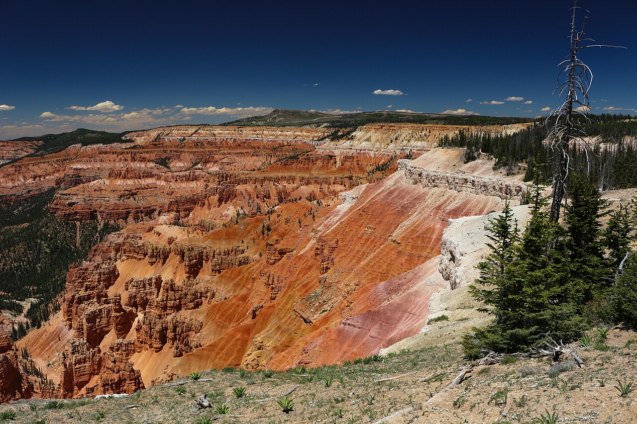
Navajo Lake disappears into a sinkhole, runs a mile through the rock, and comes back out of a cliff face — 1.1 easy miles from a trailhead 20 minutes from the inn
At a glance
Distance
1.1 miles round trip (Forest Trail #32055)
Time on trail
About 45 minutes, unhurried
Elevation
Trailhead 8,926 ft, falls platform 8,879 ft
Difficulty
Easy, but with numerous stairs and a climb on the way back
Drive from the inn
7.6 miles, 2.7 of them forest road — about 20 minutes
Dogs
Welcome on leash. Foot traffic only: no bikes, horses or vehicles
Trailhead
Large dirt loop, pit toilet, no water, no fee
Best flow
Late May to early July, on snowmelt
At a glance
The short version
Cascade Falls is a 1.1-mile round-trip hike on Forest Trail #32055, about 7.6 miles and 20 minutes from Duck Creek Village Inn — 4.5 paved miles west on Highway 14, then 2.7 miles of forest road. The water is Navajo Lake: it drains into sinkholes at the east end of the lake, travels about a mile underground through the Claron limestone, and pours out of the cliff here as the head of the North Fork of the Virgin River.
Quick facts
Trail
Forest Trail #32055, a National Recreation Trail since 1979
Distance
1.1 miles round trip, about 45 minutes
Elevation
Trailhead 8,926 ft; falls platform 8,879 ft
Drive from the inn
7.6 miles, 2.7 of them dirt
Fee
None — Dixie National Forest
Good to know
The trail is easy but it runs downhill to the falls, so the climbing is on the way back — about 110 ft, plus numerous stairs.
The last 2.7 miles are unpaved forest road with two forks people miss: left at the Cascade Falls sign, then right at the Y.
Flow depends on how full Navajo Lake is. Late May through early July is the reliable window; by fall in a dry year it can be a trickle.
The cave the water comes out of is closed to entry — low oxygen and high flows. Two railed viewing platforms are as close as you go.
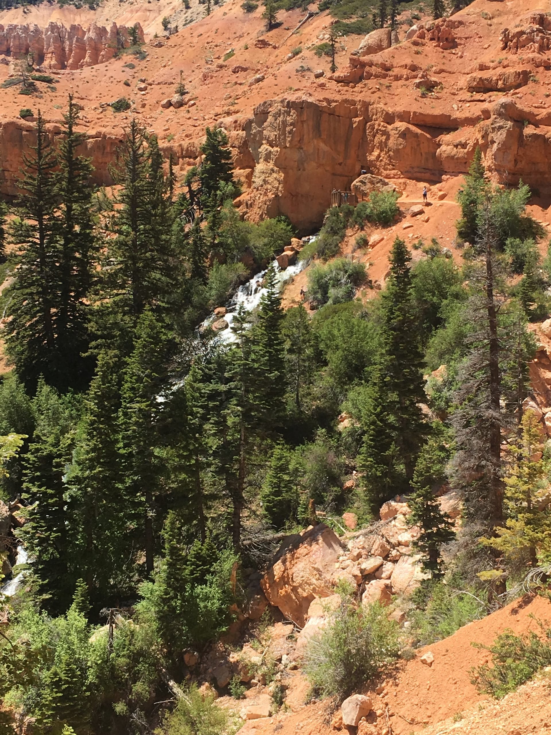
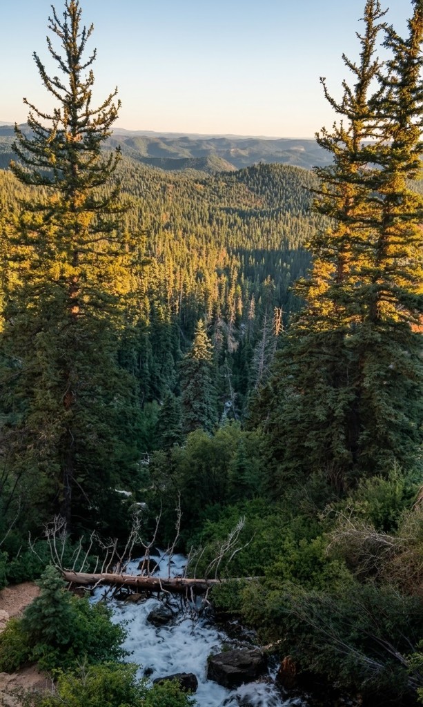
Cascade Falls is the strangest waterfall on the Markagunt Plateau: the water does not come down a creek, it comes out of the side of a cliff. Navajo Lake, a mile away and 180 feet higher, has no surface outlet — it drains into sinkholes at its east end, runs through a cave dissolved in the Claron limestone, and reappears here as the head of the North Fork of the Virgin River, the same water that goes on to carve Zion Canyon. Forest Trail #32055 gets you to it in 1.1 miles round trip along the rim, with benches, stairs and two railed viewing platforms. It has been a National Recreation Trail since 1979.
Getting to the trailhead
This is the part people get wrong, and it is worth two minutes before you leave. The trailhead is
7.6
miles from the inn and the last
2.7
of them are forest road, with two forks that decide whether you end up at a waterfall or at a lake. The
five numbered pins on the map are the five steps below.
The interactive map needs JavaScript. In short: Highway 14 west 4.5 miles, left on Navajo Lake Road, left again at the Cascade Falls sign after 0.3 miles, then 2.7 miles of forest road — bearing right at the Y — to the trailhead.
Paved (4.8 mi)
Gravel (1.1 mi)
Dirt (1.6 mi)
Trail #32055
7.6 miles from Duck Creek Village Inn, 2.7 of them on forest road. The numbered pins match the five steps below; tap one for the turn, or tap a line for what that stretch of road is like. Route traced from OpenStreetMap; leg distances match the Forest Service's own directions.
1
Highway 14 west, 4.5 miles
Leave the inn heading west. You climb steadily — the highway tops out around 9,160 ft at the turnoff, some 700 feet above the village.
Paved the whole way.
2
Left onto Navajo Lake Road (FR-053)
A signed junction on the south side of the highway near milepost 26, just past the Navajo Lake scenic pullout. Still paved.
3
Left again after 0.3 miles, at the Cascade Falls sign
The road splits. Right carries on paved to the lake, the campgrounds and the lodge. You want the left fork onto Forest Road 054, and this is where the pavement ends.
Miss this and you end up at Navajo Lake — which is a fine mistake, but it is not the falls.
4
FR-054 for 1.1 miles, then bear right at the Y
Graded gravel through the pines. At the Y, right stays on FR-054; left drops toward Duck Creek. The Forest Service signs it, but the sign is small and easy to pass at speed.
5
1.6 more miles to the trailhead
Narrower and rougher than the first stretch, and the last few hundred yards run out along the rim. The road ends in the parking loop at 8,926 ft.
Trailhead coordinates: N 37° 29.837′ W 112° 45.096′.
What the road is actually like
Reasonable in a passenger car, most of the time. The first 1.1 miles of FR-054 are graded gravel that a
rental sedan handles at 20 mph without drama. The final 1.6 miles are narrower, more rutted, and
washboarded in places, and they run out along the rim near the end — slow, not technical.
The caveats are weather and season. After a summer thunderstorm the clay in the tread turns slick and the
ruts fill, which is when high clearance stops being optional. Through winter and early spring the road is
snowed in and nobody plows it. If the forest is wet, or if you are driving something low with a full car,
give yourself the extra ten minutes and take it slowly.
There is no gas, no water and no cell coverage past the highway. The last services are in Duck Creek
Village, five minutes from your room.
The trail, in profile
Easy is the right word, but it hides something: the trail runs downhill to the falls. You climb 22
feet in the first tenth of a mile, and from there it is level or descending the whole way out, finishing
47
feet below where you parked. All the effort is on the return, and the numerous stairs are what you feel,
not the grade.
USGS 3DEP elevations sampled every 15 metres along the OpenStreetMap trace of Forest Trail #32055. You walk down to the falls and up on the way back: the platform sits 47 ft below the trailhead, the return climbs about 110 ft, and the round trip adds up to roughly 173 ft of ascent. The Forest Service signs the trail at 1.1 miles round trip.
1
Trailhead
Large dirt loop at 8,926 ft with a pit toilet and no water. The Virgin River Rim Trail leaves from the same lot.
2
High point, 0.12 mi
The only climb on the way out, and it is 22 feet. From here the trail is level or downhill all the way to the falls.
3
Halfway platform and rest area, 0.28 mi
The first of the two viewing platforms, with benches. The canyon opens up south toward Zion.
4
Cascade Falls viewing platform, 0.55 mi
End of the trail at 8,879 ft: a railed platform under the rim rock, facing the cave mouth the water pours from.
Will the falls actually be running?
Honest answer: usually, but not always, and nobody measures it. There is no gauge on Cascade Falls. What
the flow tracks is how full Navajo Lake is, because the lake is the falls — and the Utah
Geological Survey puts the range bluntly, from “a small trickle to a raging torrent.”
In a dry year an engineered earthen dam at the east end of the lake holds the water back from the sinkhole,
and the overflow drains through a small opening in the bottom of the sink. In a wet year the lake tops the
dike, fills the valley, and the sink runs like a bathtub drain.
What that means for a visit: late May through early July is the window, when snowmelt has
the lake at its highest. August and September are a gamble that gets worse in a dry summer. If you want a
read before you drive out, the winter's snowpack is the best predictor there is — our snow report tracks the two SNOTEL stations that bracket the village, and a
big year up there is a loud year down here.
And if the falls are thin, the walk is still worth the morning. The cave mouth, the Pink Cliffs and the
canyon running south toward Zion do not depend on the water.
Why a waterfall comes out of a cliff
A lava flow dammed a narrow valley on the Markagunt Plateau and made Navajo Lake. Underneath the lava
sits the Claron Formation — the soft, vividly coloured freshwater limestone and marl, roughly 50 million
years old, that erodes into the hoodoos at Bryce Canyon and the amphitheatre at Cedar Breaks. Limestone dissolves. Water percolating down through the
basalt ate a cave into it, and the lake found the drain.
So Navajo Lake has no surface outlet. It empties through sinkholes at its east end, runs a little over a
mile through the rock, and comes back out of the Pink Cliffs escarpment here, about 180 feet lower, as the
head of the North Fork of the Virgin River. That is the same river that carves Zion Canyon downstream —
and you can see the country it heads for from the second platform.
The part that is genuinely strange is what the U.S. Geological Survey found when it put dye in the
sinkholes. The water splits. Some of it surfaced at Cascade Spring after about 8.5 hours, bound
for the Virgin River and eventually the Colorado. The rest surfaced at Duck Creek Spring after about 53
hours, bound for the Sevier River and the Great Basin, which has no outlet to the sea at all. One lake,
feeding two river systems on opposite sides of the divide — and the second one comes back up beside the
village you are staying in.
A note on wording, since the signs disagree: the Forest Service calls the passage a lava tube, and the
Utah Geological Survey describes a dissolution cave in the Claron limestone beneath the lava flow. Both
descriptions are in print; the geology reads as limestone.
The cave is closed. Please do not go in.
The Forest Service closes the lava tube and cave system to travel because of low oxygen levels and high
water flows — a combination that gives no warning and no second chance. The trail ends at a railed
platform facing the cave mouth, and that is as close as anyone is meant to get. Nothing on this page
describes a route off the tread.
Know before you go
There is no water. None at the trailhead, none on the trail. At 8,900 feet in dry air, bring more than you think you need.
There is almost no shade. The Forest Service calls the trail "completely exposed to the sun during afternoon hours." Morning is the better half of the day.
Stairs, not ramps. The brochure asks for "reasonable mobility." This is not a wheelchair or stroller trail.
Steep drop-offs. Kid-friendly overall, with a few places the Forest Service says "may require some hand holding."
No fee and no permit. Dixie National Forest, Cedar City Ranger District, (435) 865-3700.
Cell service is unreliable from the moment you turn off the highway. Download the map before you leave the village.
When to go
SpringSummerFallWinter
The Forest Service gives roughly Memorial Day to Labor Day as the open season, weather permitting, and the trail is walkable into fall until snow closes the forest road. Flow is the thing that changes: it tracks how full Navajo Lake is, and the Utah Geological Survey describes it ranging from a small trickle to a raging torrent. Late May through early July, on snowmelt, is the reliable window. Later in a dry year the falls thin out, though the cave mouth, the Pink Cliffs and the canyon view are still there.
What to bring
Water — there is none at the trailhead or on the trail
Sun protection; the trail is almost entirely unshaded and bakes in the afternoon
Sturdy shoes for the stairs and the loose gravel
A camera — the falls and the canyon south toward Zion are both worth it
Make it a half day
An hour of driving and 45 minutes of walking is not a day. Here is what pairs with the falls, roughly in
the order they make sense on the way back.
1
Navajo Lake, 10 minutes back up the road
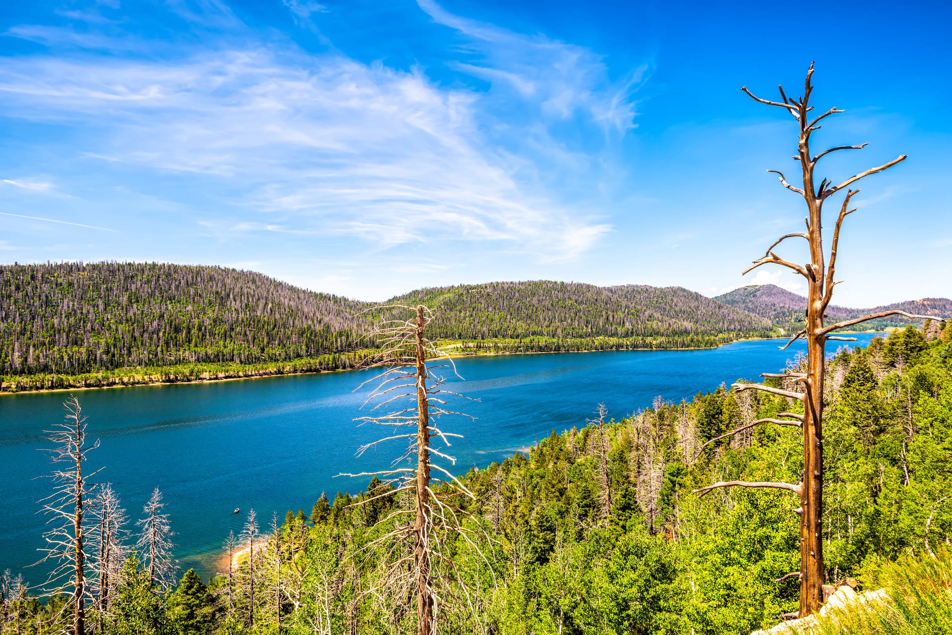
Stand at the dike on the east end and you are looking at the sinkhole that swallows the water you just watched come out of a cliff. It is the other half of the same story, and the lake has the boat ramp, the campgrounds and the lodge.
The Virgin River Rim Trail, from the same parking lot
Cascade Falls is an intermediate trailhead on the 32-mile rim trail: 9 miles north to Te-Ah Campground, 11 miles south to Strawberry Point. Walk 20 minutes out and back for the rim view without the commitment.
The south end of that same rim trail, reached by road instead: a fin of rock sticking out over the pink cliffs with one of the biggest views on the plateau. Forty minutes from the falls trailhead.
If the closed lava tube at the falls left you curious about what is under this plateau, the caves east of the village are the ones you can actually walk into.
Trail number, length, season, facilities and the cave closure come from the Forest Service’s own trail page and its Cedar City brochure. The geology and the dye-trace travel times come from the Utah Geological Survey and a USGS study of the Markagunt Plateau. Every distance and elevation on this page was measured — the drive routed over OpenStreetMap road geometry, the trail traced from the mapped tread, and elevations sampled from the USGS 3DEP dataset — then checked against the Forest Service’s published mileages, which they match. Road and snow conditions change; check the forest alerts before an early or late-season drive.
The Forest Service signs it at 1.1 miles round trip, about 0.6 miles each way, and most people spend 45 minutes to an hour including time on the platforms. It is rated easy, but there are numerous stairs and the trail loses about 50 feet on the way out, which you climb on the way back.
How do you get to the Cascade Falls trailhead from Duck Creek Village?
Head west on Highway 14 for about 4.5 miles and turn left onto Navajo Lake Road (Forest Road 053). After 0.3 miles take the left fork at the Cascade Falls sign onto Forest Road 054; the pavement ends there. Follow FR-054 for 1.1 miles, bear right at the Y to stay on it, and go another 1.6 miles to the trailhead. That is 7.6 miles total, about 20 minutes.
Can you drive to Cascade Falls in a regular car?
Usually yes. The 2.7 miles of forest road are graded dirt and gravel and are fine for a careful passenger car when dry. They get rutted and slick after storms and are snowed in through winter and early spring, so a high-clearance vehicle helps in bad conditions but is not required in good ones.
When is the best time to see Cascade Falls?
Late May through early July, when snowmelt has Navajo Lake high enough to push water through the sinkhole. The Utah Geological Survey describes the falls ranging from a small trickle to a raging torrent depending on lake level. Morning is the better half of the day: the trail has almost no shade and faces the afternoon sun.
Where does the water at Cascade Falls come from?
Navajo Lake, about a mile away and 180 feet higher. The lake has no surface outlet — it drains through sinkholes at its east end into a cave dissolved in the Claron Formation limestone. USGS dye tracing showed that water reaching Cascade Spring in about 8.5 hours, and some of the same water reaching Duck Creek Spring after about 53 hours, which sends one lake into two different river basins.
Can you go into the cave behind Cascade Falls?
No. The Forest Service closes the lava tube and cave system to travel because of low oxygen levels and high water flows. The trail ends at a railed viewing platform facing the cave mouth, and there is a second platform with benches about halfway along.
Are dogs allowed at Cascade Falls?
Yes, on leash. The trail is foot traffic only — closed to motorized vehicles, horses and bicycles — and there is no water along it, so bring some for your dog. Keep them close; parts of the trail run along steep drop-offs.
Go up one level
Start from the broader guide hub if you want the bigger set of destinations, activities, and planning pages first.
Rooms with breakfast or cabins with a kitchen at Duck Creek Village Inn — twenty minutes from the trailhead, and five from the springs where the other half of that water comes back up.