Reserva Reserva tu estancia
Reserva directo y ahorra 10%: código Ahorra 10% · hasta el 1 dic · estancias hasta el 1 dic 2026
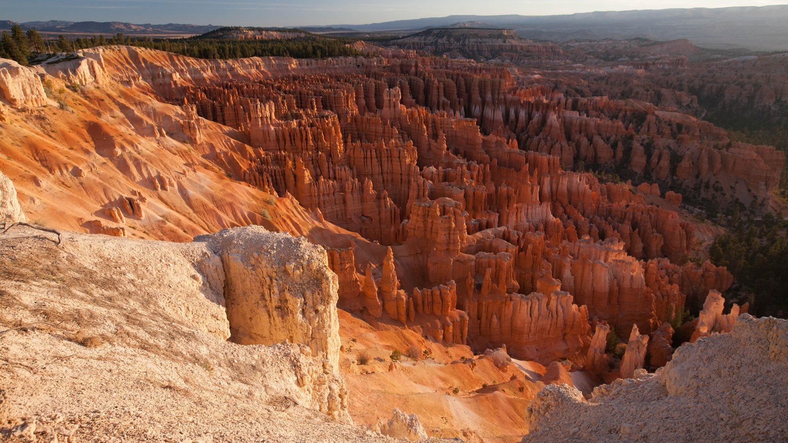
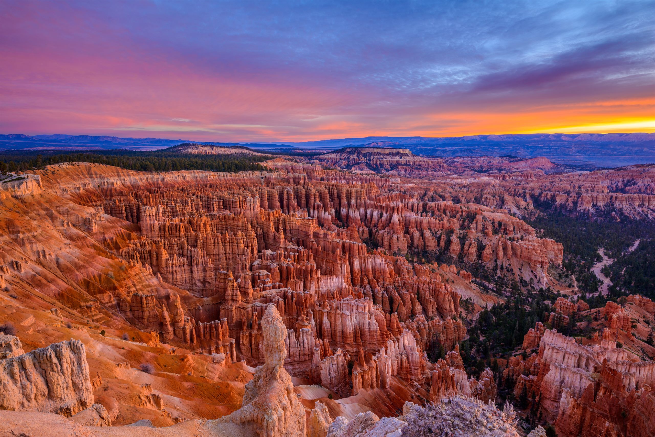
Hoodoos below the rim at Bryce Canyon, the payoff at the end of the drive from Zion

Drive guide

Zion to Bryce Canyon: the drive, measured

Eighty-five miles, three climbs and one tunnel that turns some vehicles around. Here is the road, mile by mile, with cameras on it.

The short answer

De un vistazo

La versión corta

The drive from Zion Canyon Visitor Center to Bryce Canyon Visitor Center is 85 miles and takes about 2 hours 15 minutes without stops: SR-9 east through the Zion-Mount Carmel Tunnel, US-89 north from Mount Carmel Junction, Scenic Byway 12 east through Red Canyon, then SR-63 south into the park. You climb 3,964 feet along the way. Vehicles over 11 feet 4 inches tall, 7 feet 10 inches wide or 35 feet 9 inches long are banned from the tunnel route and must go around by I-15, which is 151.6 miles.

The numbers

Distance 85 miles
Drive time About 2 hr 15 min, no stops
Net climb 3,964 ft
Around the tunnel 151.6 miles

Información útil

  • 85 miles and about 2 hr 15 min, visitor center to visitor center.
  • The tunnel is the only real obstacle, and since June 2026 oversize vehicles are banned outright rather than escorted.
  • Around the tunnel is 151.6 miles, roughly an hour longer.
  • No road in this corridor closes for the season. Only storms shut it, and only briefly.
  • Red Canyon, 14 miles before the park, has hoodoos and no entrance fee.
Distance
85 miles, visitor center to visitor center
Drive time
About 2 hr 15 min without stops. Half a day if you do it properly
Net climb
3,964 ft, from 3,930 ft at Zion to 7,894 ft at Bryce
The roads
SR-9 east, US-89 north, Scenic Byway 12 east, SR-63 south
Tunnel limits
Over 11'4" tall, 7'10" wide or 35'9" long? You cannot use this route at all
Winter
No seasonal closure on any road in this corridor. Storms close it temporarily

Live conditions

The route on a map

Every line here is real road geometry rather than a sketch, and every pin carries the note we would give you at the front desk. The dotted spur running west from Long Valley Junction is Highway 14 up onto the plateau, which matters only if you are stopping.

The interactive map needs JavaScript. The route is SR-9 east through the Zion-Mount Carmel Tunnel, US-89 north from Mount Carmel Junction, Scenic Byway 12 east through Red Canyon, then SR-63 south into the park.

  • The direct drive
  • Highway 14 to Duck Creek
  • Stop worth making
  • Junction or town
Traced from OpenStreetMap routing on 17 September 2026. 85 miles, visitor center to visitor center.

Why Bryce feels like a different season

People are surprised by the cold at Bryce, and the profile explains it better than any sentence can. You do not simply drive from one park to another; you climb 3,964 feet in three separate pushes, and the highest ground of the entire day is the last mile of it. Zion's canyon floor sits at 3,930 feet. The Bryce rim is at 7,894.

Elevation profile of the drive from Zion Canyon to Bryce Canyon About 85 miles, climbing from 3,930 feet at Zion Canyon Visitor Center to 7,894 feet at Bryce Canyon Visitor Center, a net gain of 3,964 feet. The road climbs hard through the tunnel to 5,360 feet, eases down to 5,200 feet at Mount Carmel Junction, climbs steadily up Long Valley to 7,460 feet at Long Valley Junction, drifts down to 6,745 feet where Scenic Byway 12 leaves US-89, then climbs through Red Canyon to finish on the Bryce rim, the highest ground of the drive. Tunnel climb Long Valley Red Canyon 4,000 5,000 6,000 7,000 8,000 Zion Canyon 3,930 ft Tunnel 5,360 ft Mount Carmel Jct 5,200 ft Long Valley Jct 7,460 ft Byway 12 6,745 ft Bryce rim 7,894 ft mile 0 20 40 60 80 85 mi
Eighty-five miles and 3,964 feet of net climb, in three distinct pushes. Bryce finishes higher than anything you crossed to get there, which is the whole reason the two parks can be in different seasons on the same afternoon. USGS 3DEP elevations sampled every mile along the OSRM-traced route.

The drive in six legs

  1. Zion Canyon to the tunnel, 6 miles

    Out of the visitor center, east at Canyon Junction, and straight into six switchbacks that climb 1,400 feet off the canyon floor. Low gear both directions. There is nowhere to stop on the corners, so save the photograph for the top.

    Slowest six miles of the day. Budget 20 minutes.

  2. Through the tunnel and out the east side, 6 miles

    The 1.1-mile tunnel runs dark and unlit with a handful of gallery windows you are not allowed to stop at. Beyond it the rock turns to slickrock domes and Checkerboard Mesa, and the East Entrance station is at mile 11.4.

    Canyon Overlook Trailhead is immediately east of the tunnel and its lot is tiny.

  3. SR-9 to Mount Carmel Junction, 13 miles

    Out of the park the road drops through ranch country to meet US-89 at mile 24.5. Turn left, north. This is the last junction of any size before a long quiet stretch, so deal with fuel and food here rather than after.

  4. Up Long Valley on US-89, 22 miles

    Through Orderville and Glendale, then a steady 14-mile climb to Long Valley Junction at 7,460 feet, the high point of the US-89 leg. SR-14 comes in from the west here, which is the turn for Duck Creek Village and Cedar City.

    Mile 47 of 85, and the halfway mark in effort if not in distance.

  5. Down the Sevier to the Byway 12 turn, 20 miles

    The road eases downhill along the Sevier River through open valley to Hatch, then on to the junction with Scenic Byway 12 at mile 67.2. Miss the right turn and you carry on to Panguitch.

    The lowest ground of the second half, at 6,745 feet.

  6. Red Canyon and into the park, 18 miles

    Byway 12 climbs into Red Canyon, where the hoodoos start a full 14 miles before you reach the fee booth, and threads two arches blasted through a fin of red rock. South on SR-63 at the roundabout and you are at the visitor center.

    The Forest Service visitor center in Red Canyon is free and has water and restrooms.

Every landmark, by milepost

Mileposts are measured from Zion Canyon Visitor Center along the traced route. Elevations are USGS 3DEP samples except at Bryce, where the figure is the one the Park Service publishes.

Landmarks between Zion Canyon and Bryce Canyon with milepost and elevation
Mile Landmark Elevation
0 Zion Canyon Visitor Center The start clock for this drive. If you are coming off the shuttle, add the wait: the line at Temple of Sinawava can run 30 minutes on a summer afternoon before you reach your car. 3,930 ft
1.6 Canyon Junction Turn east here and the Zion-Mount Carmel Highway begins. This is the last flat mile before the switchbacks. 4,040 ft
3.6 The switchbacks Six tight hairpins climbing the canyon wall. Low gear going up, low gear coming down. There is no pullout on the corners, so take the pictures at the top. 4,580 ft
5.6 Zion-Mount Carmel Tunnel The 1.1-mile tunnel, cut in 1927-1930. Oversize vehicles need traffic control and cannot pass each other inside, which is why this is the one section that can add half an hour to your day. 5,363 ft
6.1 Canyon Overlook Trailhead Immediately east of the tunnel. A 1-mile round trip to the best view you can earn in an hour on this drive, but the lot is tiny and fills by mid-morning. 5,130 ft
10.9 Checkerboard Mesa The cross-hatched dome on the north side, with a signed pullout. Wind carved the horizontal lines and freeze-thaw cracked the vertical ones. 6,560 ft
11.4 Zion East Entrance Leaving the park. Going the other way this booth is usually far quicker than the south entrance at Springdale. 5,690 ft
24.5 Mount Carmel Junction SR-9 ends at US-89. Turn left, north. This is the last junction of any size for a while: 22 miles on to Long Valley Junction and 43 to the Byway 12 turnoff, so sort out fuel and food around here rather than after. 5,200 ft
28.9 Orderville A strip of highway town in the bottom of Long Valley. The speed limit drops hard and it is enforced, which is the only thing most people remember about it. 5,433 ft
33.3 Glendale The last town before the long climb up Long Valley. After this the road just goes uphill for fourteen miles. 5,807 ft
47 Long Valley Junction The high point of the US-89 stretch, and the SR-14 turnoff west toward Duck Creek Village and Cedar City. No services at the junction itself. 7,460 ft
59.9 Hatch US-89 milepost 114.4, and the first town since Glendale 27 miles back. A small place in an open river valley, and the last one before you turn onto Byway 12. 6,943 ft
67.2 US-89 and Scenic Byway 12 Turn right off US-89 onto Scenic Byway 12. Miss this and you are headed for Panguitch. The low point of the second half is right here. 6,745 ft
71 Red Canyon Visitor Center Dixie National Forest, no fee, flush toilets and drinking water, and the orange hoodoos start here rather than at Bryce. The Pink Ledges and Hoodoo trails leave straight from the lot. Most people drive past it and should not. 7,100 ft
72.3 Red Canyon arches Two short arches cut through the red rock, one for each direction. They are photogenic and there is nowhere safe to stop, so have the camera ready as a passenger. 7,378 ft
81.1 SR-12 and SR-63 Turn south onto SR-63 at the roundabout for the park. Bryce Canyon City, the shuttle stop and most of the lodging sit in the next mile. 7,611 ft
85 Bryce Canyon Visitor Center The end, and the highest point of the drive. You are now 3,969 feet above where you started, which is why it can be snowing here and sunny in Zion. 7,894 ft

Three ways to do it, measured

Distances and times are traced along the real roads, not estimated. Drive times are at posted speeds with no stops, so treat them as the floor rather than the plan.

  • The direct route

    SR-9, US-89, Scenic Byway 12, SR-63

    85 mi 2 hr 10 min

    Take this one unless something below applies to you.

    Through the Zion-Mount Carmel Tunnel and north up Long Valley. It is the shortest, the most scenic and the one every map app will give you.

  • Through Duck Creek Village

    The direct route, plus 11 miles of SR-14 each way

    107.5 mi 2 hr 46 min

    Costs 22.5 miles and about 36 minutes.

    Turn west at Long Valley Junction and you climb onto the Markagunt Plateau at 8,400 ft, through aspen and lava country. Worth it if you are stopping for the night or want lunch somewhere cooler than the desert.

  • Around the tunnel

    SR-9 west, I-15 north, SR-20 east, US-89, Byway 12

    151.6 mi 3 hr 8 min

    Costs 66.6 miles and about an hour.

    The only option if your vehicle cannot go through the tunnel at all. You leave Zion the way you came in, run the interstate north, and come back east over SR-20.

The tunnel, and who it turns around

The Zion-Mount Carmel Tunnel was cut between 1927 and 1930, runs 1.1 miles, and is the one thing on this drive that can stop you outright. If you are in a car, an SUV, a pickup or a van, none of this applies: you drive through and think about it only as a dark mile with a few windows. If you are in anything larger, read carefully, because the rules changed in 2026 and a lot of what is written online is now wrong.

  • Single vehicle limits: 11'4" tall, 7'10" wide, 35'9" long, 50,000 lb.
  • Combined limits: 50'0" total length, with the trailer no more than 26' from hitch to rear axle.
  • Measurements include everything. Mirrors, air conditioners, bike racks, satellite dishes and after-market additions all count.
  • There is no escort any more. Until 7 June 2026 an oversize vehicle could buy a permit and be walked through under one-lane traffic control. That programme has been eliminated, and a great deal of advice online has not caught up.
  • The ban covers the whole highway, all 10.7 miles from Canyon Junction to the East Entrance, not just the tunnel itself. Part of the reason is weight: four bridges on that stretch carry the 50,000 lb limit.
  • No bicycles and no pedestrians in the tunnel, in either direction.

If your vehicle is over the limits, the way round is SR-9 west out of Springdale, I-15 north, and SR-20 east to US-89. It is 151.6 miles against 85, but only about an hour longer in practice, because you trade 25 mph switchbacks for interstate. The Park Service recommends exactly this detour. What you should not do is let a navigation app route you over SR-14 or SR-143 instead: UDOT warns against both for large vehicles, and those are mountain roads with steep grades and sharp curves.

The interactive map needs JavaScript. The route is SR-9 east through the Zion-Mount Carmel Tunnel, US-89 north from Mount Carmel Junction, Scenic Byway 12 east through Red Canyon, then SR-63 south into the park.

  • The direct drive
  • Around the tunnel
  • Stop worth making
  • Junction or town
The direct route in green against the way around the tunnel in grey: 151.6 miles instead of 85.

The full set of tunnel rules, entrance-station detail and what to expect at the East Entrance lives on our Zion East Entrance guide.

See the road before you drive it

Six UDOT cameras sit on this route, plus one out at Duck Creek on the mountain alternative. They are listed in the order you reach them, with the milepost measured along the same traced route as the map above. Images refresh every two minutes.

One blind stretch, and it is worth knowing about. Between the Zion east-side camera and Long Valley Junction there is nothing for about 33 miles, which covers Mount Carmel Junction, Orderville and Glendale. There is also no camera inside Zion, at the tunnel, or at Mount Carmel Junction itself, so nobody can show you the tunnel approach in real time.

  1. Live UDOT road camera: SR-9 at North Fork Road, milepost 46.58 Mile 14

    SR-9, Zion east side

    Two and a half miles east of the East Entrance, and the only camera anywhere near the tunnel. Ice here means the switchbacks are worse.

  2. Live UDOT road camera: US-89 at SR-14, Long Valley Junction, milepost 103.7 Mile 47

    Long Valley Junction

    The high point of the US-89 leg at 7,460 ft, and the SR-14 turnoff. First place on the drive where the weather turns.

  3. Live UDOT road camera: SR-14 eastbound at Mammoth Creek Road, milepost 31.06 Detour

    Duck Creek Village, SR-14

    Eleven miles west of the junction at 8,400 ft. Worth a look before you commit to the mountain detour.

  4. Live UDOT road camera: US-89 at Fish Hatchery Road, milepost 114.4 Mile 58

    US-89 at Hatch

    The Sevier River valley: open, exposed, and the stretch that drifts shut first in a blow.

  5. Live UDOT road camera: US-89 at SR-12, milepost 124.23 Mile 68

    The Byway 12 junction

    Your turn onto Scenic Byway 12. If this one is clear, the last 18 miles usually are too.

  6. Live UDOT road camera: SR-12 at milepost 7.25, Red Canyon Mile 75

    Byway 12, Red Canyon

    The red rock narrows and the two arches. Shaded, and it holds ice long after the valley has dried out.

  7. Live UDOT road camera: Main Street at Center Street, Bryce Canyon City Mile 82

    SR-63, Bryce Canyon City

    The park doorstep at 7,600 ft. What you see here is what you are walking into at the rim.

Camera images courtesy of the Utah Department of Transportation. For closures and restrictions before you leave, check udottraffic.utah.gov .

Things worth knowing before you set off

  • Entrance fees are separate. Each park charges $35 per private vehicle, valid seven days. One America the Beautiful pass at $80 covers both and everywhere else for a year.
  • Non-US residents pay a surcharge. The National Park Service adds $100 per person aged 16 and over at both parks, unless you arrive on an annual or America the Beautiful pass.
  • Bryce Canyon is cashless. Card only at the entrance station. Zion still takes cash but asks for card.
  • Neither park uses timed entry. You do not need a reservation to drive in. Angels Landing at Zion is the one exception, and that is a hiking permit rather than an entry one.
  • Fill up before the quiet stretch. From Mount Carmel Junction it is 22 miles to Long Valley Junction and another 20 to the Byway 12 turn, most of it empty.
  • Bryce is nearly 4,000 feet higher than Zion. Take a jacket you would not think to pack in the canyon, and expect the rim to be 15 to 20 degrees colder.

If you are stopping in the middle

We should be straight about this, because the internet usually is not. Duck Creek Village Inn is not on this route. You pass the turning, not the front door: Highway 14 leaves US-89 at Long Valley Junction, mile 47 of 85, and we are 11.1 miles west of that junction at 8,455 feet.

Measured properly, breaking the drive here costs 22.5 miles and about 36 minutes against driving it straight through. That is the honest number, and for a lot of people it is not worth it. It becomes worth it when you are doing both parks rather than passing through once, because from here Zion is roughly an hour one way and Bryce roughly an hour the other, and you stop moving hotels every night. It also gets you out of the desert heat, which in July is not a small thing.

Zion to Bryce Canyon: common questions

The questions we answer at the front desk most often about this drive.

How far is Zion to Bryce Canyon?

It is 85 miles from Zion Canyon Visitor Center to Bryce Canyon Visitor Center, traced along the real roads: SR-9 east through the Zion-Mount Carmel Tunnel, US-89 north from Mount Carmel Junction, Scenic Byway 12 east, then SR-63 south. If you start from Zion's East Entrance instead, knock 11 miles off.

How long does the drive from Zion to Bryce Canyon take?

About 2 hours 15 minutes moving, and that assumes nothing goes wrong. The first six miles out of Zion Canyon are switchbacks where you will not exceed 25 mph, and the tunnel can hold you up. Most people should budget three hours with one stop, or half a day if they want to walk at Red Canyon on the way.

What is the best route from Zion to Bryce Canyon?

The direct one, through the Zion-Mount Carmel Tunnel and north on US-89, unless your vehicle is too large for the tunnel. It is the shortest, the most scenic and it takes you past Checkerboard Mesa and through Red Canyon. There is no faster alternative and no more beautiful one.

Can I drive an RV or tow a trailer from Zion to Bryce Canyon?

Only if it fits. Since 7 June 2026, vehicles over 11'4" tall, 7'10" wide (mirrors included) or 35'9" long, and combinations over 50' total, are prohibited from the entire Zion-Mount Carmel Highway. The old paid-escort option no longer exists. Oversize rigs go around by SR-9 west, I-15 north and SR-20 east, which is 151.6 miles instead of 85. Do not let a navigation app send a large vehicle over SR-14 or SR-143 instead; UDOT specifically warns against it.

Does the road from Zion to Bryce Canyon close in winter?

Not seasonally. US-89, Scenic Byway 12, SR-14 and SR-143 all stay open through the winter and none of them appear on UDOT's seasonal-closure list. Storms close sections temporarily while plows work, and Bryce keeps its road shut until it is cleared after heavy snow. The only road in this corner that does gate for the season is SR-148 through Cedar Breaks, typically mid-November to mid-May, and it is not on this route.

Is there anything worth stopping for between Zion and Bryce?

Three things. Canyon Overlook, a one-mile round trip immediately east of the tunnel for the best view you can earn in an hour. Checkerboard Mesa at mile 10.9, which has a signed pullout. And Red Canyon on Byway 12, where the hoodoos start 14 miles before the park boundary, the Forest Service visitor center is free, and the two rock arches over the road are the photograph most people did not know was coming.

Should I drive Zion to Bryce in one day or stay somewhere between?

You can do it in a morning. Whether you should depends on what else you want from the trip: doing both parks from a single base means the drive happens twice, so a lot of people split the difference and stay on the plateau in the middle. Duck Creek Village sits 11.1 miles west of Long Valley Junction on SR-14, which is a 22.5-mile detour off this route.

17 September 2026

Why trust this page

Distances and drive times on this page were traced along the real roads with OpenStreetMap routing on 17 September 2026, and elevations sampled from the USGS 3DEP national elevation dataset along that same line. Tunnel restrictions, entrance fees and closure policy come from the National Park Service and the Utah Department of Transportation, checked the same day. Where a fact could not be confirmed from a primary source, we have left it out rather than repeat it.

A room halfway between the two parks

Eleven miles off US-89 at 8,455 feet, with Zion about an hour one way and Bryce about an hour the other.

10% directo con código · estancias hasta el 1 dic 2026 Mejor tarifa directa · Reserva ahora, paga después

Llámanos · 435-990-5488