
Boek Boek je verblijf
Boek direct & bespaar 10%: code Bespaar 10% · t/m 1 dec · verblijven t/m 1 dec 2026
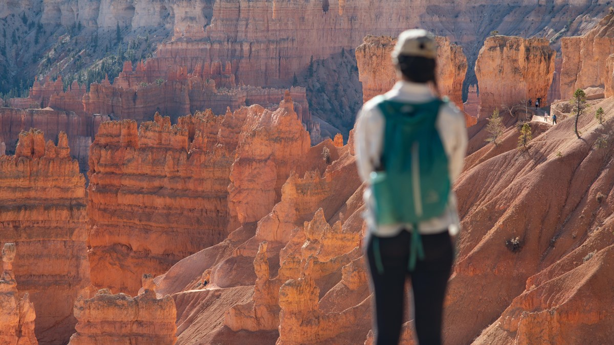
Uitzicht langs de scenic drive van Bryce Canyon

Duck Creek-gids

Bryce Canyon Scenic Drive

Van het amfitheater tot Rainbow Point

In één oogopslag

Total length
18 miles (29 km) one way, entrance to Rainbow Point. It is a dead end, so 36 miles round trip
Southern Scenic Drive
The 15 miles (24 km) from Mile 3 to the road’s end, with nine overlooks
Highest point
Rainbow and Yovimpa Points, 9,115 ft (2,778 m), the highest viewpoints in the park
Visitor Center
7,894 ft, so the drive gains roughly 1,200 ft as you head south
Drive time, no stops
About 40 minutes each way from the Visitor Center
Realistic time
2 to 3 hours for the drive plus viewpoints; a full day if you add a hike

De Bryce Canyon scenic drive is één weg van 18 mijl van de ingang tot Rainbow Point op 9.115 voet. Elk groot uitzichtpunt en trailhead ligt langs deze route.

Heb je maar een paar uur, concentreer je dan op de amfitheater-uitzichtpunten in de eerste drie mijl. Heb je een volledige dag, combineer de rit met een wandeling en rijd door naar rustigere uitzichtpunten in het zuiden.

How the road is laid out

Miles 1 through 3 hold the Bryce Amphitheater, the dense hoodoo bowl everyone comes for, plus the park shuttle, the lodge, both campgrounds, and nearly all the parking pressure. From Mile 3 south, the road becomes what the park calls the Southern Scenic Drive: 15 quieter miles climbing through ponderosa and fir to nine overlooks, most of them a few steps from the car.

The character changes as you climb. The amphitheater is about looking down into a forest of hoodoos. The southern overlooks are about looking out: over the Paria Valley, across the stepped cliffs of the Grand Staircase, and on clear days to Navajo Mountain more than 80 miles away.

De amfitheater-uitzichtpunten

Sunrise, Sunset, Inspiration en Bryce Point liggen dicht bij elkaar en zijn via de Rim Trail te verbinden.

Fairyland Point: 1-mile spur just inside the entrance, before the fee booth. The northernmost rim viewpoint in the park, looking over Fairyland Canyon and the northern Paria Valley. Trailhead for the Fairyland Loop, with a picnic table and 20 parking spaces. No shuttle stop, and the spur road closes to vehicles for the winter once plowing begins.

Sunrise Point: 8,100 ft (2,469 m), the northernmost of the four amphitheater overlooks. A 360-degree view that shows the whole hoodoo life cycle, from the eroding plateau rim to lone standing columns, with Boat Mesa and the tilted Sinking Ship to the northeast. Trailhead for Queen’s Garden. Despite the name it is just as good at day’s end. The park says both Sunrise and Sunset Points were named to lure early lodge guests out at either hour.

Sunset Point: Mile 2.25, and the busiest stop in the park with 115 spaces that still fill. Thor’s Hammer stands almost directly below the railing, and the iron and manganese oxides in the rock throw reds, oranges, yellows, purples and pinks at you all at once. Trailhead for the Navajo Loop. Restrooms, drinking water, and picnic tables here; the restrooms need assistance for wheelchair users.

Inspiration Point: just before Mile 3, and built as three separate levels, each with its own angle on the Silent City. The highest tier is the widest panorama in the amphitheater and the reason to climb past the first railing. From here it is 0.7 miles to Sunset Point, 1.2 miles to Sunrise Point, and 1.5 miles south to Bryce Point on the Rim Trail.

Bryce Point: 2 miles up a spur from Mile 3, or 3.5 miles from the Visitor Center. The park calls it perhaps the most iconic viewpoint: the whole amphitheater seen from the south, with the Wall of Windows, the Silent City, and Boat Mesa laid out below. Tropic sits nearly 3,000 feet down in the Paria Valley to the east. Trailhead for the Peekaboo Loop (5.5 miles) and the Hat Shop (4 miles), and the southern end of the Rim Trail.

Paria View: a short, quiet detour off the Bryce Point spur road that most people drive past. It faces southeast over a 500-foot amphitheater, and the White Cliffs and the dome of Navajo Mountain are at their best here at sunset. Closed to oversized vehicles at all times, and the 0.3-mile road closes for the winter with the Fairyland spur.

Ten zuiden van het amfitheater

Verder zuidwaarts vind je rustigere uitzichtpunten en meer afgelegen panorama's.

Swamp Canyon: Mile 6. The hinge point of the drive, where the hoodoo amphitheaters give way to steep cliffs and buttes; Mud and Noon Canyon Buttes stand off to the southeast. Two small creeks and a spring keep it greener than the name suggests, with tiger salamanders, wild iris, and four distinct habitats packed together. Trailhead for the Swamp Canyon Loop (4 miles, 647 feet down and back up, 3 to 4 hours), which also links to the 23-mile Under-the-Rim Trail.

Farview Point: Mile 10.25. The name earns itself: Navajo Mountain sits roughly 80 to 90 miles off on the Utah and Arizona line, and on a clear day the Henry Mountains show up about 85 miles east. You are looking across the Table Cliff and Kaiparowits Plateaus with a thousand feet of forest below the rim. Restrooms here, including accessible ones. Watch for California condors.

Piracy Point: a flat, unpaved 0.15-mile walk north from the Farview parking lot, and worth the five minutes. It is named for stream piracy: Willis Creek is slowly cutting toward the Sheep Creek drainage and will eventually steal its water outright. Views north over Swamp Canyon. This is the one viewpoint in the park where pets are not allowed, even on a leash.

Natural Bridge: Mile 12.25, and the most photographed feature on the southern road. It is not actually a bridge: bridges are carved by running water, while this window was opened by ice expanding in cracks under a hard cap layer, freeze after freeze. The gully now runs more than 125 feet below the arch. No trails leave from here: it is a park-and-look stop with 30 spaces, nine of them oversized.

Agua Canyon: Mile 13.5. Two named hoodoos anchor the view: The Hunter, the taller one on the left, and the Rabbit (some call it the Backpacker) on the right. The park is honest that many of the classic named formations have fallen or partly fallen, so bring your imagination. Only seven parking spaces, four of them oversized, so this is the one southern stop that can genuinely be full. The Agua connecting trail below is closed indefinitely after rockslides.

Ponderosa Canyon: Mile 14.75. Named for the ponderosa pines on the canyon floor a thousand feet below, though up at the rim you are standing in Engelmann spruce, Douglas-fir and white fir, a neat illustration of how far the forest shifts in a thousand vertical feet. Navajo Mountain to the southeast, the Henry Mountains about 86 miles east.

Black Birch Canyon: Mile 16.5. A bowl-shaped amphitheater of hoodoos eroded out of the plateau edge, with pine and fir a thousand feet down. There is no black birch here; that tree only grows in the eastern United States, and what you are actually looking at is quaking aspen. The park frames it as the first stop on the return trip from Rainbow Point, which is exactly how you should use it.

Rainbow Point: Mile 18, elevation 9,115 ft (2,778 m), the end of the road and the high point of the park. You look out over the eroded Paunsaugunt Plateau, the Pink Cliffs, the Paria River valley, and the distant Tushar and Black Mountains. Trailhead for the Bristlecone Loop (an easy 1-mile round trip along the plateau edge), the 8.8-mile Riggs Spring Loop, and the 23-mile Under-the-Rim Trail. Restrooms, picnic tables, accessible facilities, and 56 parking spaces.

Yovimpa Point: the same parking lot as Rainbow Point, facing the other way. Looking south you see more than 100 miles across the Grand Staircase, and the five cliff layers stacked in front of you (Pink, Grey, White, Vermilion and Chocolate) hold one of the world’s most complete sedimentary records of the last 300 million years. You are standing roughly 1,000 feet higher than the park entrance. Do not skip it because you already parked; it is a different view entirely.

Welke stops prioriteit krijgen

Heb je weinig tijd, focus dan op het amfitheatergebied.

Heb je een volledige dag, rijd dan door tot Rainbow Point.

Light, timing, and where the crowds are

The amphitheater faces east, so morning is when the hoodoos are lit head-on and glowing. By mid-afternoon the bowl falls into its own shadow and the color flattens. That argues for the same plan as the traffic does: south early, amphitheater when you get back.

The park does not publish a single "best" sunset overlook, but it does say Paria View, facing southeast toward the White Cliffs and Navajo Mountain, is wonderful at sunset, and Bryce Point’s southern angle holds light late. Both Sunrise and Sunset Points were named as marketing, not as astronomy, and the park says plainly that each is spectacular at either end of the day.

Parking is the real constraint, not the road. Sunset Point has 115 spaces and Sunrise 113, and both fill on summer mornings. Agua Canyon has seven. If you arrive at a full lot in the amphitheater, take the shuttle instead of circling; if you arrive at a full lot in the south, drive on and catch it on the way back.

Winter and shoulder season

The park never closes, and the main road is plowed. What happens after a storm is that the road beyond Mile 3 closes temporarily while crews clear the higher southern section, usually for a day or more, depending on how much fell. The amphitheater stays reachable; Rainbow Point may not be.

Two spur roads close for the whole season once snow removal begins: the 1-mile road to Fairyland Point and the 0.3-mile road to Paria View. Both stay open to skiers and snowshoers, which is why the park closes them. Everything else on the drive stays drivable between storms.

Underfoot is the other winter story. The park warns that popular trails and even parking lots and paved areas get icy enough that steep sections cannot be crossed safely without traction devices. Bring microspikes if you plan to walk anything beyond the railing. Check today’s Bryce conditions before you leave, and our road-conditions page for the drive over Cedar Mountain.

The shuttle, and what it does not cover

The free shuttle runs a roughly 50-minute loop with 15 stops through the amphitheater area (Shuttle Station, Visitor Center, the lodge and campgrounds, Sunrise, Sunset, Inspiration and Bryce Points) with buses about every 15 minutes. It is included with admission and the buses carry powered wheelchair lifts with space for two wheelchairs.

In 2026 it runs April 3 to May 8 and September 21 to October 18 from 8 a.m. to 6 p.m., and May 9 to September 20 from 8 a.m. to 8 p.m. Dates shift year to year, so confirm on the NPS shuttle page before you build a plan around it.

It does not go south. There is no shuttle service to Natural Bridge, Agua Canyon, or Rainbow Point, and the three-hour Rainbow Point bus tour is not being offered. The park points visitors to commercial operators instead. For everything past Mile 3 you need your own vehicle.

How the day flows from Duck Creek

  1. Bryce is about an hour from Duck Creek Village Inn, south on UT-14 to US-89 and east on UT-12. A workable summer day looks like this:
  2. 7:00 AM: Leave the inn with a full tank; fill up in the village before you drop off the mountain.
  3. 8:00 AM: Through the entrance and straight past the amphitheater turnoffs. Do not stop yet.
  4. 8:45 AM: Rainbow and Yovimpa Points. Walk the Bristlecone Loop while the air is still cold.
  5. 10:00 AM to 12:30 PM: Work north: Black Birch, Ponderosa, Agua Canyon, Natural Bridge, Farview and Piracy, Swamp Canyon. Every one a right turn.
  6. 12:30 PM: Lunch at the lodge or from the cooler at a picnic table.
  7. 1:30 PM: Amphitheater: Bryce Point, Inspiration, Sunset, and the paved rim walk to Sunrise.
  8. 4:00 PM: Mossy Cave on UT-12 on the way out, if anyone still has energy.
  9. 5:30 PM: Back at Duck Creek Village Inn, 8,400 feet and about twenty degrees cooler than the valley.

Practical details

Entrance fee
$35 per vehicle for 7 days, $30 motorcycle, $20 on foot or bike; America the Beautiful pass accepted. The park is cashless, cards only
International visitors
Non-US residents aged 16 and up pay a $100 nonresident fee on top of the entrance fee, unless admitted with an Annual or America the Beautiful pass
Fuel
Fill up before you go. The park’s own services run to a lodge, a general store and two campgrounds, not a gas station
Altitude
Around 8,000 ft through the amphitheater, over 9,000 ft at the south end; take the first day easy
Restrooms on the drive
Visitor Center, Sunset Point, Farview Point, and Rainbow Point
Dogs
Paved surfaces and paved viewpoints only, 6-foot leash, never on the shuttle, and never at Piracy Point
Bikes
A 5-mile shared use path links the Shuttle Station to the Visitor Center, Sunrise, the lodge, Sunset and Inspiration Point; e-bikes under 750 W allowed, and the shuttle carries two bikes

Stay planning

A scenic drive day pairs naturally with a slower day closer to home: Cedar Breaks in the morning, or an afternoon on the property. See staying near Bryce Canyon for how the drive from Duck Creek compares with the gateway towns, and where to eat near the park if you would rather not pack a cooler.

You get the park at its best hours without paying gateway-town rates, and you come home to cool mountain evenings at 8,400 feet instead of a parking lot.

August 2026

Waarom deze gids vertrouwen

We rijden deze route regelmatig vanuit Duck Creek Village en houden het praktisch en eenvoudig.

Vragen over de scenic drive

Veelgestelde vragen van reisplanners.

Hoe lang is de scenic drive?

18 mijl enkele reis.

Heb ik de shuttle nodig?

Niet voor de hele drive; de shuttle bedient alleen het amfitheatergedeelte.

Blijf hier, rijd morgen Bryce

Boek je kamer of cabin bij Duck Creek Village Inn.

10% korting direct met code · verblijven t/m 1 dec 2026 Beste prijs direct · Reserveer nu, betaal later

Bel ons · 435-990-5488