Trip Planning · Duck Creek Journal
Cannonville, Utah From Duck Creek Village: The Paria Valley Town at the Kodachrome Turnoff
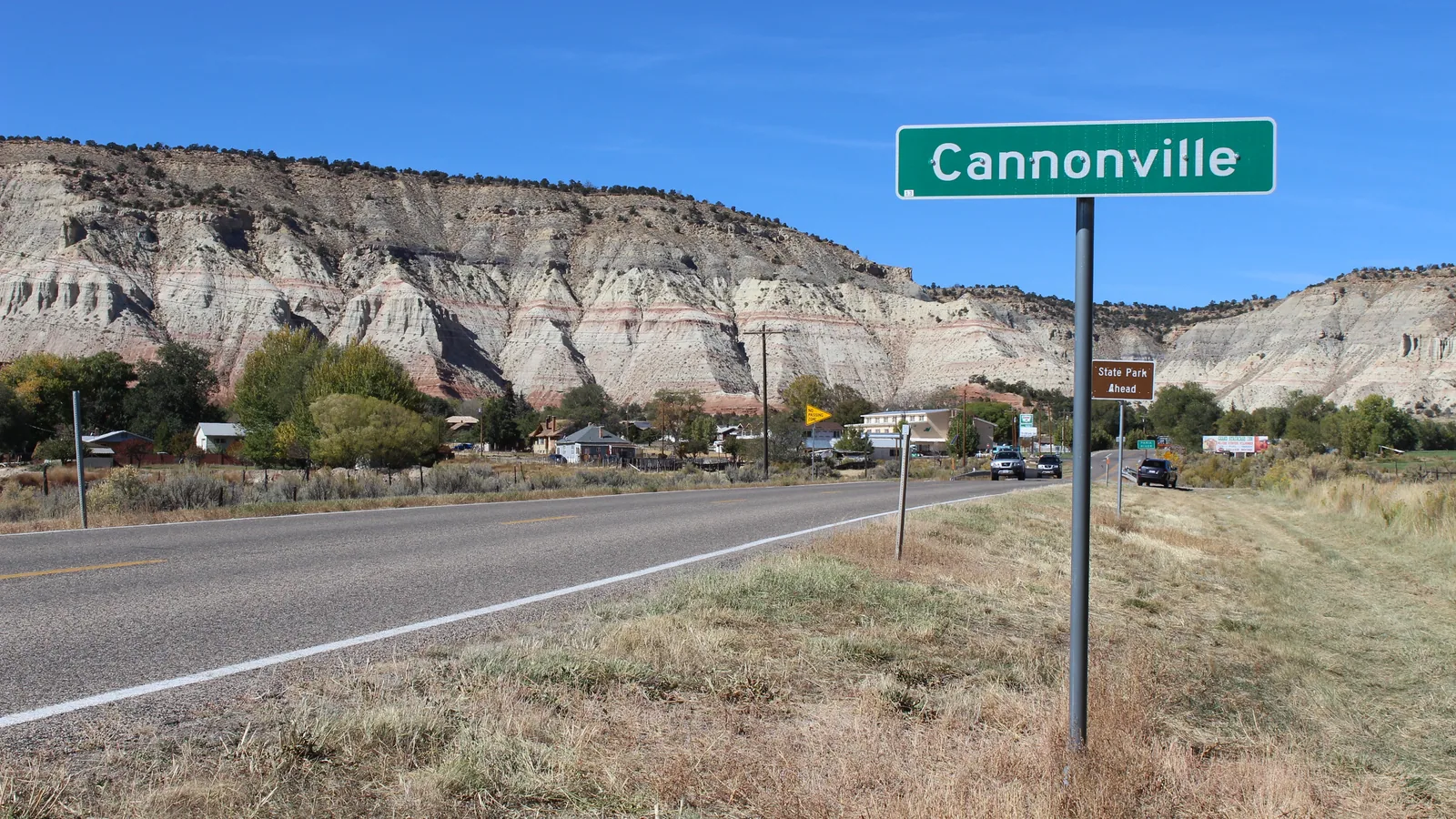
Cannonville is a Garfield County town of 186 people at about 5,900 feet in the Paria River valley, 57 road miles east of Duck Creek Village Inn. Kodachrome Basin Road and Cottonwood Canyon Road both start here, 12 miles past the Bryce Canyon turnoff on Highway 12.
In this story
Cannonville is a town of 186 people (2020 Census) in Garfield County, Utah, at about 5,900 feet in the Paria River valley. From Duck Creek Village Inn it sits 57 road miles east, about an hour and 17 minutes by car: Highway 14 east, US-89 north, then Highway 12 east past the Bryce Canyon turnoff and down through Tropic.
| Cannonville, Utah | |
|---|---|
| County | Garfield, ZIP 84718 |
| Population | 186 people, 79 homes (2020 Census) |
| Elevation | About 5,900 ft, some 2,500 ft below the inn |
| From Duck Creek Village Inn | 57 road miles, about 1 hr 17 min |
| To Bryce Canyon visitor center | 16 road miles, about 27 min |
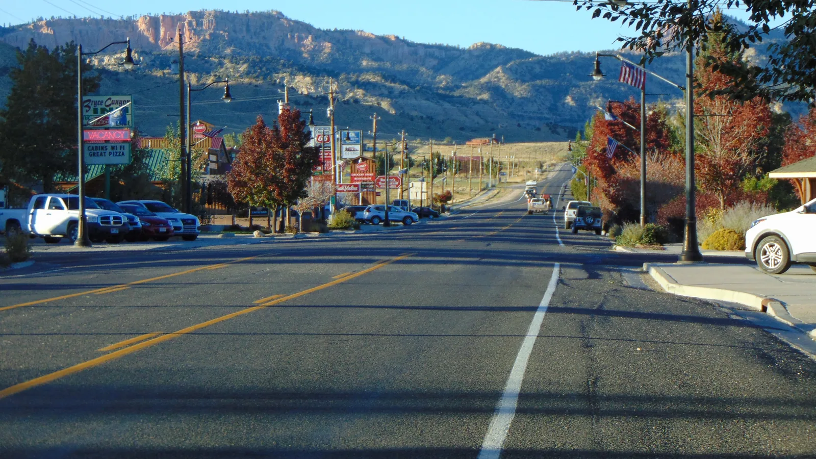
Most Bryce traffic never sees the place. Cannonville sits 12 miles past the park turnoff, at the point where two roads leave Highway 12 for the south. Kodachrome Basin Road runs paved to the state park. Cottonwood Canyon Road leaves pavement behind and heads for US-89 across the monument. The town is the corner you turn at.
The drive down from Duck Creek
The road to Cannonville runs east and keeps losing height. Leg one covers 10.6 miles on Highway 14 to Long Valley Junction. Leg two follows US-89 north past Hatch to the Highway 12 junction at mile 31. Leg three climbs through Red Canyon onto the Paunsaugunt Plateau and reaches the Bryce roundabout at mile 45.
Stay on Highway 12 at the roundabout. The road drops off the east face of the plateau into Tropic, follows the valley 5 miles south, and puts you on Cannonville’s main street at mile 57. Henrieville sits 3.5 miles farther east.
Our Tropic post covers the grade and the town above this one. For the park legs, the entrance fee and the stops along the way, see the Bryce Canyon distance breakdown.
Clifton, the night water and the move upstream
| Cannonville history | |
|---|---|
| First settlement | Clifton, about 1874 |
| Moved to Cannonville | 1877, a mile and a half upstream |
| Named for | George Q. Cannon, LDS apostle |
| Post office | 1879 to 1966 |
| Population in 1890 | 273 |
Settlers laid out a town called Clifton around 1874 and named it for the cliffs above the site. Water decided its future. The town’s own history says that in the dry summer of 1877 the Paria carried water at night and not by day, and Utah History To Go adds that families hauled drinking water from Bryce Spring.
That same year the settlement moved about a mile and a half upstream to steadier water and took the name Cannonville, after the church leader George Q. Cannon. The town counted 273 people by 1890, more than it has today.
Water stayed the story. The Park Service says the Tropic Ditch, dug through the Bryce rim and finished in 1892, has watered fields in Tropic and Cannonville every year since, except during the drought of 2002. In the 1970s and 1980s Mayor Laurie Dea Holley’s water project took the town supply from six gallons a minute to one hundred.
The visitor center and the monument
| Grand Staircase gateway | |
|---|---|
| Cannonville Visitor Center | Closed until further notice (BLM) |
| Normal season | Mid-March to mid-November |
| Open alternative | Escalante Interagency Visitor Center |
| Monument size | About 181,541 acres since July 13, 2026 |
The Bureau of Land Management runs a monument visitor center at 10 Center Street, and its page now reads “closed until further notice.” The BLM’s March 3, 2026 hours notice repeats that line and sends visitors to the Escalante Interagency Visitor Center instead. For road questions, the Paria River District answers at 435-341-0550.
The monument around the town also changed this year. A presidential proclamation signed July 13, 2026 cut Grand Staircase-Escalante to about 181,541 acres. Our Escalante post covers that change and the drive past it.
Cottonwood Canyon Road starts beside the visitor center. The BLM calls it a “rugged and scenic 47-mile dirt road” to US-89. Treat anything past the Kodachrome turnoff as a separate trip that needs a dry forecast and a call to the district first.
Weather: warmer days, colder nights than the rim
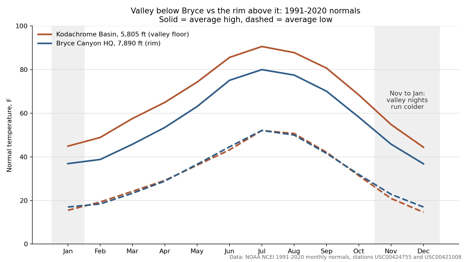
Cannonville has no NOAA station with normals of its own. The closest one sits about 5 miles southeast at Kodachrome Basin, 5,805 feet, close to the town’s height. Bryce Canyon headquarters, 7,890 feet up on the rim, makes the comparison.
| November normals | |
|---|---|
| Kodachrome Basin, 5,805 ft | 55F high, 21F low |
| Bryce Canyon HQ, 7,890 ft | 46F high, 23F low |
| Duck Creek Village, about 8,500 ft | 48 to 49F high, about 24F low |
| Annual snow, valley vs rim | 23.7 in vs 86.7 in |
Days in the valley run 8 to 12 degrees warmer than the rim in every month. Nights tell another story. In 6 of 12 months the valley station’s normal low sits below the rim’s, even with 2,085 feet less altitude, and the gap peaks from November through January at 1.5 to 2.4 degrees. Cold air sinking into low ground on clear nights is the usual explanation, and the numbers fit it.
For a November trip that means shirt-sleeve afternoons and frost on the windshield the next morning, with a valley night as cold as a November night at the inn’s height, or colder. The snow gap is the larger difference: the rim averages more than three times the valley’s snowfall.
Quick answers about Cannonville, Utah
- Where is Cannonville, Utah?
In Garfield County on Highway 12, in the Paria River valley 5 miles south of Tropic and 16 road miles from the Bryce Canyon visitor center.
- What county is Cannonville in?
Garfield County. Kodachrome Basin, a few miles south, lies across the line in Kane County, the same county as Duck Creek Village.
- What is the elevation of Cannonville?
About 5,900 feet, some 2,500 feet below Duck Creek Village Inn.
- What airport is near Cannonville?
Bryce Canyon Airport sits 13.5 road miles away at 7,590 feet, and no airline serves it. Cedar City and St. George carry the commercial flights.
- What time zone is Cannonville in?
Mountain Time, the same clock as Duck Creek Village, with daylight saving time in summer.
Cannonville makes a long day from the mountain and a warm one in the shoulder season. Come back up Highway 12 and Highway 14 to a cabin at Duck Creek Village Inn, with the aspens and the pines outside the door.
 Things to Do
Kodachrome Basin State Park From Duck Creek Village: Is the Drive Worth It?
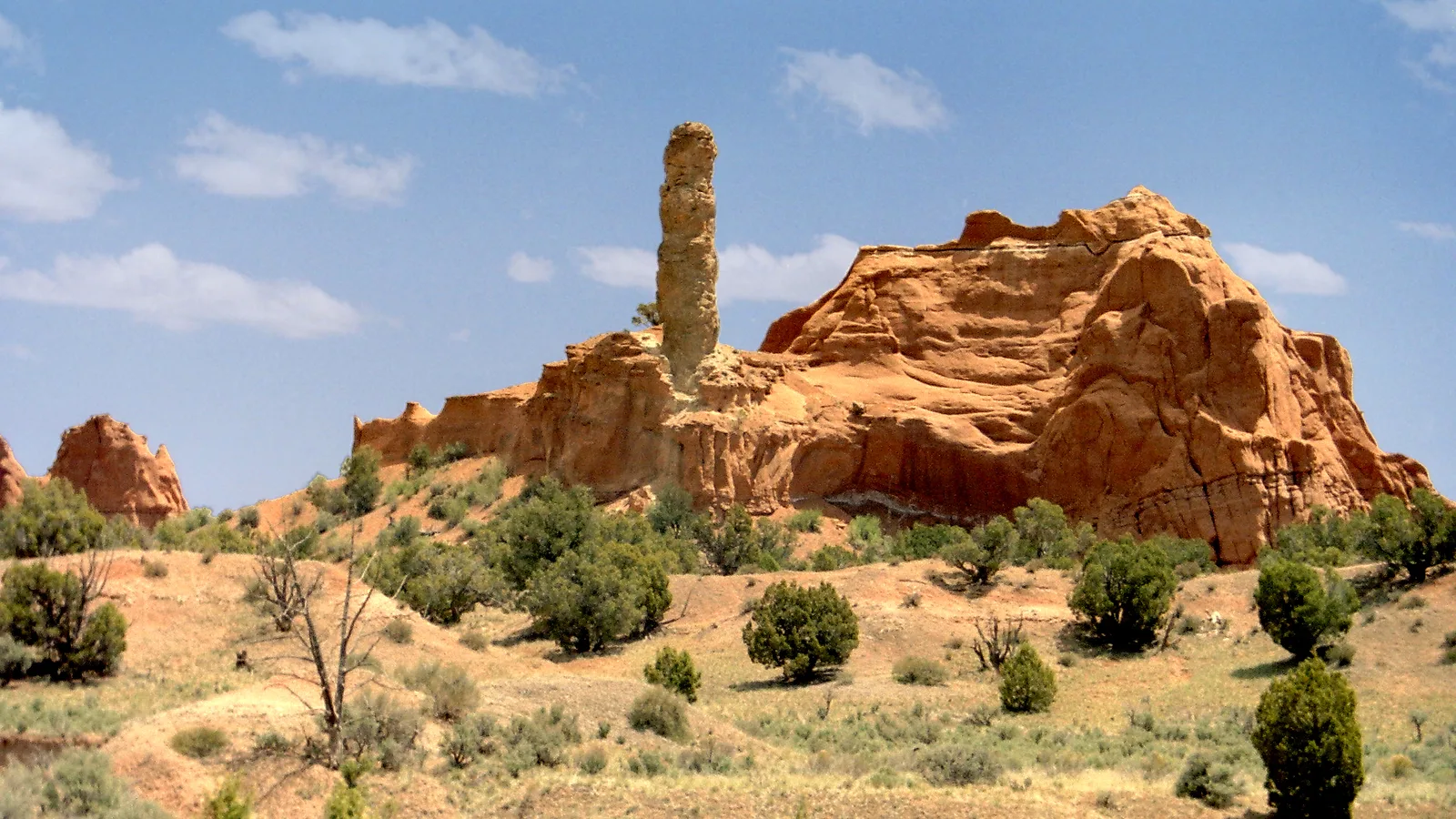
Kodachrome Basin State Park sits 65 miles east of Duck Creek Village, about 1 hour 40 minutes by car and 25 miles from the Bryce Canyon visitor center. Entry costs $10 per vehicle, the road stays paved all the way to the park, and October afternoons run about 10 degrees warmer than the Bryce rim.
 Trip Planning
Tropic, Utah From Duck Creek Village: The Town Below Bryce Canyon's Rim
Tropic is a Garfield County town of 486 people at about 6,300 feet, 52 road miles east of Duck Creek Village Inn by Highway 14, US-89 and Highway 12. It sits 7 miles past the Bryce Canyon turnoff, and it exists because 40 men dug a ditch through the park in 1892.
 Trip Planning
How Far Is Duck Creek Village From Escalante, Utah? 91 Miles Over Two Summits
Escalante sits 91 road miles from Duck Creek Village, a drive of about two hours by Highway 14, US-89 and Scenic Byway 12. The road crosses two summits on the way, lands 2,600 feet lower, and runs about ten degrees warmer in October.
Book the basecamp
When the trip idea is taking shape, Duck Creek Village Inn makes an easy base between slower mountain time and bigger Southern Utah days.