Duck Creek Village sits 70 road miles from Hurricane, Utah, about an hour and a half by I-15 and Highway 14 through Cedar City. You finish 5,250 feet higher, and most of that climb comes in the 17 miles above Cedar City.
How Far Is Duck Creek Village From Hurricane, Utah? 70 Miles and 5,250 Feet Up
Duck Creek Village sits 70 road miles from Hurricane, Utah. The fast route runs north on SR-9 and SR-17 through La Verkin and Toquerville, joins I-15 for about 30 miles to Cedar City, then climbs Highway 14 east to the village. Plan on an hour and a half without stops. You finish about 5,250 feet higher than you started.
Hurricane sits at 3,258 feet on the Virgin River, 23 miles from the Springdale gate of Zion, and the village sits at 8,507 feet on the Markagunt Plateau. That gap in elevation shapes the drive, the weather at each end, and the clothes you pack for a trip that uses both towns.
| Hurricane to Duck Creek Village | Details |
|---|---|
| Road distance | About 70 miles |
| Driving time | 1.5 hours, closer to 2 with stops |
| Main route | SR-9, SR-17, I-15, Highway 14 |
| Elevation | 3,258 ft up to 8,507 ft |
| Highest point | Midway Summit, 9,896 ft |
The fast route north through Cedar City
You leave Hurricane downhill. The road crosses the Virgin River near La Verkin, about four miles out, at the lowest point of the trip, about 3,100 feet. SR-17 then climbs past Toquerville to I-15, which you join about nine miles from town.
The interstate leg covers about 30 miles and gains about 2,000 feet, a grade that feels flat at highway speed. Kolob Canyons, the quieter northwest corner of Zion, sits at Exit 40 on this stretch, 17 miles south of Cedar City. The five mile scenic drive there needs a Zion pass or the park entrance fee.
| Stop on the drive | Road miles from Hurricane |
|---|---|
| Virgin River at La Verkin | 4 |
| Join I-15 | 9 |
| Kolob Canyons, Exit 40 | 24 |
| Cedar City, Highway 14 | 41 |
| Midway Summit | 58 |
| Duck Creek Village | 70 |
Cedar City marks the turn. Highway 14 leaves town up Coal Creek and Cedar Canyon, and the next 17.5 miles to Midway Summit gain about 4,050 feet. A quarter of the distance carries sixty percent of the climbing. The road then drops 1,400 feet over the last 12 miles into the village. Our page on the drive from Cedar City covers that canyon mile by mile.
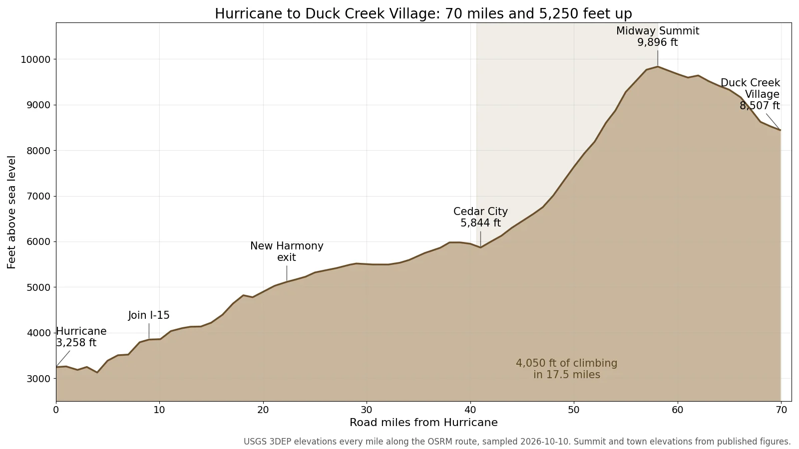 Elevation every mile along the route, from USGS 3DEP data we sampled for this post.
Two other routes and the price of each
Two more roads connect the towns, and both take longer. The decision comes down to what you want to see, what you drive, and whether you already hold a Zion pass.
| Route from Hurricane | Distance and time |
|---|---|
| I-15 and Cedar City | 70 mi, about 1 h 30 min |
| Through Zion | 81 mi, about 2 h 15 min |
| SR-59, Fredonia, Kanab | 113 mi, about 2 h 30 min |
The Zion route follows SR-9 through Springdale, up the switchbacks and through the tunnel to the east entrance, then north on US-89 and west on Highway 14 at Long Valley Junction. It costs $35 per private vehicle, a pass good for seven days, plus $100 per person for non-US residents age 16 and up without an annual pass. Since June 7, 2026 the park caps single vehicles on that highway at 35 feet 9 inches long, 7 feet 10 inches wide and 11 feet 4 inches tall. Our Zion tunnel post has the full limits for trailers.
The southern route climbs the cliffs east of Hurricane on SR-59, crosses into Arizona for 36 miles through Fredonia, and comes back north through Kanab. It skips both the park fee and the tunnel limits, and it makes sense if you want a stop in Kanab. For a straight transfer, the Cedar City route beats it by 43 miles.
Driving the Hurricane Fault the whole way
The town and the cliffs above it share a name with the fault that built this landscape. The Hurricane Fault runs about 155 miles, from northern Arizona to just north of Cedar City, according to Southern Utah University. Land west of it has dropped for the last 10 million years while the east side rose, and the National Park Service credits that movement for lifting Cedar Breaks and the Markagunt Plateau to their present height.
Between Toquerville and Cedar City, I-15 runs along the base of the Hurricane Cliffs past Pintura and New Harmony, so the fault sits off your right shoulder for 30 miles. The low valley holds the interstate and the plateau stands above it. A 1989 Utah Geological Survey study put the total offset at about 1,500 meters near Toquerville, close to 4,900 feet. The climb up Highway 14 out of Cedar City takes you from the dropped side onto the raised block where the village sits.
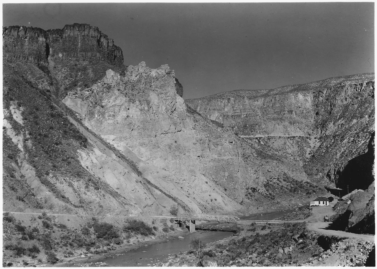 The Hurricane Fault where it crosses the Virgin River at La Verkin Warm Sulphur Springs, photographed by George A. Grant on September 6, 1929, and now in the public domain through the National Archives.
Southern Utah University calls the fault active and capable of an earthquake as large as magnitude 7. It also explains the name of the town. Wikipedia credits Erastus Snow with naming Hurricane Hill after a whirlwind damaged his buggy, and the town followed in 1896.
October at each end of the drive
The two towns feel like different seasons on the same day. The nearest long record to Hurricane comes from La Verkin, two miles away at 3,194 feet.
| October and November normals | Temperature |
|---|---|
| La Verkin, October high and low | 76F and 47F |
| Duck Creek Village, October | 58 to 60F, nights near 33F |
| La Verkin, November high and low | 62F and 35F |
| Duck Creek Village, November high | 48 to 49F |
An October afternoon in the village runs 16 to 18 degrees cooler than one near Hurricane, and the nights split by about 14 degrees. Our October weather post has the station detail. Pack a jacket for the top even when Hurricane sits in shorts weather. The forecast we pulled on October 10 calls for rain at the village on October 11 and 12 and a low of 28F on the morning of the 13th, cold enough for snow on the summit. Check the Highway 14 road cameras before you head up.
Quick answers about Hurricane and Duck Creek Village
How long does the drive from Hurricane to Duck Creek Village take? About an hour and a half for 70 miles through Cedar City. Give it two hours with a fuel stop or a loaded vehicle.
Is it faster to go through Zion? No. The Zion route runs 81 miles and about 2 hours 15 minutes, and it needs a park pass. It wins on scenery and loses on the clock.
Can a large RV drive from Hurricane to Duck Creek Village? Yes, by I-15 and Highway 14 through Cedar City. Rigs over the Zion size limits cannot use the park route.
How much higher is Duck Creek Village than Hurricane? About 5,250 feet. The road tops out at 9,896 feet on Midway Summit, 12 miles before the village.
Does Sand Hollow State Park charge a fee? Yes, $25 per vehicle for Utah residents and $35 for nonresidents, per Utah State Parks.
Hurricane puts you close to the Springdale gate, and Duck Creek puts you on top of the plateau with Cedar Breaks, Bryce and the east side of Zion in reach. If you want the cool half of that trip, our cabins in Duck Creek Village sit 70 miles up the road.
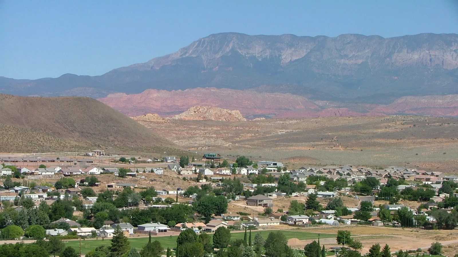
Hero photograph: Hurricane, Utah, by John Bonzo, CC BY 3.0 via Wikimedia Commons.