No. On October 4, 2026, no wildfire is burning near Duck Creek Village, and Dixie National Forest has no fire restrictions in place. Sixteen small fires started within 10 miles this year and all of them are out. Here are the numbers, the big fires in the record, and the four places to check on the day you drive.
Is There a Fire Near Duck Creek Village? Today’s Status and the Checks to Run
No. On October 4, 2026, no wildfire is burning anywhere near Duck Creek Village. The federal incident feed lists 458 active incidents across the country and none within 25 miles of the village. The closest one sits 91 miles away in Arizona at full containment. Dixie National Forest lifted its last fire restrictions on August 31, and the Cedar City district reads Moderate on fire danger today.
| Fire status near Duck Creek, October 4, 2026 | |
|---|---|
| Active fires within 25 miles | None |
| Nearest active incident | Mount Emma, Arizona, 91 mi, 100% contained |
| Fire restrictions, Dixie National Forest | None since August 31 |
| Fire danger, Cedar City district | Moderate |
| Report a fire | 911, or Color Country dispatch at 435-865-4611 |
That answer has a date on it for a reason. Fire status changes by the hour in June and July, so treat this page as a record of today plus a method for checking the day you drive.
Sixteen fires near the village in 2026, and all of them out
Fire crews logged 16 wildfire starts within 10 miles of the village between May 26 and September 22 this year. Together they burned 1.8 acres. The biggest, Whispering Pine in August, reached a quarter acre. Every one of them carries an out date in the federal record.
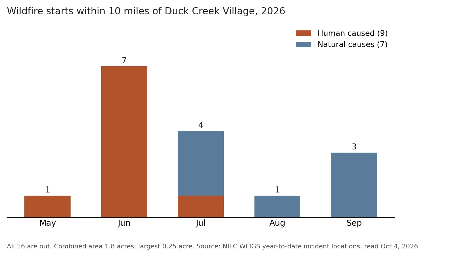
Wildfire starts within 10 miles of the village in 2026, by month and cause. Data: NIFC WFIGS year to date incident locations, read October 4, 2026. Chart by Duck Creek Village Inn.
The pattern matters more than the total. Of the 16, humans started 9, and 7 of those 9 came in June, before the monsoon and before the Forest Service banned campfires. One carries the name “Mammoth Campfire.” One called “Duck Creek” burned 0.16 acre about 2.6 miles from the inn on June 23. Inside 5 miles of the village, people caused 9 of 10 starts. After July the human starts stop and natural starts take over, scattered across the plateau through September.
| Dixie National Forest restrictions, 2026 | |
|---|---|
| Stage 2 (no campfires, no daytime chainsaws or OHV) | From June 26 |
| Back to Stage 1 after monsoon rain | July 27 |
| All restrictions lifted | August 31 |
| Fireworks on federal land | Banned all year |
The June 26 order quoted the forest’s fire officer saying crews were “responding to more reports of abandoned campfires.” Read the chart with that line in mind. On this mountain the fire risk in early summer comes from campsites, cabins and machines, and the fix sits with you.
The three big fires closest to Duck Creek
Big fires do reach this plateau. The national perimeter record holds three whose edges came within about 8 miles of the village, the closest within 3.4.
| Large fires closest to the village | |
|---|---|
| Uinta Flat, 1989 | 7,526 acres, nearest edge 3.4 mi away |
| Shingle, 2012 | 8,064 acres, nearest edge 4.7 mi away |
| Brian Head, 2017 | 71,673 acres, nearest edge 8.2 mi away |
The Shingle Fire shut the village’s own highway. It started at 3:38 p.m. on July 1, 2012 near Swains Creek, south of the highway, and investigators traced it to a faulty spark arrestor on an ATV. Swains Creek, Stout Canyon, Ponderosa, Elk Ridge and Harris Flat all evacuated, and Highway 14 closed from Mammoth Junction to US-89 until July 6. If you ride the Markagunt trails from the village, that history explains why the rules on spark arrestors exist. Our post on riding legal with an out of state OHV covers the gear.
The Brian Head Fire was far bigger. It began on June 17, 2017 when a man burning a pile of weeds near a cabin in Brian Head lost control of it. It burned for close to a month, destroyed at least 13 homes and forced about 1,500 people out. Its nearest edge stopped about 8 miles from Duck Creek Village. Its burn runs along Highway 143 in Parowan Canyon, the winter route to the ski hill in our Brian Head guide.
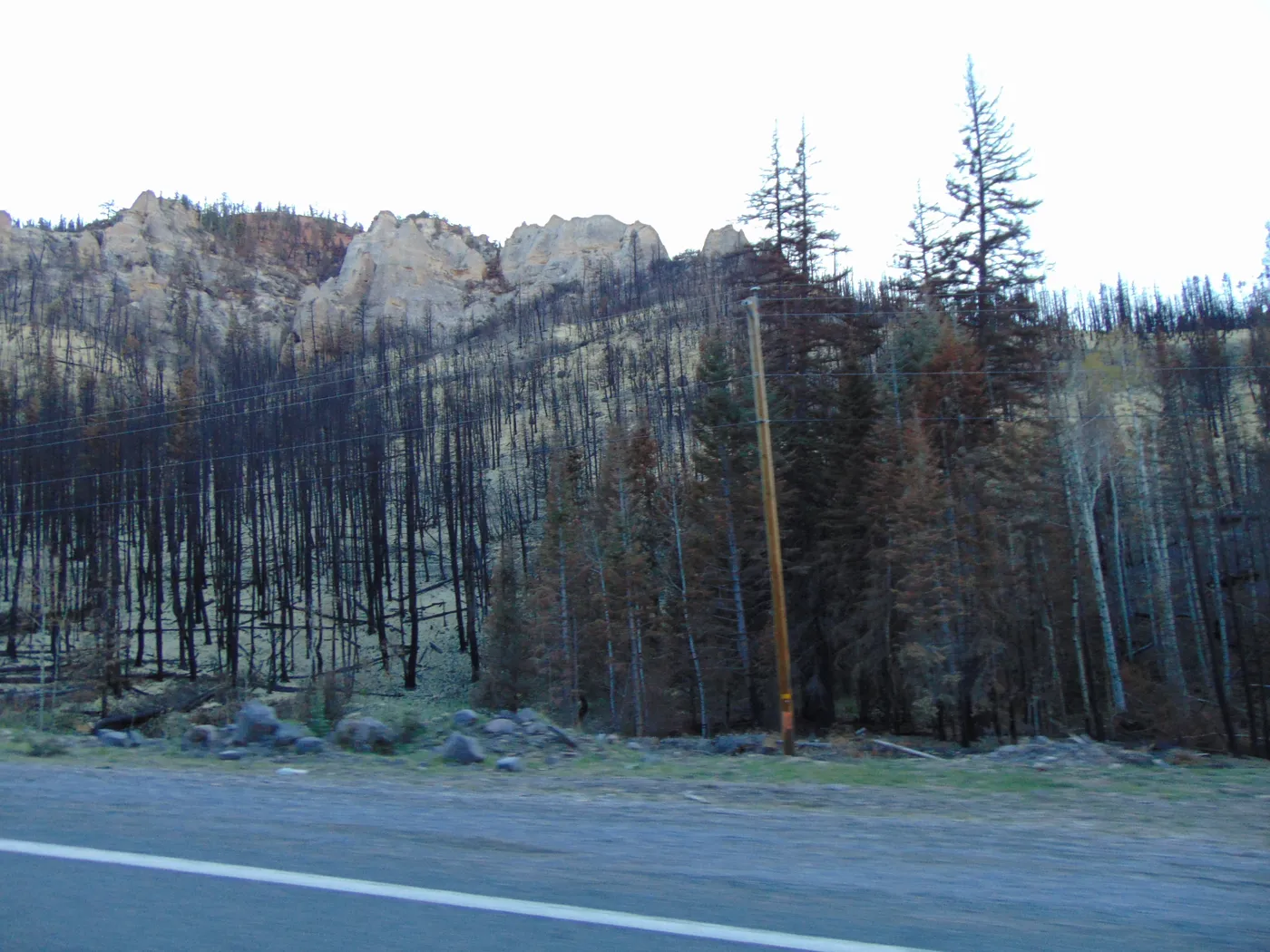
Brian Head Fire burn along Highway 143 in Parowan Canyon, September 2017. Photo: An Errant Knight, Wikimedia Commons, CC BY-SA 4.0.
Four checks to run on the day you drive up
Fire season here ran from late May to late September this year. Inside that window, run these four checks the morning you leave.
- InciWeb lists named fires and planned burns with maps and evacuation notes. Search for Dixie National Forest.
- Utah Fire Info (utahfireinfo.gov) posts restriction orders and fire news for the whole state.
- The Dixie National Forest alerts page shows the current restriction order and fire danger by ranger district. Duck Creek sits in the Cedar City district.
- Road status. A fire near Highway 14 closes the highway, as Shingle did. Our road conditions page puts the UDOT cameras for the routes up on one map.
Outside the season the checks still take two minutes, and in October they tend to turn up prescribed burns. Plan for cold nights instead, since October in Duck Creek brings about a dozen freezing nights.
Quick answers about fire near Duck Creek Village
Is Duck Creek Village closed because of a fire? No. On October 4, 2026, no fire is burning within 25 miles, and the village, Highway 14 and the forest all stay open.
Can I have a campfire near Duck Creek right now? Dixie National Forest has had no restrictions since August 31, so you can light a campfire on the forest again. Keep them in a fire ring and drown them cold before you leave. Fireworks stay banned on federal land all year. Our camping guide lists the campgrounds.
Did the Brian Head Fire burn Duck Creek Village? No. The 2017 perimeter stopped about 8 miles away. The Shingle Fire in 2012 came closer, 4.7 miles, and closed Highway 14 for five days.
What causes most fires around Duck Creek? Human ignitions, early in the summer. In 2026, people started 9 of the 16 fires within 10 miles, 7 of them in June.
Why do I see smoke in October? Prescribed burns. The Forest Service burns brush and debris on Cedar Mountain in fall and winter, and announces burns on its website, its social media and InciWeb.
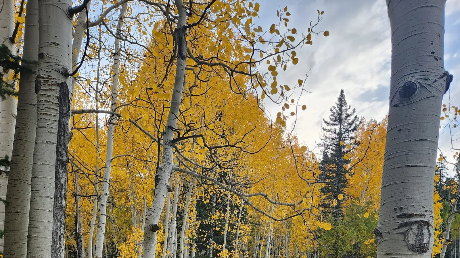
If the forecast looks clear and the feed reads quiet, the mountain is ready for you. Book one of our cabins and come see the aspens before the snow.