
SR-143 @ Milepost 31.14 (Panguitch side)
Brian Head Road Conditions & Live Cameras
SR-143 from both sides of the mountain, camera by camera
Live road map for the Brian Head drive
The map opens on the SR-143 corridor over the 10,620 ft summit. Tap any camera pin for the live view; road colors show current UDOT surface conditions.
Tap any camera pin for the live view. Road colors show current UDOT surface conditions.
Wondering about snow? Check the live Duck Creek snow report →
Live SR-143 cameras
From the Panguitch Lake side over the summit to the Parowan canyon side — the full camera sequence for the highest year-round road in the region. Images refresh every minute.
SR-14 → SR-148 / SR-143
SR-143 @ Milepost 25.13
SR-143 @ Milepost 21.91
SR-143 @ Brian Head / Milepost 18.19
SR-143 @ Milepost 13.43 (Parowan side)
The drive: what the road actually does
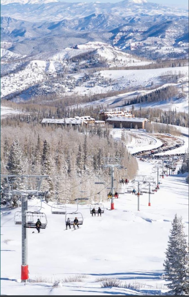
Brian Head town sits at 9,800 ft and SR-143 crosses 10,620 ft — the highest paved through-road in southern Utah, and it behaves like it. From Duck Creek Village in summer, the pretty way is SR-14 west to SR-148 through Cedar Breaks, about 40 minutes. In winter, with SR-148 gated, you loop via Mammoth Creek and Panguitch Lake on SR-143’s east side, roughly an hour of plowed pavement.
The two sides of the mountain are different roads. The Parowan side is a steep canyon climb — 13% grades in places — that ices early and is where UDOT posts traction requirements first. The Panguitch Lake side is gentler and more forgiving in storms; if the Parowan-side camera looks bad, the east-side approach is usually the better call.
The cameras above cover both sides plus the summit, so you can compare approaches in one glance before choosing a route.
Winter driving to Brian Head
SR-143 is plowed aggressively all winter — it serves a ski resort — but this is real mountain driving: during storms UDOT regularly posts traction-device requirements (they appear automatically in the strip above), and the Parowan canyon grades demand respect in a 2WD car. Skiers staying with us usually take the Panguitch Lake side in weather. Watch the plow markers on the map on storm mornings; seeing plows working the road is the best open-for-business signal there is.
Brian Head road questions we hear at the desk
Straight answers for ski mornings and summer scenic loops.
What are the road conditions on SR-143 right now?
The strip above shows UDOT’s live surface condition and any traction requirement for all three SR-143 segments, and the cameras show the pavement itself on both sides of the summit. In storms, check the Parowan-side camera specifically — that canyon is always the first stretch to ice and the first to get restricted.
Do I need chains or 4WD to get to Brian Head?
On dry days, no — it is normal highway driving. During and right after storms, UDOT often requires traction devices (snow tires or chains) on SR-143, and that requirement appears in the live strip above the moment it is posted. A 2WD rental on all-seasons should take the Panguitch Lake side in weather, or simply wait for the plows to finish.
Which way should I drive from Duck Creek Village?
Summer and fall: SR-14 to SR-148 through Cedar Breaks — 40 minutes and arguably the most scenic approach in Utah. Winter and spring, with SR-148 gated: SR-143 via Mammoth Creek and Panguitch Lake, about an hour on plowed roads. The Parowan side is the steepest option and best saved for clear pavement.
Is Brian Head open year-round?
Yes — the town and resort operate all year, and SR-143 stays open from both the Parowan and Panguitch sides through winter. Only the SR-148 connection through Cedar Breaks closes seasonally. Summer brings lift-served mountain biking and 60-degree afternoons at 10,000 ft.
Related guides
Road Conditions
Live SR-14 cameras, current mountain weather, and closure detours before you drive up.
See pageLive Webcams & Road Cams
17 live UDOT road cameras on SR-14, Brian Head, and the park drives, plus Zion and Bryce webcams.
See pageBrian Head
Skiing, snow tubing, and lift-served summer trails
View guideSnow Report
Live snow depth and the 47-year record for Duck Creek Village, from two SNOTEL stations minutes away.
See pageCedar Breaks Driving Conditions & Cameras
SR-14 and SR-148 live cameras, current conditions, and the seasonal winter closure explained.
See pageNext steps
Winter Driving & Access
The climb up Highway 14, chains and 4WD, snow depths, daylight, and storm-day calls
Plan thisBrian Head
Skiing, snow tubing, and lift-served summer trails
View guideSnowmobile Lodging
Winter-ready rooms and cabins with trailer parking near the Markagunt groomed trails.
See snowmobile lodgingSki Brian Head, sleep in the pines
Check both sides of the mountain from your breakfast table.