Duck Creek Village sits about 400 road miles north of Phoenix, close to eight hours of driving by way of Flagstaff, US-89 and Highway 14. The route through Las Vegas adds 85 miles. You finish 7,400 feet higher than you started, on the highest ground of the whole drive.
How Far Is Duck Creek Village From Phoenix?
Duck Creek Village sits about 400 road miles north of Phoenix. Plan on eight hours behind the wheel before you add a stop. Most drivers take I-17 to Flagstaff, US-89 north into Utah through Kanab, then Highway 14 west for the last climb. Swinging around by Las Vegas costs 85 extra miles. You finish 7,400 feet above the valley you left.
| The short answer | |
|---|---|
| Road distance | About 400 miles |
| Time behind the wheel | 7.5 to 8.5 hours |
| Main corridor | I-17, US-89, Highway 14 |
| Start and finish elevation | 1,086 ft to 8,507 ft |
| Clock difference | Arizona runs an hour behind Utah until November 1 |
These 400 miles do not behave like 400 interstate miles. Past Flagstaff the drive moves onto two lane US-89, and the towns space out to 40 and 60 miles apart. Eight hours is the honest number for the driving. Nine is the number a real family day takes, with lunch and one stop at the Colorado River.
Three ways north and what each one costs
Two corridors lead from the Salt River Valley to Cedar Mountain, and the shorter one surprises people who assume the interstate wins.
| Route from Phoenix | Road miles |
|---|---|
| Flagstaff, US-89A, Jacob Lake, Kanab | 396 |
| Flagstaff, US-89, Page, Kanab | 400 to 403 |
| Las Vegas, I-15, Cedar City | 486 |
The Las Vegas line looks tempting on a map because I-15 is fast, wide and familiar. It is also 85 miles longer, and it hands you Las Vegas traffic in the middle. Skip it unless you want a night on the Strip on the way.
That leaves a genuine choice at Bitter Springs, 60 miles north of Cameron. Stay on US-89 and you run past Glen Canyon and Page, cross into Utah at Big Water, and reach Kanab from the east. Turn onto US-89A and you cross the Colorado River at Marble Canyon, run the foot of the Vermilion Cliffs, climb the Kaibab Plateau to Jacob Lake at 7,921 feet, and drop into Fredonia. Seven miles separate the two. Pick on scenery, not on arithmetic.
The Jacob Lake side carries one detail worth the turn. The Navajo Bridge at Marble Canyon stands 470 feet above the Colorado, and the 1929 bridge beside it now takes foot traffic, so you can walk out over the river. The National Park Service counts this as one of seven land crossings of the Colorado in 750 miles.
What the road does under the car
Sampling USGS elevation every five miles along the route turns up something no mileage chart shows. The highest ground on the whole drive is the place you are going.
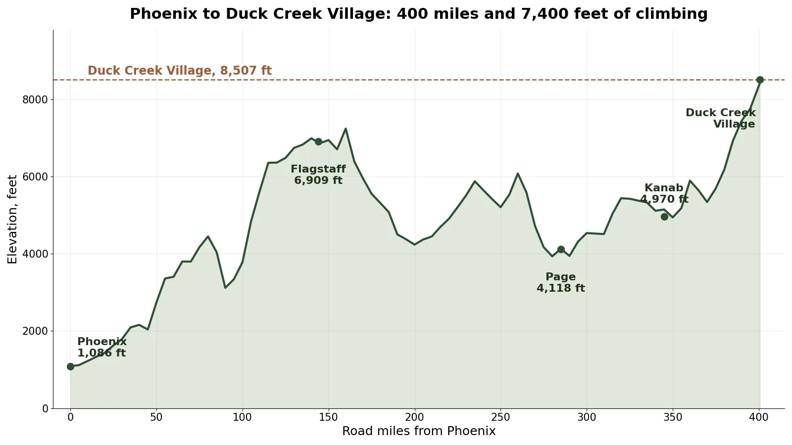
Elevation along the Phoenix to Duck Creek Village route, sampled every five miles from the USGS 3DEP public domain elevation service.
| Elevation along the way | Feet |
|---|---|
| Phoenix | 1,086 |
| Flagstaff | 6,909 |
| Near Page, the low point after Flagstaff | 3,934 |
| Kanab | 4,970 |
| Duck Creek Village | 8,507 |
Read that as three climbs and two descents rather than one long grade. I-17 lifts you almost 6,000 feet to Flagstaff in two and a half hours. US-89 then gives most of it back, running down the Painted Desert and reaching under 4,000 feet near Page. The last 60 miles take it all back and more. Nothing between the two ends of this drive stands as high as the village, not Flagstaff, not Jacob Lake, not the Kaibab.
Thin air is the practical end of that. An engine without a turbo gives up about 3 percent of its power per 1,000 feet of climb, so a loaded vehicle that pulled the Flagstaff grade fine has less to give on the last one. More on what 8,507 feet changes sits in our note on the village elevation.
The air you are driving toward
Anyone who has spent a Phoenix summer already knows why this drive exists. The weather station normals at each end put a number on it.
| Normal temperatures, midsummer | High and low |
|---|---|
| Phoenix Sky Harbor | 106.5F / 84.5F |
| Panguitch Lake, 8,300 ft | 77.7F / 50.6F |
| Assay station, 8,100 ft | 81.3F / 53.0F |
Look at the Phoenix low. The normal overnight temperature in Phoenix in the hottest month, 84.5F, runs warmer than the normal afternoon high at village elevation. A Duck Creek night in the same week averages near 51F, which is a jacket and an open window. September narrows the gap and never closes it: Phoenix normals sit at 100.4F and 78.1F, the mountain at 69 to 72F by day and the low to mid 40s at night.
That 30 degree gap is the whole reason Arizona plates fill the lots here from June through September. Our October weather post carries the fall numbers, and the gas station piece covers fuel once you arrive.
Clocks, daylight, and leaving Phoenix on time
Arizona skips daylight saving. Utah does not. Through October 31 of this year the mountain runs one hour ahead of Phoenix, so an 8 a.m. departure plus eight hours of driving puts you at the inn near 5 p.m. local. On November 1 the clocks match, and they stay matched until March.
That hour catches people every fall. A reservation confirmation reads in Utah time, and an Arizona phone may show Phoenix time for most of the drive.
Where to break a drive this long
Flagstaff falls at 144 miles, two and a half hours out, and makes the obvious fuel and food stop. Past there the choices thin. Jacob Lake sits at the 89A junction with an inn, a store, a restaurant and a gas station, open 7 days a week from 6:30 a.m. to 9:30 p.m. Kanab is the last real town, 50 miles and about 70 minutes from the inn, and it has groceries, a hospital and more restaurants than the mountain does. Our Kanab guide covers what to do with an hour there.
Two notes for anyone pairing this drive with the Grand Canyon. SR-67, the only paved road to the North Rim, closes for winter on December 1 and reopens around mid-May, while US-89A itself stays open at that junction. And the North Rim runs its own conditions now, which our North Rim post lays out.
Ready to book the far end of the drive? Our cabins and rooms sit on Highway 14 at the top of that last climb.
Quick answers about the drive from Phoenix
How many hours is Phoenix to Duck Creek Village? About eight hours of driving for 400 miles. Budget nine with a meal and a stop.
What is the shortest route from Phoenix? I-17 to Flagstaff, US-89 north, then US-89A over Jacob Lake to Fredonia and Kanab, at 396 miles. The Page variant runs 400 to 403 miles.
Should I drive through Las Vegas instead? Not for the distance. That line runs 486 miles, 85 more than the eastern route.
Is there a time change between Phoenix and Duck Creek Village? Yes, from March to the end of October, when Utah runs an hour ahead. Arizona does not observe daylight saving, so the two match all winter.
How much cooler is Duck Creek Village than Phoenix? About 25 degrees by day in midsummer and more than 30 at night. Phoenix averages a 106.5F afternoon and an 84.5F night in the hottest month, against 78 to 81F and near 51F at village elevation.
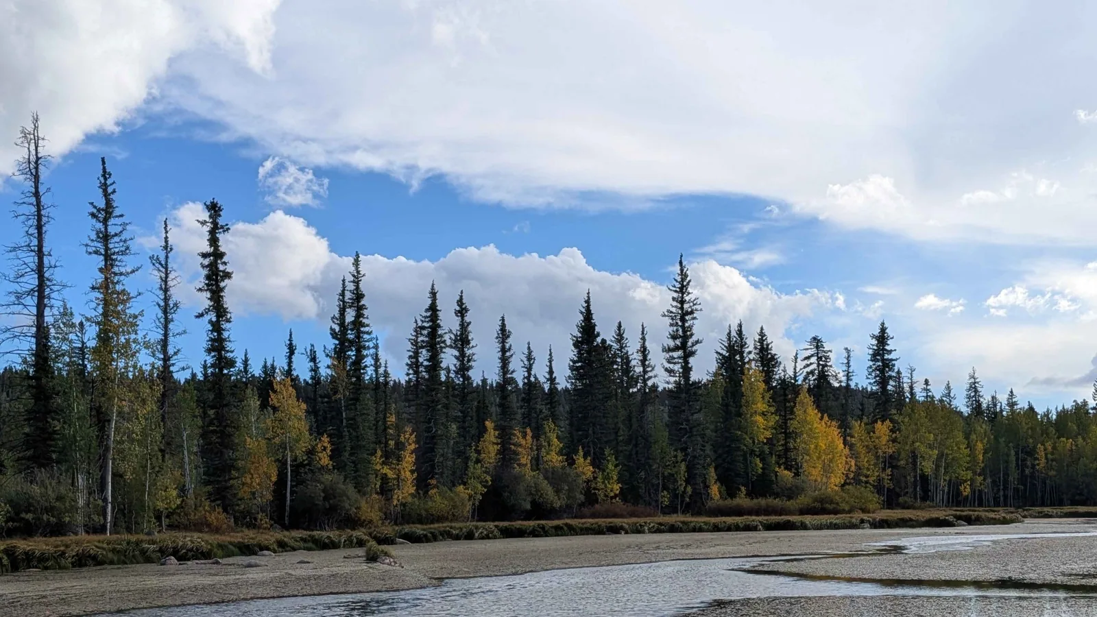
Hero photograph: Duck Lake in Duck Creek Village, September 2026, from the Duck Creek Village Inn image library.