
Trip Planning · Duck Creek Journal
Is Highway 14 Open in Winter? The Cedar City Climb to Duck Creek Village, and This Week's Storms
Yes. Utah Highway 14 stays plowed and open all winter between Cedar City and Long Valley Junction, and it runs through Duck Creek Village. The nearby paved road that closes for the season is Highway 148 to Cedar Breaks. The catch is the climb: 30 miles and about 4,000 feet up to a high point near 9,900 feet, where storms hit first.
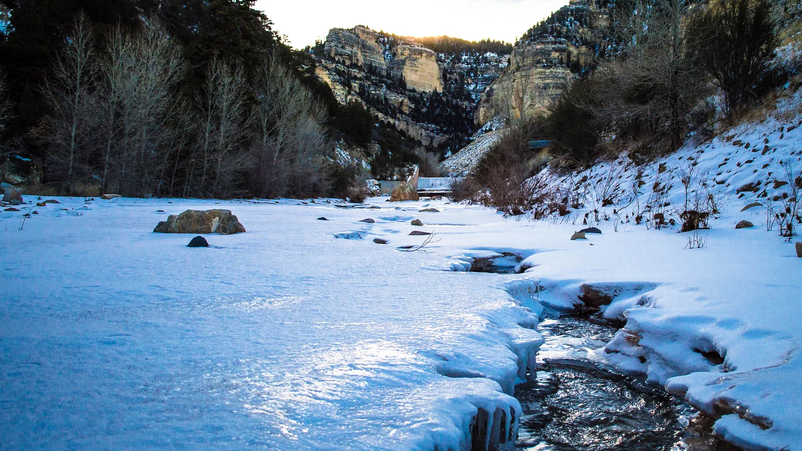
In this story
Yes. Utah Highway 14 stays open all winter between Cedar City and Long Valley Junction, and it runs straight through Duck Creek Village. The National Park Service says it in one line: “Highway 14 is kept open all winter.” The nearby paved road that closes for the season is Highway 148, the spur to Cedar Breaks. The hard part of a winter drive is the climb, about 4,000 feet in 17 miles out of Cedar City.
| Highway 14 in winter | |
|---|---|
| Season status | Plowed and open all winter |
| Length | 41 miles, Cedar City to US-89 |
| High point | About 9,900 ft, near Midway Valley |
| Cedar City to the inn | 30 miles, 45 to 60 minutes |
| Nearby winter closure | Highway 148 to Cedar Breaks |
UDOT’s own 2014 study of Utah roads with seasonal closures listed eight of them statewide. Highway 148 made that list, and so did Highway 153 east of Beaver. Highway 14 did not. It has carried state highway status since 1912.
The climb is the whole story
Cedar City sits at 5,847 feet. Highway 14 leaves Main Street, enters Cedar Canyon and climbs to a high point near 9,900 feet at about mile 17, close to the Midway Valley snow sensor and a UDOT weather station. From there it eases down to the inn at 8,431 feet and on to Long Valley Junction at 7,490. The steepest stretch, between miles 12.5 and 14.5, gains about 700 feet.
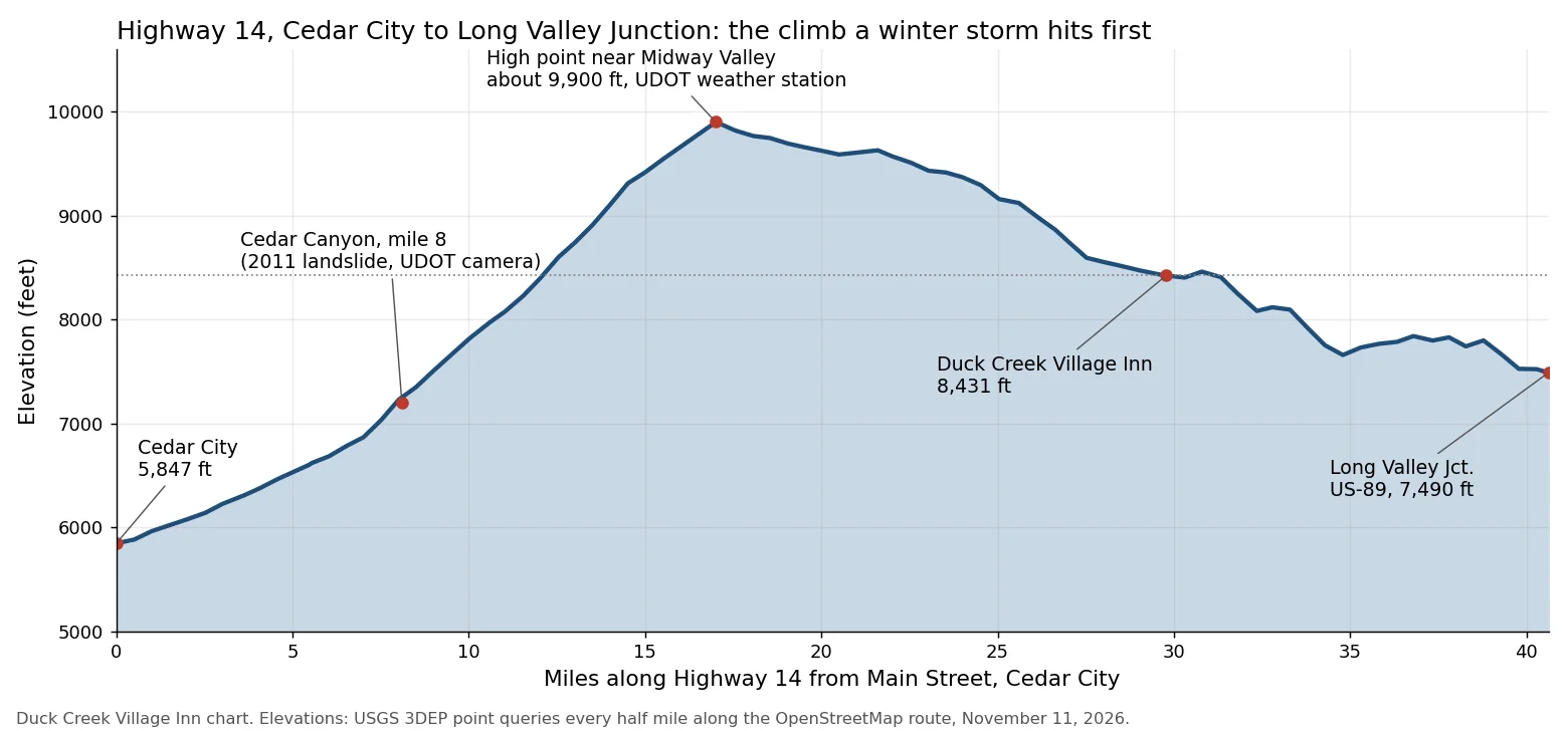
That shape decides your winter drive. A storm that drops rain on Cedar City can drop snow on the high point, and the village gets something in between. This morning the Midway Valley sensor near the top held 9 inches of snow on the ground, while the Harris Flat sensor, 5.5 miles east of the inn at 7,800 feet, read zero. At 6 a.m. the UDOT summit station read a dry road surface at 24.6 degrees, cold enough that any meltwater turns to ice.
On October 8, 2011, a landslide near mile 8 in Cedar Canyon buried the highway and closed it for more than seven months. Limited traffic resumed May 12, 2012. A similar slide closed it for months in 1989. UDOT finished a resurfacing, guardrail and culvert project on Highway 14 near Cedar City on November 5, 2026.
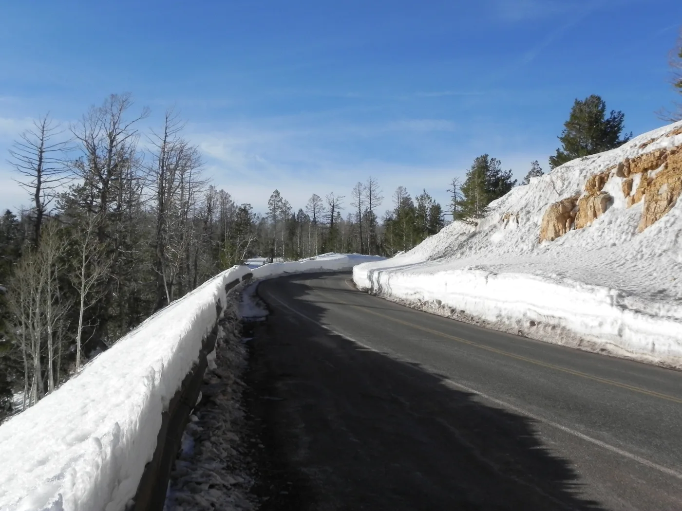
This week’s two storms on the climb
The National Weather Service forecast issued November 11 shows two systems, and both split along the climb.
| Forecast, issued Nov 11 | |
|---|---|
| Fri night, high point | 6 to 10 in of snow |
| Sat, high point | 5 to 9 in more |
| Sat, the village | 2 to 4 in |
| Fri night, Cedar City | Rain, 0.5 to 0.75 in |
| Mon night, high point | 6 to 10 in of snow |
Cedar City gets rain both nights. The village sees rain turn to snow Friday evening and a mix Monday night, with 3 to 5 inches possible. Between the two storms the forecast gives Sunday sun and a high near 33 at the top. If your arrival falls on Friday night or Monday night, move it to Sunday, the dry day between the storms, and cross Cedar Canyon in daylight after the plows have had a shift.
Tires, chains and the traction law
Utah’s traction law, Administrative Rule R920-6, lets UDOT or police require traction devices during severe weather. UDOT’s map sorts roads into classes, and the class tells you who has to meet it.
| Who the traction law covers | |
|---|---|
| Highway 14 | Class I: vehicles over 12,000 lb |
| Highway 143 to Brian Head | Class II: every vehicle |
| 2WD car, Class II | Snowflake-symbol tires, or chains |
| AWD or 4WD, Class II | M+S tires at minimum |
| Advance notice | Up to 24 hours before a storm |
On Highway 14 a posted traction order targets trucks and buses. Under a Class I order, a passenger car with all-season tires stays legal, though legal and comfortable are different on a 9,900 foot pass at 24 degrees. If your trip includes skiing at Brian Head, Highway 143 up Parowan Canyon is Class II, and every car must meet the tire rule once UDOT posts it. UDOT announces orders on road signs, message boards, the UDOT Traffic app and its social accounts. On November 9 it added an online quiz that tells you whether your car and tires qualify for any state road.
Check the cameras before you leave the valley
UDOT keeps six cameras on Highway 14 between Cedar Canyon and the village, a quick way to see snow on the road before you commit to the climb.
| UDOT cameras on Highway 14 | |
|---|---|
| Milepost 8.1 | Cedar Canyon, the 2011 slide area |
| Milepost 16.6 | Below the high point |
| Milepost 17.3 | Summit, with the weather station |
| Milepost 20.6 and 24.3 | Upper plateau, west of the village |
| Milepost 31.1 | Mammoth Creek Road, at the village |
Our live cams page collects these with the 24 hour rewind, and the snow report carries both snow sensors. For the full winter driving brief, read our winter access page, and for what to do once you arrive, the Duck Creek winter guide covers snowmobile trails, Nordic skiing and Cedar Breaks on snowshoes.
Quick answers about Highway 14 in winter
- Is Highway 14 open right now?
On the morning of November 11, 2026, the UDOT summit station read a dry road, the UDOT map showed no incident along the route, and Highway 148 to Cedar Breaks was still open. Check the UDOT Traffic app or the cameras above on the morning you drive.
- Does Highway 14 close in winter?
Not for the season, since UDOT plows it through the winter and the Park Service lists it as kept open all winter. Highway 148 to Cedar Breaks closes from about mid-November to mid-May.
- Do I need four-wheel drive to reach Duck Creek Village?
The law does not require it on Highway 14 for passenger cars. Snow tires and daylight make the bigger difference on the climb out of Cedar City.
- How high does Highway 14 go?
About 9,900 feet near Midway Valley, 17 miles from Cedar City and about 1,500 feet above the village.
- Is there a lower way in?
Yes. Coming up US-89 to Long Valley Junction and west on Highway 14 never climbs above the village. Our post on how much snow Duck Creek Village gets shows why the high point carries far more snow than the village.
Once the road looks good, come up and stay a while. Our cabins sit on Highway 14 in the village, 30 miles from Cedar City.
 Trip Planning
How Much Snow Does Duck Creek Village Get a Year? The Gauges Below and Above It Say 77 and 215 Inches
No gauge in Duck Creek Village measures snowfall. The two long NOAA records on either side of it do: Alton, 1,300 feet lower, averages 77.5 inches a year, and Blowhard Mountain, 2,300 feet higher, logged a median 215 inches a winter. The snow sensor nearest the village peaks at about 30 inches on the ground.
 Trip Planning
How Far Is Duck Creek Village From Cedar City? Thirty Miles, and the Road Climbs First
Thirty miles on Highway 14, about forty five minutes, and 2,600 feet of elevation between the village and town. The road climbs to just under 10,000 feet before it drops into Cedar Canyon.
 Trip Planning
Does Cedar City, Utah Get Snow? 60 Inches a Year in Town, Five Feet at the Top of Highway 14
Yes. Cedar City averages 59.6 inches of snow a year, more than Salt Lake City's airport, with December and March the snowiest months. Snow in town melts within a couple of days, while the snow sensor beside Highway 14, 18 miles up the road, reads five and a half feet by mid March. Months, records, last winter and the drive up.
Book the basecamp
When the trip idea is taking shape, Duck Creek Village Inn makes an easy base between slower mountain time and bigger Southern Utah days.