Trip Planning · Duck Creek Journal
Paragonah, Utah From Duck Creek Village: The Fremont Mound Town 4 Miles Past Parowan
Paragonah is an Iron County town of 536 people at about 5,900 feet, 4 miles northeast of Parowan off I-15 exit 82. From Duck Creek Village Inn it sits 41 road miles away over Cedar Breaks in summer, or 55 miles through Cedar City after Highway 148 closes, about 75 minutes either way.
In this story
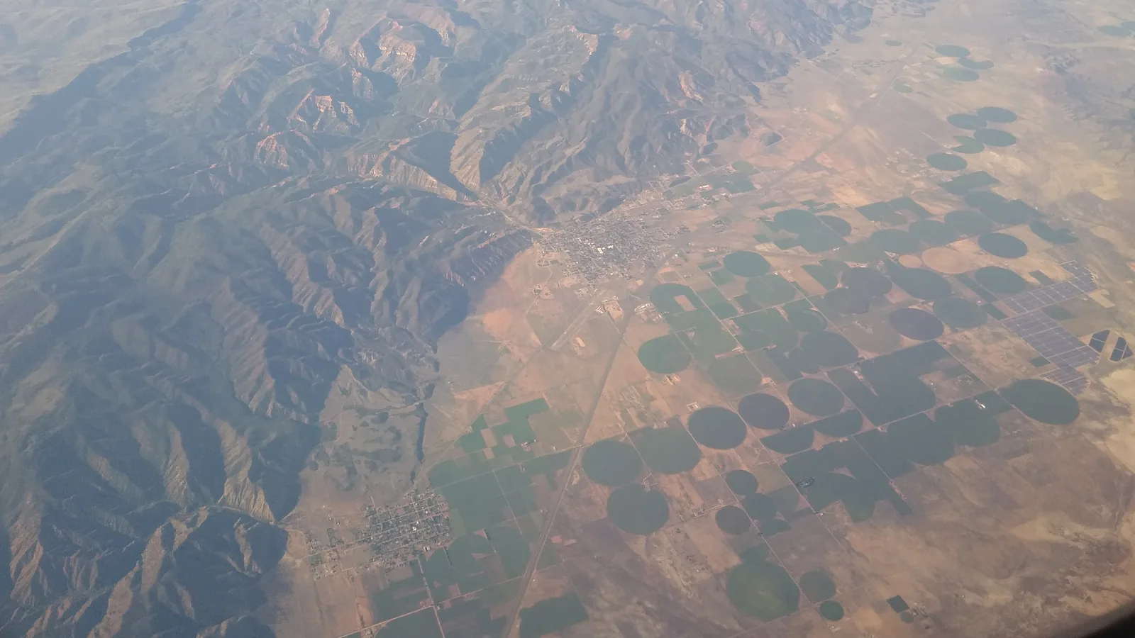
Paragonah is a town of 536 people (2020 Census) in Iron County, Utah, at about 5,900 feet, 4 miles northeast of Parowan off I-15 exit 82. Say it PARR-uh-GOO-nuh. From Duck Creek Village Inn the drive covers 41 miles over Cedar Breaks while Highway 148 stays open, or 55 miles through Cedar City after it closes. Both routes take about 75 minutes.
| Paragonah, Utah | |
|---|---|
| County | Iron, 4 miles northeast of Parowan |
| Population | 536 people, 238 homes (2020 Census) |
| Elevation | About 5,900 ft, some 2,500 ft below the inn |
| Settled | 1852 as Red Creek, resettled 1855 |
| Incorporated | 1916 |
From I-15 the town reads as an exit sign. It deserves more than that, because its fields held one of the largest Fremont villages in Utah, a farming people who lived here from about A.D. 700 to 1300. The mounds they left still stand in Paragonah, and a conservation group now owns the best of them.
Two roads from Duck Creek, and the same clock
| Duck Creek to Paragonah | |
|---|---|
| Summer route | 40.6 miles over Cedar Breaks and Brian Head |
| Winter route | 55.2 miles by Cedar City and I-15 |
| Drive time | About 75 minutes on both |
| Highway 148 season | Closed mid-November to mid-May, on average |
The short road heads west on Highway 14, turns north on Highway 148 across Cedar Breaks, then follows Highway 143 down 15.8 miles through Brian Head and Parowan Canyon. From Parowan, Highway 271 runs the last 3.8 miles north to Paragonah. The long road stays on Highway 14 all the way to Cedar City, takes I-15 north for 19 miles, and leaves at exit 82.
The routing engine puts the two drives one minute apart, because the long one spends 19 miles at freeway speed. Your choice comes down to the calendar. On November 9 the Park Service listed Highway 148 as open, and its average closure starts in mid-November. Once the gate shuts, Cedar City becomes the route. Our Cedar City drive breakdown covers the first 30 miles of it, including the climb to almost 10,000 feet before Cedar Canyon.
The mounds you cannot walk
| Paragonah mounds | |
|---|---|
| Culture | Fremont, about A.D. 700 to 1300 |
| Mounds in 1872 | More than 400, by Dr. H. C. Yarrow’s count |
| Intact by 1915 to 1917 | About 50, when Neil Judd dug |
| Protected today | 12 acres, 28 mounds |
| Public access | None, private preserve |
The count fell fast once plows reached the valley. Yarrow put the mounds above 400 in 1872. Henry Montgomery of the University of Utah reported about 100 in 1893. Neil Judd of the Smithsonian found about 50 intact when he excavated between 1915 and 1917, and published his report in 1919. Judd measured the “big mound” at 225 feet across and about 10 feet high. UCLA field schools followed in 1954 and dug close to 30 more.
The Parowan city history page quotes one of those archaeologists, Clement Meighan, on the village’s size. He put its permanent population near 400, about the size of Paragonah itself in the years he dug.
Southern Utah University held the last undisturbed piece for decades. A housing subdivision went in next to it, and in 2013 the Archaeological Conservancy bought the 12-acre remnant with $108,000 from a fine the Utah Transit Authority paid after it damaged a site in Draper. Paragonah Mounds became the group’s third preserve in Utah.
Plan around one fact: you cannot visit. The Conservancy’s preserves page says its sites are private property and “not open for public visitation.” Please stay on the road.
For Fremont rock art you can stand in front of, drive to the Parowan Gap petroglyphs, 10.5 miles west of Parowan on a gravel road. For Fremont artifacts, Fremont Indian State Park sits 70 miles north of Paragonah by I-15 and I-70, about 73 minutes. Its collection comes from the largest known Fremont village, uncovered during the I-70 construction. Check before you go: the museum exhibits stay closed for renovation, while the visitor center, gallery and trails remain open, Monday to Saturday, 9 am to 5 pm in winter.
The name, the fort and the adobe house
The town square marker at 49 North Main tells the settlement story. Farmers from Parowan built huts at a place they called Red Creek in 1852, abandoned the site in 1853 amid what the marker calls Indian skirmishes, and came back in 1855 to build a fort. The town incorporated in 1916.
The name has three translations, and no source settles it. The square’s 1996 marker says “Paragoonah” means “many watering holes,” for the artesian wells that once dotted the fields. Wikipedia calls it Southern Paiute for the red color of the water. A third reading, recorded with the Little Salt Lake, gives “Paragoon” as “vile water,” the same root behind the names of Parowan and the valley.
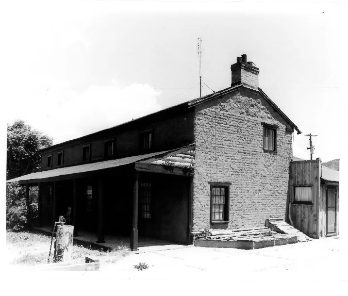
Marius Ensign built the house about 1862 from local red-clay adobe, two rooms down and two up. Silas S. Smith bought it in 1872 and added the north section, and two small frame rooms at the back served as the town post office. Smith had a larger claim to fame. In 1880 he captained the Hole-in-the-Rock expedition, the Mormon pioneer company that cut a road through the Colorado River canyon. The house now sits on the National Register. It belonged to a private owner when nominated, so take your look from the street.
Paragonah in November and winter
| Weather at the Paragonah gauge | |
|---|---|
| November median | High 51 F, low 24 F |
| January median | High 43 F, low 17 F |
| Snow in a winter | Median 53.5 in, 15 full seasons since 1990 |
NOAA’s Paragonah station, at 5,910 feet, has day-by-day records back to 1991, with gaps. November afternoons in the valley still reach the 50s, and the nights drop well below freezing. Snow reaches the valley floor too, close to four and a half feet in a median winter at this gauge, a little under the 59.6 inch normal at Cedar City.
The inn sits about 2,500 feet higher, so the town and the village keep different weather. A dry road here says little about Cedar Canyon. Check both before you start home.
Quick answers about Paragonah, Utah
- Where is Paragonah, Utah?
Paragonah sits in Iron County, 4 miles northeast of Parowan and 23 miles northeast of Cedar City, beside I-15 at exit 82.
- How far is Paragonah from Duck Creek Village?
The drive covers 40.6 road miles over Cedar Breaks while Highway 148 stays open, and 55.2 miles through Cedar City after it closes. Both take about 75 minutes.
- What does the name Paragonah mean?
Sources disagree. The 1996 town square marker says “many watering holes,” Wikipedia ties it to red water, and a third reading gives “vile water.”
- Can you visit the Paragonah mounds?
No. The Archaeological Conservancy owns the 12-acre preserve and keeps its sites closed to the public. Parowan Gap and Fremont Indian State Park welcome visitors.
- Does Paragonah get snow?
Yes. Its NOAA gauge recorded a median of 53.5 inches across 15 complete winters since 1990.
Paragonah makes a short stop on a Parowan day, and the road home climbs back into the pines above 8,000 feet. Find a room for the night in our rooms.
 Trip Planning
Parowan, Utah From Duck Creek Village: The 1851 Town at the Bottom of the Brian Head Road
Parowan is the Iron County seat, a town of 2,996 people at about 6,000 feet, settled on January 13, 1851. From Duck Creek Village Inn it sits 36 road miles away over Cedar Breaks in summer, or 49 miles by Cedar City and I-15 once Highway 148 closes for the winter.
 Things to Do
Parowan Gap Petroglyphs From Duck Creek Village: Is the 49 Mile Drive Worth It?
Parowan Gap is a free Bureau of Land Management site in the Red Hills north of Cedar City, with more than 90 panels and 1,500 carved figures. From Duck Creek Village it is about 49 miles and 70 minutes through Cedar City. Pair it with a Cedar City day or a loop home over Cedar Breaks.
 Trip Planning
How Far Is Duck Creek Village From Cedar City? Thirty Miles, and the Road Climbs First
Thirty miles on Highway 14, about forty five minutes, and 2,600 feet of elevation between the village and town. The road climbs to just under 10,000 feet before it drops into Cedar Canyon.
Book the basecamp
When the trip idea is taking shape, Duck Creek Village Inn makes an easy base between slower mountain time and bigger Southern Utah days.