Parowan Gap is a free Bureau of Land Management site in the Red Hills north of Cedar City, with more than 90 panels and 1,500 carved figures. From Duck Creek Village it is about 49 miles and 70 minutes through Cedar City. Pair it with a Cedar City day or a loop home over Cedar Breaks.
Parowan Gap Petroglyphs From Duck Creek Village: Is the 49 Mile Drive Worth It?
Parowan Gap is a free rock art site run by the Bureau of Land Management, in a notch through the Red Hills north of Cedar City. It holds more than 90 panels and over 1,500 carved figures. From Duck Creek Village you drive about 49 miles, a little over an hour, down Highway 14 and north through Cedar City. The stop takes under an hour, so pair it with a Cedar City day or a loop home.
| Parowan Gap at a glance | |
|---|---|
| From Duck Creek Village | 49 miles, about 70 minutes |
| From Cedar City | 16 miles north |
| Rock art | 90+ panels, 1,500+ figures |
| Elevation at the site | About 5,560 ft |
| Entrance fee | None listed |
| Managed by | BLM Cedar City Field Office |
The rock art and the notch it sits in
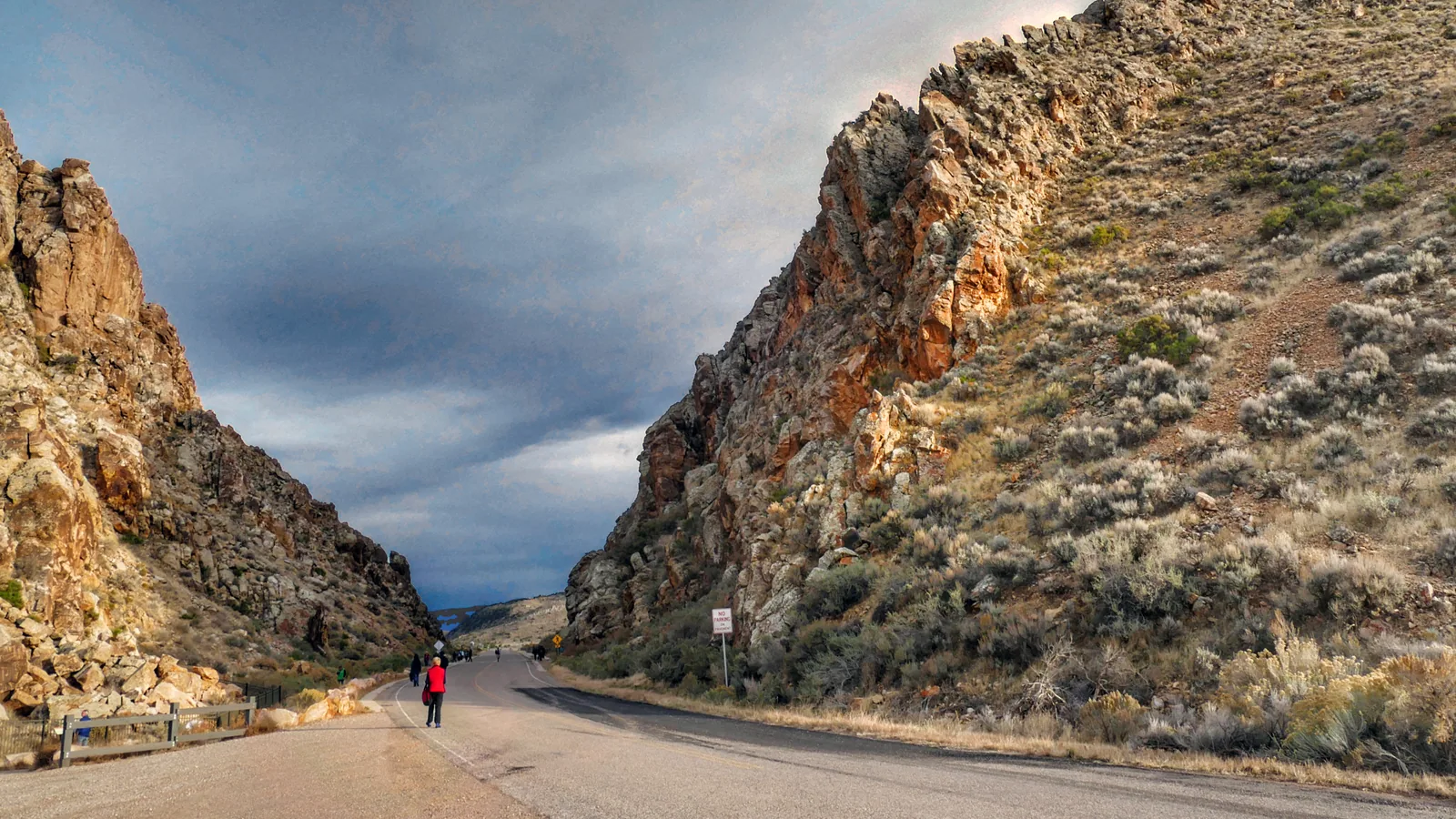
The Gap is a wind gap. An ancient stream cut a pass straight through the Red Hills and then abandoned it, and the road now runs through the slot. Visit Utah puts the notch at 500 feet deep and Utah.com says 600. The walls are sandstone, and the carvings cover boulders and faces on both sides of the road.
Most of the work belongs to the Fremont people and to the ancestors of the Southern Paiute and Hopi, according to Visit Utah. Utah.com describes at least 1,000 years of carving. The BLM adds later marks from Spanish explorers and 19th century pioneers, and calls it the highest concentration of petroglyphs in southwest Utah. The site joined the National Register of Historic Places on October 10, 1975.
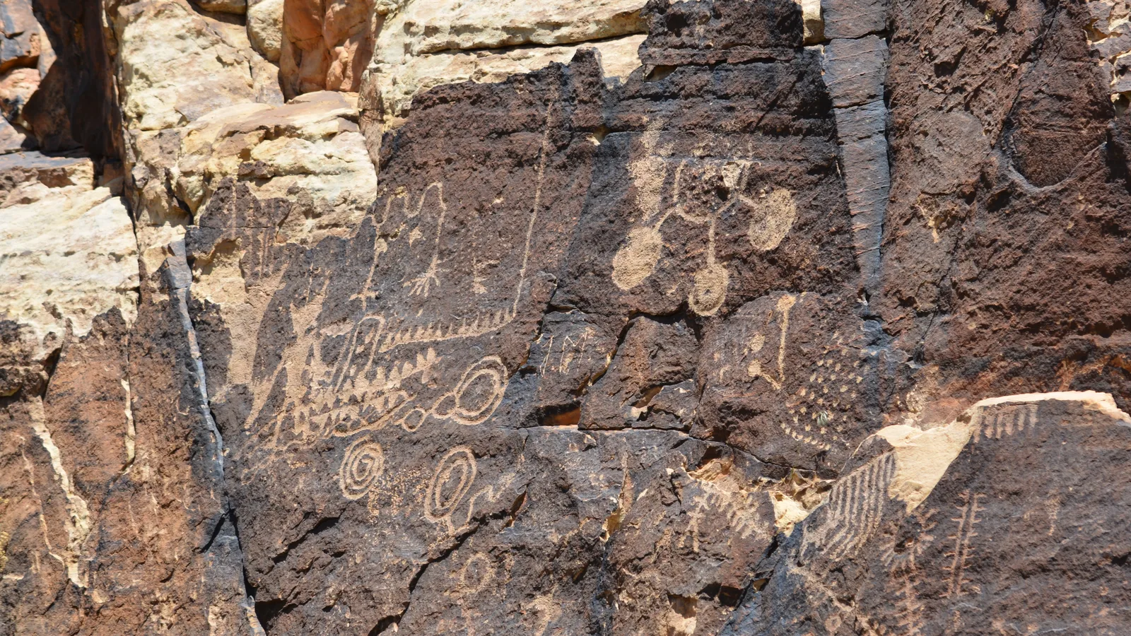 One of the carved panels at Parowan Gap, photographed on a May 2023 field trip. BLM Utah photo, public domain.
Expect circles, spirals, wavy lines, lizards, snakes, mountain sheep and bear claws. The famous one is the Zipper, on the northeast side. Researchers have proposed it as a map and as part of a solar calendar tied to notches in the ridgeline. Treat that as a debated idea rather than a settled fact. Visit Cedar City lists solar observation programs around the solstices and equinoxes, so check their calendar if you want to see the sun line up for yourself.
Two ways to drive there from the village
| Route | Distance from the inn |
|---|---|
| Highway 14, Cedar City, UT-130, Gap Road | 49 miles, about 70 minutes |
| Highway 148, Brian Head, Parowan, Gap Road | 47 miles, about 87 minutes by routing |
| Round loop, out one way and back the other | 96 miles |
| Open in winter | Cedar City route year round |
The Cedar City route is the faster one. Take Highway 14 down Cedar Canyon, follow Main Street north through Enoch onto UT-130, the Minersville Highway, and turn east on Gap Road after about 13 miles. Gap Road runs 2.5 miles to the site. Utah.com describes it as a paved road, and map data shows asphalt through the notch itself. The parking lot sits just past the Gap on the left.
The Parowan side saves two miles and still loses time, because it climbs over Cedar Breaks at more than 10,000 feet before dropping into Parowan. Visit Utah describes the 10.5 miles west from Parowan on 400 North as gravel, which we could not confirm with a second source. Drive it as the return leg of the loop, in daylight, and keep the Cedar City route for anything after mid November.
The Gap sits close to 3,000 feet below the village. Expect warmer air than at the cabin, and dress for sun more than cold on an October afternoon. Our Cedar City guide covers the museums and food in town if you want to fill out a full day in town.
What you find when you park
| On site | Details |
|---|---|
| Parking | 15 gravel spaces, 1 paved accessible space |
| Restroom | 1 accessible vault toilet |
| Shade | Circular shade structure with 3 benches |
| Water, tables, grills | None |
| Cell service | Spotty, per the BLM |
The BLM keeps the site simple. A painted crosswalk takes you across Gap Road to a sidewalk and a short gravel path with interpretive signs, and a metal fence keeps you back from the rock. Utah.com asks you to photograph or sketch the carvings and never touch them, since skin oils speed the wear.
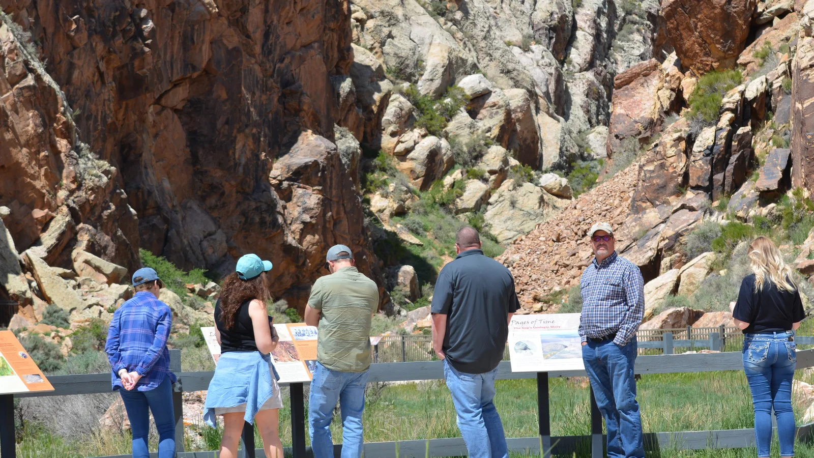 The walkway, the signs and the railing at Parowan Gap, May 2023. BLM Utah photo, public domain.
Bring water and lunch from Cedar City, because the site has neither. Watch the brush too. The BLM lists sage grouse, Utah prairie dogs and nesting raptors around the Gap.
Dinosaur tracks two miles further east
A second stop sits east of the Gap, with a trailhead lot of its own. Visit Cedar City lists ornithopod, ceratopsian and theropod tracks there. The two tourism offices disagree on the distance: Visit Utah says one mile east, Visit Cedar City says two. We measured the coordinates Visit Utah itself publishes for both sites, and they sit 2.1 miles apart. Map routing gives 2.2 miles by road. Plan on two miles and a five minute drive.
The tracks make a good second stop for kids, since a theropod print has three toes you can count. Add half an hour to the day for it. If the day leans toward geology, our post on the lava under Duck Creek Village covers the younger rock you drove over on the way down.
Quick answers about visiting Parowan Gap
Is Parowan Gap free to visit? Yes. None of the BLM or tourism office pages lists a fee or permit, and a 2019 trail report from gjhikes.com records the fee as none.
Can you touch the petroglyphs? No. A metal fence separates the path from the rock, and Utah.com asks you to photograph or sketch the carvings and keep your hands off them.
Is there water or food at Parowan Gap? No. The BLM lists a vault toilet and shade but no running water, picnic tables or grills, so stock up in Cedar City.
Can you combine Parowan Gap with Cedar Breaks? Yes, until Highway 148 closes for winter. Go out through Cedar City and come home through Parowan, Brian Head and Cedar Breaks, about 96 miles in all.
Does Parowan Gap stay open in winter? The BLM publishes no seasonal closure, and the Cedar City route runs year round. Call the Cedar City Field Office at (435) 865-3000 after a storm.
Parowan Gap makes a good excuse to see the valley below the plateau, then climb back to a warm cabin at 8,500 feet. See our cabins when you pick your dates.
Hero photograph: Parowan Gap, Utah, by Bernard Spragg, public domain via Wikimedia Commons.