Duck Creek Village sits on a basalt lava flow with its own name on the geologic map, inside the Markagunt Plateau volcanic field. The nearest cinder cones stand 2 miles east, the field holds 40 to 50 of them, and the last eruptions ran out long before anyone lived here.
Is Duck Creek Village on a Volcano? The Lava Under Cedar Mountain
Yes. Duck Creek Village sits on a basalt lava flow, one of dozens inside the Markagunt Plateau volcanic field, and the Utah Geological Survey gives the rock under the village its own name on the map: the Duck Creek lava flow. The nearest volcanoes are Strawberry Knolls, a pair of cinder cones 2.2 miles east. Somewhere between 40 and 50 cinder cones sit in this field, and the last of them went quiet long before anyone lived here.
| Duck Creek Village volcano facts | |
|---|---|
| Volcanic field | Markagunt Plateau, 1,160 square miles |
| Cinder cones in the field | 40 to 50 |
| Rock under the village | Duck Creek lava flow, basalt |
| Nearest cinder cones | Strawberry Knolls, 2.2 miles east |
| Nearest dated lava | Henrie Knolls, 58,000 years |
| USGS threat rating | Low to very low |
The flow under the village has a name
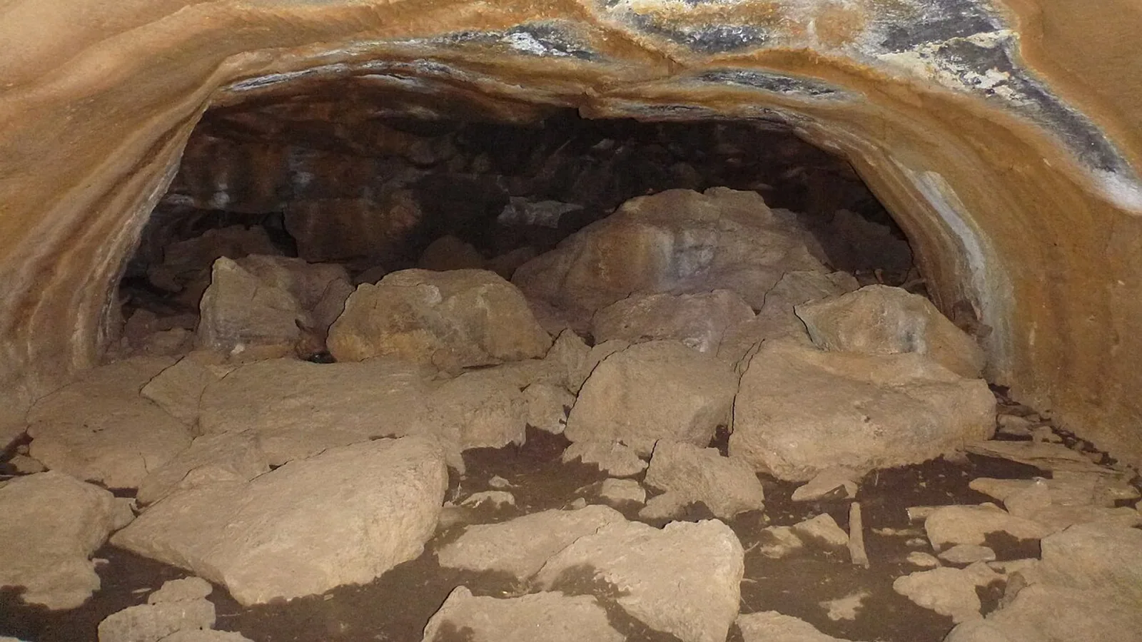
Open-File Report 553 from the Utah Geological Survey maps this ground in detail, and the unit under the village carries the label Qbdc, the Duck Creek lava flow. It ran west to east down the ancestral Duck Creek drainage, then kept going northeast to at least Bowers Flat. Near Aspen Mirror Lake its exposed edge stands about 15 feet thick, and it holds a long open lava tube that the Forest Service closes to visitors.
Geologists have never found the vent that erupted it. The report offers three possibilities: the source hides under the Henrie Knolls flow, or under the Navajo Lake flow, or the Duck Creek flow is the far end of the Midway Creek or Horse Pasture flows, whose cones stand north of Navajo Lake. Two separate geologic map compilations return Quaternary basalt at our own coordinates, so the question is which volcano, rather than whether.
The cones you can reach from the village
| Volcanic feature | Where it sits |
|---|---|
| Strawberry Knolls | Two cinder cones, 2.2 miles east |
| Bowers Knoll | Cinder cone, 3.4 miles northeast |
| Mammoth Cave | Lava tube at 8,050 feet, 6 miles northeast |
| Henrie Knolls | 20 or more vents, north of the village |
| Hancock Peak | Cinder cone, 9.3 miles northwest |
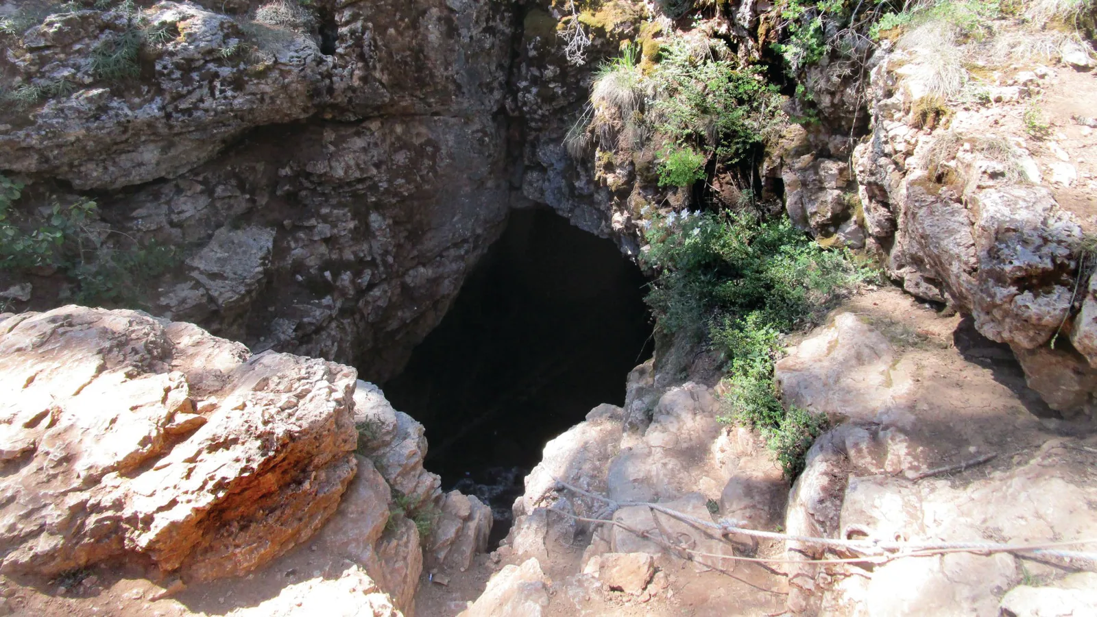
Strawberry Knolls sits closest, two well vegetated cones whose flow ran northeast along Strawberry Creek to Uinta Flat. Bowers Knoll is the one that earns a day. Its flow holds both Mammoth Cave, with over 2,200 feet of passage, and Bower Cave next door. Dixie National Forest shuts both for the winter at the start of October and reopens them at the end of April, so hibernating bats get the season to themselves. That makes the next few days the last of the 2026 window.
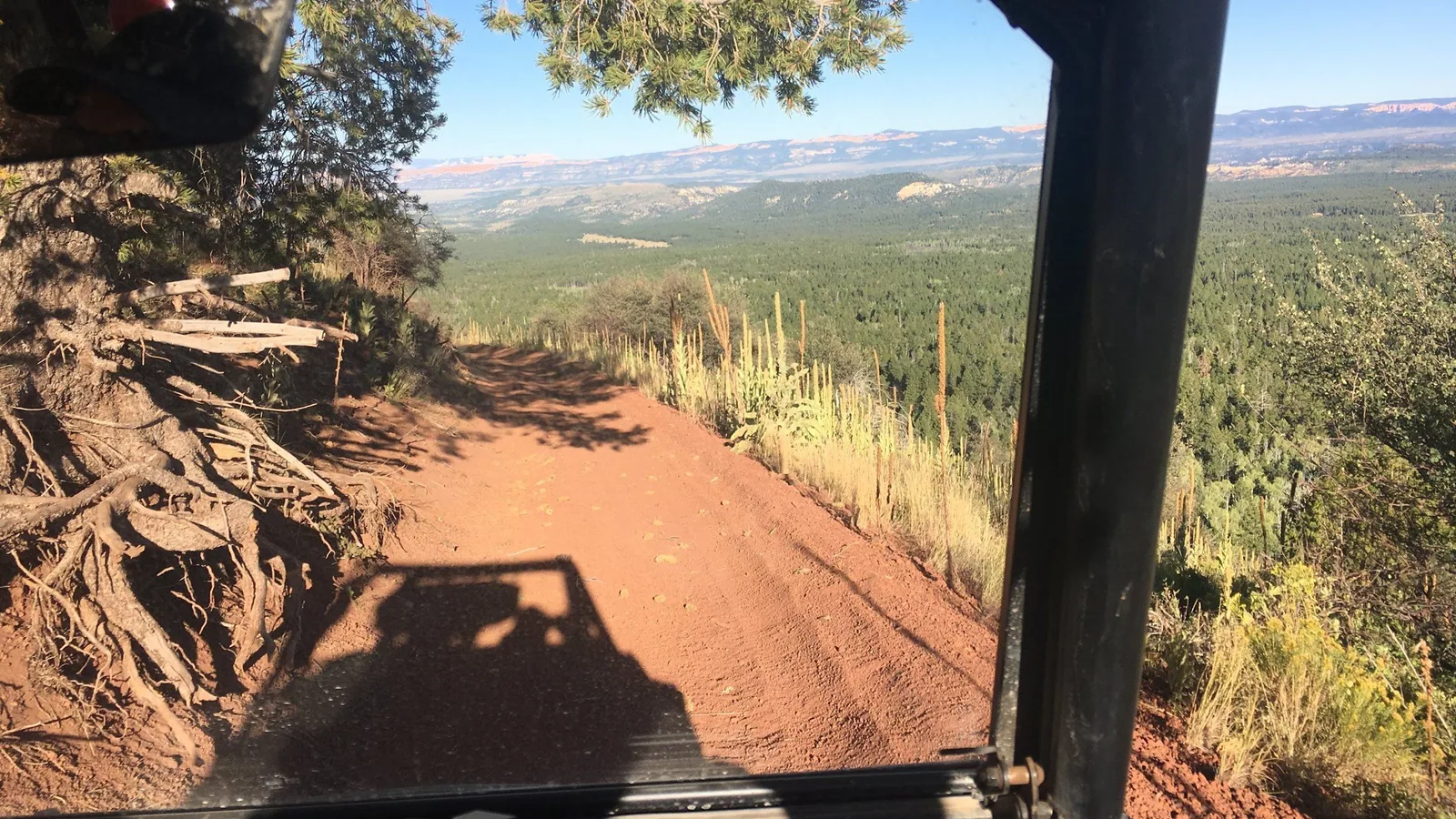
Henrie Knolls is the bigger story. At least 20 separate vents erupted that flow complex, and their cones follow a northeast trend in a line so straight that the mapping geologists concluded a buried fault steers them. The southernmost of those flows blocked two drainages at once and made Navajo Lake and intermittent Cow Lake. Our own ride to the top of the northernmost knoll runs 22.4 miles out and back from the lot, and the last two miles climb hard. Prominent cones here stand as much as 500 feet above the lava fields around them.
Why the creek runs dry in summer
| Where the water goes | |
|---|---|
| Duck Creek Sinks elevation | 8,370 feet, inside the village |
| Creek flow lost into the sinks | All of it |
| Resurfaces at | Lower Asay Spring, 6 miles on |
| Dye travel time underground | About 68 hours |
| Navajo Lake surface outlet | None |
Basalt drinks. High infiltration through these flows has cut surface runoff across the whole plateau, which is why a creek with a name and a valley spends much of the year as a dry channel. USGS hydrologists tracked it: Duck Creek Spring loses its entire flow into the Duck Creek Sinks about 2.5 miles east of the spring, and dye poured into those swallow holes turned up at Lower Asay Spring about 68 hours later.
Navajo Lake does the same trick at a larger scale. The lava dam gave it no surface outlet, so the lake drains through sinkholes and the water splits underground. Part of it surfaces at Cascade Falls and becomes the North Fork of the Virgin River, bound for the Colorado. The rest feeds Duck Creek Spring and the Sevier River, bound for the Great Basin. One lake, two river systems, and a lava flow as the switch.
How old the lava under you is
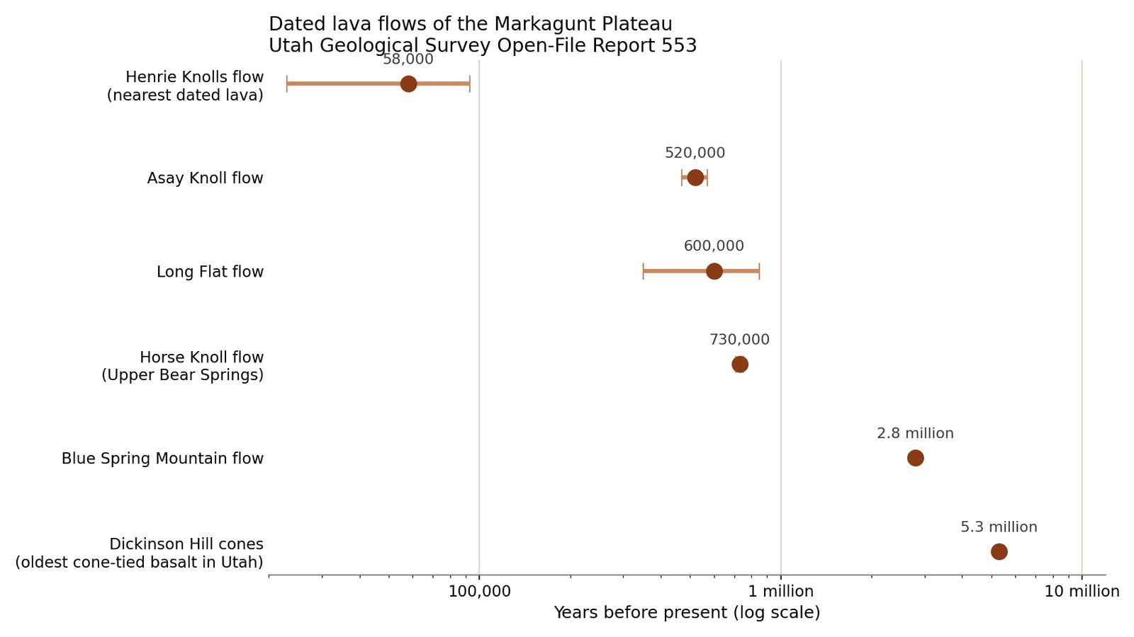
Radiometric ages from Utah Geological Survey Open-File Report 553, with published uncertainty shown as bars.
The Forest Service page for Mammoth Cave says some of this lava is only several thousand years old, and that number travels. The geologic map tells a slower story. The flow holding Mammoth Cave erupted from Bowers Knoll, the map places it earlier than the Duck Creek flow, and the closest comparison the authors reach for is a neighboring flow dated at 520,000 years. One sample near Henrie Knolls returned 58,000 years, give or take 35,000, and the report calls that low precision.
Field wide, USGS brackets the eruptions between 5.3 million and under 10,000 years. The youngest flows in the field, at Dry Valley and Panguitch Lake, are not the one you park on. So the ground you park on is old enough that no human saw it arrive, and young enough that its blocky surface still has sharp edges.
The deeper layer is stranger. Before the basalt, an older volcanic field on this plateau collapsed and slid, spreading wreckage across at least 2,000 square miles about 23 million years ago. Geologists call the deposit the Markagunt megabreccia, and it competes with Heart Mountain in Wyoming for the title of largest landslide known on land.
Quick answers about volcanoes near Duck Creek Village
Is the volcano under Duck Creek Village active? No eruption here appears in the human record, and the USGS threat rating for the Markagunt Plateau field sits at low to very low. Utah’s youngest lava is in the Black Rock Desert of Millard County, well north of Cedar Mountain.
Where can you stand on a lava flow near Duck Creek Village? The forest roads and dispersed camping areas north of the village run over the flow, and the blocky black rock along their edges is the flow front. Mammoth Cave puts you inside one, from May through September.
Is Mammoth Cave a lava tube? Yes. It runs over 2,200 feet at 8,050 feet elevation, and it formed inside the Bowers Knoll flow. Carry a light for every person, and expect a crawl at the exit.
Is the Duck Creek Ice Cave a lava tube as well? No. The ice cave is a cold trap sinkhole at 8,820 feet whose chamber sits below its entrance, so winter air settles in and stays. The ice often melts out by late August.
What is the Markagunt Plateau volcanic field? It covers 1,160 square miles of southwestern Utah, and each of its 40 to 50 cinder cones erupted once and stopped. That is what monogenetic means, and it is why the landscape reads as scattered black flows rather than one mountain.
Cedar Mountain hands you the evidence at road level: a cinder road, a lava tube, a lake with no outlet, a creek that vanishes. We keep cabins and rooms in the middle of all of it, ten minutes from the flow fronts and twenty from the cave.