Things to Do · Duck Creek Journal
Where Does Duck Creek Start and End? The Spring, the Sinks and the Sevier
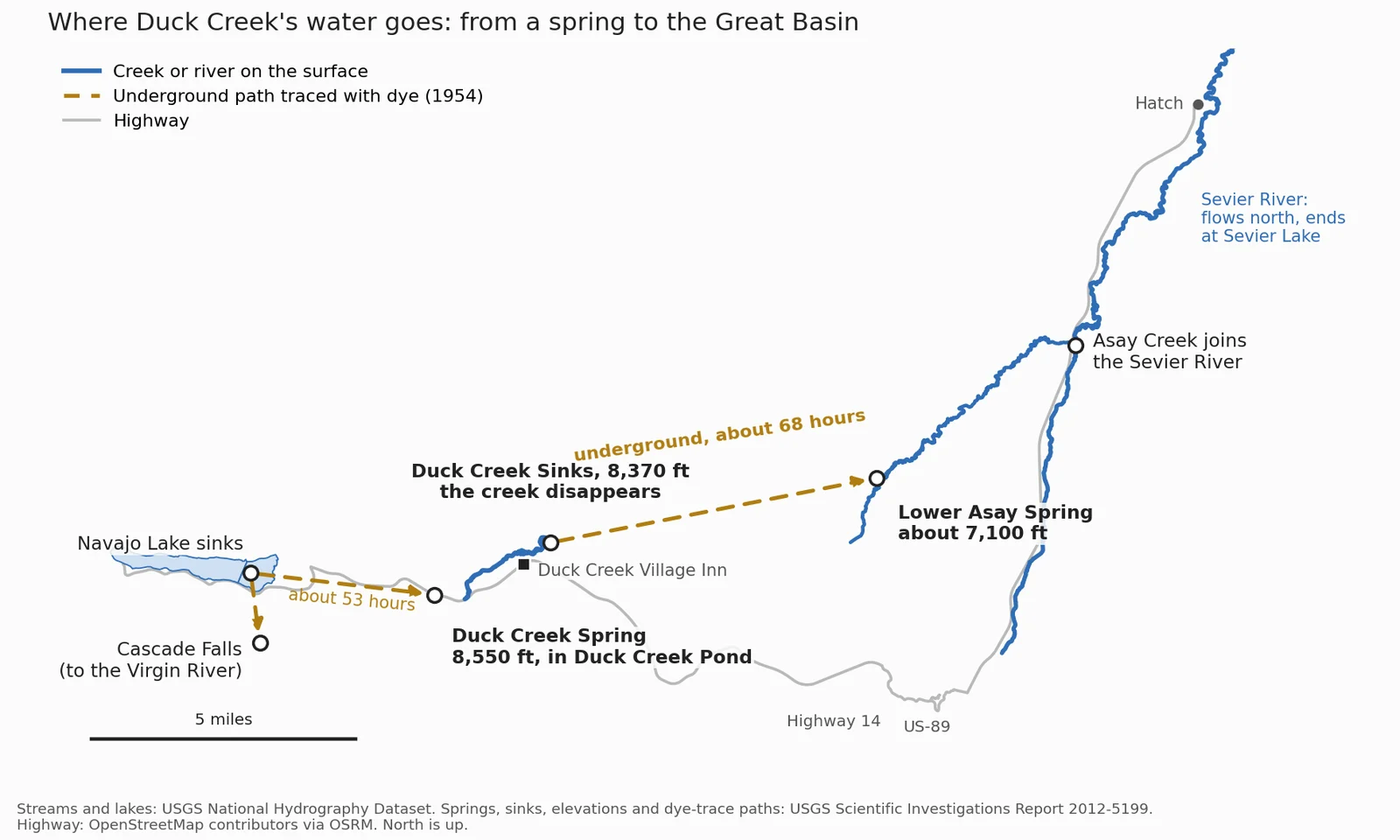
Duck Creek starts at Duck Creek Spring, a rise pool inside Duck Creek Pond at 8,550 feet, and runs about 3 miles east before the whole stream drops into the Duck Creek Sinks at the edge of the village. The water comes back up at Lower Asay Spring, joins the Sevier River and never reaches the sea.
In this story
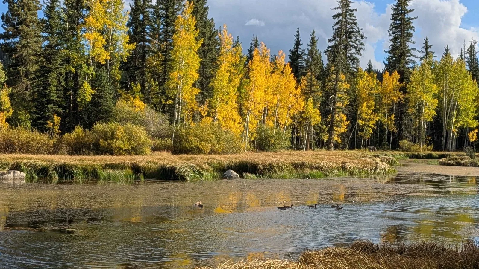
Duck Creek starts at Duck Creek Spring, a rise pool inside Duck Creek Pond beside Highway 14 at 8,550 feet. It runs about 3 miles east through Duck Creek Village and then disappears. The whole stream drains into the Duck Creek Sinks, swallow holes in the rock at the north end of the valley. The water comes back up at Lower Asay Spring, joins the Sevier River and never reaches the sea.
| Duck Creek at a glance | |
|---|---|
| Starts | Duck Creek Spring, 8,550 ft, in Duck Creek Pond |
| Surface length | About 3 miles |
| Ends | Duck Creek Sinks, 8,370 ft, in the village |
| Comes back up | Lower Asay Spring, about 6 miles east |
| Final stop | Sevier River, then Sevier Lake |
Duck Creek starts in a pond fed by Navajo Lake
The spring sits at the edge of Duck Creek Pond, beside the Forest Service visitor center 28 miles east of Cedar City. USGS hydrologists describe it as a large rise pool, where groundwater wells up into the pond from below. The state wildlife agency even lists the pond on its stocking reports as “Duck Cr Springs.”
Part of that groundwater starts at Navajo Lake, 475 feet higher and about 3.5 miles west. A lava flow blocked the lake’s natural outlet, so it drains through sinkholes at its east end. In August 1954 a USGS team poured fluorescein dye into those sinks. The green showed up at Cascade Spring in 8.5 hours and at Duck Creek Spring in a little over two days.
| Navajo Lake to Duck Creek Spring | |
|---|---|
| Dye test | August 12, 1954 |
| Travel time | About 53 hours |
| Distance | About 3.5 miles |
| Drop | 475 feet |
| Share of the lake’s sink water | About 60 percent |
The other 40 percent comes out of a cave in the Pink Cliffs as Cascade Falls, feeds the North Fork of the Virgin River and heads for the Colorado. Duck Creek’s share goes the opposite way, into the Great Basin. Tests in 1956 showed one more trick. Crews released extra water into the lake’s sinks, and Duck Creek Spring rose within about 12 hours, long before any dye could arrive, because pressure travels through the rock faster than the water does. The same study found that both springs draw on other sources besides the lake.
Three miles through the village, then into the lava
On the national hydrography map, Duck Creek leaves the pond and runs about 3 miles east. It passes through Aspen Mirror Lake, loses some water to a swallow hole below it, and winds through the meadows under the village to the Duck Creek Sinks. The USGS lists three sink points there at 8,360 to 8,370 feet: two sinkholes at the base of a hill and a collapse in the basalt, all less than a mile from the inn.
At normal flow the sinks swallow the whole creek. Early USGS work reported flows as high as 226 cubic feet per second at these sinks. In a big melt, swallow holes like these can fill to the brim and spill water into channels that sit dry most of the year.
Underground along the same stretch runs the Duck Creek Lava Tube, about 2.27 miles long, which the USGS report calls one of the longest lava tubes in the continental United States. A 1975 Forest Service dye test showed pond water leaking into the tube and flowing out its lower end, about 7,400 feet away, in under 24 hours. That outflow served as the village’s public water supply until 2008. The Forest Service restricts entry to the tube.
The water comes back at Lower Asay Spring
| Duck Creek Sinks to Lower Asay Spring | |
|---|---|
| Dye test | August 24, 1954 |
| Travel time | About 68 hours |
| County line | Kane to Garfield, underground |
| Drop | 1,260 feet |
| Pace | About a tenth of a mile an hour |
The dye that went into the Duck Creek Sinks surfaced at Lower Asay Spring, on the bank of Asay Creek near 7,100 feet. A release of extra water into the sinks raised the flow at Lower Asay in about 9 hours. Upper Asay Spring, 2,000 feet upstream, showed no dye and no change. Mammoth Spring, 8 miles north, picked up nothing from the Navajo Lake sinks or the Duck Creek Sinks.
From the spring, Asay Creek runs about 8 miles northeast and meets the Sevier River near 7,000 feet, about 5 miles south of Hatch. The USGS names Mammoth and Asay Springs as the major sources of flow in the Sevier River. The Sevier then runs north for most of its 400 or so miles, turns southwest and ends at Sevier Lake in Millard County. Farms along the way divert most of the river for irrigation, which is why Sevier Lake sits dry most of the time. None of Duck Creek’s water reaches an ocean.
Duck Creek runs high in May and June
| Duck Creek flow, USGS gage, 1953 to 1959 | |
|---|---|
| March median | 0.5 cubic feet per second |
| May median | 23 cubic feet per second |
| June median | 21 cubic feet per second |
| October median | 3 cubic feet per second |
| Highest day | 191 cubic feet per second |
Snowmelt drives the creek. The USGS ran a stream gage on upper Duck Creek, near the pond, from October 1953 to March 1959, and its day by day record shows the whole year in one swing. Flow bottoms out around half a cubic foot per second in March, under the snow, and peaks between mid May and mid June. The biggest day, June 6, 1958, ran more than 400 times the lowest.
Readings taken for the 2012 USGS study fit the same pattern: 32.2 cubic feet per second below the pond on June 6, 2010, and an estimated 3 to 4 at the spring in mid November 2009. No gage runs on Duck Creek today, so treat these numbers as a guide to the seasons. For the fullest creek, come in the last two weeks of May or the first two of June.
Quick answers on Duck Creek
- Does Duck Creek have a lake?
Two sit on it. Duck Creek Pond holds the spring where the creek begins, and Aspen Mirror Lake sits partway down its 3 miles. Navajo Lake feeds it from underground.
- Can you fish Duck Creek?
Yes. The state stocked the creek with 753 rainbow trout across three plants between May 21 and June 16, 2026, and the pond with 5,017 trout from March to July. Our Duck Creek fishing guide compares the stocked waters around the village.
- Does Duck Creek flow into Mammoth Creek?
No. Dye from the Duck Creek Sinks never reached Mammoth Spring, 8 miles north. The water surfaces in Asay Creek instead, which meets the Sevier River on its own.
- Does Duck Creek reach the Colorado River?
No. Duck Creek ends in the Great Basin by way of the Sevier River. The Navajo Lake water that comes out at Cascade Falls is the share bound for the Colorado.
We keep cabins and rooms less than a mile from the Duck Creek Sinks and under 2 miles from the spring, so the creek’s whole 3 mile run sits on our doorstep.
 Things to Do
Is Duck Creek Village on a Volcano? The Lava Under Cedar Mountain
Duck Creek Village sits on a basalt lava flow with its own name on the geologic map, inside the Markagunt Plateau volcanic field. The nearest cinder cones stand 2 miles east, the field holds 40 to 50 of them, and the last eruptions ran out long before anyone lived here.
 Things to Do
Strawberry Point and Cascade Falls: The Two Short Walks With the Biggest Payoff Per Mile
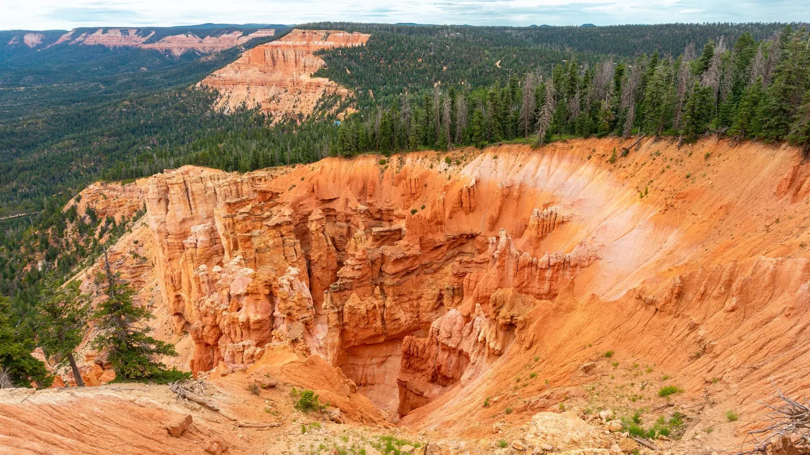
The plateau's best views are not on its long hikes. They are on two short walks most visitors drive right past. Here is how to reach each one, what vehicle you need, and how to time them around the light and the afternoon storms.
 Things to Do
Mammoth Cave: Walking Into a Lava Tube 20 Minutes From Duck Creek
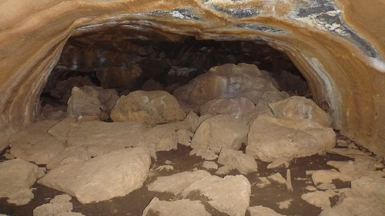
Not the Kentucky one, and not the Ice Cave. Mammoth Cave is a walk-through lava tube 20 minutes from the village, and it rewards a little planning. Here is the drive, the light math, the gate, and how to do it right.
Book the basecamp
When the trip idea is taking shape, Duck Creek Village Inn makes an easy base between slower mountain time and bigger Southern Utah days.